
World maps & models
Mercator’s world map for navigation
Historical recordMercator’s 1569 world map in the Basel holding, shown as the institution’s complete-map composite. Its southern continent is conjectural, not a verified survey of ice-free Antarctica.
What this record establishes
Institutional record documented; does not authenticate interpretations.
Record details
- Original title
- Nova et aucta orbis terrae descriptio ad usum navigantium emendate accomodata
- Artifact date
- 1569
- Holding institution
- Universitätsbibliothek Basel
- Accession
- UBH Kartenslg AA 3-5
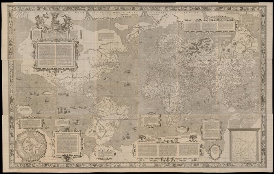
Gerhard Mercator (1569), Universitätsbibliothek Basel, UBH Kartenslg AA 3-5, https://doi.org/10.3931/e-rara-25290 / Public Domain Mark. Actual institutional image reproduction; not proof of later interpretations. Source & reuse ↗
Image source record
Image rights and evidence limits
Public Domain Mark 1.0
Image existence does not prove a linked claim. Consult image-specific captions and reuse conditions.
Sources and what they support
Links document the record, the claim’s circulation, an assessment, or reuse terms as labeled. A source link is not automatically corroboration.
- institutional or documentary recordhttps://www.e-rara.ch/bau_1/content/titleinfo/7955225
Connected records
These are contextual links, not automatic corroboration.
- Ancient sea kings surveyed Antarctica
Inspect conjectural southern land on an actual 1569 world map; the drawing alone does not establish a lost survey tradition.
Explore the same topic
- Historical record
Abizaid’s flat, stationary-Earth map
John George Abizaid’s map with English and Arabic text.
- Historical record
Al-Idrisi’s world map — a sixteenth-century copy
Orientation is a cartographic convention, not inversion of the physical Earth.
- Historical record
Babylonian Map of the World
Disc and surrounding cosmic waters; ancient worldview, not an Antarctic survey.
- Historical record
Bertelli’s map of the known world
Southern land and fantastic fauna are speculative; do not label them surveyed ice-free Antarctica.