313 source-linked artifacts: the original 300-record catalog, six merged featured originals and seven additional institutional records, each indexed once. Featured badges point to those same records—not a second collection.
Looking for world maps? There are 18 geographic world maps and 13 alternative or sacred terrestrial world-model artifacts. Use World maps & models below; detailed distinctions remain on each record. Regional/polar charts and celestial diagrams are separate categories.
Featured and image-backed records appear first. All filters and search operate on the same 313 records. Captions distinguish an original artifact, a modern digital assembly, a related copy and an interpretation. Image rights gaps are not filled with invented proof.
Collection counts, visual access & reuse
The original 300-record visual audit found 81 confirmed institutional routes, 160 delivery-unverified routes and 59 catalog-only/missing visuals. The six merged featured originals add five existing cleared images and one linked audio record; they are not newly discovered records. Further licensed thumbnails are being added without changing source identities.
Only cleared images are embedded; other records link to institutions. Many dates distinguish publication, surviving copy or exposure. A historical map’s existence does not establish the accuracy of its geography. Download full structured catalog ↗
How to read the labels
Documented record: an institutional source is linked; its existence does not prove interpretations. Disputed: the claim faces substantive counterevidence described in the reader. Unverified: independently authenticated support is not established here. Speculative: a proposed model or interpretation, not an observed fact. Research context: scientific or methodological background, not another conspiracy claim.
Labels summarize this collection’s review, not a guarantee of truth. Missing dates, origins and visual evidence remain explicit.
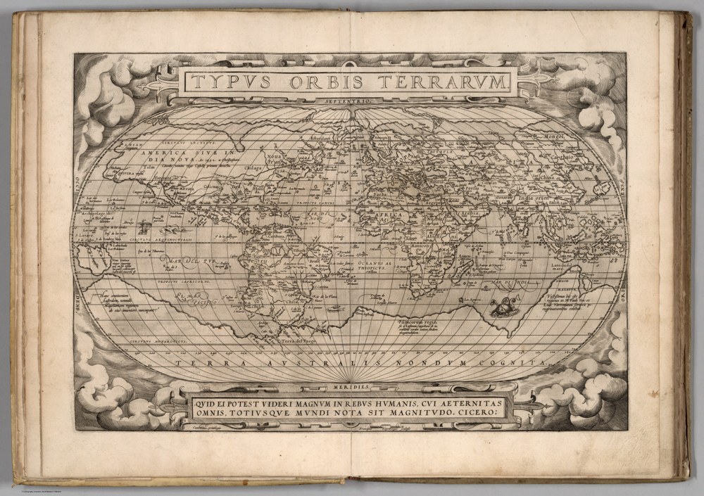
David Rumsey Map Collection, David Rumsey Map Center, Stanford University Libraries; courtesy of www.davidrumsey.com. Ortelius, Typus Orbis Terrarum, 1570 first-edition atlas map. Terra Australis is conjectural geography, not a measured Antarctic coastline. Proportionally resized; no reconstruction. Source & reuse ↗Source image · inspect provenance
HISTORICAL WORLD MAP1570
World maps & models · 1570
Ortelius: Typus Orbis Terrarum
The 1570 edition of Ortelius’s world map, distinct from the existing 1598 edition. Historical conjectural geography is not evidence of a surveyed Antarctic civilization.
Edition, source & reuse
Edition-specific1570 record; do not substitute a later edition image.
Current Rumsey terms permit attributed publication subject to conditions; this entry remains source-link only.
SOURCE-LINKED ENTRYOriginal visual not embeddedRead the source record, image availability and reuse limits.
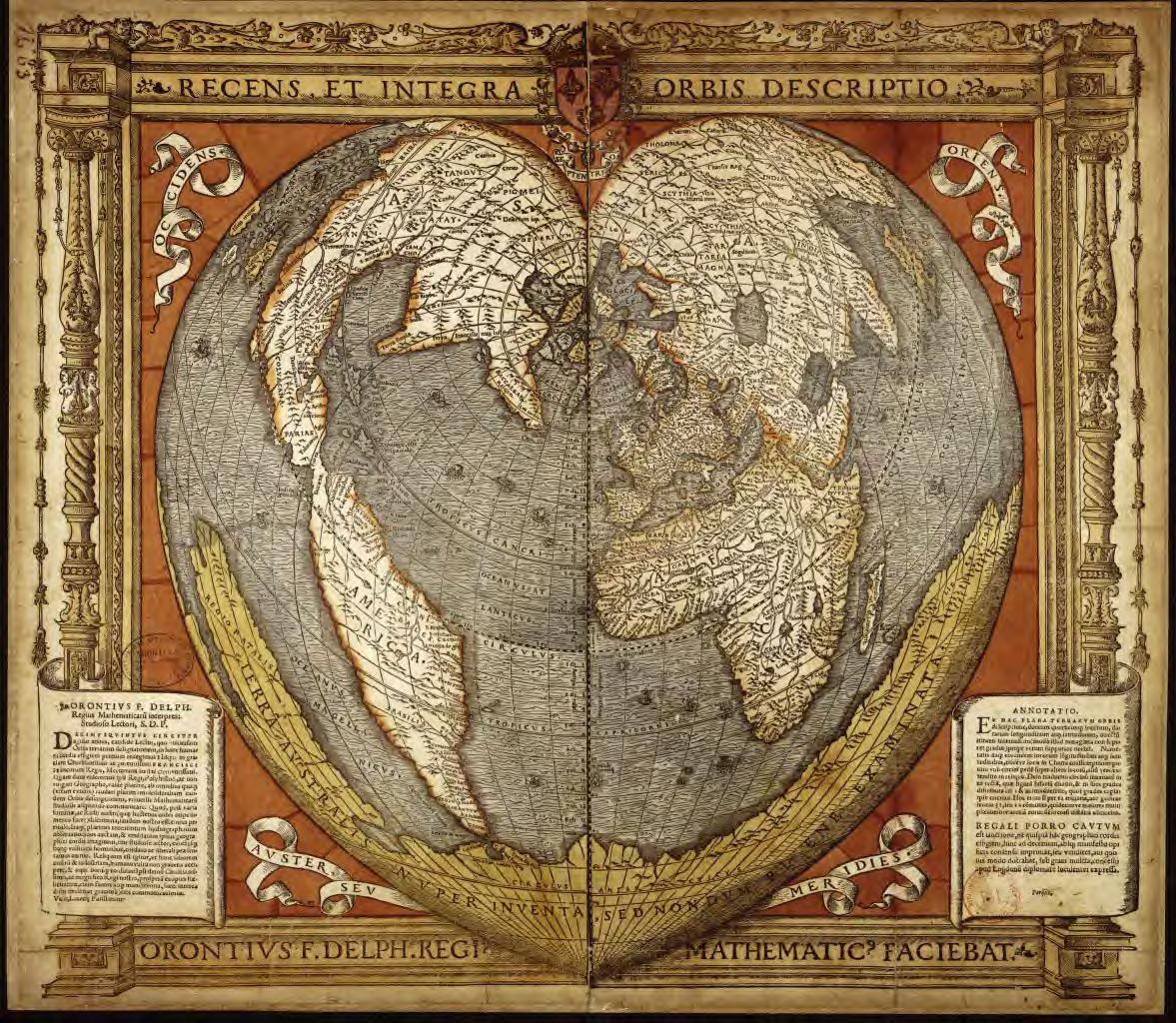
HISTORICAL WORLD MAP1531 signature; [1532] cataloged impression
World maps & models · 1531 signature; [1532] cataloged impression
Oronce Fine: Nova et integra universi orbis descriptio
Fine’s double-heart world map, distinct from the 1534 single-heart map already in the collection. Its conjectural southern land is not a verified Antarctic survey.
Edition, source & reuse
Signature/design date1531; this BnF impression is cataloged [1532].
Specific scan reuse is not cleared; external viewer only.
SOURCE-LINKED ENTRYOriginal visual not embeddedRead the source record, image availability and reuse limits.
HISTORICAL WORLD MAP1513
World maps & models · 1513
Piri Reis world map fragment
An authentic surviving fragment of Piri Reis’s world map. Provenance of the artifact does not establish the later interpretation that it depicts an ice-free Antarctic coast.
Edition, source & reuse
Surviving fragment; not a complete map.
Museum-controlled image rights; external source only, pending permission.
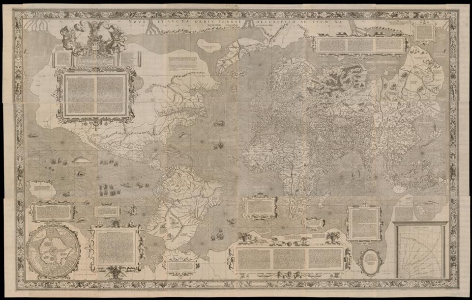
Gerhard Mercator (1569), Universitätsbibliothek Basel, UBH Kartenslg AA 3-5, https://doi.org/10.3931/e-rara-25290 / Public Domain Mark. Actual institutional image reproduction; not proof of later interpretations. Source & reuse ↗Source image · inspect provenance
WORLD MAP / INSTITUTIONAL ORIGINAL1569
World maps & models · 1569
Mercator’s 1569 world map
Mercator’s 1569 world map in the Basel holding, shown as the institution’s complete-map composite. Its southern continent is conjectural, not a verified survey of ice-free Antarctica.
Universitätsbibliothek Basel
Provenance & reuse
Public Domain Mark 1.0. Institution’s complete-map composite canvas [4], not a reconstructed coastline. Southern land is conjectural. Institution requests citation and notification of published digital offering; no notification sent.
SOURCE-LINKED ENTRYOriginal visual not embeddedRead the source record, image availability and reuse limits.
NEW SOURCE RECORD / NOT PROOF OF A THEORYcirca 1914
Objects & equipment · circa 1914
Boat compass and binnacle — Shackleton expedition
A liquid lifeboat compass taken on Shackleton’s Trans-Antarctic expedition. The museum says it was possibly the one carried in the James Caird to South Georgia—not a certain identification.
Royal Museums Greenwich / National Maritime Museum
A liquid lifeboat compass taken on Shackleton’s Trans-Antarctic expedition. The museum says it was possibly the one carried in the James Caird to South Georgia—not a certain identification.
Provenance & reuse
Institutional identifier: ZBA1610
Institutional images include a do-not-reproduce notice; external object record only. No image copied.
Chart of the South Polar Sea — annotated expedition copy
The institution catalogs a June 1839 Hydrographic Office chart with later manuscript tracks associated with John Edward Davis and Joseph Dalton Hooker during the Ross expedition. Printing and annotations are different events;…
David Rumsey Historical Map Collection
The institution catalogs a June 1839 Hydrographic Office chart with later manuscript tracks associated with John Edward Davis and Joseph Dalton Hooker during the Ross expedition. Printing and annotations are different events; this is not a claim that all later tracks were known in 1839.
Provenance & reuse
Institutional identifier: 16137.000
Source viewer linked. Current Rumsey publication terms require attribution and item-specific checking; no new image embedded in this update.
SOURCE-LINKED ENTRYOriginal visual not embeddedRead the source record, image availability and reuse limits.
NEW SOURCE RECORD / NOT PROOF OF A THEORY1754
Polar maps & surveys · 1754
Buache’s Carte des terres australes
A southern-region chart compiled from Bouvet de Lozier’s expedition material. The BnF dates this edition to 1754. It is not a modern subglacial survey and is distinct from later Buache maps.
Bibliothèque nationale de France
A southern-region chart compiled from Bouvet de Lozier’s expedition material. The BnF dates this edition to 1754. It is not a modern subglacial survey and is distinct from later Buache maps.
Provenance & reuse
Institutional identifier: FRBNF40592237
BnF commercial reproduction requires authorization; source link only. No image copied.
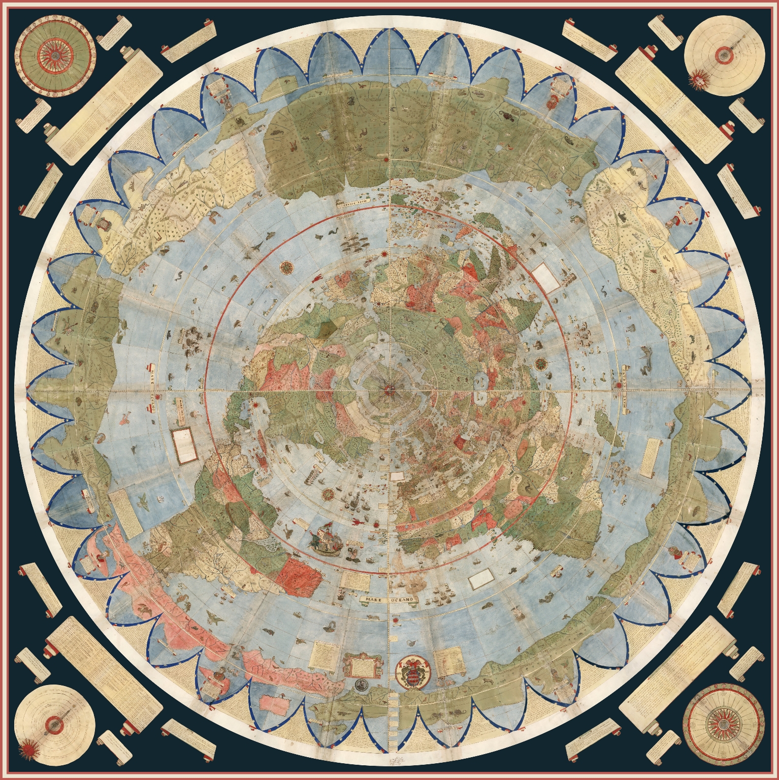
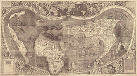
Modern digital assembly of 60 original 1587 sheets—not an original one-sheet map. David Rumsey Map Collection, David Rumsey Map Center, Stanford University Libraries; courtesy of the David Rumsey Map Collection, www.davidrumsey.com. Reuse terms ↗Source image · inspect provenanceFeatured
Original visual source linkedmodern digital assembly of original 1587 map sheetsOpen institutional image ↗Open original viewer / source context ↗Visual evidence of the artifact itself, not proof of modern interpretations or hidden-land claims. Image reproduction is not cleared here; linked externally.
FEATURED ORIGINAL065 / MAPS1587
Geographic world map
World maps & models · 1587
Manuscript world map, Tavola 1–60
Urbano Monte’s sixty-sheet map represents a globe in polar projection.
David Rumsey Historical Map Collection, Stanford Libraries
Urbano Monte’s sixty-sheet map represents a globe in polar projection.
Provenance, rights & context
Counted once: modern stitched composites, rotations and reprojections are not additional historical artifacts.
Accession / identifier: 10130.000
Reuse status: Unknown; collection image license not verified
Catalog check: Institutional source checked; uncertainties retained in metadata
Notes: Counted once: modern stitched composites, rotations and reprojections are not additional historical artifacts.
Library of Congress / World Digital Library / Actual archival image. Existing cleared LOC reproduction; source credit retained.Source image · inspect provenanceFeatured
FEATURED ORIGINALMERGED FEATURED ORIGINAL1534
World maps & models · 1534
Oronce Fine world map, 1534
A historical world map with a conjectural southern continent—not a verified Antarctic survey.
Library of Congress / World Digital Library
A historical world map with a conjectural southern continent—not a verified Antarctic survey.
Provenance & reuse
Existing cleared LOC reproduction; source credit retained.
Previously shown in the separate featured gallery; now indexed once in this collection.
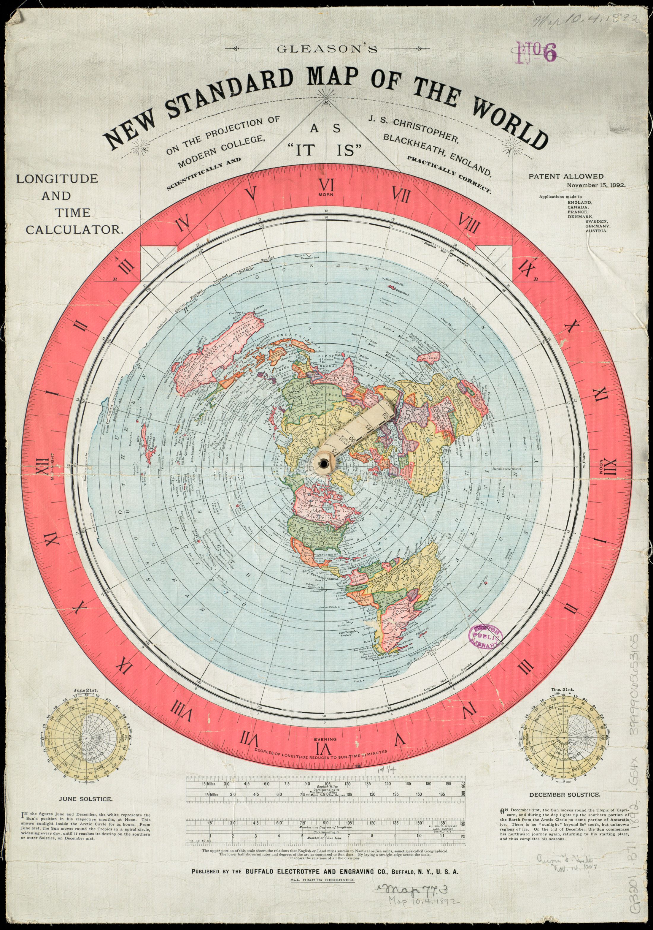
Boston Public Library / Norman B. Leventhal Map Center / Actual archival image. No known copyright restrictions reported by the holding institution.Source image · inspect provenanceFeatured
FEATURED ORIGINALMERGED FEATURED ORIGINAL1892
World maps & models · 1892
Gleason’s New Standard Map of the World
An authentic historical flat-Earth advocacy artifact. Its publication is not evidence that its world model is accurate.
Boston Public Library / Norman B. Leventhal Map Center
An authentic historical flat-Earth advocacy artifact. Its publication is not evidence that its world model is accurate.
Provenance & reuse
No known copyright restrictions reported by the holding institution.
Previously shown in the separate featured gallery; now indexed once in this collection.
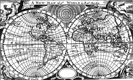
Washington University Libraries; Robert Morden, Geography Rectified,1680 Reuse terms ↗Source image · inspect provenanceFeatured
Original visual source linkedinstitutional digital object viewerOpen original viewer / source context ↗Visual evidence of the artifact itself, not proof of modern interpretations or hidden-land claims. Image reproduction is not cleared here; linked externally.
FEATURED ORIGINAL083 / MAPS1680
Geographic world map
World maps & models · 1680
World map in Geography Rectified
Hemispheric arrangement belongs to globe cartography, not a two-disc cosmology.
Washington University Libraries
Hemispheric arrangement belongs to globe cartography, not a two-disc cosmology.
Provenance, rights & context
Contextual visual history; not direct evidence about Antarctica
Creator: Robert Morden
Reuse status: Public Domain Mark 1.0 recorded by institution.
Catalog check: Institutional source inspected via web text/search; full-resolution asset not downloaded.
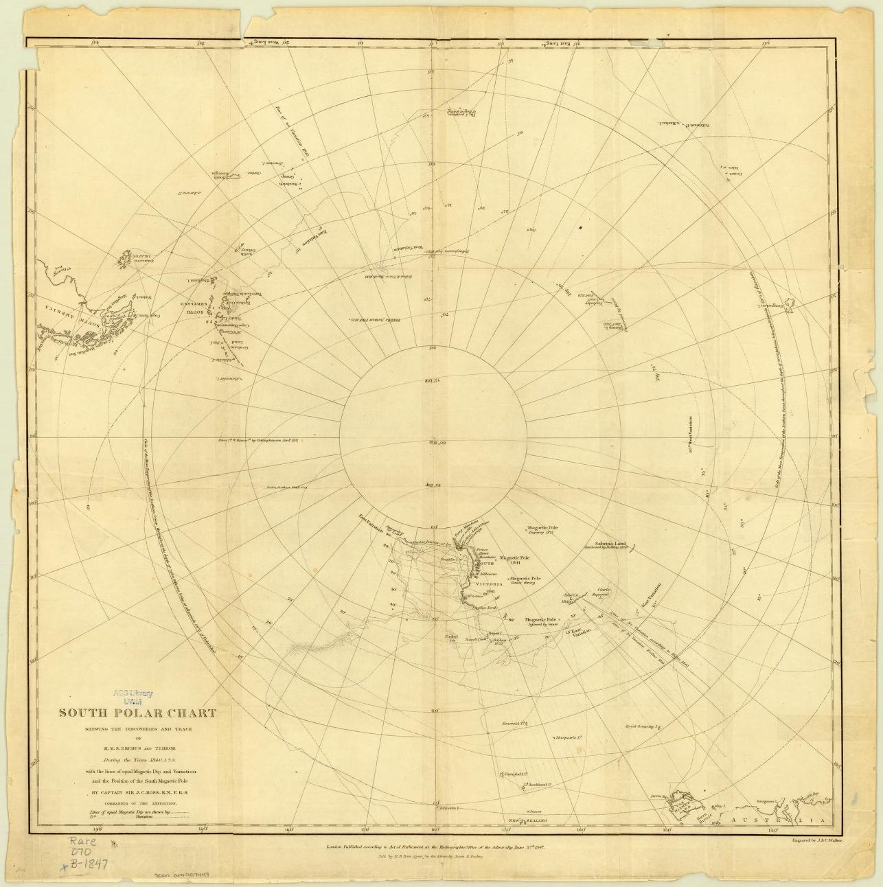
UWM Libraries / World Digital Library / Library of Congress / Actual archival image. No known copyright restrictions reported for the linked collection.Source image · inspect provenanceFeatured
FEATURED ORIGINALMERGED FEATURED ORIGINAL1847
Polar maps & surveys · 1847
Ross South Polar Chart
Expedition routes and geographic knowledge recorded on a historical southern-polar chart.
UWM Libraries / World Digital Library / Library of Congress
Expedition routes and geographic knowledge recorded on a historical southern-polar chart.
Provenance & reuse
No known copyright restrictions reported for the linked collection.
Previously shown in the separate featured gallery; now indexed once in this collection.
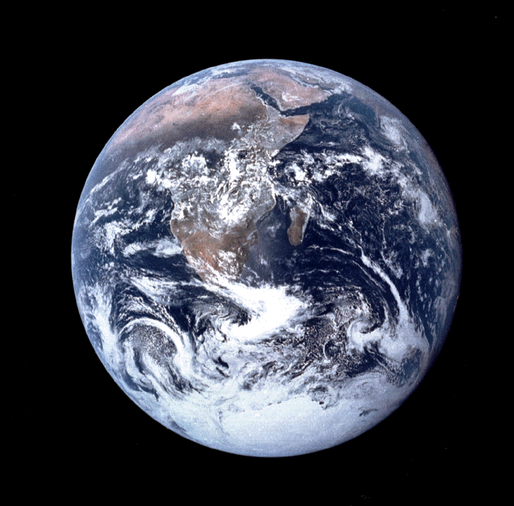
Actual artifact image; source credit: NASA.Source image · inspect provenance
Original visual source linkedinstitutional reproduction of original artifactOpen institutional image ↗Open original viewer / source context ↗Visual evidence of the artifact itself, not proof of modern interpretations or hidden-land claims. Reuse status: NASA informational/editorial reuse guidelines; credit NASA, do not imply endorsement.
029 / PHOTOGRAPHY1972-12-07
Expedition photography · 1972-12-07
Apollo 17 Blue Marble exposure
Astronaut photograph includes the illuminated Antarctic ice cap.
NASA
Astronaut photograph includes the illuminated Antarctic ice cap.
Provenance, rights & context
Read the institution’s catalog context before interpreting this artifact.
Accession / identifier: AS17-148-22727
Reuse status: NASA informational/editorial reuse guidelines; credit NASA and do not imply endorsement.
Catalog check: Institutional catalog or institutional illustrated collection checked
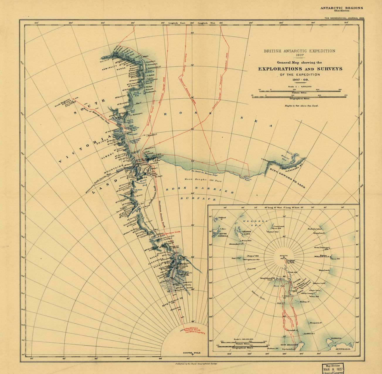
Actual artifact image; source credit: Library of Congress.Source image · inspect provenance
Original visual source linkedinstitutional reproduction of original artifactOpen institutional image ↗Open original viewer / source context ↗Visual evidence of the artifact itself, not proof of modern interpretations or hidden-land claims. Reuse status: LOC item2002624045 explicitly free use/reuse absent contrary advisory.
032 / MAPS1909
Polar maps & surveys · 1909
Nimrod exploration and survey map
Map traces the expedition’s distinct survey parties.
Library of Congress
Map traces the expedition’s distinct survey parties.
Provenance, rights & context
Read the institution’s catalog context before interpreting this artifact.
Accession / identifier: LOC 2002624045
Reuse status: LOC Geography and Map Division: free use/reuse absent contrary advisory.
Catalog check: Institutional catalog or institutional illustrated collection checked
Atlas title-page preview, not a survey sheet. Open the original atlas viewer.Source image · inspect provenance
Original visual source linkedarchive scanOpen institutional image ↗Open original viewer / source context ↗Visual evidence of the artifact itself, not proof of modern interpretations or hidden-land claims. Reuse status: Institutional record previously verified: free use/reuse or no known restrictions; retain source credit.
033 / MAPS1844
Polar maps & surveys · 1844
Wilkes expedition atlas
Original expedition atlas includes an Antarctic continent chart.
Library of Congress
Original expedition atlas includes an Antarctic continent chart.
Provenance, rights & context
Count atlas once; do not additionally count its Antarctic chart in this inventory.
Accession / identifier: LOC 2010589747
Reuse status: LOC Geography and Map Division: free use/reuse absent contrary advisory.
Catalog check: Institutional catalog or institutional illustrated collection checked
Notes: Count atlas once; do not additionally count its Antarctic chart in this inventory.
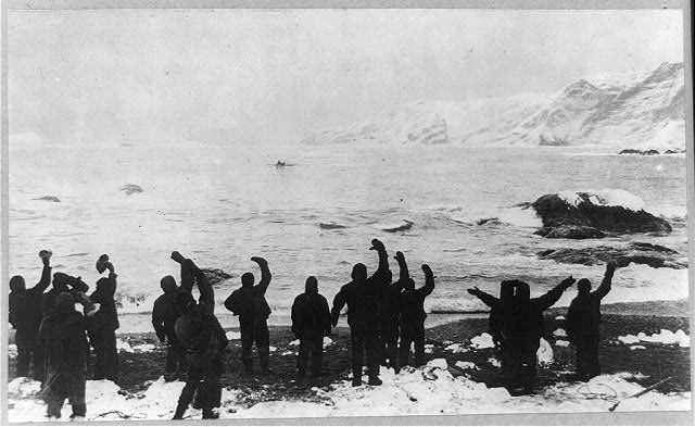
Actual artifact image; source credit: Library of Congress.Source image · inspect provenance
Original visual source linkedarchive scanOpen institutional image ↗Open original viewer / source context ↗Visual evidence of the artifact itself, not proof of modern interpretations or hidden-land claims. Reuse status: Institutional record previously verified: free use/reuse or no known restrictions; retain source credit.
036 / PHOTOGRAPHYcirca 1916
Expedition photography · circa 1916
Elephant Island party waving toward a boat
Frank Hurley photograph cataloged under a historical rescue caption.
Library of Congress
Frank Hurley photograph cataloged under a historical rescue caption.
Provenance, rights & context
Preserve distinction between catalog caption and unverified exact exposure event; not independently dated to rescue day.
Accession / identifier: LOC 2013646124
Reuse status: LOC rights advisory: No known restrictions on publication.
Catalog check: Institutional item metadata and explicit rights advisory checked.
Notes: Preserve distinction between catalog caption and unverified exact exposure event; not independently dated to rescue day.
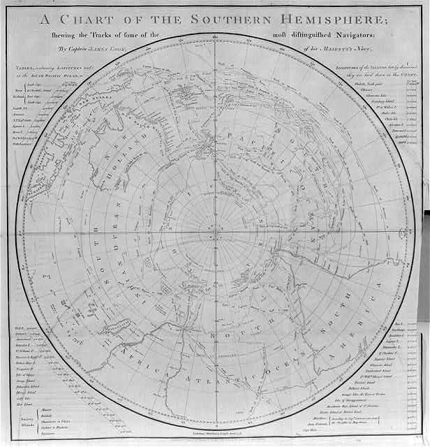
Related LOC copy of Cook’s 1777 chart—not the British Library holding cataloged below. 616×640 film-copy preview; no added detail.Source image · inspect provenance
Original visual source linkedinstitutional photograph/scan of historical mapOpen institutional image ↗Open original viewer / source context ↗Visual evidence of the artifact itself, not proof of modern interpretations or hidden-land claims. Image reproduction is not cleared here; linked externally.
039 / MAPS1777
Polar maps & surveys · 1777
Chart of the Southern Hemisphere
Cook voyage tracks surround an uncharted center.
British Library
Cook voyage tracks surround an uncharted center.
Provenance, rights & context
Read the institution’s catalog context before interpreting this artifact.
Accession / identifier: 10025.f. 20
Reuse status: Unknown; reproduction permission not verified
Catalog check: Institutional source checked; uncertainties retained in metadata
Actual artifact image; source credit: Library of Congress.Source image · inspect provenance
Original visual source linkedarchive scanOpen institutional image ↗Open original viewer / source context ↗Visual evidence of the artifact itself, not proof of modern interpretations or hidden-land claims. Reuse status: Institutional record previously verified: free use/reuse or no known restrictions; retain source credit.
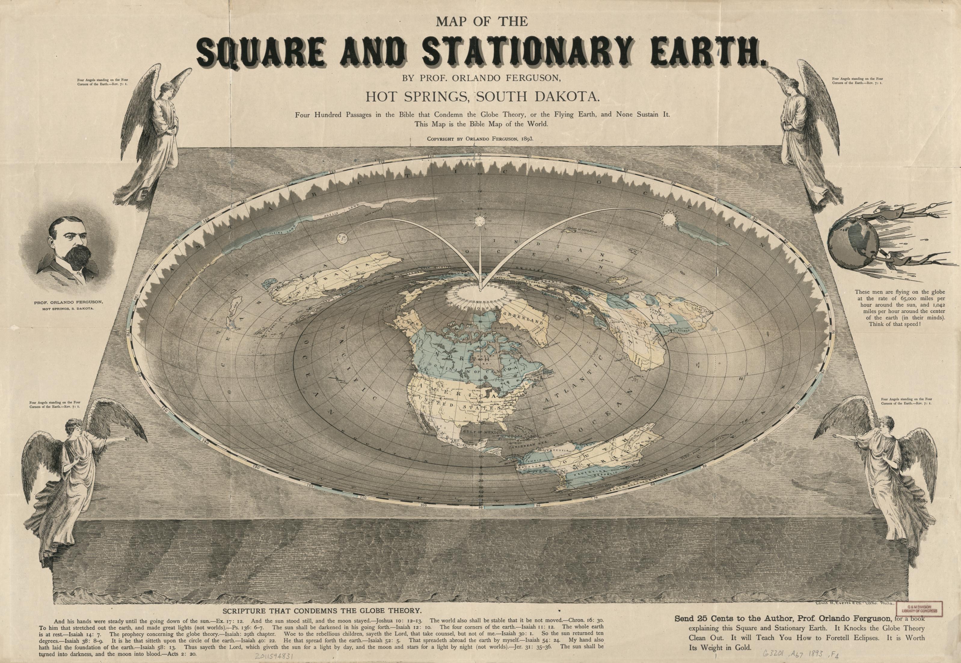
053 / COSMOLOGY1893
Alternative / sacred terrestrial world model
World maps & models · 1893
Map of the square and stationary earth
Orlando Ferguson’s explicitly anti-globe map.
Library of Congress
Orlando Ferguson’s explicitly anti-globe map.
Provenance, rights & context
Read the institution’s catalog context before interpreting this artifact.
Accession / identifier: 2011594831
Reuse status: Free to use and reuse per LOC Geography and Map Division statement; check item for exceptions
Catalog check: Institutional source checked; uncertainties retained in metadata
Actual artifact image; source credit: Library of Congress.Source image · inspect provenance
Original visual source linkedarchive scanOpen institutional image ↗Open original viewer / source context ↗Visual evidence of the artifact itself, not proof of modern interpretations or hidden-land claims. Reuse status: Institutional record previously verified: free use/reuse or no known restrictions; retain source credit.
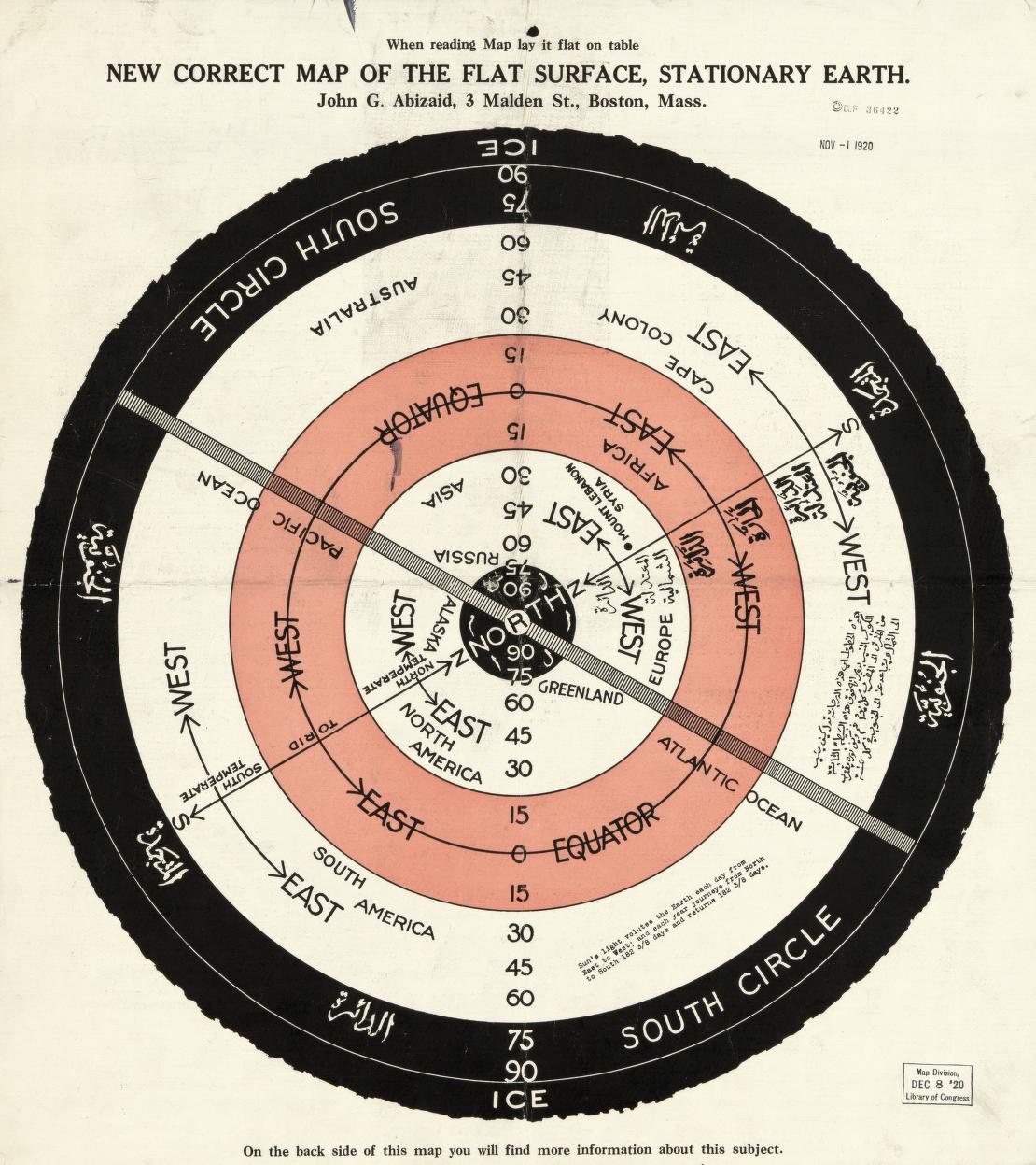
054 / COSMOLOGYcirca 1920
Alternative / sacred terrestrial world model
World maps & models · circa 1920
New correct map of the flat surface, stationary earth
John George Abizaid’s map with English and Arabic text.
Library of Congress
John George Abizaid’s map with English and Arabic text.
Provenance, rights & context
Read the institution’s catalog context before interpreting this artifact.
Accession / identifier: 2013585077
Reuse status: Free to use and reuse per LOC Geography and Map Division statement; check item for exceptions
Catalog check: Institutional source checked; uncertainties retained in metadata
Low-resolution institutional preview; open original viewer for detail.Source image · inspect provenance
Original visual source linkedarchive scanOpen institutional image ↗Open original viewer / source context ↗Visual evidence of the artifact itself, not proof of modern interpretations or hidden-land claims. Reuse status: Institutional record previously verified: free use/reuse or no known restrictions; retain source credit.
055 / COSMOLOGYcirca 1860
Alternative / sacred terrestrial world model
World maps & models · circa 1860
The universe after Cosmas, A.D. 550
Kohl’s nineteenth-century tracing of a Cosmas reconstruction.
Library of Congress
Kohl’s nineteenth-century tracing of a Cosmas reconstruction.
Provenance, rights & context
550 is the represented model’s date, not this artifact’s creation date.
Accession / identifier: 2011594788
Reuse status: Free to use and reuse per LOC Geography and Map Division statement; check item for exceptions
Catalog check: Institutional source checked; uncertainties retained in metadata
Notes: 550 is the represented model’s date, not this artifact’s creation date.
Actual artifact image; source credit: Library of Congress.Source image · inspect provenance
Original visual source linkedarchive scanOpen institutional image ↗Open original viewer / source context ↗Visual evidence of the artifact itself, not proof of modern interpretations or hidden-land claims. Reuse status: Institutional record previously verified: free use/reuse or no known restrictions; retain source credit.
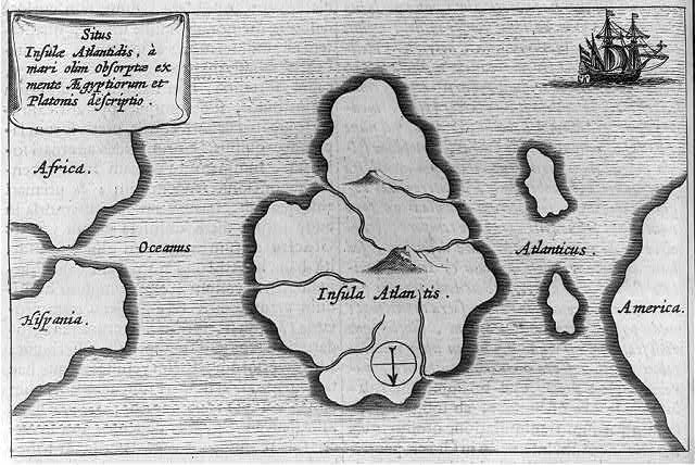
056 / MAPS1665 (catalog attribution)
Polar maps & surveys · 1665 (catalog attribution)
Insula Atlantis
Kircher’s imagined Atlantic island.
Library of Congress
Kircher’s imagined Atlantic island.
Provenance, rights & context
LOC warns caption-card metadata is unverified; reproduction source needs care.
Accession / identifier: 2002698490
Reuse status: No known restrictions on publication
Catalog check: Institutional source checked; uncertainties retained in metadata
Notes: LOC warns caption-card metadata is unverified; reproduction source needs care.
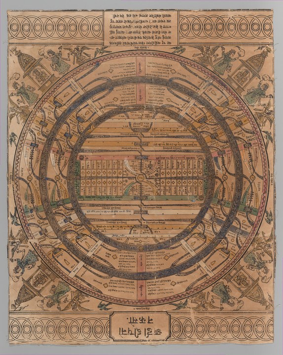
The Metropolitan Museum of Art, Gift of Mark Baron and Elise Boisanté, 2016; object 2016.499.3. Actual institutional reproduction; labels and artifact existence do not verify later interpretations. Source & reuse ↗Source image · inspect provenance
057 / COSMOLOGY1900
Alternative / sacred terrestrial world model
World maps & models · 1900
Jain cosmological map of adhaidvipa
Concentric continents and oceans express Jain cosmology.
The Metropolitan Museum of Art
Concentric continents and oceans express Jain cosmology.
Provenance, rights & context
Read the institution’s catalog context before interpreting this artifact.
Accession / identifier: 2016.499.3
Reuse status: Public Domain; Met Open Access
Catalog check: Institutional source checked; uncertainties retained in metadata
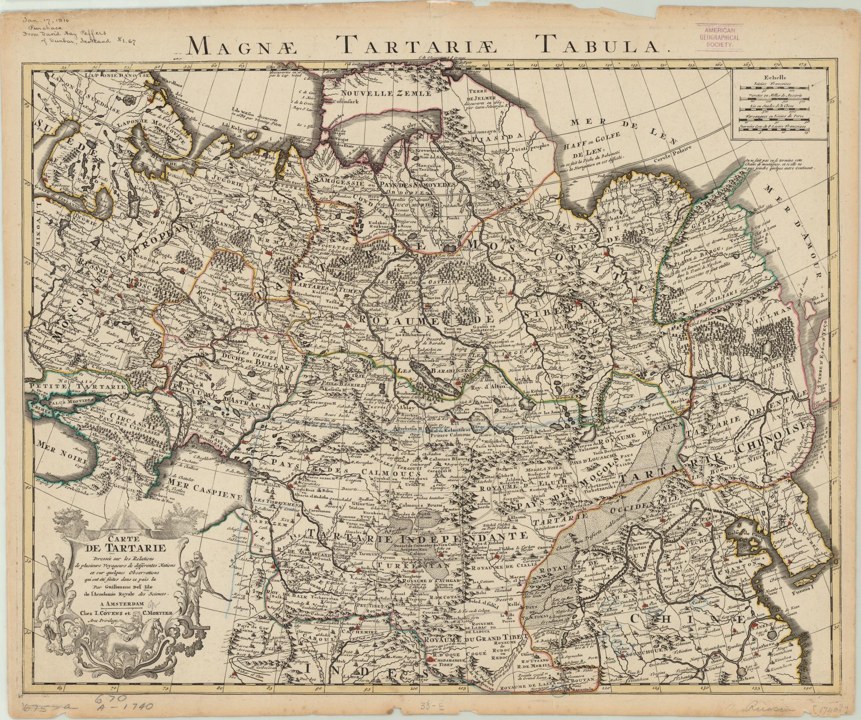
Guillaume de L’Isle, Covens and Mortier (1757). University of Wisconsin–Milwaukee Libraries, World Digital Library / Library of Congress. Actual institutional reproduction; labels and artifact existence do not verify later interpretations. Source & reuse ↗Source image · inspect provenance
060 / MAPS1757
Polar maps & surveys · 1757
Carte de Tartarie
Published edition of a 1706 map distinguishing several Tartaries.
University of Wisconsin–Milwaukee Libraries
Published edition of a 1706 map distinguishing several Tartaries.
Provenance, rights & context
Creator: Guillaume de l’Isle; Covens and Mortier
Reuse status: Unknown; reproduction permission not verified
Catalog check: Institutional source checked; uncertainties retained in metadata
Notes: Creator: Guillaume de l’Isle; Covens and Mortier
Low-resolution institutional preview; original viewer may offer more detail. Library of Congress, Geography and Map Division Reuse terms ↗Source image · inspect provenance
Original visual source linkedarchive scanOpen institutional image ↗Open original viewer / source context ↗Visual evidence of the artifact itself, not proof of modern interpretations or hidden-land claims. Image reproduction is not cleared here; linked externally.
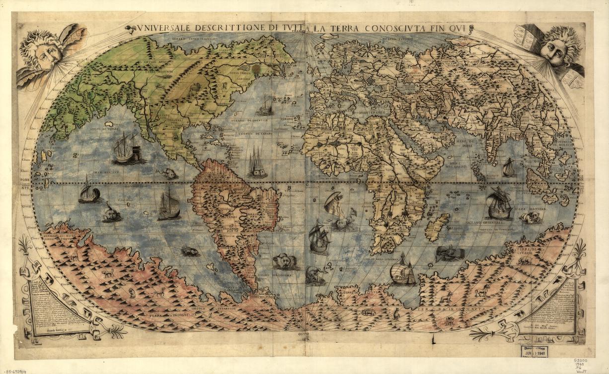
Library of Congress, Geography and Map Division Reuse terms ↗Source image · inspect provenance
Original visual source linkedprimary-source artifact reproductionOpen institutional image ↗Open original viewer / source context ↗Visual evidence of the artifact itself, not proof of modern interpretations or hidden-land claims. Image reproduction is not cleared here; linked externally.
082 / RECORDS1565
Geographic world map
World maps & models · 1565
Vniversale descrittione di tvtta la terra conoscivta fin qvi
Southern land and fantastic fauna are speculative; do not label them surveyed ice-free Antarctica.
Library of Congress
Southern land and fantastic fauna are speculative; do not label them surveyed ice-free Antarctica.
Provenance, rights & context
Conjectural Terra Australis; not surveyed Antarctica
Creator: Ferrando Bertelli; associated with Paolo Forlani
Reuse status: Not verified; historical age alone is not a confirmed digital-image reuse license.
Catalog check: Institutional source inspected via web text/search; full-resolution asset not downloaded.
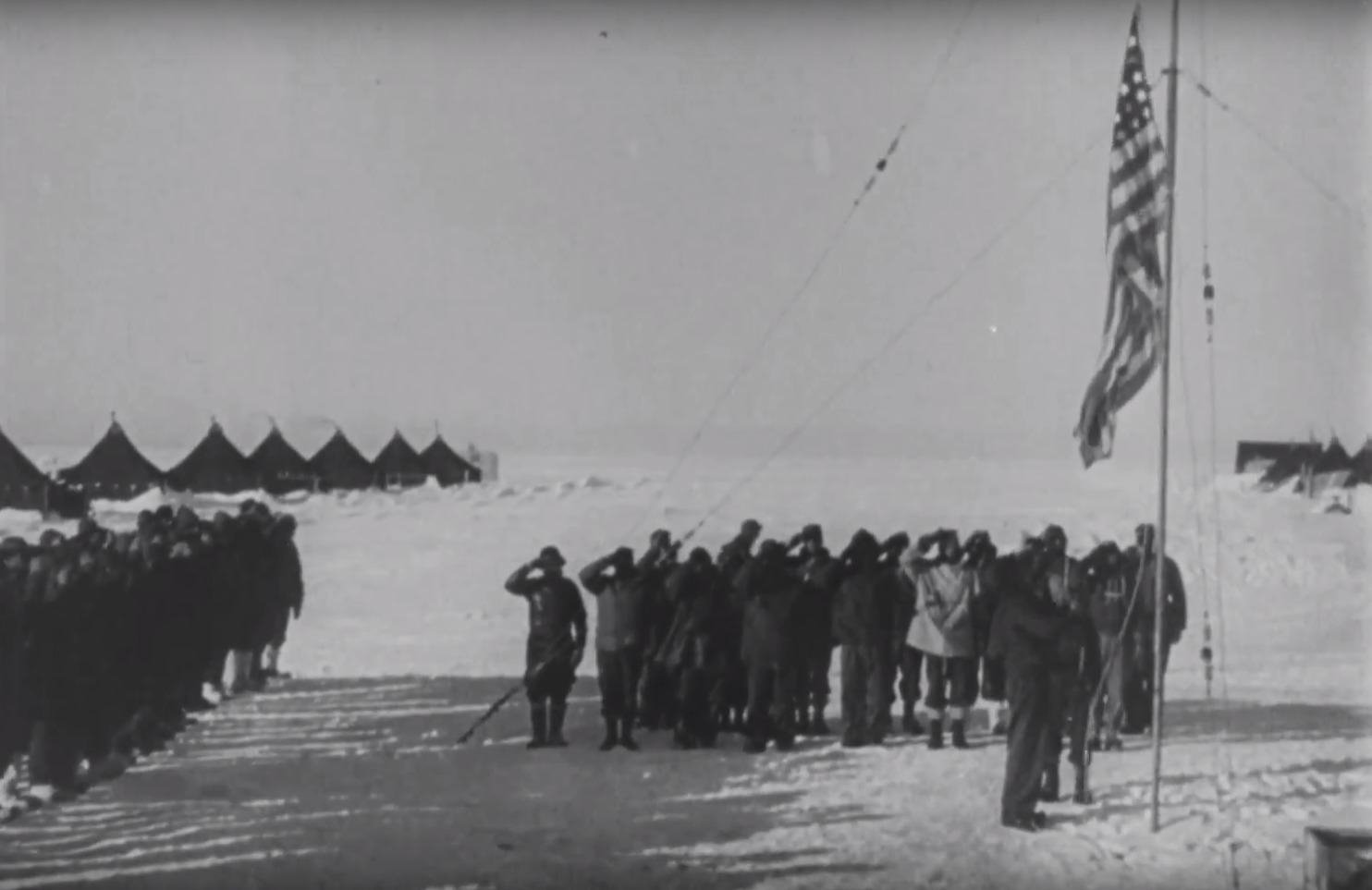
US National Archives / Actual archival image. Existing cleared US government archival still. Distinct frame, not a crop duplicate.Source image · inspect provenance
MERGED FEATURED ORIGINAL1946–47 expedition
Expedition photography · 1946–47 expedition
Highjump at Little America IV — archival film still
A distinct archival film frame reproduced in NARA’s Highjump feature. It shows a documented expedition base, not evidence of a hidden-base claim.
US National Archives
A distinct archival film frame reproduced in NARA’s Highjump feature. It shows a documented expedition base, not evidence of a hidden-base claim.
Provenance & reuse
Existing cleared US government archival still. Distinct frame, not a crop duplicate.
Previously shown in the separate featured gallery; now indexed once in this collection.
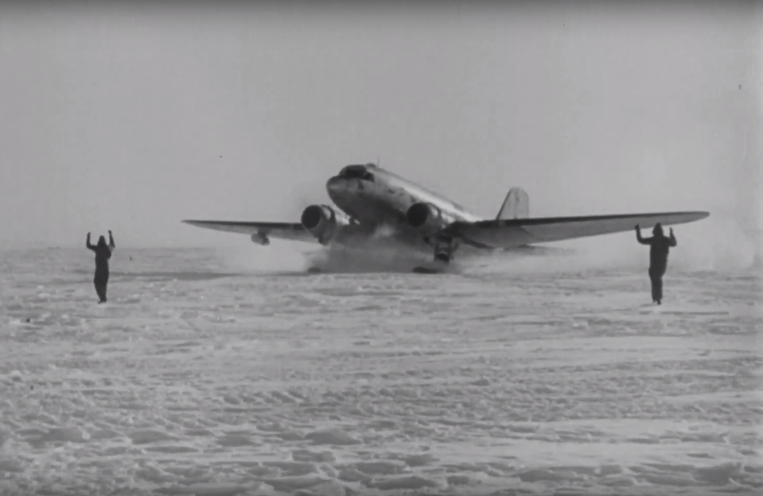
US National Archives / Actual archival image. Existing cleared US government archival still. Distinct frame, not a crop duplicate.Source image · inspect provenance
MERGED FEATURED ORIGINAL1946–47 expedition
Expedition photography · 1946–47 expedition
Aircraft on Antarctic ice — archival film still
A different archival frame showing expedition aircraft. The two frames are not counted as two independent expeditions or corroborations.
US National Archives
A different archival frame showing expedition aircraft. The two frames are not counted as two independent expeditions or corroborations.
Provenance & reuse
Existing cleared US government archival still. Distinct frame, not a crop duplicate.
Previously shown in the separate featured gallery; now indexed once in this collection.
SOURCE-LINKED ENTRYOriginal visual not embeddedRead the source record, image availability and reuse limits.Open institutional image ↗Open original viewer / source context ↗Visual evidence of the artifact itself, not proof of modern interpretations or hidden-land claims. Image reproduction is not cleared here; linked externally.
001 / PHOTOGRAPHY1902-01
Expedition photography · 1902-01
Hekla at Sandefjord
Scottish expedition photograph.
University of Glasgow
Scottish expedition photograph.
Provenance, rights & context
Distinct original negative; crops are not counted separately. Date range used where caption gives no specific date.
Accession / identifier: C1/2
Reuse status: Not verified; source link only until reuse terms are checked.
Catalog check: Institutional catalog or institutional illustrated collection checked
Notes: Distinct original negative; crops are not counted separately. Date range used where caption gives no specific date.
SOURCE-LINKED ENTRYOriginal visual not embeddedRead the source record, image availability and reuse limits.Open institutional image ↗Open original viewer / source context ↗Visual evidence of the artifact itself, not proof of modern interpretations or hidden-land claims. Image reproduction is not cleared here; linked externally.
002 / PHOTOGRAPHY1902-07-15
Expedition photography · 1902-07-15
Bruce aboard Scotia
Scottish expedition photograph.
University of Glasgow
Scottish expedition photograph.
Provenance, rights & context
Distinct original negative; crops are not counted separately. Date range used where caption gives no specific date.
Accession / identifier: C1/43
Reuse status: Not verified; source link only until reuse terms are checked.
Catalog check: Institutional catalog or institutional illustrated collection checked
Notes: Distinct original negative; crops are not counted separately. Date range used where caption gives no specific date.
SOURCE-LINKED ENTRYOriginal visual not embeddedRead the source record, image availability and reuse limits.Open institutional image ↗Open original viewer / source context ↗Visual evidence of the artifact itself, not proof of modern interpretations or hidden-land claims. Image reproduction is not cleared here; linked externally.
003 / PHOTOGRAPHY1903-09
Expedition photography · 1903-09
Scotia cabin companions
Scottish expedition photograph.
University of Glasgow
Scottish expedition photograph.
Provenance, rights & context
Distinct original negative; crops are not counted separately. Date range used where caption gives no specific date.
Accession / identifier: C1/618
Reuse status: Not verified; source link only until reuse terms are checked.
Catalog check: Institutional catalog or institutional illustrated collection checked
Notes: Distinct original negative; crops are not counted separately. Date range used where caption gives no specific date.
SOURCE-LINKED ENTRYOriginal visual not embeddedRead the source record, image availability and reuse limits.Open institutional image ↗Open original viewer / source context ↗Visual evidence of the artifact itself, not proof of modern interpretations or hidden-land claims. Image reproduction is not cleared here; linked externally.
004 / PHOTOGRAPHY1904-03-21
Expedition photography · 1904-03-21
Robertson using sextant
Scottish expedition photograph.
University of Glasgow
Scottish expedition photograph.
Provenance, rights & context
Distinct original negative; crops are not counted separately. Date range used where caption gives no specific date.
Accession / identifier: C1/1731
Reuse status: Not verified; source link only until reuse terms are checked.
Catalog check: Institutional catalog or institutional illustrated collection checked
Notes: Distinct original negative; crops are not counted separately. Date range used where caption gives no specific date.
SOURCE-LINKED ENTRYOriginal visual not embeddedRead the source record, image availability and reuse limits.Open institutional image ↗Open original viewer / source context ↗Visual evidence of the artifact itself, not proof of modern interpretations or hidden-land claims. Image reproduction is not cleared here; linked externally.
005 / PHOTOGRAPHY1902–1904
Expedition photography · 1902–1904
Men aloft
Scottish expedition photograph.
University of Glasgow
Scottish expedition photograph.
Provenance, rights & context
Distinct original negative; crops are not counted separately. Date range used where caption gives no specific date.
Accession / identifier: C1/539
Reuse status: Not verified; source link only until reuse terms are checked.
Catalog check: Institutional catalog or institutional illustrated collection checked
Notes: Distinct original negative; crops are not counted separately. Date range used where caption gives no specific date.
SOURCE-LINKED ENTRYOriginal visual not embeddedRead the source record, image availability and reuse limits.Open institutional image ↗Open original viewer / source context ↗Visual evidence of the artifact itself, not proof of modern interpretations or hidden-land claims. Image reproduction is not cleared here; linked externally.
006 / PHOTOGRAPHY1902–1904
Expedition photography · 1902–1904
Scotia helmsman
Scottish expedition photograph.
University of Glasgow
Scottish expedition photograph.
Provenance, rights & context
Distinct original negative; crops are not counted separately. Date range used where caption gives no specific date.
Accession / identifier: C1/662
Reuse status: Not verified; source link only until reuse terms are checked.
Catalog check: Institutional catalog or institutional illustrated collection checked
Notes: Distinct original negative; crops are not counted separately. Date range used where caption gives no specific date.
SOURCE-LINKED ENTRYOriginal visual not embeddedRead the source record, image availability and reuse limits.Open institutional image ↗Open original viewer / source context ↗Visual evidence of the artifact itself, not proof of modern interpretations or hidden-land claims. Image reproduction is not cleared here; linked externally.
007 / PHOTOGRAPHY1903-02-22
Expedition photography · 1903-02-22
Skiers and Russ
Scottish expedition photograph.
University of Glasgow
Scottish expedition photograph.
Provenance, rights & context
Distinct original negative; crops are not counted separately. Date range used where caption gives no specific date.
Accession / identifier: C1/521
Reuse status: Not verified; source link only until reuse terms are checked.
Catalog check: Institutional catalog or institutional illustrated collection checked
Notes: Distinct original negative; crops are not counted separately. Date range used where caption gives no specific date.
SOURCE-LINKED ENTRYOriginal visual not embeddedRead the source record, image availability and reuse limits.Open institutional image ↗Open original viewer / source context ↗Visual evidence of the artifact itself, not proof of modern interpretations or hidden-land claims. Image reproduction is not cleared here; linked externally.
008 / PHOTOGRAPHY1903-04-20
Expedition photography · 1903-04-20
Omond construction sledging
Scottish expedition photograph.
University of Glasgow
Scottish expedition photograph.
Provenance, rights & context
Distinct original negative; crops are not counted separately. Date range used where caption gives no specific date.
Accession / identifier: C1/212
Reuse status: Not verified; source link only until reuse terms are checked.
Catalog check: Institutional catalog or institutional illustrated collection checked
Notes: Distinct original negative; crops are not counted separately. Date range used where caption gives no specific date.
SOURCE-LINKED ENTRYOriginal visual not embeddedRead the source record, image availability and reuse limits.Open institutional image ↗Open original viewer / source context ↗Visual evidence of the artifact itself, not proof of modern interpretations or hidden-land claims. Image reproduction is not cleared here; linked externally.
009 / PHOTOGRAPHY1904-02-19
Expedition photography · 1904-02-19
Omond meteorological screen
Scottish expedition photograph.
University of Glasgow
Scottish expedition photograph.
Provenance, rights & context
Distinct original negative; crops are not counted separately. Date range used where caption gives no specific date.
Accession / identifier: C1/228
Reuse status: Not verified; source link only until reuse terms are checked.
Catalog check: Institutional catalog or institutional illustrated collection checked
Notes: Distinct original negative; crops are not counted separately. Date range used where caption gives no specific date.
SOURCE-LINKED ENTRYOriginal visual not embeddedRead the source record, image availability and reuse limits.Open institutional image ↗Open original viewer / source context ↗Visual evidence of the artifact itself, not proof of modern interpretations or hidden-land claims. Image reproduction is not cleared here; linked externally.
010 / PHOTOGRAPHY1904-02-21
Expedition photography · 1904-02-21
Mossman observing weather
Scottish expedition photograph.
University of Glasgow
Scottish expedition photograph.
Provenance, rights & context
Distinct original negative; crops are not counted separately. Date range used where caption gives no specific date.
Accession / identifier: C1/221
Reuse status: Not verified; source link only until reuse terms are checked.
Catalog check: Institutional catalog or institutional illustrated collection checked
Notes: Distinct original negative; crops are not counted separately. Date range used where caption gives no specific date.
SOURCE-LINKED ENTRYOriginal visual not embeddedRead the source record, image availability and reuse limits.Open institutional image ↗Open original viewer / source context ↗Visual evidence of the artifact itself, not proof of modern interpretations or hidden-land claims. Image reproduction is not cleared here; linked externally.
011 / PHOTOGRAPHY1902
Expedition photography · 1902
Thomson using rangefinder
Scottish expedition photograph.
University of Glasgow
Scottish expedition photograph.
Provenance, rights & context
Distinct original negative; crops are not counted separately. Date range used where caption gives no specific date.
Accession / identifier: C1/584
Reuse status: Not verified; source link only until reuse terms are checked.
Catalog check: Institutional catalog or institutional illustrated collection checked
Notes: Distinct original negative; crops are not counted separately. Date range used where caption gives no specific date.
SOURCE-LINKED ENTRYOriginal visual not embeddedRead the source record, image availability and reuse limits.Open institutional image ↗Open original viewer / source context ↗Visual evidence of the artifact itself, not proof of modern interpretations or hidden-land claims. Image reproduction is not cleared here; linked externally.
012 / PHOTOGRAPHY1903-10-15
Expedition photography · 1903-10-15
Graptolite penguin rookery
Scottish expedition photograph.
University of Glasgow
Scottish expedition photograph.
Provenance, rights & context
Distinct original negative; crops are not counted separately. Date range used where caption gives no specific date.
Accession / identifier: C1/781
Reuse status: Not verified; source link only until reuse terms are checked.
Catalog check: Institutional catalog or institutional illustrated collection checked
Notes: Distinct original negative; crops are not counted separately. Date range used where caption gives no specific date.
SOURCE-LINKED ENTRYOriginal visual not embeddedRead the source record, image availability and reuse limits.Open institutional image ↗Open original viewer / source context ↗Visual evidence of the artifact itself, not proof of modern interpretations or hidden-land claims. Image reproduction is not cleared here; linked externally.
013 / PHOTOGRAPHYcirca 1903-10-14
Expedition photography · circa 1903-10-14
Fitchie Bay camp
Scottish expedition photograph.
University of Glasgow
Scottish expedition photograph.
Provenance, rights & context
Distinct original negative; crops are not counted separately. Date range used where caption gives no specific date.
Accession / identifier: C1/300
Reuse status: Not verified; source link only until reuse terms are checked.
Catalog check: Institutional catalog or institutional illustrated collection checked
Notes: Distinct original negative; crops are not counted separately. Date range used where caption gives no specific date.
SOURCE-LINKED ENTRYOriginal visual not embeddedRead the source record, image availability and reuse limits.Open institutional image ↗Open original viewer / source context ↗Visual evidence of the artifact itself, not proof of modern interpretations or hidden-land claims. Image reproduction is not cleared here; linked externally.
014 / PHOTOGRAPHY1903-09-02
Expedition photography · 1903-09-02
Cuthbertson beside Scotia
Scottish expedition photograph.
University of Glasgow
Scottish expedition photograph.
Provenance, rights & context
Distinct original negative; crops are not counted separately. Date range used where caption gives no specific date.
Accession / identifier: C1/211
Reuse status: Not verified; source link only until reuse terms are checked.
Catalog check: Institutional catalog or institutional illustrated collection checked
Notes: Distinct original negative; crops are not counted separately. Date range used where caption gives no specific date.
SOURCE-LINKED ENTRYOriginal visual not embeddedRead the source record, image availability and reuse limits.Open institutional image ↗Open original viewer / source context ↗Visual evidence of the artifact itself, not proof of modern interpretations or hidden-land claims. Image reproduction is not cleared here; linked externally.
015 / PHOTOGRAPHY1903-04-28
Expedition photography · 1903-04-28
Icebound Scotia gangway
Scottish expedition photograph.
University of Glasgow
Scottish expedition photograph.
Provenance, rights & context
Distinct original negative; crops are not counted separately. Date range used where caption gives no specific date.
Accession / identifier: C1/545
Reuse status: Not verified; source link only until reuse terms are checked.
Catalog check: Institutional catalog or institutional illustrated collection checked
Notes: Distinct original negative; crops are not counted separately. Date range used where caption gives no specific date.
SOURCE-LINKED ENTRYOriginal visual not embeddedRead the source record, image availability and reuse limits.Open institutional image ↗Open original viewer / source context ↗Visual evidence of the artifact itself, not proof of modern interpretations or hidden-land claims. Image reproduction is not cleared here; linked externally.
016 / PHOTOGRAPHY1904-03-28
Expedition photography · 1904-03-28
Scotia sounding depths
Scottish expedition photograph.
University of Glasgow
Scottish expedition photograph.
Provenance, rights & context
Distinct original negative; crops are not counted separately. Date range used where caption gives no specific date.
Accession / identifier: C1/555
Reuse status: Not verified; source link only until reuse terms are checked.
Catalog check: Institutional catalog or institutional illustrated collection checked
Notes: Distinct original negative; crops are not counted separately. Date range used where caption gives no specific date.
SOURCE-LINKED ENTRYOriginal visual not embeddedRead the source record, image availability and reuse limits.Open institutional image ↗Open original viewer / source context ↗Visual evidence of the artifact itself, not proof of modern interpretations or hidden-land claims. Image reproduction is not cleared here; linked externally.
017 / PHOTOGRAPHY1904-03-28
Expedition photography · 1904-03-28
Lucas sounding apparatus
Scottish expedition photograph.
University of Glasgow
Scottish expedition photograph.
Provenance, rights & context
Distinct original negative; crops are not counted separately. Date range used where caption gives no specific date.
Accession / identifier: C1/553
Reuse status: Not verified; source link only until reuse terms are checked.
Catalog check: Institutional catalog or institutional illustrated collection checked
Notes: Distinct original negative; crops are not counted separately. Date range used where caption gives no specific date.
SOURCE-LINKED ENTRYOriginal visual not embeddedRead the source record, image availability and reuse limits.Open institutional image ↗Open original viewer / source context ↗Visual evidence of the artifact itself, not proof of modern interpretations or hidden-land claims. Image reproduction is not cleared here; linked externally.
018 / PHOTOGRAPHY1904-04-22
Expedition photography · 1904-04-22
Gough Island anchorage
Scottish expedition photograph.
University of Glasgow
Scottish expedition photograph.
Provenance, rights & context
Distinct original negative; crops are not counted separately. Date range used where caption gives no specific date.
Accession / identifier: C1/313
Reuse status: Not verified; source link only until reuse terms are checked.
Catalog check: Institutional catalog or institutional illustrated collection checked
Notes: Distinct original negative; crops are not counted separately. Date range used where caption gives no specific date.
SOURCE-LINKED ENTRYOriginal visual not embeddedRead the source record, image availability and reuse limits.Open institutional image ↗Open original viewer / source context ↗Visual evidence of the artifact itself, not proof of modern interpretations or hidden-land claims. Image reproduction is not cleared here; linked externally.
019 / PHOTOGRAPHY1904-07-21
Expedition photography · 1904-07-21
Scotia homecoming
Scottish expedition photograph.
University of Glasgow
Scottish expedition photograph.
Provenance, rights & context
Distinct original negative; crops are not counted separately. Date range used where caption gives no specific date.
Accession / identifier: C1/714
Reuse status: Not verified; source link only until reuse terms are checked.
Catalog check: Institutional catalog or institutional illustrated collection checked
Notes: Distinct original negative; crops are not counted separately. Date range used where caption gives no specific date.
SOURCE-LINKED ENTRYOriginal visual not embeddedRead the source record, image availability and reuse limits.Open institutional image ↗Open original viewer / source context ↗Visual evidence of the artifact itself, not proof of modern interpretations or hidden-land claims. Image reproduction is not cleared here; linked externally.
020 / PHOTOGRAPHY1903-03-23
Expedition photography · 1903-03-23
Lethwait Strait coast
Scottish expedition photograph.
University of Glasgow
Scottish expedition photograph.
Provenance, rights & context
Distinct original negative; crops are not counted separately. Date range used where caption gives no specific date.
Accession / identifier: C1/171
Reuse status: Not verified; source link only until reuse terms are checked.
Catalog check: Institutional catalog or institutional illustrated collection checked
Notes: Distinct original negative; crops are not counted separately. Date range used where caption gives no specific date.
SOURCE-LINKED ENTRYOriginal visual not embeddedRead the source record, image availability and reuse limits.Open institutional image ↗Open original viewer / source context ↗Visual evidence of the artifact itself, not proof of modern interpretations or hidden-land claims. Image reproduction is not cleared here; linked externally.
022 / RECORDS1903-02-24
Documents & broadcasts · 1903-02-24
Markham instructions to Colbeck
Instructions connect the Morning relief voyage to Discovery logistics.
Dundee Heritage Trust
Instructions connect the Morning relief voyage to Discovery logistics.
Provenance, rights & context
Read the institution’s catalog context before interpreting this artifact.
Accession / identifier: DUNIH 1.015
Reuse status: Not verified; source link only until reuse terms are checked.
Catalog check: Institutional catalog or institutional illustrated collection checked
SOURCE-LINKED ENTRYOriginal visual not embeddedRead the source record, image availability and reuse limits.Open institutional image ↗Open original viewer / source context ↗Visual evidence of the artifact itself, not proof of modern interpretations or hidden-land claims. Image reproduction is not cleared here; linked externally.
023 / RECORDS1912-03
Documents & broadcasts · 1912-03
Scott final letter to Bridgeman
Final-camp letter acquired by the institute in 2013.
Scott Polar Research Institute, University of Cambridge
Final-camp letter acquired by the institute in 2013.
Provenance, rights & context
Read the institution’s catalog context before interpreting this artifact.
Reuse status: Not verified; source link only until reuse terms are checked.
Catalog check: Institutional catalog or institutional illustrated collection checked
SOURCE-LINKED ENTRYOriginal visual not embeddedRead the source record, image availability and reuse limits.
024 / RECORDS1912
Documents & broadcasts · 18 February–29 March 1912
Scott final sledging diary
Scott’s final sledging diary volume, Add MS 51035, dated 18 February–29 March 1912. This exact volume is part of the larger diaries series, not an additional duplicate artifact.
British Library
Scott’s final sledging diary volume, Add MS 51035, dated 18 February–29 March 1912. This exact volume is part of the larger diaries series, not an additional duplicate artifact.
Provenance, rights & context
One specified volume, not the entire twelve-volume series.
Accession / identifier: Add MS 51035
Reuse status: Not verified; source link only until reuse terms are checked.
Catalog check: Institutional catalog or institutional illustrated collection checked
Notes: One specified volume, not the entire twelve-volume series.
SOURCE-LINKED ENTRYOriginal visual not embeddedRead the source record, image availability and reuse limits.Open original viewer / source context ↗Visual evidence of the artifact itself, not proof of modern interpretations or hidden-land claims. Image reproduction is not cleared here; linked externally.
SOURCE-LINKED ENTRYOriginal visual not embeddedRead the source record, image availability and reuse limits.Open original viewer / source context ↗This institutional link could not be confirmed loading during review. Use the catalog source below as a fallback. Visual evidence of the artifact itself, not proof of modern interpretations or hidden-land claims. Image reproduction is not cleared here; linked externally.
028 / MAPS1903/1905; edition date unresolved
Polar maps & surveys · 1903/1905; edition date unresolved
Belgica hydrographic atlas
Lecointe’s map appendix documents expedition navigation and coastlines.
KU Leuven Libraries, 2Bergen Campus Arenberg
Lecointe’s map appendix documents expedition navigation and coastlines.
Provenance, rights & context
Exhibit heading says1905; plate citations say1903. Count atlas once, not its constituent maps.
Accession / identifier: IE8979248
Reuse status: Not verified; source link only until reuse terms are checked.
Catalog check: Institutional catalog or institutional illustrated collection checked
Notes: Exhibit heading says1905; plate citations say1903. Count atlas once, not its constituent maps.
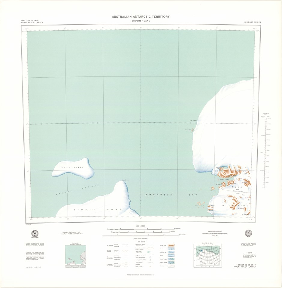
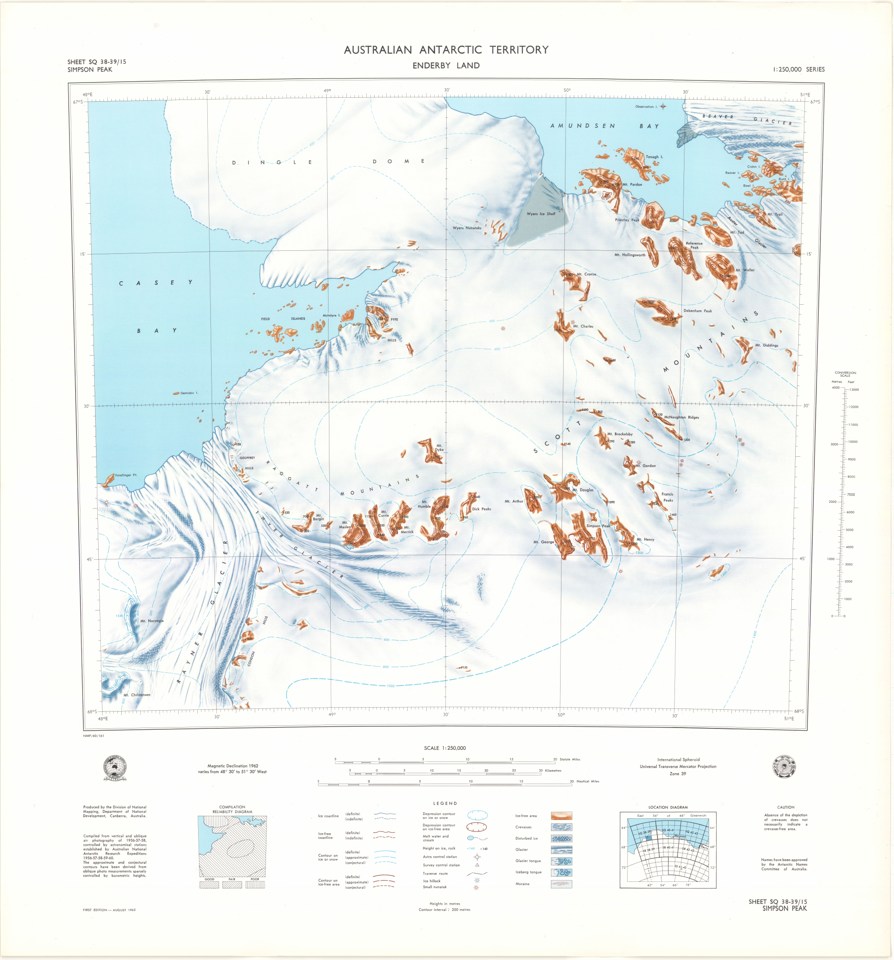
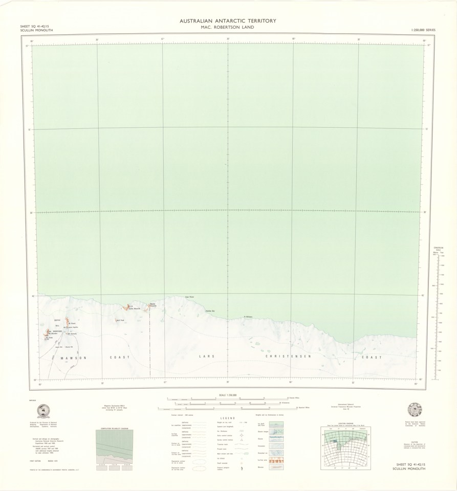
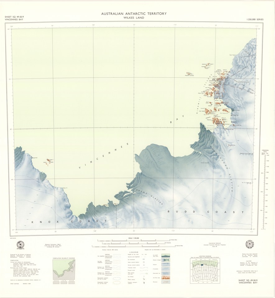
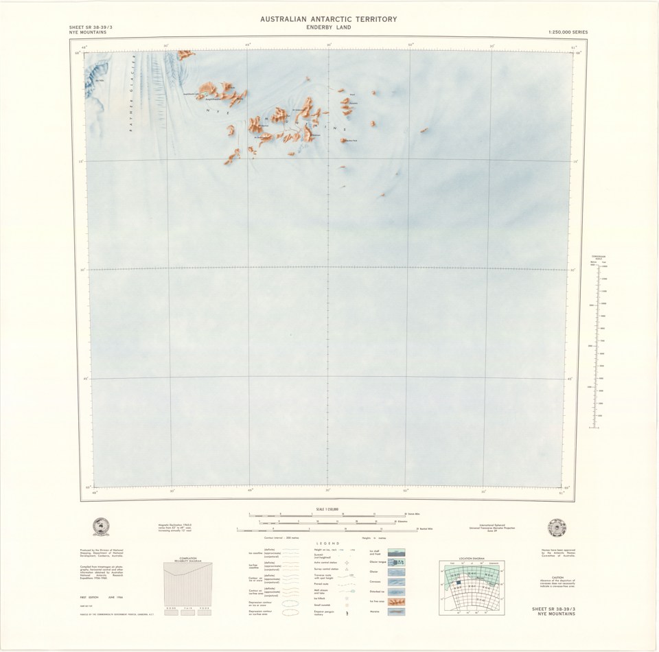
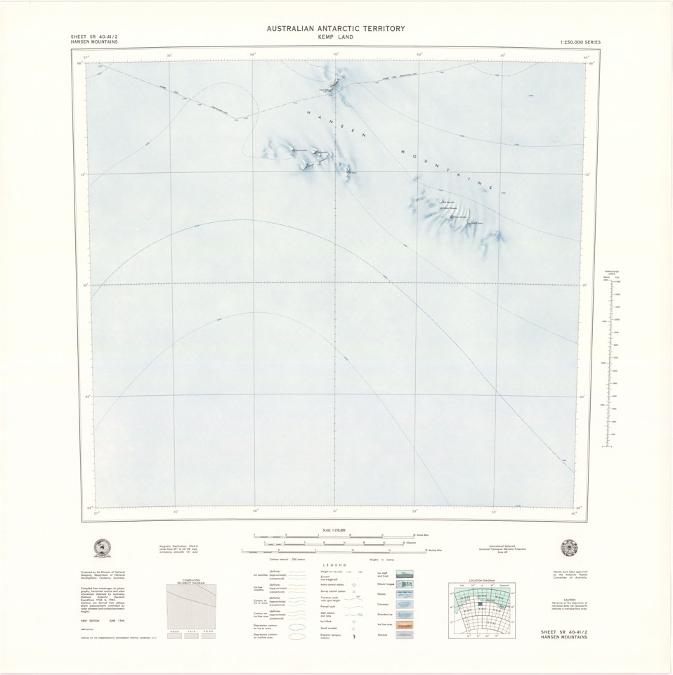
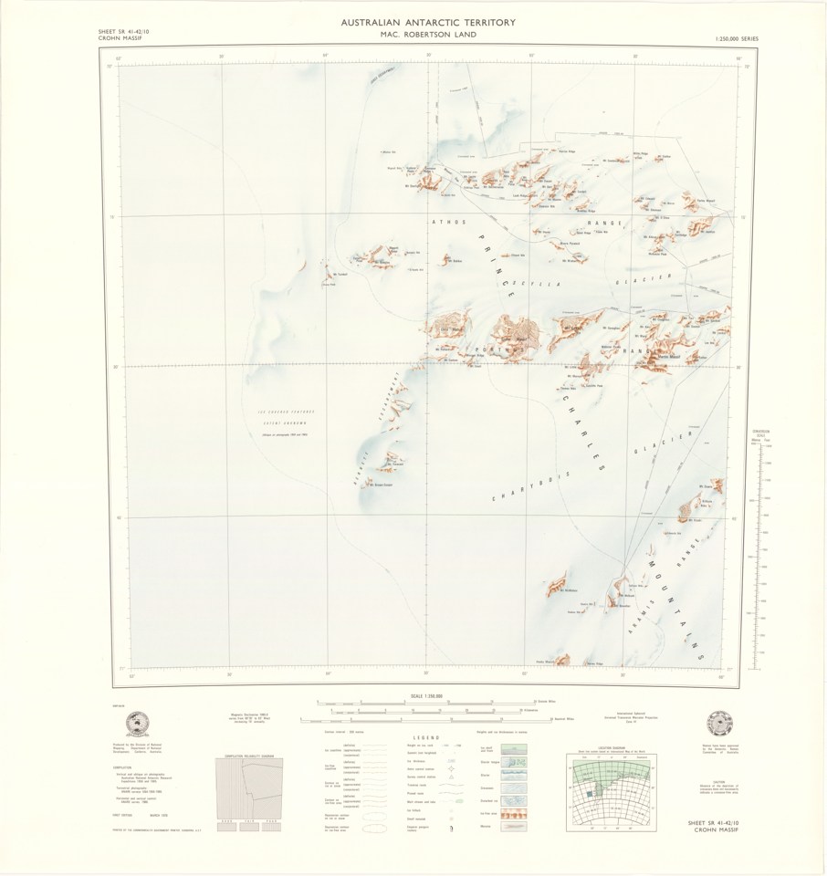
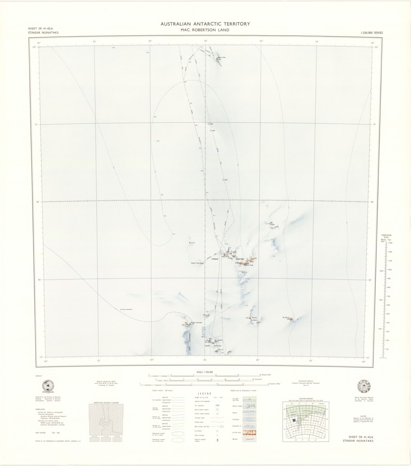
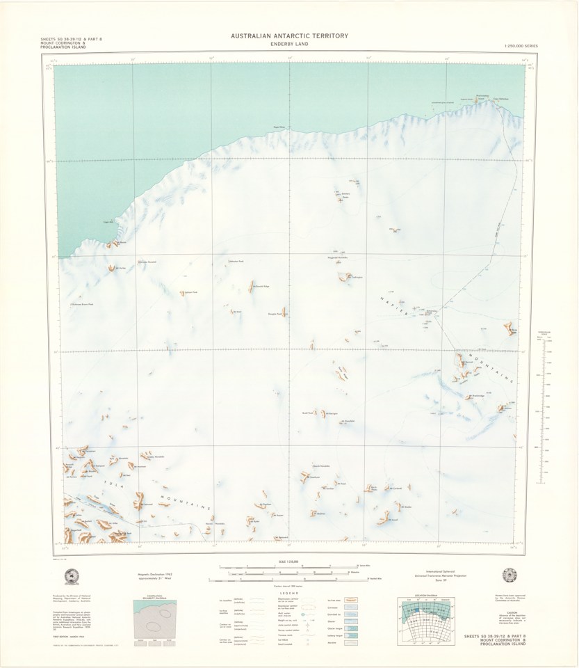
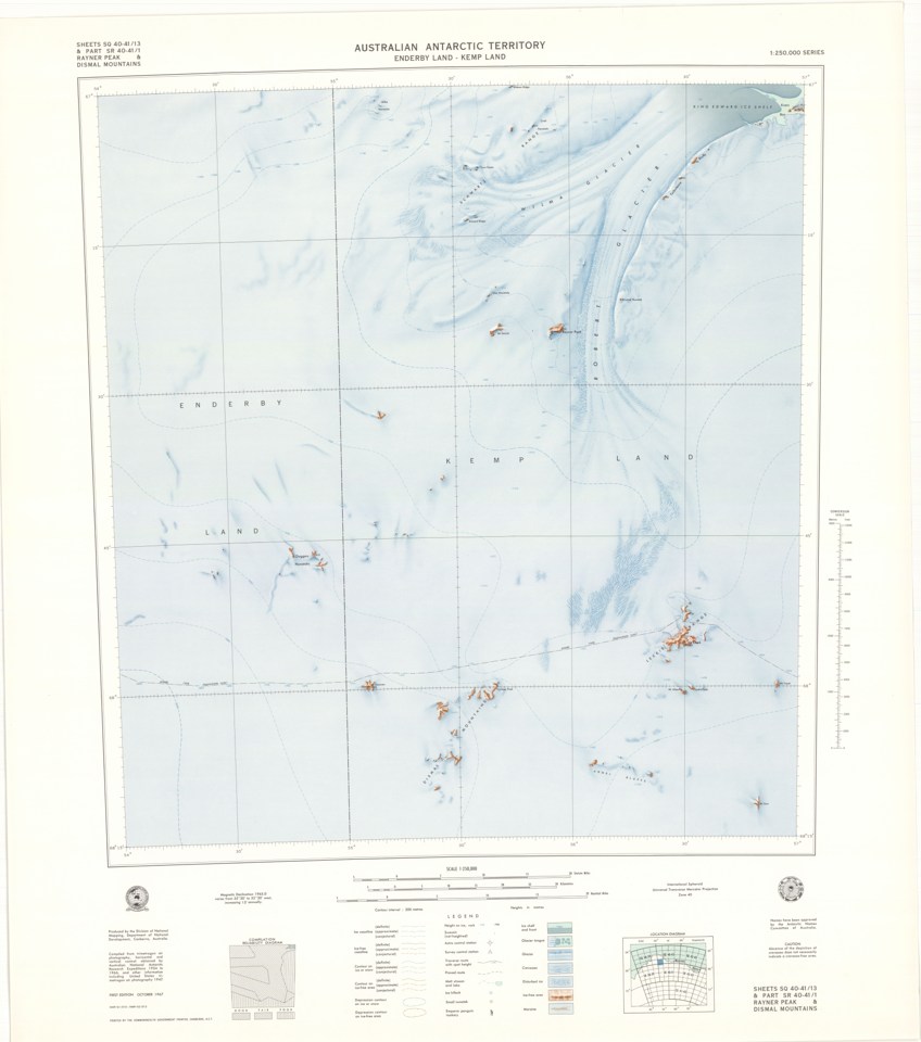
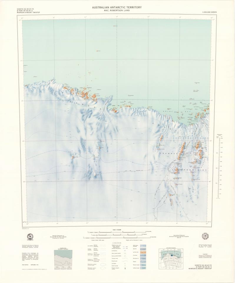
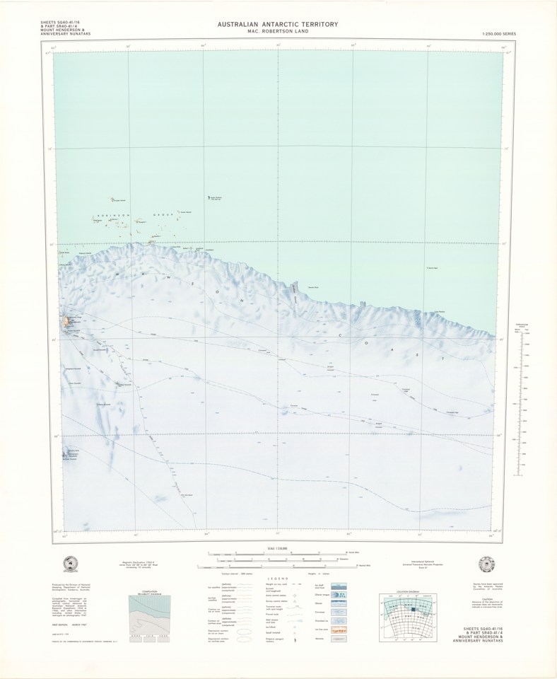
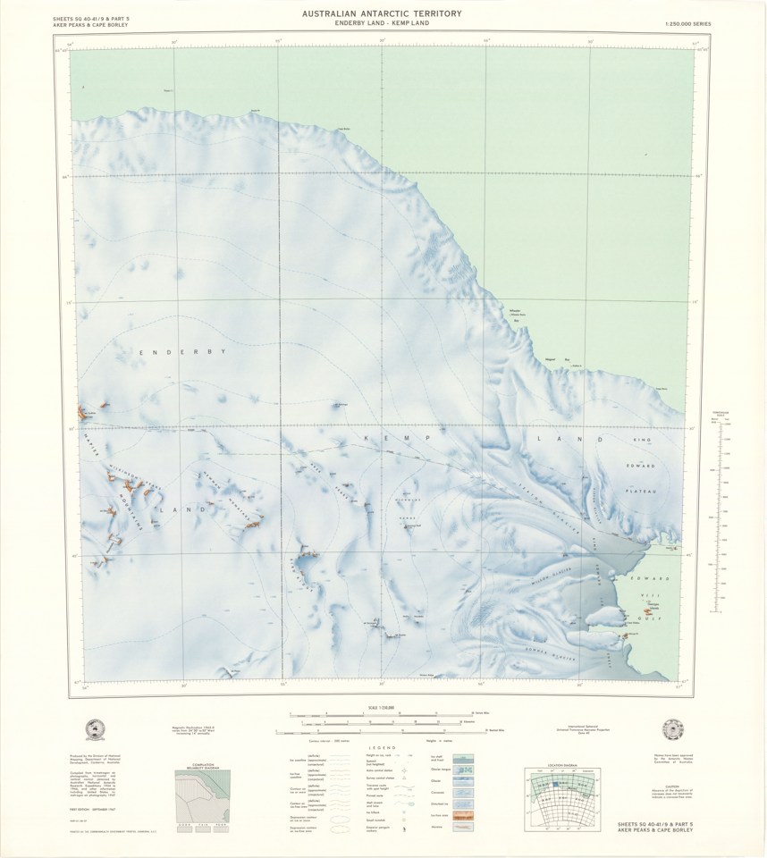
Commonwealth of Australia, Division of National Mapping; Australian Antarctic Data Centre, map 13393. CC BY 4.0. Historical map reproduction, not evidence for modern hidden-land claims. Not for navigation; missing hazards does not imply safe terrain. Thumbnail resized without reconstruction. Source & reuse ↗Source image · inspect provenance
SOURCE-LINKED ENTRYOriginal visual not embeddedRead the source record, image availability and reuse limits.Open original viewer / source context ↗This institutional link could not be confirmed loading during review. Use the catalog source below as a fallback. Visual evidence of the artifact itself, not proof of modern interpretations or hidden-land claims. Image reproduction is not cleared here; linked externally.
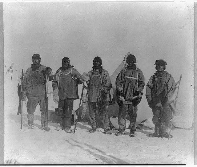
Library of Congress, Prints and Photographs Division, LC-USZ62-30081. Actual institutional image reproduction; not proof of later interpretations. Source & reuse ↗Source image · inspect provenance
035 / PHOTOGRAPHY1912
Expedition photography · 1912
Camp at the South Pole
Historical photograph records Scott’s polar party at Amundsen’s tent.
Library of Congress
Historical photograph records Scott’s polar party at Amundsen’s tent.
Provenance, rights & context
LOC curator links item; individual photographer attribution requires record review, do not assume copyright claimant took it.
Accession / identifier: LOC 2009633384
Reuse status: Not verified; source link only until reuse terms are checked.
Catalog check: Institutional catalog or institutional illustrated collection checked
Notes: LOC curator links item; individual photographer attribution requires record review, do not assume copyright claimant took it.
SOURCE-LINKED ENTRYOriginal visual not embeddedRead the source record, image availability and reuse limits.Open institutional image ↗Open original viewer / source context ↗Visual evidence of the artifact itself, not proof of modern interpretations or hidden-land claims. Image reproduction is not cleared here; linked externally.
037 / MAPS1598
Geographic world map
World maps & models · 1598
Typus orbis terrarum
Conjectural southern continent.
British Library
Conjectural southern continent.
Provenance, rights & context
Read the institution’s catalog context before interpreting this artifact.
Accession / identifier: Maps C.2.d.7
Reuse status: Unknown; reproduction permission not verified
Catalog check: Institutional source checked; uncertainties retained in metadata
SOURCE-LINKED ENTRYOriginal visual not embeddedRead the source record, image availability and reuse limits.Open institutional image ↗Open original viewer / source context ↗Visual evidence of the artifact itself, not proof of modern interpretations or hidden-land claims. Image reproduction is not cleared here; linked externally.
038 / MAPScirca 1690
Polar maps & surveys · circa 1690
Polus Antarcticus
Hondius-derived polar map; center remains uncertain.
British Library
Hondius-derived polar map; center remains uncertain.
Provenance, rights & context
Read the institution’s catalog context before interpreting this artifact.
Accession / identifier: Maps * 88710.(2.)
Reuse status: Unknown; reproduction permission not verified
Catalog check: Institutional source checked; uncertainties retained in metadata
SOURCE-LINKED ENTRYOriginal visual not embeddedRead the source record, image availability and reuse limits.Open institutional image ↗Open original viewer / source context ↗Visual evidence of the artifact itself, not proof of modern interpretations or hidden-land claims. Image reproduction is not cleared here; linked externally.
040 / MAPS1844
Polar maps & surveys · 1844
Circumjacent the South Pole
Early charted Antarctic coastline.
British Library
Early charted Antarctic coastline.
Provenance, rights & context
Read the institution’s catalog context before interpreting this artifact.
Accession / identifier: Maps 38.e.8
Reuse status: Unknown; reproduction permission not verified
Catalog check: Institutional source checked; uncertainties retained in metadata
SOURCE-LINKED ENTRYOriginal visual not embeddedRead the source record, image availability and reuse limits.Open institutional image ↗Open original viewer / source context ↗Visual evidence of the artifact itself, not proof of modern interpretations or hidden-land claims. Image reproduction is not cleared here; linked externally.
041 / MAPS1869; epoch 1840–1845
Polar maps & surveys · 1869; epoch 1840–1845
Antarctic Magnetic Survey: Declination
Magnetic survey, not geographic-pole map.
British Library
Magnetic survey, not geographic-pole map.
Provenance, rights & context
Read the institution’s catalog context before interpreting this artifact.
Accession / identifier: L.R.292
Reuse status: Unknown; reproduction permission not verified
Catalog check: Institutional source checked; uncertainties retained in metadata
SOURCE-LINKED ENTRYOriginal visual not embeddedRead the source record, image availability and reuse limits.Open institutional image ↗Open original viewer / source context ↗Visual evidence of the artifact itself, not proof of modern interpretations or hidden-land claims. Image reproduction is not cleared here; linked externally.
042 / MAPS1858
Polar maps & surveys · 1858
Chart of South Latitudes beyond 20 Degrees
J. D. Potter great-circle sailing chart.
British Library
J. D. Potter great-circle sailing chart.
Provenance, rights & context
Read the institution’s catalog context before interpreting this artifact.
Accession / identifier: Maps 88710.(6.)
Reuse status: Unknown; reproduction permission not verified
Catalog check: Institutional source checked; uncertainties retained in metadata
SOURCE-LINKED ENTRYOriginal visual not embeddedRead the source record, image availability and reuse limits.Open institutional image ↗Open original viewer / source context ↗Visual evidence of the artifact itself, not proof of modern interpretations or hidden-land claims. Image reproduction is not cleared here; linked externally.
043 / MAPS1886
Polar maps & surveys · 1886
South Polar Chart
J. G. Bartholomew polar geography.
British Library
J. G. Bartholomew polar geography.
Provenance, rights & context
Read the institution’s catalog context before interpreting this artifact.
Accession / identifier: Ac.6182
Reuse status: Unknown; reproduction permission not verified
Catalog check: Institutional source checked; uncertainties retained in metadata
SOURCE-LINKED ENTRYOriginal visual not embeddedRead the source record, image availability and reuse limits.Open institutional image ↗Open original viewer / source context ↗Visual evidence of the artifact itself, not proof of modern interpretations or hidden-land claims. Image reproduction is not cleared here; linked externally.
044 / MAPS1898
Polar maps & surveys · 1898
South Polar Chart: exploration schemes
Bartholomew map advocates future exploration.
British Library
Bartholomew map advocates future exploration.
Provenance, rights & context
Read the institution’s catalog context before interpreting this artifact.
Reuse status: Unknown; reproduction permission not verified
Catalog check: Institutional source checked; uncertainties retained in metadata
SOURCE-LINKED ENTRYOriginal visual not embeddedRead the source record, image availability and reuse limits.Open institutional image ↗Open original viewer / source context ↗Visual evidence of the artifact itself, not proof of modern interpretations or hidden-land claims. Image reproduction is not cleared here; linked externally.
045 / MAPS1902–1904 survey; publication date not specified
Polar maps & surveys · 1902–1904 survey; publication date not specified
Work of the National Antarctic Expedition
Discovery expedition survey coverage.
British Library
Discovery expedition survey coverage.
Provenance, rights & context
Read the institution’s catalog context before interpreting this artifact.
Accession / identifier: Maps 88710.(8.)
Reuse status: Unknown; reproduction permission not verified
Catalog check: Institutional source checked; uncertainties retained in metadata
SOURCE-LINKED ENTRYOriginal visual not embeddedRead the source record, image availability and reuse limits.Open institutional image ↗Open original viewer / source context ↗Visual evidence of the artifact itself, not proof of modern interpretations or hidden-land claims. Image reproduction is not cleared here; linked externally.
046 / MAPS1906
Polar maps & surveys · 1906
District near Discovery winter quarters
Detailed McMurdo-area survey.
British Library
Detailed McMurdo-area survey.
Provenance, rights & context
Read the institution’s catalog context before interpreting this artifact.
Accession / identifier: Maps X.11702
Reuse status: Unknown; reproduction permission not verified
Catalog check: Institutional source checked; uncertainties retained in metadata
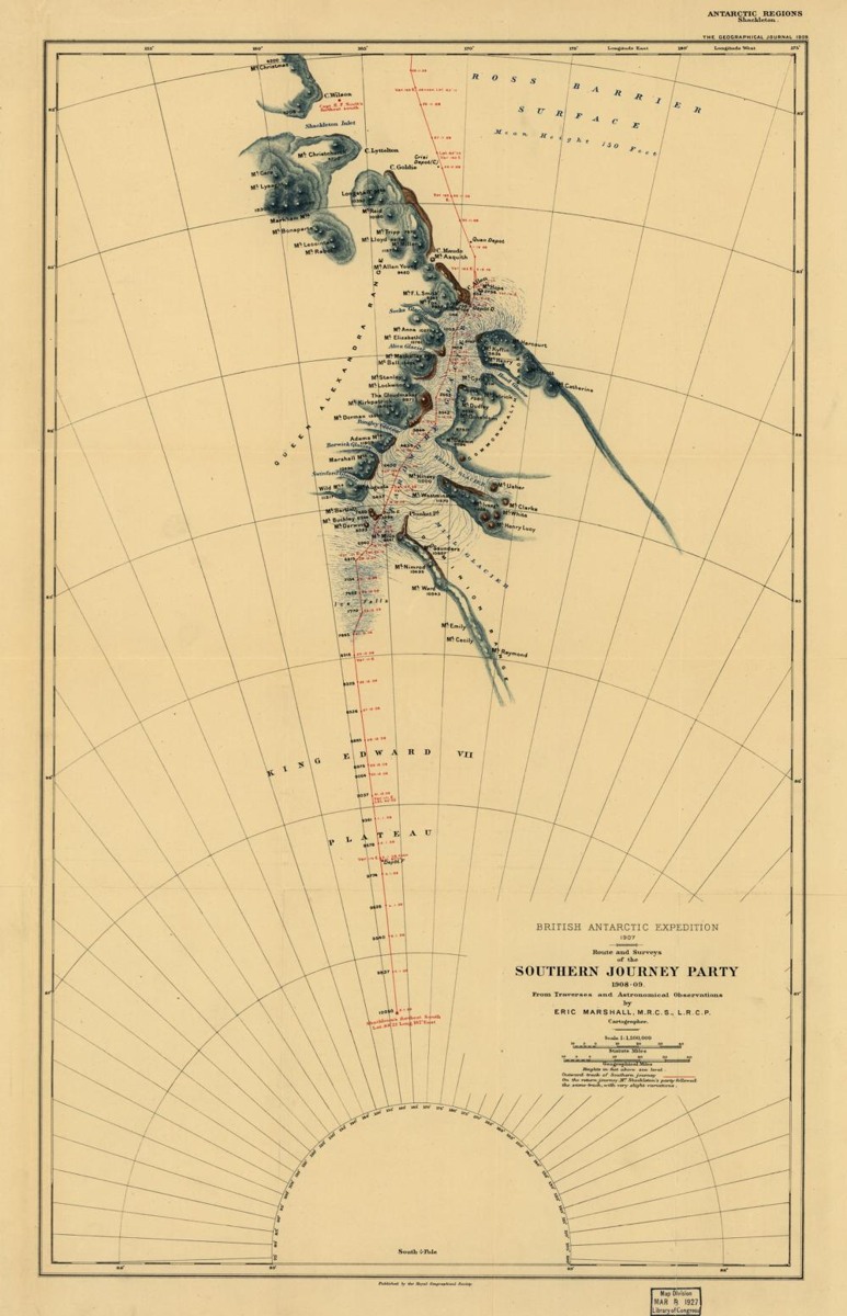
Library of Congress, Geography and Map Division Route and Surveys of the Southern Journey Party, 1908-09 (1909), Royal Geographical Society; Library of Congress copy. Same Geographical Journal1909 published sheet as BL source; DIFFERENT physical copy, LOC stamp retained. Not a scan of the BL-held exemplar. Source & reuse ↗Source image · inspect provenance
047 / MAPS1909
Polar maps & surveys · 1909
Southern Journey Party
Nimrod southern-route survey sheet.
British Library
Nimrod southern-route survey sheet.
Provenance, rights & context
Read the institution’s catalog context before interpreting this artifact.
Accession / identifier: Maps 159
Reuse status: Unknown; reproduction permission not verified
Catalog check: Institutional source checked; uncertainties retained in metadata
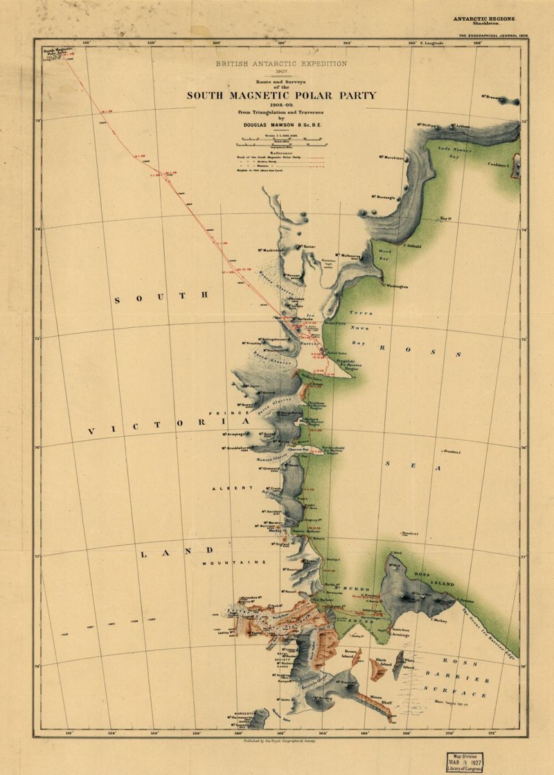
Library of Congress, Geography and Map Division Route and Surveys of the South Magnetic Polar Party, 1908-09 (1909), Royal Geographical Society; Library of Congress copy. Same Geographical Journal1909 published sheet as BL source; DIFFERENT physical copy, LOC stamp retained. Not a scan of the BL-held exemplar. Source & reuse ↗Source image · inspect provenance
048 / MAPS1909
Polar maps & surveys · 1909
South Magnetic Polar Party
Separate Nimrod magnetic-pole survey sheet.
British Library
Separate Nimrod magnetic-pole survey sheet.
Provenance, rights & context
Read the institution’s catalog context before interpreting this artifact.
Accession / identifier: Maps 159
Reuse status: Unknown; reproduction permission not verified
Catalog check: Institutional source checked; uncertainties retained in metadata
SOURCE-LINKED ENTRYOriginal visual not embeddedRead the source record, image availability and reuse limits.Open institutional image ↗Open original viewer / source context ↗Visual evidence of the artifact itself, not proof of modern interpretations or hidden-land claims. Image reproduction is not cleared here; linked externally.
049 / MAPS1912
Polar maps & surveys · 1912
Approximate Bird’s-Eye View
Amundsen route illustration; not aerial photography.
Wellesley College Library; reproduced by British Library
Amundsen route illustration; not aerial photography.
Provenance, rights & context
Read the institution’s catalog context before interpreting this artifact.
Accession / identifier: Rare Books 2370.f. 13
Reuse status: Unknown; reproduction permission not verified
Catalog check: Institutional source checked; uncertainties retained in metadata
SOURCE-LINKED ENTRYOriginal visual not embeddedRead the source record, image availability and reuse limits.Open institutional image ↗Open original viewer / source context ↗Visual evidence of the artifact itself, not proof of modern interpretations or hidden-land claims. Image reproduction is not cleared here; linked externally.
050 / MAPScirca 1921
Polar maps & surveys · circa 1921
The Antarctic Regions
Stanford regional map.
British Library
Stanford regional map.
Provenance, rights & context
Read the institution’s catalog context before interpreting this artifact.
Accession / identifier: Maps 88710.(13.)
Reuse status: Unknown; reproduction permission not verified
Catalog check: Institutional source checked; uncertainties retained in metadata
SOURCE-LINKED ENTRYOriginal visual not embeddedRead the source record, image availability and reuse limits.Open institutional image ↗Open original viewer / source context ↗Visual evidence of the artifact itself, not proof of modern interpretations or hidden-land claims. Image reproduction is not cleared here; linked externally.
051 / MAPS1957
Polar maps & surveys · 1957
Daily Telegraph Map of Antarctica
Territorial sectors and expedition plans.
British Library
Territorial sectors and expedition plans.
Provenance, rights & context
Read the institution’s catalog context before interpreting this artifact.
Accession / identifier: Maps 88710.(57.)
Reuse status: Unknown; reproduction permission not verified
Catalog check: Institutional source checked; uncertainties retained in metadata
SOURCE-LINKED ENTRYOriginal visual not embeddedRead the source record, image availability and reuse limits.Open institutional image ↗Open original viewer / source context ↗Visual evidence of the artifact itself, not proof of modern interpretations or hidden-land claims. Image reproduction is not cleared here; linked externally.
052 / MAPS1972
Polar maps & surveys · 1972
Karta Mira, sheet 234
Soviet Antarctic plateau mapping.
British Library
Soviet Antarctic plateau mapping.
Provenance, rights & context
Read the institution’s catalog context before interpreting this artifact.
Accession / identifier: Maps 920.(494.)
Reuse status: Unknown; reproduction permission not verified
Catalog check: Institutional source checked; uncertainties retained in metadata
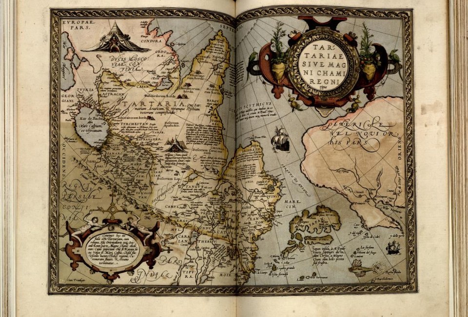
Abraham Ortelius (1570). Library of Congress, Geography and Map Division, G1006 .T5 1570, LCCN 2003683482. Actual institutional reproduction; labels and artifact existence do not verify later interpretations. Source & reuse ↗Source image · inspect provenance
058 / MAPS1570
Polar maps & surveys · 1570
Tartaria sive magni chami imperium
Historic Asian regional designation; not evidence of a global lost empire.
Library of Congress
Historic Asian regional designation; not evidence of a global lost empire.
Provenance, rights & context
Creator: Abraham Ortelius
Reuse status: Unknown; reproduction permission not verified
Catalog check: Institutional source checked; uncertainties retained in metadata
SOURCE-LINKED ENTRYOriginal visual not embeddedRead the source record, image availability and reuse limits.Open institutional image ↗Open original viewer / source context ↗Visual evidence of the artifact itself, not proof of modern interpretations or hidden-land claims. Image reproduction is not cleared here; linked externally.
059 / MAPScirca 1657
Polar maps & surveys · circa 1657
Nova et acurata totius Asiae tabula
Asian geography labels a broad Tartaria region.
Library of Congress
Asian geography labels a broad Tartaria region.
Provenance, rights & context
Creator: Nicolaes Visscher
Reuse status: Unknown; reproduction permission not verified
Catalog check: Institutional source checked; uncertainties retained in metadata
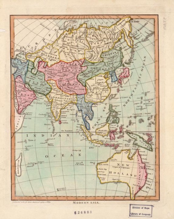
John Wilkes and Samuel John Neele (1796). Library of Congress, Geography and Map Division, World Digital Library. Actual institutional reproduction; labels and artifact existence do not verify later interpretations. Source & reuse ↗Source image · inspect provenance
061 / MAPS1796
Polar maps & surveys · 1796
Modern Asia
Map distinguishes Western and Chinese Tartary.
Library of Congress
Map distinguishes Western and Chinese Tartary.
Provenance, rights & context
Creator: John Wilkes
Reuse status: Unknown; reproduction permission not verified
Catalog check: Institutional source checked; uncertainties retained in metadata
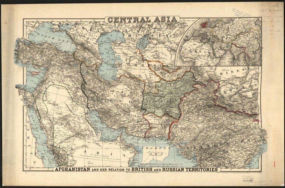
G.W. & C.B. Colton & Co. (1885). Library of Congress, Geography and Map Division, World Digital Library. Actual institutional reproduction; labels and artifact existence do not verify later interpretations. Source & reuse ↗Source image · inspect provenance
062 / MAPS1885
Polar maps & surveys · 1885
Central Asia
Later regional naming provides comparison with earlier Tartary labels.
Library of Congress
Later regional naming provides comparison with earlier Tartary labels.
Provenance, rights & context
Creator: G.W. & C.B. Colton
Reuse status: Unknown; reproduction permission not verified
Catalog check: Institutional source checked; uncertainties retained in metadata
SOURCE-LINKED ENTRYOriginal visual not embeddedRead the source record, image availability and reuse limits.Open institutional image ↗Open original viewer / source context ↗Visual evidence of the artifact itself, not proof of modern interpretations or hidden-land claims. Image reproduction is not cleared here; linked externally.
063 / MAPS1903
Polar maps & surveys · 1903
Antarctica Exploration Sketch Map: first year
Discovery routes, winter quarters and observation-balloon site.
Library of Congress
Discovery routes, winter quarters and observation-balloon site.
Provenance, rights & context
Read the institution’s catalog context before interpreting this artifact.
Reuse status: Unknown; reproduction permission not verified
Catalog check: Institutional source checked; uncertainties retained in metadata
SOURCE-LINKED ENTRYOriginal visual not embeddedRead the source record, image availability and reuse limits.Open institutional image ↗Open original viewer / source context ↗Visual evidence of the artifact itself, not proof of modern interpretations or hidden-land claims. Image reproduction is not cleared here; linked externally.
064 / MAPS1913
Polar maps & surveys · 1913
Sphere of Operations of the British Antarctic Expedition
Terra Nova expedition operations and final-journey locations.
Library of Congress
Terra Nova expedition operations and final-journey locations.
Provenance, rights & context
Read the institution’s catalog context before interpreting this artifact.
Reuse status: Unknown; reproduction permission not verified
Catalog check: Institutional source checked; uncertainties retained in metadata
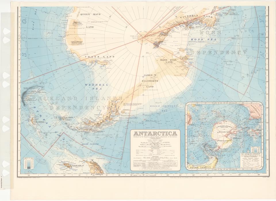
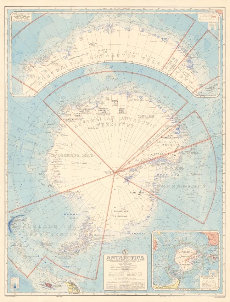
Commonwealth of Australia, Division of National Mapping; Australian Antarctic Data Centre, map 14161. CC BY 4.0. Historical map reproduction, not evidence for modern hidden-land claims. Not for navigation; missing hazards does not imply safe terrain. Thumbnail resized without reconstruction. Source & reuse ↗Source image · inspect provenance
067 / MAPS1956
Polar maps & surveys · 1956
Antarctica, second edition
Revised Bayliss map includes Ellsworth’s flight and later Antarctic research.
Australian Antarctic Data Centre
Revised Bayliss map includes Ellsworth’s flight and later Antarctic research.
Provenance, rights & context
Read the institution’s catalog context before interpreting this artifact.
Creator: Australian Division of National Mapping
Accession / identifier: AADC map 14161
Reuse status: Unknown for original map/reproduction; AADC scientific-data footer alone is not a map-specific license
Catalog check: Institutional source checked; uncertainties retained in metadata
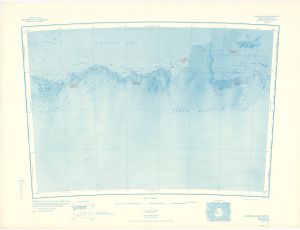
U.S. Geological Survey; reproduction from Australian Antarctic Data Centre, map 3515 (CC BY 4.0). Historical map reproduction, not evidence for modern hidden-land claims. Small institutional preview; no upscaling. Thumbnail resized without reconstruction. Source & reuse ↗Source image · inspect provenance
068 / MAPS1956
Polar maps & surveys · 1956
Antarctica Reconnaissance Preliminary Base: Australian Quadrant E2-66-12
Polar-stereographic preliminary base map of Shackleton Ice Shelf and adjacent coast.
Australian Antarctic Data Centre
Polar-stereographic preliminary base map of Shackleton Ice Shelf and adjacent coast.
Provenance, rights & context
Read the institution’s catalog context before interpreting this artifact.
Creator: U.S. Geological Survey
Accession / identifier: AADC map 3515
Reuse status: Unknown for original map/reproduction; AADC scientific-data footer alone is not a map-specific license
Catalog check: Institutional source checked; uncertainties retained in metadata
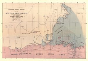
Australasian Antarctic Expedition, ca.1915. National Library of Australia, SCAR map collection 10/3/2, Bib ID 4980815; Australian Antarctic Data Centre reproduction, map 14050 (CC BY 4.0). Historical map reproduction, not evidence for modern hidden-land claims. Small institutional preview; no upscaling. Thumbnail resized without reconstruction. Source & reuse ↗Source image · inspect provenance
069 / MAPS1915
Polar maps & surveys · 1915
Australasian Antarctic Expedition: sledging operations from Western Base
Map records Western Base exploration tracks from 1912–1914.
Australian Antarctic Data Centre
Map records Western Base exploration tracks from 1912–1914.
Provenance, rights & context
Read the institution’s catalog context before interpreting this artifact.
Creator: Australia
Accession / identifier: AADC map 14050
Reuse status: Unknown for original map/reproduction; AADC scientific-data footer alone is not a map-specific license
Catalog check: Institutional source checked; uncertainties retained in metadata
SOURCE-LINKED ENTRYOriginal visual not embeddedRead the source record, image availability and reuse limits.Open institutional image ↗Open original viewer / source context ↗This institutional link could not be confirmed loading during review. Use the catalog source below as a fallback. Visual evidence of the artifact itself, not proof of modern interpretations or hidden-land claims. Image reproduction is not cleared here; linked externally.
071 / MAPS1960
Polar maps & surveys · 1960
Antarctica 1956–1960
Soviet overview map issued at 1:20,000,000.
Australian Antarctic Data Centre
Soviet overview map issued at 1:20,000,000.
Provenance, rights & context
Read the institution’s catalog context before interpreting this artifact.
Creator: USSR
Accession / identifier: AADC map 2673
Reuse status: Unknown for original map/reproduction; AADC scientific-data footer alone is not a map-specific license
Catalog check: Institutional source checked; uncertainties retained in metadata
SOURCE-LINKED ENTRYOriginal visual not embeddedRead the source record, image availability and reuse limits.Open institutional image ↗Open original viewer / source context ↗This institutional link could not be confirmed loading during review. Use the catalog source below as a fallback. Visual evidence of the artifact itself, not proof of modern interpretations or hidden-land claims. Image reproduction is not cleared here; linked externally.
072 / MAPSAugust 1932
Polar maps & surveys · August 1932
BANZARE exploration and survey charts, 1929–1931
Single sheet records Mawson’s coastal survey work and astronomical position fixes.
Australian Antarctic Data Centre
Single sheet records Mawson’s coastal survey work and astronomical position fixes.
Provenance, rights & context
Read the institution’s catalog context before interpreting this artifact.
Creator: Royal Geographical Society
Accession / identifier: AADC map 3705
Reuse status: Unknown for original map/reproduction; AADC scientific-data footer alone is not a map-specific license
Catalog check: Institutional source checked; uncertainties retained in metadata
SOURCE-LINKED ENTRYOriginal visual not embeddedRead the source record, image availability and reuse limits.Open institutional image ↗Open original viewer / source context ↗This institutional link could not be confirmed loading during review. Use the catalog source below as a fallback. Visual evidence of the artifact itself, not proof of modern interpretations or hidden-land claims. Image reproduction is not cleared here; linked externally.
074 / MAPS1913
Polar maps & surveys · 1913
Aurora preliminary deep-sea sounding chart
Bathymetric observations from Mawson expedition voyages of 1912–1913.
Australian Antarctic Data Centre
Bathymetric observations from Mawson expedition voyages of 1912–1913.
Provenance, rights & context
Read the institution’s catalog context before interpreting this artifact.
Creator: Royal Geographical Society
Accession / identifier: AADC map 3695
Reuse status: Unknown for original map/reproduction; AADC scientific-data footer alone is not a map-specific license
Catalog check: Institutional source checked; uncertainties retained in metadata
SOURCE-LINKED ENTRYOriginal visual not embeddedRead the source record, image availability and reuse limits.Open original viewer / source context ↗Visual evidence of the artifact itself, not proof of modern interpretations or hidden-land claims. Image reproduction is not cleared here; linked externally.
076 / COSMOLOGYc. 6th century BCE
Alternative / sacred terrestrial world model
World maps & models · c. 6th century BCE
Babylonian Map of the World
Disc and surrounding cosmic waters; ancient worldview, not an Antarctic survey.
British Museum
Disc and surrounding cosmic waters; ancient worldview, not an Antarctic survey.
Provenance, rights & context
Contextual visual history; not direct evidence about Antarctica
Creator: Unknown Babylonian scribe
Reuse status: Not verified; historical age alone is not a confirmed digital-image reuse license.
Catalog check: Institutional source inspected via web text/search; full-resolution asset not downloaded.
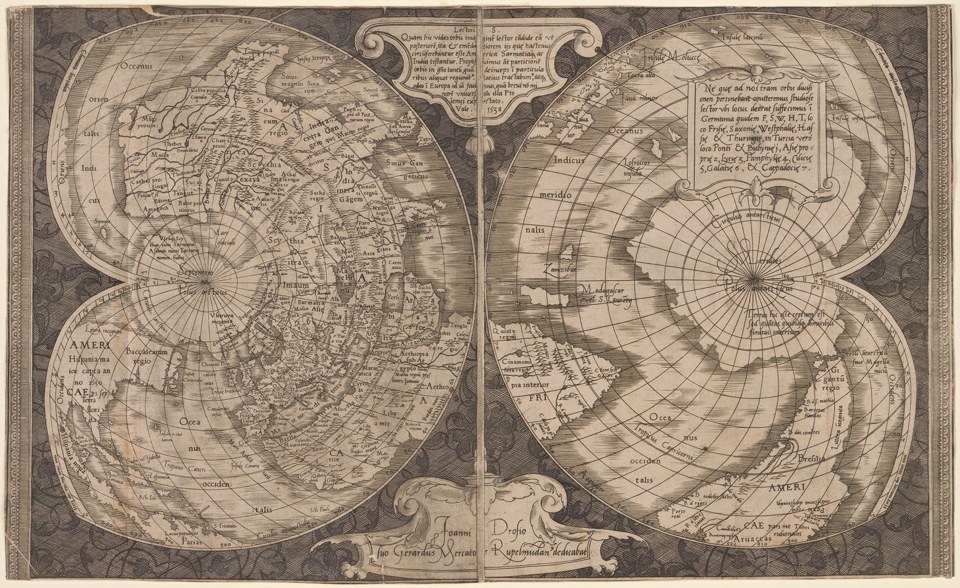
Gerhard Mercator (1538). From The New York Public Library, Rare Book Division. Actual institutional image reproduction; not proof of later interpretations. Source & reuse ↗Source image · inspect provenance
078 / MAPS1538
Geographic world map
World maps & models · 1538
World map on double cordiform projection
Two heart-shaped hemispheres project a globe, not a heart-shaped physical Earth.
New York Public Library
Two heart-shaped hemispheres project a globe, not a heart-shaped physical Earth.
Provenance, rights & context
Contextual visual history; not direct evidence about Antarctica
Creator: Gerhard Mercator
Reuse status: NYPL states public domain in United States; other jurisdictions not determined.
Catalog check: Institutional source inspected via web text/search; full-resolution asset not downloaded.
SOURCE-LINKED ENTRYOriginal visual not embeddedRead the source record, image availability and reuse limits.Open original viewer / source context ↗This institutional link could not be confirmed loading during review. Use the catalog source below as a fallback. Visual evidence of the artifact itself, not proof of modern interpretations or hidden-land claims. Image reproduction is not cleared here; linked externally.
079 / MAPS1602
Geographic world map
World maps & models · 1602
Kunyu wanguo quantu
Chinese-European collaboration; compare continental outlines and placement, not evidence of hidden polar territory.
University of Minnesota, James Ford Bell Library
Chinese-European collaboration; compare continental outlines and placement, not evidence of hidden polar territory.
Provenance, rights & context
Contextual visual history; not direct evidence about Antarctica
Creator: Matteo Ricci with Li Zhizao and Chinese collaborators
Reuse status: Not verified; historical age alone is not a confirmed digital-image reuse license.
Catalog check: Institutional source inspected via web text/search; full-resolution asset not downloaded.
SOURCE-LINKED ENTRYOriginal visual not embeddedRead the source record, image availability and reuse limits.Open original viewer / source context ↗Visual evidence of the artifact itself, not proof of modern interpretations or hidden-land claims. Image reproduction is not cleared here; linked externally.
081 / MAPS1516
Geographic world map
World maps & models · 1516
Carta marina
Compare with the 1507 map as changing cartographic knowledge, not literal cosmological geometry.
Library of Congress
Compare with the 1507 map as changing cartographic knowledge, not literal cosmological geometry.
Provenance, rights & context
Contextual visual history; not direct evidence about Antarctica
Creator: Martin Waldseemüller
Reuse status: Not verified; historical age alone is not a confirmed digital-image reuse license.
Catalog check: Institutional source inspected via web text/search; full-resolution asset not downloaded.
SOURCE-LINKED ENTRYOriginal visual not embeddedRead the source record, image availability and reuse limits.Open institutional image ↗Open original viewer / source context ↗Visual evidence of the artifact itself, not proof of modern interpretations or hidden-land claims. Image reproduction is not cleared here; linked externally.
084 / MAPS1587 edition
Geographic world map
World maps & models · 1587 edition
World map in Théâtre de l’Univers
Date the displayed edition 1587, not the atlas's first edition of 1570.
Library of Congress / World Digital Library
Date the displayed edition 1587, not the atlas's first edition of 1570.
Provenance, rights & context
Contextual visual history; not direct evidence about Antarctica
Creator: Abraham Ortelius
Reuse status: Not verified; historical age alone is not a confirmed digital-image reuse license.
Catalog check: Institutional source inspected via web text/search; full-resolution asset not downloaded.
SOURCE-LINKED ENTRYOriginal visual not embeddedRead the source record, image availability and reuse limits.Open institutional image ↗Open original viewer / source context ↗Visual evidence of the artifact itself, not proof of modern interpretations or hidden-land claims. Image reproduction is not cleared here; linked externally.
085 / MAPS1840
Geographic world map
World maps & models · 1840
The World, on Mercator’s Projection
Antarctic omission reflects incomplete polar mapping; it does not imply physical nonexistence.
Library of Congress / World Digital Library
Antarctic omission reflects incomplete polar mapping; it does not imply physical nonexistence.
Provenance, rights & context
Antarctica omitted from historical map
Creator: A & C Black
Reuse status: Not verified; historical age alone is not a confirmed digital-image reuse license.
Catalog check: Institutional source inspected via web text/search; full-resolution asset not downloaded.
SOURCE-LINKED ENTRYOriginal visual not embeddedRead the source record, image availability and reuse limits.Open original viewer / source context ↗Visual evidence of the artifact itself, not proof of modern interpretations or hidden-land claims. Image reproduction is not cleared here; linked externally.
086 / MAPS1553 copy of medieval work
Geographic world map
World maps & models · 1553 copy of medieval work
Al-Idrisi world map, MS Pococke 375
Orientation is a cartographic convention, not inversion of the physical Earth.
Bodleian Libraries
Orientation is a cartographic convention, not inversion of the physical Earth.
Provenance, rights & context
Contextual visual history; not direct evidence about Antarctica
Creator: Copyist after al-Idrisi
Reuse status: Oxford Cabinet labels photograph CC BY-NC 4.0.
Catalog check: Institutional source inspected via web text/search; full-resolution asset not downloaded.
SOURCE-LINKED ENTRYOriginal visual not embeddedRead the source record, image availability and reuse limits.Open institutional image ↗Open original viewer / source context ↗Visual evidence of the artifact itself, not proof of modern interpretations or hidden-land claims. Image reproduction is not cleared here; linked externally.
087 / COSMOLOGY1220
Alternative / sacred terrestrial world model
World maps & models · 1220
World map in genealogical table, MS M.429 fol. 8v
Three continents assigned to Noah’s sons; sacred history rather than polar observation.
Morgan Library & Museum
Three continents assigned to Noah’s sons; sacred history rather than polar observation.
Provenance, rights & context
Contextual visual history; not direct evidence about Antarctica
Creator: Unknown Spanish illuminator; text after Beatus
Reuse status: Not verified; historical age alone is not a confirmed digital-image reuse license.
Catalog check: Institutional source inspected via web text/search; full-resolution asset not downloaded.
SOURCE-LINKED ENTRYOriginal visual not embeddedRead the source record, image availability and reuse limits.Open original viewer / source context ↗Visual evidence of the artifact itself, not proof of modern interpretations or hidden-land claims. Image reproduction is not cleared here; linked externally.
089 / MAPS1150–1300 manuscript
Geographic world map
World maps & models · 1150–1300 manuscript
World map, Book of Curiosities
Rectangular page geometry is not a physical Earth-shape claim.
Bodleian Libraries
Rectangular page geometry is not a physical Earth-shape claim.
Provenance, rights & context
Contextual visual history; not direct evidence about Antarctica
SOURCE-LINKED ENTRYOriginal visual not embeddedRead the source record, image availability and reuse limits.Open institutional image ↗Open original viewer / source context ↗Visual evidence of the artifact itself, not proof of modern interpretations or hidden-land claims. Image reproduction is not cleared here; linked externally.
090 / COSMOLOGYLate 17th century
Alternative / sacred terrestrial world model
World maps & models · Late 17th century
Kharidat al-‘Aja’ib world map
Schematic cosmology, not Antarctic evidence.
Library of Congress
Schematic cosmology, not Antarctic evidence.
Provenance, rights & context
Contextual visual history; not direct evidence about Antarctica
Creator: Ibn al-Wardi tradition
Reuse status: Not verified; historical age alone is not a confirmed digital-image reuse license.
Catalog check: Institutional source inspected via web text/search; full-resolution asset not downloaded.
SOURCE-LINKED ENTRYOriginal visual not embeddedRead the source record, image availability and reuse limits.Open institutional image ↗Open original viewer / source context ↗Visual evidence of the artifact itself, not proof of modern interpretations or hidden-land claims. Image reproduction is not cleared here; linked externally.
091 / COSMOLOGYc. 1553
Alternative / sacred terrestrial world model
World maps & models · c. 1553
Acaib-ül Mahlûkat world diagram
Mythic world-supporting creatures; not navigation.
Library of Congress
Mythic world-supporting creatures; not navigation.
Provenance, rights & context
Contextual visual history; not direct evidence about Antarctica
Creator: Zekeriya Kazvinî tradition
Reuse status: Not verified; historical age alone is not a confirmed digital-image reuse license.
Catalog check: Institutional source inspected via web text/search; full-resolution asset not downloaded.
SOURCE-LINKED ENTRYOriginal visual not embeddedRead the source record, image availability and reuse limits.Open institutional image ↗Open original viewer / source context ↗Visual evidence of the artifact itself, not proof of modern interpretations or hidden-land claims. Image reproduction is not cleared here; linked externally.
092 / MAPS1472
Alternative / sacred terrestrial world model
World maps & models · 1472
Etymologiae T-O map
Three-part symbolic map, not a polar projection.
Library of Congress
Three-part symbolic map, not a polar projection.
Provenance, rights & context
Contextual visual history; not direct evidence about Antarctica
Creator: Isidore of Seville; printer Guntherus Ziner
Reuse status: Not verified; historical age alone is not a confirmed digital-image reuse license.
Catalog check: Institutional source inspected via web text/search; full-resolution asset not downloaded.
SOURCE-LINKED ENTRYOriginal visual not embeddedRead the source record, image availability and reuse limits.Open institutional image ↗Open original viewer / source context ↗Visual evidence of the artifact itself, not proof of modern interpretations or hidden-land claims. Image reproduction is not cleared here; linked externally.
093 / RECORDS1482
Geographic world map
World maps & models · 1482
Cosmographia world map
Classical geographical knowledge, not Antarctic surveying.
Library of Congress
Classical geographical knowledge, not Antarctic surveying.
Provenance, rights & context
Contextual visual history; not direct evidence about Antarctica
Creator: Claudius Ptolemy tradition
Reuse status: Not verified; historical age alone is not a confirmed digital-image reuse license.
Catalog check: Institutional source inspected via web text/search; full-resolution asset not downloaded.
SOURCE-LINKED ENTRYOriginal visual not embeddedRead the source record, image availability and reuse limits.Open institutional image ↗Open original viewer / source context ↗Visual evidence of the artifact itself, not proof of modern interpretations or hidden-land claims. Image reproduction is not cleared here; linked externally.
094 / COSMOLOGY1710
Alternative / sacred terrestrial world model
World maps & models · 1710
Nansenbushū bankoku shōka no zu
Sacred geography; India-centered, not polar evidence.
Library of Congress
Sacred geography; India-centered, not polar evidence.
Provenance, rights & context
Contextual visual history; not direct evidence about Antarctica
Creator: Hōtan
Reuse status: Not verified; historical age alone is not a confirmed digital-image reuse license.
Catalog check: Institutional source inspected via web text/search; full-resolution asset not downloaded.
SOURCE-LINKED ENTRYOriginal visual not embeddedRead the source record, image availability and reuse limits.Open institutional image ↗Open original viewer / source context ↗Visual evidence of the artifact itself, not proof of modern interpretations or hidden-land claims. Image reproduction is not cleared here; linked externally.
095 / COSMOLOGY1540
Cosmologies · 1540
Astronomicum Caesareum
Earth-centered does not mean flat Earth.
Library of Congress
Earth-centered does not mean flat Earth.
Provenance, rights & context
Contextual visual history; not direct evidence about Antarctica
Creator: Petrus Apianus
Reuse status: Not verified; historical age alone is not a confirmed digital-image reuse license.
Catalog check: Institutional source inspected via web text/search; full-resolution asset not downloaded.
SOURCE-LINKED ENTRYOriginal visual not embeddedRead the source record, image availability and reuse limits.Open institutional image ↗Open original viewer / source context ↗Visual evidence of the artifact itself, not proof of modern interpretations or hidden-land claims. Image reproduction is not cleared here; linked externally.
096 / COSMOLOGY1543
Cosmologies · 1543
De revolutionibus orbium coelestium
Contrasts celestial systems, not Antarctic mapping.
Library of Congress
Contrasts celestial systems, not Antarctic mapping.
Provenance, rights & context
Contextual visual history; not direct evidence about Antarctica
Creator: Nicolaus Copernicus
Reuse status: Not verified; historical age alone is not a confirmed digital-image reuse license.
Catalog check: Institutional source inspected via web text/search; full-resolution asset not downloaded.
SOURCE-LINKED ENTRYOriginal visual not embeddedRead the source record, image availability and reuse limits.Open institutional image ↗Open original viewer / source context ↗Visual evidence of the artifact itself, not proof of modern interpretations or hidden-land claims. Image reproduction is not cleared here; linked externally.
097 / RECORDS1559
Documents & broadcasts · 1559
Coelifer Atlas, Cosmographical Glasse
Celestial spheres are not flat-Earth evidence.
Library of Congress
Celestial spheres are not flat-Earth evidence.
Provenance, rights & context
Contextual visual history; not direct evidence about Antarctica
Creator: William Cuningham
Reuse status: Not verified; historical age alone is not a confirmed digital-image reuse license.
Catalog check: Institutional source inspected via web text/search; full-resolution asset not downloaded.
SOURCE-LINKED ENTRYOriginal visual not embeddedRead the source record, image availability and reuse limits.Open institutional image ↗Open original viewer / source context ↗Visual evidence of the artifact itself, not proof of modern interpretations or hidden-land claims. Image reproduction is not cleared here; linked externally.
098 / COSMOLOGY1644
Cosmologies · 1644
Principia philosophiae vortex diagram
Historical planetary theory, not polar geography.
Library of Congress
Historical planetary theory, not polar geography.
Provenance, rights & context
Contextual visual history; not direct evidence about Antarctica
Creator: René Descartes
Reuse status: Not verified; historical age alone is not a confirmed digital-image reuse license.
Catalog check: Institutional source inspected via web text/search; full-resolution asset not downloaded.
SOURCE-LINKED ENTRYOriginal visual not embeddedRead the source record, image availability and reuse limits.Open institutional image ↗Open original viewer / source context ↗Visual evidence of the artifact itself, not proof of modern interpretations or hidden-land claims. Image reproduction is not cleared here; linked externally.
099 / COSMOLOGY1481 edition
Cosmologies · 1481 edition
Buch der Natur universe diagram
Stacked visual bands do not establish terrestrial shape.
Library of Congress
Stacked visual bands do not establish terrestrial shape.
Provenance, rights & context
Contextual visual history; not direct evidence about Antarctica
Creator: Konrad von Megenberg
Reuse status: Not verified; historical age alone is not a confirmed digital-image reuse license.
Catalog check: Institutional source inspected via web text/search; full-resolution asset not downloaded.
SOURCE-LINKED ENTRYOriginal visual not embeddedRead the source record, image availability and reuse limits.Open institutional image ↗Open original viewer / source context ↗Visual evidence of the artifact itself, not proof of modern interpretations or hidden-land claims. Image reproduction is not cleared here; linked externally.
100 / COSMOLOGY1830
Alternative / sacred terrestrial world model
World maps & models · 1830
Sekai daisō no zu
Heavens and hells contextualize a geographical world.
Library of Congress
Heavens and hells contextualize a geographical world.
Provenance, rights & context
Contextual visual history; not direct evidence about Antarctica
Creator: Zontō
Reuse status: Not verified; historical age alone is not a confirmed digital-image reuse license.
Catalog check: Institutional source inspected via web text/search; full-resolution asset not downloaded.
Saucer as used on Captain Robert Falcon Scott's Antarctic expedition of 1910
Individually cataloged saucer associated by Royal Museums Greenwich with the Terra Nova expedition; accession AAA5379.
Royal Museums Greenwich, National Maritime Museum
Individually cataloged saucer associated by Royal Museums Greenwich with the Terra Nova expedition; accession AAA5379.
Provenance, rights & context
Accession / identifier: AAA5379
Reuse status: Institutional image marked DO NOT REPRODUCE. Link to official object viewer only; do not embed.
Verification scope: Individual institutional record fetched; exact image URL extracted where available. Artifact existence does not prove modern speculative interpretations.
Source-linked artifact record · no new image embedded
Documented record
SOURCE-LINKED ENTRYOriginal visual not embeddedOpen institutional image ↗Open institutional viewer / record ↗Current image/viewer delivery was not confirmed; the source record may still be useful. No image reproduction permission has been established here; source links only. This artifact does not prove a modern speculative claim.
102 / Expedition equipment and relics1910
Objects & equipment · 1910
Mitten — Terra Nova expedition
Individually cataloged mitten associated by Royal Museums Greenwich with the Terra Nova expedition; accession TXT0319.
Royal Museums Greenwich, National Maritime Museum
Individually cataloged mitten associated by Royal Museums Greenwich with the Terra Nova expedition; accession TXT0319.
Provenance, rights & context
Accession / identifier: TXT0319
Reuse status: Institutional image marked DO NOT REPRODUCE. Link to official object viewer only; do not embed.
Verification scope: Individual institutional record fetched; exact image URL extracted where available. Artifact existence does not prove modern speculative interpretations.
Notes: One mitten of a documented pair; companion TXT0318 deliberately not counted separately.
Source-linked artifact record · no new image embedded
Documented record
SOURCE-LINKED ENTRYOriginal visual not embeddedOpen institutional image ↗Open institutional viewer / record ↗Current image/viewer delivery was not confirmed; the source record may still be useful. No image reproduction permission has been established here; source links only. This artifact does not prove a modern speculative claim.
103 / Expedition equipment and relicscirca 1910
Objects & equipment · circa 1910
Sledging Goggles — Terra Nova expedition
Individually cataloged sledging goggles associated by Royal Museums Greenwich with the Terra Nova expedition; accession ZBA1612.
Royal Museums Greenwich, National Maritime Museum
Individually cataloged sledging goggles associated by Royal Museums Greenwich with the Terra Nova expedition; accession ZBA1612.
Provenance, rights & context
Accession / identifier: ZBA1612
Reuse status: Reuse not cleared. RMG asks users to contact its image-licensing service; external viewer only.
Verification scope: Individual institutional record fetched; exact image URL extracted where available. Artifact existence does not prove modern speculative interpretations.
Source-linked artifact record · no new image embedded
Documented record
SOURCE-LINKED ENTRYOriginal visual not embeddedOpen institutional image ↗Open institutional viewer / record ↗Current image/viewer delivery was not confirmed; the source record may still be useful. No image reproduction permission has been established here; source links only. This artifact does not prove a modern speculative claim.
104 / Expedition equipment and relicscirca 1910
Objects & equipment · circa 1910
The green canvas bag used to carry the diaries of Captain R. F. Scott, RN.
Individually cataloged book bag associated by Royal Museums Greenwich with the Terra Nova expedition; accession ZBA1613.
Royal Museums Greenwich, National Maritime Museum
Individually cataloged book bag associated by Royal Museums Greenwich with the Terra Nova expedition; accession ZBA1613.
Provenance, rights & context
Accession / identifier: ZBA1613
Reuse status: Reuse not cleared. RMG asks users to contact its image-licensing service; external viewer only.
Verification scope: Individual institutional record fetched; exact image URL extracted where available. Artifact existence does not prove modern speculative interpretations.
Source-linked artifact record · no new image embedded
Documented record
SOURCE-LINKED ENTRYOriginal visual not embeddedOpen institutional image ↗Open institutional viewer / record ↗Current image/viewer delivery was not confirmed; the source record may still be useful. No image reproduction permission has been established here; source links only. This artifact does not prove a modern speculative claim.
105 / Expedition equipment and relicscirca 1910
Objects & equipment · circa 1910
A pair of sealskin over shoes reputedly found on Captain R. F. Scott's body
Individually cataloged over shoes associated by Royal Museums Greenwich with the Terra Nova expedition; accession AAA4171.
Royal Museums Greenwich, National Maritime Museum
Individually cataloged over shoes associated by Royal Museums Greenwich with the Terra Nova expedition; accession AAA4171.
Provenance, rights & context
Accession / identifier: AAA4171
Reuse status: Reuse not cleared. RMG asks users to contact its image-licensing service; external viewer only.
Verification scope: Individual institutional record fetched; exact image URL extracted where available. Artifact existence does not prove modern speculative interpretations.
Source-linked artifact record · no new image embedded
Documented record
SOURCE-LINKED ENTRYOriginal visual not embeddedRead the source record, image availability and reuse limits.
106 / Expedition equipment and relics1910
Objects & equipment · 1910
Ration Bags — Terra Nova expedition
Individually cataloged ration bags associated by Royal Museums Greenwich with the Terra Nova expedition; accession ZBA1615.
Royal Museums Greenwich, National Maritime Museum
Individually cataloged ration bags associated by Royal Museums Greenwich with the Terra Nova expedition; accession ZBA1615.
Provenance, rights & context
Accession / identifier: ZBA1615
Reuse status: Reuse not cleared. RMG asks users to contact its image-licensing service; external viewer only.
Verification scope: Individual institutional record fetched; exact image URL extracted where available. Artifact existence does not prove modern speculative interpretations.
Source-linked artifact record · no new image embedded
Documented record
SOURCE-LINKED ENTRYOriginal visual not embeddedRead the source record, image availability and reuse limits.
107 / Expedition equipment and relicscirca 1901
Objects & equipment · circa 1901
Dry card compass — Terra Nova expedition
Individually cataloged dry card compass associated by Royal Museums Greenwich with the Terra Nova expedition; accession ACO0127.
Royal Museums Greenwich, National Maritime Museum
Individually cataloged dry card compass associated by Royal Museums Greenwich with the Terra Nova expedition; accession ACO0127.
Provenance, rights & context
Accession / identifier: ACO0127
Reuse status: Reuse not cleared. RMG asks users to contact its image-licensing service; external viewer only.
Verification scope: Individual institutional record fetched; exact image URL extracted where available. Artifact existence does not prove modern speculative interpretations.
Source-linked artifact record · no new image embedded
Documented record
SOURCE-LINKED ENTRYOriginal visual not embeddedOpen institutional image ↗Open institutional viewer / record ↗Current image/viewer delivery was not confirmed; the source record may still be useful. No image reproduction permission has been established here; source links only. This artifact does not prove a modern speculative claim.
108 / Expedition equipment and relics1910
Objects & equipment · 1910
Waistcoat — Terra Nova expedition
Individually cataloged waistcoat associated by Royal Museums Greenwich with the Terra Nova expedition; accession TXT0317.
Royal Museums Greenwich, National Maritime Museum
Individually cataloged waistcoat associated by Royal Museums Greenwich with the Terra Nova expedition; accession TXT0317.
Provenance, rights & context
Accession / identifier: TXT0317
Reuse status: Institutional image marked DO NOT REPRODUCE. Link to official object viewer only; do not embed.
Verification scope: Individual institutional record fetched; exact image URL extracted where available. Artifact existence does not prove modern speculative interpretations.
Source-linked artifact record · no new image embedded
Documented record
SOURCE-LINKED ENTRYOriginal visual not embeddedRead the source record, image availability and reuse limits.
109 / Expedition equipment and relicscirca 1910
Objects & equipment · circa 1910
Stove, Primus (parts) — Terra Nova expedition
Individually cataloged stove, primus (parts) associated by Royal Museums Greenwich with the Terra Nova expedition; accession ZBA1614.
Royal Museums Greenwich, National Maritime Museum
Individually cataloged stove, primus (parts) associated by Royal Museums Greenwich with the Terra Nova expedition; accession ZBA1614.
Provenance, rights & context
Accession / identifier: ZBA1614
Reuse status: Reuse not cleared. RMG asks users to contact its image-licensing service; external viewer only.
Verification scope: Individual institutional record fetched; exact image URL extracted where available. Artifact existence does not prove modern speculative interpretations.
Notes: Complete cataloged component group counted once; individual parts not counted separately.
Source-linked artifact record · no new image embedded
Documented record
SOURCE-LINKED ENTRYOriginal visual not embeddedOpen institutional image ↗Open institutional viewer / record ↗Current image/viewer delivery was not confirmed; the source record may still be useful. No image reproduction permission has been established here; source links only. This artifact does not prove a modern speculative claim.
110 / Expedition equipment and relicscirca 1910
Objects & equipment · circa 1910
Burgee, Royal Yacht Squadron — Terra Nova expedition
Individually cataloged burgee associated by Royal Museums Greenwich with the Terra Nova expedition; accession ZBA1616.
Royal Museums Greenwich, National Maritime Museum
Individually cataloged burgee associated by Royal Museums Greenwich with the Terra Nova expedition; accession ZBA1616.
Provenance, rights & context
Accession / identifier: ZBA1616
Reuse status: Reuse not cleared. RMG asks users to contact its image-licensing service; external viewer only.
Verification scope: Individual institutional record fetched; exact image URL extracted where available. Artifact existence does not prove modern speculative interpretations.
Source-linked artifact record · no new image embedded
Documented record
SOURCE-LINKED ENTRYOriginal visual not embeddedOpen institutional image ↗Open institutional viewer / record ↗Current image/viewer delivery was not confirmed; the source record may still be useful. No image reproduction permission has been established here; source links only. This artifact does not prove a modern speculative claim.
111 / Expedition equipment and relicscirca 1910
Objects & equipment · circa 1910
Sledge flag, Robert Falcon Scott — Terra Nova expedition
Individually cataloged sledge flag associated by Royal Museums Greenwich with the Terra Nova expedition; accession ZBA1609.
Royal Museums Greenwich, National Maritime Museum
Individually cataloged sledge flag associated by Royal Museums Greenwich with the Terra Nova expedition; accession ZBA1609.
Provenance, rights & context
Accession / identifier: ZBA1609
Reuse status: Reuse not cleared. RMG asks users to contact its image-licensing service; external viewer only.
Verification scope: Individual institutional record fetched; exact image URL extracted where available. Artifact existence does not prove modern speculative interpretations.
Source-linked artifact record · no new image embedded
Documented record
SOURCE-LINKED ENTRYOriginal visual not embeddedOpen institutional image ↗Open institutional viewer / record ↗Current image/viewer delivery was not confirmed; the source record may still be useful. No image reproduction permission has been established here; source links only. This artifact does not prove a modern speculative claim.
112 / Expedition equipment and relics1910
Objects & equipment · 1910
Sledge plate — Terra Nova expedition
Individually cataloged sledge plate associated by Royal Museums Greenwich with the Terra Nova expedition; accession AAA4212.
Royal Museums Greenwich, National Maritime Museum
Individually cataloged sledge plate associated by Royal Museums Greenwich with the Terra Nova expedition; accession AAA4212.
Provenance, rights & context
Accession / identifier: AAA4212
Reuse status: Institutional image marked DO NOT REPRODUCE. Link to official object viewer only; do not embed.
Verification scope: Individual institutional record fetched; exact image URL extracted where available. Artifact existence does not prove modern speculative interpretations.
Source-linked artifact record · no new image embedded
Documented record
SOURCE-LINKED ENTRYOriginal visual not embeddedOpen institutional image ↗Open institutional viewer / record ↗Current image/viewer delivery was not confirmed; the source record may still be useful. No image reproduction permission has been established here; source links only. This artifact does not prove a modern speculative claim.
113 / Expedition equipment and relicscirca 1910
Objects & equipment · circa 1910
Reindeer sleeping bag used by Surgeon Commander George Murray Levick (1877-1956) on the British Antarctic Expedition 1910-14
Individually cataloged sleeping bag associated by Royal Museums Greenwich with the Terra Nova expedition; accession AAA4213.
Royal Museums Greenwich, National Maritime Museum
Individually cataloged sleeping bag associated by Royal Museums Greenwich with the Terra Nova expedition; accession AAA4213.
Provenance, rights & context
Accession / identifier: AAA4213
Reuse status: Reuse not cleared. RMG asks users to contact its image-licensing service; external viewer only.
Verification scope: Individual institutional record fetched; exact image URL extracted where available. Artifact existence does not prove modern speculative interpretations.
Source-linked artifact record · no new image embedded
Documented record
SOURCE-LINKED ENTRYOriginal visual not embeddedOpen institutional image ↗Open institutional viewer / record ↗Current image/viewer delivery was not confirmed; the source record may still be useful. No image reproduction permission has been established here; source links only. This artifact does not prove a modern speculative claim.
114 / Commemorative objectsAfter 1913
Objects & equipment · After 1913
"Ponko" the Penguin — Terra Nova expedition
Individually cataloged toy, stuffed associated by Royal Museums Greenwich with the Terra Nova expedition; accession ZBA1691.
Royal Museums Greenwich, National Maritime Museum
Individually cataloged toy, stuffed associated by Royal Museums Greenwich with the Terra Nova expedition; accession ZBA1691.
Provenance, rights & context
Accession / identifier: ZBA1691
Reuse status: Reuse not cleared. RMG asks users to contact its image-licensing service; external viewer only.
Verification scope: Individual institutional record fetched; exact image URL extracted where available. Artifact existence does not prove modern speculative interpretations.
Notes: Post-expedition toy inspired by Ponting photographs; not equipment taken to Antarctica.
Source-linked artifact record · no new image embedded
Documented record
SOURCE-LINKED ENTRYOriginal visual not embeddedOpen institutional image ↗Open institutional viewer / record ↗Current image/viewer delivery was not confirmed; the source record may still be useful. No image reproduction permission has been established here; source links only. This artifact does not prove a modern speculative claim.
115 / Expedition equipment and relics1910
Objects & equipment · 1910
A frame transit — Terra Nova expedition
Individually cataloged theodolite associated by Royal Museums Greenwich with the Terra Nova expedition; accession NAV1464.
Royal Museums Greenwich, National Maritime Museum
Individually cataloged theodolite associated by Royal Museums Greenwich with the Terra Nova expedition; accession NAV1464.
Provenance, rights & context
Accession / identifier: NAV1464
Reuse status: Institutional image marked DO NOT REPRODUCE. Link to official object viewer only; do not embed.
Verification scope: Individual institutional record fetched; exact image URL extracted where available. Artifact existence does not prove modern speculative interpretations.
Source-linked artifact record · no new image embedded
Documented record
SOURCE-LINKED ENTRYOriginal visual not embeddedOpen institutional image ↗Open institutional viewer / record ↗Current image/viewer delivery was not confirmed; the source record may still be useful. No image reproduction permission has been established here; source links only. This artifact does not prove a modern speculative claim.
116 / Expedition equipment and relics1910
Objects & equipment · 1910
National flag of New Zealand — Terra Nova expedition
Individually cataloged national flag associated by Royal Museums Greenwich with the Terra Nova expedition; accession AAA0489.
Royal Museums Greenwich, National Maritime Museum
Individually cataloged national flag associated by Royal Museums Greenwich with the Terra Nova expedition; accession AAA0489.
Provenance, rights & context
Accession / identifier: AAA0489
Reuse status: Reuse not cleared. RMG asks users to contact its image-licensing service; external viewer only.
Verification scope: Individual institutional record fetched; exact image URL extracted where available. Artifact existence does not prove modern speculative interpretations.
Source-linked artifact record · no new image embedded
Documented record
SOURCE-LINKED ENTRYOriginal visual not embeddedRead the source record, image availability and reuse limits.
117 / Expedition equipment and relics1911-14
Objects & equipment · 1911-14
Sleeping bag — Australasian Antarctic Expedition
Individually cataloged sleeping bag associated by Royal Museums Greenwich with the Australasian Antarctic Expedition; accession AAA4217.
Royal Museums Greenwich, National Maritime Museum
Individually cataloged sleeping bag associated by Royal Museums Greenwich with the Australasian Antarctic Expedition; accession AAA4217.
Provenance, rights & context
Accession / identifier: AAA4217
Reuse status: Reuse not cleared. RMG asks users to contact its image-licensing service; external viewer only.
Verification scope: Individual institutional record fetched; exact image URL extracted where available. Artifact existence does not prove modern speculative interpretations.
Source-linked artifact record · no new image embedded
Documented record
SOURCE-LINKED ENTRYOriginal visual not embeddedRead the source record, image availability and reuse limits.
118 / Expedition equipment and relics1911-14
Objects & equipment · 1911-14
Bell Tent — Australasian Antarctic Expedition
Individually cataloged bell tent associated by Royal Museums Greenwich with the Australasian Antarctic Expedition; accession AAA4215.
Royal Museums Greenwich, National Maritime Museum
Individually cataloged bell tent associated by Royal Museums Greenwich with the Australasian Antarctic Expedition; accession AAA4215.
Provenance, rights & context
Accession / identifier: AAA4215
Reuse status: Reuse not cleared. RMG asks users to contact its image-licensing service; external viewer only.
Verification scope: Individual institutional record fetched; exact image URL extracted where available. Artifact existence does not prove modern speculative interpretations.
Source-linked artifact record · no new image embedded
Documented record
SOURCE-LINKED ENTRYOriginal visual not embeddedOpen institutional image ↗Open institutional viewer / record ↗Current image/viewer delivery was not confirmed; the source record may still be useful. No image reproduction permission has been established here; source links only. This artifact does not prove a modern speculative claim.
Individually cataloged boots, finnesko associated by Royal Museums Greenwich with the Australasian Antarctic Expedition; accession AAA4236.
Royal Museums Greenwich, National Maritime Museum
Individually cataloged boots, finnesko associated by Royal Museums Greenwich with the Australasian Antarctic Expedition; accession AAA4236.
Provenance, rights & context
Accession / identifier: AAA4236
Reuse status: Institutional image marked DO NOT REPRODUCE. Link to official object viewer only; do not embed.
Verification scope: Individual institutional record fetched; exact image URL extracted where available. Artifact existence does not prove modern speculative interpretations.
Source-linked artifact record · no new image embedded
Documented record
SOURCE-LINKED ENTRYOriginal visual not embeddedOpen institutional image ↗Open institutional viewer / record ↗Current image/viewer delivery was not confirmed; the source record may still be useful. No image reproduction permission has been established here; source links only. This artifact does not prove a modern speculative claim.
120 / Expedition equipment and relics1911-14
Objects & equipment · 1911-14
Crampons — Australasian Antarctic Expedition
Individually cataloged crampons associated by Royal Museums Greenwich with the Australasian Antarctic Expedition; accession AAA4240.
Royal Museums Greenwich, National Maritime Museum
Individually cataloged crampons associated by Royal Museums Greenwich with the Australasian Antarctic Expedition; accession AAA4240.
Provenance, rights & context
Accession / identifier: AAA4240
Reuse status: Institutional image marked DO NOT REPRODUCE. Link to official object viewer only; do not embed.
Verification scope: Individual institutional record fetched; exact image URL extracted where available. Artifact existence does not prove modern speculative interpretations.
Source-linked artifact record · no new image embedded
Documented record
SOURCE-LINKED ENTRYOriginal visual not embeddedRead the source record, image availability and reuse limits.
121 / Expedition equipment and relics1911
Objects & equipment · 1911
Longjohns — Australasian Antarctic Expedition
Individually cataloged longjohns associated by Royal Museums Greenwich with the Australasian Antarctic Expedition; accession AAA4260.
Royal Museums Greenwich, National Maritime Museum
Individually cataloged longjohns associated by Royal Museums Greenwich with the Australasian Antarctic Expedition; accession AAA4260.
Provenance, rights & context
Accession / identifier: AAA4260
Reuse status: Reuse not cleared. RMG asks users to contact its image-licensing service; external viewer only.
Verification scope: Individual institutional record fetched; exact image URL extracted where available. Artifact existence does not prove modern speculative interpretations.
Source-linked artifact record · no new image embedded
Documented record
SOURCE-LINKED ENTRYOriginal visual not embeddedOpen institutional image ↗Open institutional viewer / record ↗Current image/viewer delivery was not confirmed; the source record may still be useful. No image reproduction permission has been established here; source links only. This artifact does not prove a modern speculative claim.
122 / Expedition equipment and relics1911-14
Objects & equipment · 1911-14
Parka — Australasian Antarctic Expedition
Individually cataloged parka associated by Royal Museums Greenwich with the Australasian Antarctic Expedition; accession AAA4264.
Royal Museums Greenwich, National Maritime Museum
Individually cataloged parka associated by Royal Museums Greenwich with the Australasian Antarctic Expedition; accession AAA4264.
Provenance, rights & context
Accession / identifier: AAA4264
Reuse status: Reuse not cleared. RMG asks users to contact its image-licensing service; external viewer only.
Verification scope: Individual institutional record fetched; exact image URL extracted where available. Artifact existence does not prove modern speculative interpretations.
Source-linked artifact record · no new image embedded
Documented record
SOURCE-LINKED ENTRYOriginal visual not embeddedRead the source record, image availability and reuse limits.
123 / Expedition equipment and relicscirca 1911
Objects & equipment · circa 1911
Bell Tent Design — Australasian Antarctic Expedition
Individually cataloged tent associated by Royal Museums Greenwich with the Australasian Antarctic Expedition; accession AAA4214.
Royal Museums Greenwich, National Maritime Museum
Individually cataloged tent associated by Royal Museums Greenwich with the Australasian Antarctic Expedition; accession AAA4214.
Provenance, rights & context
Accession / identifier: AAA4214
Reuse status: Reuse not cleared. RMG asks users to contact its image-licensing service; external viewer only.
Verification scope: Individual institutional record fetched; exact image URL extracted where available. Artifact existence does not prove modern speculative interpretations.
Notes: Catalog title says Bell Tent Design, but description identifies a tent; preserve this ambiguity rather than claiming an architectural drawing.
Source-linked artifact record · no new image embedded
Documented record
SOURCE-LINKED ENTRYOriginal visual not embeddedOpen institutional image ↗Open institutional viewer / record ↗Current image/viewer delivery was not confirmed; the source record may still be useful. No image reproduction permission has been established here; source links only. This artifact does not prove a modern speculative claim.
124 / Expedition equipment and relics1911-14
Objects & equipment · 1911-14
Handcuffs — Australasian Antarctic Expedition
Individually cataloged handcuffs associated by Royal Museums Greenwich with the Australasian Antarctic Expedition; accession AAA4266.
Royal Museums Greenwich, National Maritime Museum
Individually cataloged handcuffs associated by Royal Museums Greenwich with the Australasian Antarctic Expedition; accession AAA4266.
Provenance, rights & context
Accession / identifier: AAA4266
Reuse status: Institutional image marked DO NOT REPRODUCE. Link to official object viewer only; do not embed.
Verification scope: Individual institutional record fetched; exact image URL extracted where available. Artifact existence does not prove modern speculative interpretations.
Source-linked artifact record · no new image embedded
Documented record
SOURCE-LINKED ENTRYOriginal visual not embeddedOpen institutional image ↗Open institutional viewer / record ↗Current image/viewer delivery was not confirmed; the source record may still be useful. No image reproduction permission has been established here; source links only. This artifact does not prove a modern speculative claim.
125 / Expedition equipment and relics1911-14
Objects & equipment · 1911-14
Spirit level — Australasian Antarctic Expedition
Individually cataloged spirit level associated by Royal Museums Greenwich with the Australasian Antarctic Expedition; accession AAA4227.
Royal Museums Greenwich, National Maritime Museum
Individually cataloged spirit level associated by Royal Museums Greenwich with the Australasian Antarctic Expedition; accession AAA4227.
Provenance, rights & context
Accession / identifier: AAA4227
Reuse status: Institutional image marked DO NOT REPRODUCE. Link to official object viewer only; do not embed.
Verification scope: Individual institutional record fetched; exact image URL extracted where available. Artifact existence does not prove modern speculative interpretations.
Source-linked artifact record · no new image embedded
Documented record
SOURCE-LINKED ENTRYOriginal visual not embeddedOpen institutional image ↗Open institutional viewer / record ↗Current image/viewer delivery was not confirmed; the source record may still be useful. No image reproduction permission has been established here; source links only. This artifact does not prove a modern speculative claim.
126 / Expedition equipment and relics1911-14
Objects & equipment · 1911-14
Snow goggles — Australasian Antarctic Expedition
Individually cataloged snow goggles associated by Royal Museums Greenwich with the Australasian Antarctic Expedition; accession AAA4224.
Royal Museums Greenwich, National Maritime Museum
Individually cataloged snow goggles associated by Royal Museums Greenwich with the Australasian Antarctic Expedition; accession AAA4224.
Provenance, rights & context
Accession / identifier: AAA4224
Reuse status: Institutional image marked DO NOT REPRODUCE. Link to official object viewer only; do not embed.
Verification scope: Individual institutional record fetched; exact image URL extracted where available. Artifact existence does not prove modern speculative interpretations.
Source-linked artifact record · no new image embedded
Documented record
SOURCE-LINKED ENTRYOriginal visual not embeddedOpen institutional image ↗Open institutional viewer / record ↗Current image/viewer delivery was not confirmed; the source record may still be useful. No image reproduction permission has been established here; source links only. This artifact does not prove a modern speculative claim.
Individually cataloged theodolite components associated by Royal Museums Greenwich with the Australasian Antarctic Expedition; accession AAA4229.
Royal Museums Greenwich, National Maritime Museum
Individually cataloged theodolite components associated by Royal Museums Greenwich with the Australasian Antarctic Expedition; accession AAA4229.
Provenance, rights & context
Accession / identifier: AAA4229
Reuse status: Institutional image marked DO NOT REPRODUCE. Link to official object viewer only; do not embed.
Verification scope: Individual institutional record fetched; exact image URL extracted where available. Artifact existence does not prove modern speculative interpretations.
Notes: Complete cataloged component group counted once; individual parts not counted separately.
Source-linked artifact record · no new image embedded
Documented record
SOURCE-LINKED ENTRYOriginal visual not embeddedRead the source record, image availability and reuse limits.
128 / Expedition equipment and relics1911-14
Objects & equipment · 1911-14
Thermometer — Australasian Antarctic Expedition
Individually cataloged thermometer associated by Royal Museums Greenwich with the Australasian Antarctic Expedition; accession AAA4232.
Royal Museums Greenwich, National Maritime Museum
Individually cataloged thermometer associated by Royal Museums Greenwich with the Australasian Antarctic Expedition; accession AAA4232.
Provenance, rights & context
Accession / identifier: AAA4232
Reuse status: Reuse not cleared. RMG asks users to contact its image-licensing service; external viewer only.
Verification scope: Individual institutional record fetched; exact image URL extracted where available. Artifact existence does not prove modern speculative interpretations.
Source-linked artifact record · no new image embedded
Documented record
SOURCE-LINKED ENTRYOriginal visual not embeddedOpen institutional image ↗Open institutional viewer / record ↗Current image/viewer delivery was not confirmed; the source record may still be useful. No image reproduction permission has been established here; source links only. This artifact does not prove a modern speculative claim.
Individually cataloged whaling harpoon associated by Royal Museums Greenwich with the Australasian Antarctic Expedition; accession TOA0030.
Royal Museums Greenwich, National Maritime Museum
Individually cataloged whaling harpoon associated by Royal Museums Greenwich with the Australasian Antarctic Expedition; accession TOA0030.
Provenance, rights & context
Accession / identifier: TOA0030
Reuse status: Institutional image marked DO NOT REPRODUCE. Link to official object viewer only; do not embed.
Verification scope: Individual institutional record fetched; exact image URL extracted where available. Artifact existence does not prove modern speculative interpretations.
Source-linked artifact record · no new image embedded
Documented record
SOURCE-LINKED ENTRYOriginal visual not embeddedRead the source record, image availability and reuse limits.
130 / Expedition equipment and relics1911-14
Objects & equipment · 1911-14
Tunic — Australasian Antarctic Expedition
Individually cataloged tunic associated by Royal Museums Greenwich with the Australasian Antarctic Expedition; accession AAA4256.
Royal Museums Greenwich, National Maritime Museum
Individually cataloged tunic associated by Royal Museums Greenwich with the Australasian Antarctic Expedition; accession AAA4256.
Provenance, rights & context
Accession / identifier: AAA4256
Reuse status: Reuse not cleared. RMG asks users to contact its image-licensing service; external viewer only.
Verification scope: Individual institutional record fetched; exact image URL extracted where available. Artifact existence does not prove modern speculative interpretations.
Source-linked artifact record · no new image embedded
Documented record
SOURCE-LINKED ENTRYOriginal visual not embeddedOpen institutional image ↗Open institutional viewer / record ↗Current image/viewer delivery was not confirmed; the source record may still be useful. No image reproduction permission has been established here; source links only. This artifact does not prove a modern speculative claim.
131 / Expedition equipment and relics1911-14
Objects & equipment · 1911-14
Socks — Australasian Antarctic Expedition
Individually cataloged socks associated by Royal Museums Greenwich with the Australasian Antarctic Expedition; accession AAA4244.
Royal Museums Greenwich, National Maritime Museum
Individually cataloged socks associated by Royal Museums Greenwich with the Australasian Antarctic Expedition; accession AAA4244.
Provenance, rights & context
Accession / identifier: AAA4244
Reuse status: Institutional image marked DO NOT REPRODUCE. Link to official object viewer only; do not embed.
Verification scope: Individual institutional record fetched; exact image URL extracted where available. Artifact existence does not prove modern speculative interpretations.
Source-linked artifact record · no new image embedded
Documented record
SOURCE-LINKED ENTRYOriginal visual not embeddedOpen institutional image ↗Open institutional viewer / record ↗Current image/viewer delivery was not confirmed; the source record may still be useful. No image reproduction permission has been established here; source links only. This artifact does not prove a modern speculative claim.
132 / Expedition equipment and relics1911
Objects & equipment · 1911
Balaclava — Australasian Antarctic Expedition
Individually cataloged balaclava associated by Royal Museums Greenwich with the Australasian Antarctic Expedition; accession AAA4252.
Royal Museums Greenwich, National Maritime Museum
Individually cataloged balaclava associated by Royal Museums Greenwich with the Australasian Antarctic Expedition; accession AAA4252.
Provenance, rights & context
Accession / identifier: AAA4252
Reuse status: Reuse not cleared. RMG asks users to contact its image-licensing service; external viewer only.
Verification scope: Individual institutional record fetched; exact image URL extracted where available. Artifact existence does not prove modern speculative interpretations.
Source-linked artifact record · no new image embedded
Documented record
SOURCE-LINKED ENTRYOriginal visual not embeddedRead the source record, image availability and reuse limits.
133 / Expedition equipment and relics1911
Objects & equipment · 1911
Woollen vest — Australasian Antarctic Expedition
Individually cataloged vest associated by Royal Museums Greenwich with the Australasian Antarctic Expedition; accession AAA4253.
Royal Museums Greenwich, National Maritime Museum
Individually cataloged vest associated by Royal Museums Greenwich with the Australasian Antarctic Expedition; accession AAA4253.
Provenance, rights & context
Accession / identifier: AAA4253
Reuse status: Reuse not cleared. RMG asks users to contact its image-licensing service; external viewer only.
Verification scope: Individual institutional record fetched; exact image URL extracted where available. Artifact existence does not prove modern speculative interpretations.
Individually cataloged maximum/minimum thermometer associated by Royal Museums Greenwich with the Australasian Antarctic Expedition; accession AAA4234.
Royal Museums Greenwich, National Maritime Museum
Individually cataloged maximum/minimum thermometer associated by Royal Museums Greenwich with the Australasian Antarctic Expedition; accession AAA4234.
Provenance, rights & context
Accession / identifier: AAA4234
Reuse status: Reuse not cleared. RMG asks users to contact its image-licensing service; external viewer only.
Verification scope: Individual institutional record fetched; exact image URL extracted where available. Artifact existence does not prove modern speculative interpretations.
Source-linked artifact record · no new image embedded
Documented record
SOURCE-LINKED ENTRYOriginal visual not embeddedRead the source record, image availability and reuse limits.
135 / Expedition equipment and relics1911-14
Objects & equipment · 1911-14
Ski wax — Australasian Antarctic Expedition
Individually cataloged ski wax associated by Royal Museums Greenwich with the Australasian Antarctic Expedition; accession AAA4267.
Royal Museums Greenwich, National Maritime Museum
Individually cataloged ski wax associated by Royal Museums Greenwich with the Australasian Antarctic Expedition; accession AAA4267.
Provenance, rights & context
Accession / identifier: AAA4267
Reuse status: Reuse not cleared. RMG asks users to contact its image-licensing service; external viewer only.
Verification scope: Individual institutional record fetched; exact image URL extracted where available. Artifact existence does not prove modern speculative interpretations.
Source-linked artifact record · no new image embedded
Documented record
SOURCE-LINKED ENTRYOriginal visual not embeddedRead the source record, image availability and reuse limits.
136 / Expedition equipment and relics1911-14
Objects & equipment · 1911-14
Sledge cover — Australasian Antarctic Expedition
Individually cataloged sledge cover associated by Royal Museums Greenwich with the Australasian Antarctic Expedition; accession AAA4218.
Royal Museums Greenwich, National Maritime Museum
Individually cataloged sledge cover associated by Royal Museums Greenwich with the Australasian Antarctic Expedition; accession AAA4218.
Provenance, rights & context
Accession / identifier: AAA4218
Reuse status: Reuse not cleared. RMG asks users to contact its image-licensing service; external viewer only.
Verification scope: Individual institutional record fetched; exact image URL extracted where available. Artifact existence does not prove modern speculative interpretations.
Source-linked artifact record · no new image embedded
Documented record
SOURCE-LINKED ENTRYOriginal visual not embeddedOpen institutional image ↗Open institutional viewer / record ↗Current image/viewer delivery was not confirmed; the source record may still be useful. No image reproduction permission has been established here; source links only. This artifact does not prove a modern speculative claim.
137 / Expedition equipment and relics1911-14
Objects & equipment · 1911-14
Over trousers — Australasian Antarctic Expedition
Individually cataloged over trousers associated by Royal Museums Greenwich with the Australasian Antarctic Expedition; accession AAA4265.
Royal Museums Greenwich, National Maritime Museum
Individually cataloged over trousers associated by Royal Museums Greenwich with the Australasian Antarctic Expedition; accession AAA4265.
Provenance, rights & context
Accession / identifier: AAA4265
Reuse status: Reuse not cleared. RMG asks users to contact its image-licensing service; external viewer only.
Verification scope: Individual institutional record fetched; exact image URL extracted where available. Artifact existence does not prove modern speculative interpretations.
Source-linked artifact record · no new image embedded
Documented record
SOURCE-LINKED ENTRYOriginal visual not embeddedOpen institutional image ↗Open institutional viewer / record ↗Current image/viewer delivery was not confirmed; the source record may still be useful. No image reproduction permission has been established here; source links only. This artifact does not prove a modern speculative claim.
138 / Expedition equipment and relics1911-14
Objects & equipment · 1911-14
Gauntlets — Australasian Antarctic Expedition
Individually cataloged gauntlets associated by Royal Museums Greenwich with the Australasian Antarctic Expedition; accession AAA4246.
Royal Museums Greenwich, National Maritime Museum
Individually cataloged gauntlets associated by Royal Museums Greenwich with the Australasian Antarctic Expedition; accession AAA4246.
Provenance, rights & context
Accession / identifier: AAA4246
Reuse status: Institutional image marked DO NOT REPRODUCE. Link to official object viewer only; do not embed.
Verification scope: Individual institutional record fetched; exact image URL extracted where available. Artifact existence does not prove modern speculative interpretations.
Individually cataloged sledge harness associated by Royal Museums Greenwich with the Australasian Antarctic Expedition; accession AAA4219.
Royal Museums Greenwich, National Maritime Museum
Individually cataloged sledge harness associated by Royal Museums Greenwich with the Australasian Antarctic Expedition; accession AAA4219.
Provenance, rights & context
Accession / identifier: AAA4219
Reuse status: Reuse not cleared. RMG asks users to contact its image-licensing service; external viewer only.
Verification scope: Individual institutional record fetched; exact image URL extracted where available. Artifact existence does not prove modern speculative interpretations.
Source-linked artifact record · no new image embedded
Documented record
SOURCE-LINKED ENTRYOriginal visual not embeddedOpen institutional image ↗Open institutional viewer / record ↗Current image/viewer delivery was not confirmed; the source record may still be useful. No image reproduction permission has been established here; source links only. This artifact does not prove a modern speculative claim.
140 / Expedition equipment and relics1911-14
Objects & equipment · 1911-14
Bryant & May's Motor Match — Australasian Antarctic Expedition
Individually cataloged match box associated by Royal Museums Greenwich with the Australasian Antarctic Expedition; accession AAA4228.
Royal Museums Greenwich, National Maritime Museum
Individually cataloged match box associated by Royal Museums Greenwich with the Australasian Antarctic Expedition; accession AAA4228.
Provenance, rights & context
Accession / identifier: AAA4228
Reuse status: Institutional image marked DO NOT REPRODUCE. Link to official object viewer only; do not embed.
Verification scope: Individual institutional record fetched; exact image URL extracted where available. Artifact existence does not prove modern speculative interpretations.
Source-linked artifact record · no new image embedded
Documented record
SOURCE-LINKED ENTRYOriginal visual not embeddedOpen institutional image ↗Open institutional viewer / record ↗Current image/viewer delivery was not confirmed; the source record may still be useful. No image reproduction permission has been established here; source links only. This artifact does not prove a modern speculative claim.
141 / Expedition equipment and relics1911-14
Objects & equipment · 1911-14
Ice axe — Australasian Antarctic Expedition
Individually cataloged ice axe associated by Royal Museums Greenwich with the Australasian Antarctic Expedition; accession AAA4222.
Royal Museums Greenwich, National Maritime Museum
Individually cataloged ice axe associated by Royal Museums Greenwich with the Australasian Antarctic Expedition; accession AAA4222.
Provenance, rights & context
Accession / identifier: AAA4222
Reuse status: Institutional image marked DO NOT REPRODUCE. Link to official object viewer only; do not embed.
Verification scope: Individual institutional record fetched; exact image URL extracted where available. Artifact existence does not prove modern speculative interpretations.
Source-linked artifact record · no new image embedded
Documented record
SOURCE-LINKED ENTRYOriginal visual not embeddedOpen institutional image ↗Open institutional viewer / record ↗Current image/viewer delivery was not confirmed; the source record may still be useful. No image reproduction permission has been established here; source links only. This artifact does not prove a modern speculative claim.
142 / Expedition equipment and relics1911-14
Objects & equipment · 1911-14
Dog rope — Australasian Antarctic Expedition
Individually cataloged dog rope associated by Royal Museums Greenwich with the Australasian Antarctic Expedition; accession AAA4220.
Royal Museums Greenwich, National Maritime Museum
Individually cataloged dog rope associated by Royal Museums Greenwich with the Australasian Antarctic Expedition; accession AAA4220.
Provenance, rights & context
Accession / identifier: AAA4220
Reuse status: Institutional image marked DO NOT REPRODUCE. Link to official object viewer only; do not embed.
Verification scope: Individual institutional record fetched; exact image URL extracted where available. Artifact existence does not prove modern speculative interpretations.
Source-linked artifact record · no new image embedded
Documented record
SOURCE-LINKED ENTRYOriginal visual not embeddedOpen institutional image ↗Open institutional viewer / record ↗Current image/viewer delivery was not confirmed; the source record may still be useful. No image reproduction permission has been established here; source links only. This artifact does not prove a modern speculative claim.
143 / Expedition equipment and relics1911-14
Objects & equipment · 1911-14
Plumb Line — Australasian Antarctic Expedition
Individually cataloged plumb line associated by Royal Museums Greenwich with the Australasian Antarctic Expedition; accession AAA4225.
Royal Museums Greenwich, National Maritime Museum
Individually cataloged plumb line associated by Royal Museums Greenwich with the Australasian Antarctic Expedition; accession AAA4225.
Provenance, rights & context
Accession / identifier: AAA4225
Reuse status: Institutional image marked DO NOT REPRODUCE. Link to official object viewer only; do not embed.
Verification scope: Individual institutional record fetched; exact image URL extracted where available. Artifact existence does not prove modern speculative interpretations.
Source-linked artifact record · no new image embedded
Documented record
SOURCE-LINKED ENTRYOriginal visual not embeddedOpen institutional image ↗Open institutional viewer / record ↗Current image/viewer delivery was not confirmed; the source record may still be useful. No image reproduction permission has been established here; source links only. This artifact does not prove a modern speculative claim.
144 / Expedition equipment and relics1911-14
Objects & equipment · 1911-14
Hydrometer — Australasian Antarctic Expedition
Individually cataloged hydrometer associated by Royal Museums Greenwich with the Australasian Antarctic Expedition; accession AAA4231.
Royal Museums Greenwich, National Maritime Museum
Individually cataloged hydrometer associated by Royal Museums Greenwich with the Australasian Antarctic Expedition; accession AAA4231.
Provenance, rights & context
Accession / identifier: AAA4231
Reuse status: Institutional image marked DO NOT REPRODUCE. Link to official object viewer only; do not embed.
Verification scope: Individual institutional record fetched; exact image URL extracted where available. Artifact existence does not prove modern speculative interpretations.
Source-linked artifact record · no new image embedded
Documented record
SOURCE-LINKED ENTRYOriginal visual not embeddedRead the source record, image availability and reuse limits.
145 / Expedition equipment and relics1911-14
Objects & equipment · 1911-14
Deep sea thermometer — Australasian Antarctic Expedition
Individually cataloged deep sea thermometer associated by Royal Museums Greenwich with the Australasian Antarctic Expedition; accession AAA4230.
Royal Museums Greenwich, National Maritime Museum
Individually cataloged deep sea thermometer associated by Royal Museums Greenwich with the Australasian Antarctic Expedition; accession AAA4230.
Provenance, rights & context
Accession / identifier: AAA4230
Reuse status: Reuse not cleared. RMG asks users to contact its image-licensing service; external viewer only.
Verification scope: Individual institutional record fetched; exact image URL extracted where available. Artifact existence does not prove modern speculative interpretations.
Source-linked artifact record · no new image embedded
Documented record
SOURCE-LINKED ENTRYOriginal visual not embeddedOpen institutional image ↗Open institutional viewer / record ↗Current image/viewer delivery was not confirmed; the source record may still be useful. No image reproduction permission has been established here; source links only. This artifact does not prove a modern speculative claim.
146 / Scientific specimens1839-1842
Objects & equipment · 1839-1842
Seaweed — Ross Antarctic expedition
Individually cataloged seaweed associated by Royal Museums Greenwich with the Ross Antarctic expedition; accession AAB0212.
Royal Museums Greenwich, National Maritime Museum
Individually cataloged seaweed associated by Royal Museums Greenwich with the Ross Antarctic expedition; accession AAB0212.
Provenance, rights & context
Accession / identifier: AAB0212
Reuse status: Institutional image marked DO NOT REPRODUCE. Link to official object viewer only; do not embed.
Verification scope: Individual institutional record fetched; exact image URL extracted where available. Artifact existence does not prove modern speculative interpretations.
Notes: One bound specimen group, not ten separately counted artifacts; specimens collected in New Zealand during the expedition.
Source-linked artifact record · no new image embedded
Documented record
SOURCE-LINKED ENTRYOriginal visual not embeddedOpen institutional image ↗Open institutional viewer / record ↗Current image/viewer delivery was not confirmed; the source record may still be useful. No image reproduction permission has been established here; source links only. This artifact does not prove a modern speculative claim.
147 / Expedition equipment and relicscirca 1839
Objects & equipment · circa 1839
Dry card compass — Ross Antarctic expedition
Individually cataloged dry card compass associated by Royal Museums Greenwich with the Ross Antarctic expedition; accession ACO0114.
Royal Museums Greenwich, National Maritime Museum
Individually cataloged dry card compass associated by Royal Museums Greenwich with the Ross Antarctic expedition; accession ACO0114.
Provenance, rights & context
Accession / identifier: ACO0114
Reuse status: Institutional image marked DO NOT REPRODUCE. Link to official object viewer only; do not embed.
Verification scope: Individual institutional record fetched; exact image URL extracted where available. Artifact existence does not prove modern speculative interpretations.
Source-linked artifact record · no new image embedded
Documented record
SOURCE-LINKED ENTRYOriginal visual not embeddedOpen institutional image ↗Open institutional viewer / record ↗Current image/viewer delivery was not confirmed; the source record may still be useful. No image reproduction permission has been established here; source links only. This artifact does not prove a modern speculative claim.
148 / Expedition equipment and relics1829-1830
Objects & equipment · 1829-1830
No 1844 — Ross Antarctic expedition
Individually cataloged watch associated by Royal Museums Greenwich with the Ross Antarctic expedition; accession JEW0221.
Royal Museums Greenwich, National Maritime Museum
Individually cataloged watch associated by Royal Museums Greenwich with the Ross Antarctic expedition; accession JEW0221.
Provenance, rights & context
Accession / identifier: JEW0221
Reuse status: Reuse not cleared. RMG asks users to contact its image-licensing service; external viewer only.
Verification scope: Individual institutional record fetched; exact image URL extracted where available. Artifact existence does not prove modern speculative interpretations.
Source-linked artifact record · no new image embedded
Documented record
SOURCE-LINKED ENTRYOriginal visual not embeddedOpen institutional image ↗Open institutional viewer / record ↗Current image/viewer delivery was not confirmed; the source record may still be useful. No image reproduction permission has been established here; source links only. This artifact does not prove a modern speculative claim.
149 / Expedition artworks1840
Objects & equipment · 1840
Christmas Harbour, Kergeulen Island — Ross Antarctic expedition
Individually cataloged drawing associated by Royal Museums Greenwich with the Ross Antarctic expedition; accession PAF0587.
Royal Museums Greenwich, National Maritime Museum
Individually cataloged drawing associated by Royal Museums Greenwich with the Ross Antarctic expedition; accession PAF0587.
Provenance, rights & context
Accession / identifier: PAF0587
Reuse status: Reuse not cleared. RMG asks users to contact its image-licensing service; external viewer only.
Verification scope: Individual institutional record fetched; exact image URL extracted where available. Artifact existence does not prove modern speculative interpretations.
Source-linked artifact record · no new image embedded
Documented record
SOURCE-LINKED ENTRYOriginal visual not embeddedOpen institutional image ↗Open institutional viewer / record ↗Current image/viewer delivery was not confirmed; the source record may still be useful. No image reproduction permission has been established here; source links only. This artifact does not prove a modern speculative claim.
150 / Expedition artworks6 March 1841
Objects & equipment · 6 March 1841
Appearance of an iceberg seen at a considerable distance on the morning of 6 March 1841 - about 8'30' a.m.
Individually cataloged drawing associated by Royal Museums Greenwich with the Ross Antarctic expedition; accession PAE9983.
Royal Museums Greenwich, National Maritime Museum
Individually cataloged drawing associated by Royal Museums Greenwich with the Ross Antarctic expedition; accession PAE9983.
Provenance, rights & context
Accession / identifier: PAE9983
Reuse status: Reuse not cleared. RMG asks users to contact its image-licensing service; external viewer only.
Verification scope: Individual institutional record fetched; exact image URL extracted where available. Artifact existence does not prove modern speculative interpretations.
Notes: One cataloged sketch sheet; not evidence for hidden cities or nonstandard geography.
Source-linked artifact record · no new image embedded
Documented record
SOURCE-LINKED ENTRYOriginal visual not embeddedOpen institutional image ↗Open institutional viewer / record ↗Current image/viewer delivery was not confirmed; the source record may still be useful. No image reproduction permission has been established here; source links only. This artifact does not prove a modern speculative claim.
151 / Printed expedition mapsApril 1918
Polar maps & surveys · April 1918
Antarctic Regions : chart to illustrate the paper on the Drift of the "Endurance" by Lieut. J.M. Wordie R.F.A.
A separately catalogued expedition or regional map; scale 1 : 7 500 000. It records historical cartographic knowledge, not evidence of hidden continents.
Australian Antarctic Data Centre
A separately catalogued expedition or regional map; scale 1 : 7 500 000. It records historical cartographic knowledge, not evidence of hidden continents.
Provenance, rights & context
Accession / identifier: AADC map 3700
Reuse status: Map-specific reproduction rights not verified; institutional data license is not assumed to cover all scans.
Verification scope: Individual institutional detail record and itemized catalog verified; no scan delivery verified.
Source-linked artifact record · no new image embedded
Documented record
SOURCE-LINKED ENTRYOriginal visual not embeddedOpen institutional image ↗Open institutional viewer / record ↗Current image/viewer delivery was not confirmed; the source record may still be useful. No image reproduction permission has been established here; source links only. This artifact does not prove a modern speculative claim.
152 / Printed expedition maps1914
Polar maps & surveys · 1914
Australasian Antarctic Expedition: King George V Land showing tracks of the Eastern Sledging Parties from the Main Base, 1914
A separately catalogued expedition or regional map; scale 1 : 1 000 000. It records historical cartographic knowledge, not evidence of hidden continents.
Australian Antarctic Data Centre
A separately catalogued expedition or regional map; scale 1 : 1 000 000. It records historical cartographic knowledge, not evidence of hidden continents.
Provenance, rights & context
Accession / identifier: AADC map 3697
Reuse status: Map-specific reproduction rights not verified; institutional data license is not assumed to cover all scans.
Verification scope: Individual institutional detail record and itemized catalog verified; no scan delivery verified.
Source-linked artifact record · no new image embedded
Documented record
SOURCE-LINKED ENTRYOriginal visual not embeddedOpen institutional image ↗Open institutional viewer / record ↗Current image/viewer delivery was not confirmed; the source record may still be useful. No image reproduction permission has been established here; source links only. This artifact does not prove a modern speculative claim.
153 / Printed expedition maps1914
Polar maps & surveys · 1914
British Antarctic Expedition 1910-13 : Sketch map to illustrate the paper by Raymond E. Priestley on The Work of the Northern Party
A separately catalogued expedition or regional map; scale 1 : 5 000 000. It records historical cartographic knowledge, not evidence of hidden continents.
Australian Antarctic Data Centre
A separately catalogued expedition or regional map; scale 1 : 5 000 000. It records historical cartographic knowledge, not evidence of hidden continents.
Provenance, rights & context
Accession / identifier: AADC map 3699
Reuse status: Map-specific reproduction rights not verified; institutional data license is not assumed to cover all scans.
Verification scope: Individual institutional detail record and itemized catalog verified; no scan delivery verified.
Source-linked artifact record · no new image embedded
Documented record
SOURCE-LINKED ENTRYOriginal visual not embeddedRead the source record, image availability and reuse limits.
154 / Printed expedition mapsJune-1963
Polar maps & surveys · June-1963
British Antarctic Territory : Alexander Island and Charcot Island
A separately catalogued expedition or regional map; scale 1 : 1 000 000. It records historical cartographic knowledge, not evidence of hidden continents.
Australian Antarctic Data Centre
A separately catalogued expedition or regional map; scale 1 : 1 000 000. It records historical cartographic knowledge, not evidence of hidden continents.
Provenance, rights & context
Accession / identifier: AADC map 3719
Reuse status: Map-specific reproduction rights not verified; institutional data license is not assumed to cover all scans.
Verification scope: Individual artifact metadata verified in institutional itemized catalog; image not yet verified.
Source-linked artifact record · no new image embedded
Documented record
SOURCE-LINKED ENTRYOriginal visual not embeddedOpen institutional image ↗Open institutional viewer / record ↗Current image/viewer delivery was not confirmed; the source record may still be useful. No image reproduction permission has been established here; source links only. This artifact does not prove a modern speculative claim.
155 / Printed expedition mapsSeptember 1940
Polar maps & surveys · September 1940
British Graham Land Expedition : Sledge Journeys and Flights from Southern Base, 1936-7; Diagram Relating the Discoveries of Wilkins and Ellsworth to those of the British Graham Land Expedition
A separately catalogued expedition or regional map; scale 1 : 1 000 000. It records historical cartographic knowledge, not evidence of hidden continents.
Australian Antarctic Data Centre
A separately catalogued expedition or regional map; scale 1 : 1 000 000. It records historical cartographic knowledge, not evidence of hidden continents.
Provenance, rights & context
Accession / identifier: AADC map 3716
Reuse status: Map-specific reproduction rights not verified; institutional data license is not assumed to cover all scans.
Verification scope: Individual institutional detail record and itemized catalog verified; no scan delivery verified.
Chart showing the discoveries and approximate track of Edward Bransfield, Master R.N. in the hired brig "Williams" of Blyth, when exploring the South Shetland Islands and the northern extremity of Graham Land in the year 1820.
A separately catalogued expedition or regional map; scale 1 : 2 650 000. It records historical cartographic knowledge, not evidence of hidden continents.
Australian Antarctic Data Centre
A separately catalogued expedition or regional map; scale 1 : 2 650 000. It records historical cartographic knowledge, not evidence of hidden continents.
Provenance, rights & context
Accession / identifier: AADC map 3701
Reuse status: Map-specific reproduction rights not verified; institutional data license is not assumed to cover all scans.
Verification scope: Individual institutional detail record and itemized catalog verified; no scan delivery verified.
Source-linked artifact record · no new image embedded
Documented record
SOURCE-LINKED ENTRYOriginal visual not embeddedRead the source record, image availability and reuse limits.
157 / Printed expedition mapsMarch-1929
Polar maps & surveys · March-1929
Discoveries in Graham Land by Sir Hubert Wilkins, December, 1928.
A separately catalogued expedition or regional map; scale 1 : 6 250 000. It records historical cartographic knowledge, not evidence of hidden continents.
Australian Antarctic Data Centre
A separately catalogued expedition or regional map; scale 1 : 6 250 000. It records historical cartographic knowledge, not evidence of hidden continents.
Provenance, rights & context
Accession / identifier: AADC map 3702
Reuse status: Map-specific reproduction rights not verified; institutional data license is not assumed to cover all scans.
Verification scope: Individual artifact metadata verified in institutional itemized catalog; image not yet verified.
Source-linked artifact record · no new image embedded
Documented record
SOURCE-LINKED ENTRYOriginal visual not embeddedOpen institutional image ↗Open institutional viewer / record ↗Current image/viewer delivery was not confirmed; the source record may still be useful. No image reproduction permission has been established here; source links only. This artifact does not prove a modern speculative claim.
158 / Printed expedition mapsSeptember 1972
Polar maps & surveys · September 1972
Elephant Island : From a survey by the Joint Services Expedition, December 1970.
A separately catalogued expedition or regional map; scale 1 : 132 000. It records historical cartographic knowledge, not evidence of hidden continents.
Australian Antarctic Data Centre
A separately catalogued expedition or regional map; scale 1 : 132 000. It records historical cartographic knowledge, not evidence of hidden continents.
Provenance, rights & context
Accession / identifier: AADC map 3722
Reuse status: Map-specific reproduction rights not verified; institutional data license is not assumed to cover all scans.
Verification scope: Individual institutional detail record and itemized catalog verified; no scan delivery verified.
Source-linked artifact record · no new image embedded
Documented record
SOURCE-LINKED ENTRYOriginal visual not embeddedOpen institutional image ↗Open institutional viewer / record ↗Current image/viewer delivery was not confirmed; the source record may still be useful. No image reproduction permission has been established here; source links only. This artifact does not prove a modern speculative claim.
159 / Printed expedition mapsMay 1938
Polar maps & surveys · May 1938
Graham Land : British Graham Land Expedition, January 1935 - March 1937
A separately catalogued expedition or regional map; scale 1 : 3 500 000. It records historical cartographic knowledge, not evidence of hidden continents.
Australian Antarctic Data Centre
A separately catalogued expedition or regional map; scale 1 : 3 500 000. It records historical cartographic knowledge, not evidence of hidden continents.
Provenance, rights & context
Accession / identifier: AADC map 3714
Reuse status: Map-specific reproduction rights not verified; institutional data license is not assumed to cover all scans.
Verification scope: Individual institutional detail record and itemized catalog verified; no scan delivery verified.
Source-linked artifact record · no new image embedded
Documented record
SOURCE-LINKED ENTRYOriginal visual not embeddedOpen institutional image ↗Open institutional viewer / record ↗Current image/viewer delivery was not confirmed; the source record may still be useful. No image reproduction permission has been established here; source links only. This artifact does not prove a modern speculative claim.
160 / Printed expedition maps1938
Polar maps & surveys · 1938
Graham Land as known 1934-37 (4 maps)
A separately catalogued expedition or regional map; scale 1 : 12 000 000. It records historical cartographic knowledge, not evidence of hidden continents.
Australian Antarctic Data Centre
A separately catalogued expedition or regional map; scale 1 : 12 000 000. It records historical cartographic knowledge, not evidence of hidden continents.
Provenance, rights & context
Accession / identifier: AADC map 3710
Reuse status: Map-specific reproduction rights not verified; institutional data license is not assumed to cover all scans.
Verification scope: Individual institutional detail record and itemized catalog verified; no scan delivery verified.
Source-linked artifact record · no new image embedded
Documented record
SOURCE-LINKED ENTRYOriginal visual not embeddedOpen institutional image ↗Open institutional viewer / record ↗Current image/viewer delivery was not confirmed; the source record may still be useful. No image reproduction permission has been established here; source links only. This artifact does not prove a modern speculative claim.
161 / Printed expedition mapsApril 1938
Polar maps & surveys · April 1938
Graham Land Coast : B.G.L.E. September 1935 - February 1936
A separately catalogued expedition or regional map; scale 1 : 750 000. It records historical cartographic knowledge, not evidence of hidden continents.
Australian Antarctic Data Centre
A separately catalogued expedition or regional map; scale 1 : 750 000. It records historical cartographic knowledge, not evidence of hidden continents.
Provenance, rights & context
Accession / identifier: AADC map 3713
Reuse status: Map-specific reproduction rights not verified; institutional data license is not assumed to cover all scans.
Verification scope: Individual institutional detail record and itemized catalog verified; no scan delivery verified.
Source-linked artifact record · no new image embedded
Documented record
SOURCE-LINKED ENTRYOriginal visual not embeddedOpen institutional image ↗Open institutional viewer / record ↗Current image/viewer delivery was not confirmed; the source record may still be useful. No image reproduction permission has been established here; source links only. This artifact does not prove a modern speculative claim.
162 / Printed expedition mapsJune 1900
Polar maps & surveys · June 1900
Map of a part of the coastline of Victoria Land
A separately catalogued expedition or regional map; scale Not Entered. It records historical cartographic knowledge, not evidence of hidden continents.
Australian Antarctic Data Centre
A separately catalogued expedition or regional map; scale Not Entered. It records historical cartographic knowledge, not evidence of hidden continents.
Provenance, rights & context
Accession / identifier: AADC map 1086
Reuse status: Map-specific reproduction rights not verified; institutional data license is not assumed to cover all scans.
Verification scope: Individual institutional detail record and itemized catalog verified; no scan delivery verified.
Source-linked artifact record · no new image embedded
Documented record
SOURCE-LINKED ENTRYOriginal visual not embeddedOpen institutional image ↗Open institutional viewer / record ↗Current image/viewer delivery was not confirmed; the source record may still be useful. No image reproduction permission has been established here; source links only. This artifact does not prove a modern speculative claim.
163 / Printed expedition maps1904
Polar maps & surveys · 1904
Map showing track of the S.Y. "Morning" to accompany Captain W. Colbecks report on the second Antarctic Relief Expedition 1903-04.
A separately catalogued expedition or regional map; scale 1 : 15 000 000. It records historical cartographic knowledge, not evidence of hidden continents.
Australian Antarctic Data Centre
A separately catalogued expedition or regional map; scale 1 : 15 000 000. It records historical cartographic knowledge, not evidence of hidden continents.
Provenance, rights & context
Accession / identifier: AADC map 3686
Reuse status: Map-specific reproduction rights not verified; institutional data license is not assumed to cover all scans.
Verification scope: Individual institutional detail record and itemized catalog verified; no scan delivery verified.
Source-linked artifact record · no new image embedded
Documented record
SOURCE-LINKED ENTRYOriginal visual not embeddedOpen institutional image ↗Open institutional viewer / record ↗Current image/viewer delivery was not confirmed; the source record may still be useful. No image reproduction permission has been established here; source links only. This artifact does not prove a modern speculative claim.
164 / Printed expedition mapsMarch 1937
Polar maps & surveys · March 1937
Map to illustrate the paper on the "First Crossing of Antarctica" by Lincoln Ellsworth
A separately catalogued expedition or regional map; scale 1 : 12 000 000. It records historical cartographic knowledge, not evidence of hidden continents.
Australian Antarctic Data Centre
A separately catalogued expedition or regional map; scale 1 : 12 000 000. It records historical cartographic knowledge, not evidence of hidden continents.
Provenance, rights & context
Accession / identifier: AADC map 3709
Reuse status: Map-specific reproduction rights not verified; institutional data license is not assumed to cover all scans.
Verification scope: Individual institutional detail record and itemized catalog verified; no scan delivery verified.
Source-linked artifact record · no new image embedded
Documented record
SOURCE-LINKED ENTRYOriginal visual not embeddedOpen institutional image ↗Open institutional viewer / record ↗Current image/viewer delivery was not confirmed; the source record may still be useful. No image reproduction permission has been established here; source links only. This artifact does not prove a modern speculative claim.
165 / Printed expedition maps1911
Polar maps & surveys · 1911
Maps to illustrate the paper by Dr. J.B. Charcot on the French Antarctic Expedition 1908-1910.
A separately catalogued expedition or regional map; scale 1 : 5 000 000. It records historical cartographic knowledge, not evidence of hidden continents.
Australian Antarctic Data Centre
A separately catalogued expedition or regional map; scale 1 : 5 000 000. It records historical cartographic knowledge, not evidence of hidden continents.
Provenance, rights & context
Accession / identifier: AADC map 3691
Reuse status: Map-specific reproduction rights not verified; institutional data license is not assumed to cover all scans.
Verification scope: Individual institutional detail record and itemized catalog verified; no scan delivery verified.
Source-linked artifact record · no new image embedded
Documented record
SOURCE-LINKED ENTRYOriginal visual not embeddedOpen institutional image ↗Open institutional viewer / record ↗Current image/viewer delivery was not confirmed; the source record may still be useful. No image reproduction permission has been established here; source links only. This artifact does not prove a modern speculative claim.
167 / Printed expedition mapsDecember 1963
Polar maps & surveys · December 1963
Queen Maud Range and Axel Heiberg Glacier Region
A separately catalogued expedition or regional map; scale 1 : 316 800. It records historical cartographic knowledge, not evidence of hidden continents.
Australian Antarctic Data Centre
A separately catalogued expedition or regional map; scale 1 : 316 800. It records historical cartographic knowledge, not evidence of hidden continents.
Provenance, rights & context
Accession / identifier: AADC map 3720
Reuse status: Map-specific reproduction rights not verified; institutional data license is not assumed to cover all scans.
Verification scope: Individual institutional detail record and itemized catalog verified; no scan delivery verified.
Source-linked artifact record · no new image embedded
Documented record
SOURCE-LINKED ENTRYOriginal visual not embeddedRead the source record, image availability and reuse limits.
168 / Printed expedition mapsNovember-1931
Polar maps & surveys · November-1931
Recent Work of Norwegian Expeditions in the Antarctic Regions to illustrate a paper by Prof. Olaf Holtedahl
A separately catalogued expedition or regional map; scale 1 : 30 500 000. It records historical cartographic knowledge, not evidence of hidden continents.
Australian Antarctic Data Centre
A separately catalogued expedition or regional map; scale 1 : 30 500 000. It records historical cartographic knowledge, not evidence of hidden continents.
Provenance, rights & context
Accession / identifier: AADC map 3703
Reuse status: Map-specific reproduction rights not verified; institutional data license is not assumed to cover all scans.
Verification scope: Individual artifact metadata verified in institutional itemized catalog; image not yet verified.
Source-linked artifact record · no new image embedded
Documented record
SOURCE-LINKED ENTRYOriginal visual not embeddedOpen institutional image ↗Open institutional viewer / record ↗Current image/viewer delivery was not confirmed; the source record may still be useful. No image reproduction permission has been established here; source links only. This artifact does not prove a modern speculative claim.
169 / Printed expedition maps1914
Polar maps & surveys · 1914
Regional Map showing the area covered by the Australasian Antarctic Expedition 1911-14 under Sir Douglas Mawson
A separately catalogued expedition or regional map; scale 1 : 15 000 000. It records historical cartographic knowledge, not evidence of hidden continents.
Australian Antarctic Data Centre
A separately catalogued expedition or regional map; scale 1 : 15 000 000. It records historical cartographic knowledge, not evidence of hidden continents.
Provenance, rights & context
Accession / identifier: AADC map 3696
Reuse status: Map-specific reproduction rights not verified; institutional data license is not assumed to cover all scans.
Verification scope: Individual institutional detail record and itemized catalog verified; no scan delivery verified.
Source-linked artifact record · no new image embedded
Documented record
SOURCE-LINKED ENTRYOriginal visual not embeddedOpen institutional image ↗Open institutional viewer / record ↗Current image/viewer delivery was not confirmed; the source record may still be useful. No image reproduction permission has been established here; source links only. This artifact does not prove a modern speculative claim.
170 / Printed expedition maps1913
Polar maps & surveys · 1913
Routes of Captain R. Amundsen's South Polar Expedition 1911-12
A separately catalogued expedition or regional map; scale 1 : 6 000 000. It records historical cartographic knowledge, not evidence of hidden continents.
Australian Antarctic Data Centre
A separately catalogued expedition or regional map; scale 1 : 6 000 000. It records historical cartographic knowledge, not evidence of hidden continents.
Provenance, rights & context
Accession / identifier: AADC map 3694
Reuse status: Map-specific reproduction rights not verified; institutional data license is not assumed to cover all scans.
Verification scope: Individual institutional detail record and itemized catalog verified; no scan delivery verified.
Source-linked artifact record · no new image embedded
Documented record
SOURCE-LINKED ENTRYOriginal visual not embeddedOpen institutional image ↗Open institutional viewer / record ↗Current image/viewer delivery was not confirmed; the source record may still be useful. No image reproduction permission has been established here; source links only. This artifact does not prove a modern speculative claim.
171 / Printed expedition maps1904
Polar maps & surveys · 1904
Sketch Map to illustrate the Exploration of the Swedish Antarctic Expedition 1902-3
A separately catalogued expedition or regional map; scale 1 : 3 000 000. It records historical cartographic knowledge, not evidence of hidden continents.
Australian Antarctic Data Centre
A separately catalogued expedition or regional map; scale 1 : 3 000 000. It records historical cartographic knowledge, not evidence of hidden continents.
Provenance, rights & context
Accession / identifier: AADC map 3682
Reuse status: Map-specific reproduction rights not verified; institutional data license is not assumed to cover all scans.
Verification scope: Individual institutional detail record and itemized catalog verified; no scan delivery verified.
Source-linked artifact record · no new image embedded
Documented record
SOURCE-LINKED ENTRYOriginal visual not embeddedOpen institutional image ↗Open institutional viewer / record ↗Current image/viewer delivery was not confirmed; the source record may still be useful. No image reproduction permission has been established here; source links only. This artifact does not prove a modern speculative claim.
172 / Printed expedition maps1905
Polar maps & surveys · 1905
Sketch Map to illustrate the paper by Dr. Charcot on the French Antarctic Expedition 1903-5.
A separately catalogued expedition or regional map; scale 1 : 2 500 000. It records historical cartographic knowledge, not evidence of hidden continents.
Australian Antarctic Data Centre
A separately catalogued expedition or regional map; scale 1 : 2 500 000. It records historical cartographic knowledge, not evidence of hidden continents.
Provenance, rights & context
Accession / identifier: AADC map 3687
Reuse status: Map-specific reproduction rights not verified; institutional data license is not assumed to cover all scans.
Verification scope: Individual institutional detail record and itemized catalog verified; no scan delivery verified.
Source-linked artifact record · no new image embedded
Documented record
SOURCE-LINKED ENTRYOriginal visual not embeddedOpen institutional image ↗Open institutional viewer / record ↗Current image/viewer delivery was not confirmed; the source record may still be useful. No image reproduction permission has been established here; source links only. This artifact does not prove a modern speculative claim.
173 / Printed expedition maps1904
Polar maps & surveys · 1904
Sketch Maps showing the Track and Explorations of the German South Polar Expedition 1902-3 by Dr. Von Drygalski.
A separately catalogued expedition or regional map; scale 1 : 6 000 000. It records historical cartographic knowledge, not evidence of hidden continents.
Australian Antarctic Data Centre
A separately catalogued expedition or regional map; scale 1 : 6 000 000. It records historical cartographic knowledge, not evidence of hidden continents.
Provenance, rights & context
Accession / identifier: AADC map 3684
Reuse status: Map-specific reproduction rights not verified; institutional data license is not assumed to cover all scans.
Verification scope: Individual institutional detail record and itemized catalog verified; no scan delivery verified.
Source-linked artifact record · no new image embedded
Documented record
SOURCE-LINKED ENTRYOriginal visual not embeddedRead the source record, image availability and reuse limits.
174 / Printed expedition maps1901
Polar maps & surveys · 1901
Sketch of Danco Land, the Belgica Strait and Palmer Archipelago surveyed by Captain G. Lecointe. 1898
A separately catalogued expedition or regional map; scale Not Entered. It records historical cartographic knowledge, not evidence of hidden continents.
Australian Antarctic Data Centre
A separately catalogued expedition or regional map; scale Not Entered. It records historical cartographic knowledge, not evidence of hidden continents.
Provenance, rights & context
Accession / identifier: AADC map 3679
Reuse status: Map-specific reproduction rights not verified; institutional data license is not assumed to cover all scans.
Verification scope: Individual artifact metadata verified in institutional itemized catalog; image not yet verified.
Source-linked artifact record · no new image embedded
Documented record
SOURCE-LINKED ENTRYOriginal visual not embeddedOpen institutional image ↗Open institutional viewer / record ↗Current image/viewer delivery was not confirmed; the source record may still be useful. No image reproduction permission has been established here; source links only. This artifact does not prove a modern speculative claim.
175 / Printed expedition maps1912
Polar maps & surveys · 1912
South Polar Regions to illustrate the paper by H.R. Mill, D.Sc., LL.D.
A separately catalogued expedition or regional map; scale 1 : 40 000 000. It records historical cartographic knowledge, not evidence of hidden continents.
Australian Antarctic Data Centre
A separately catalogued expedition or regional map; scale 1 : 40 000 000. It records historical cartographic knowledge, not evidence of hidden continents.
Provenance, rights & context
Accession / identifier: AADC map 3693
Reuse status: Map-specific reproduction rights not verified; institutional data license is not assumed to cover all scans.
Verification scope: Individual institutional detail record and itemized catalog verified; no scan delivery verified.
Source-linked artifact record · no new image embedded
Documented record
SOURCE-LINKED ENTRYOriginal visual not embeddedRead the source record, image availability and reuse limits.
176 / Printed expedition maps1911
Polar maps & surveys · 1911
South Polar Regions with the Antarctic Continent drawn to illustrate the probable topography as deduced from present available data by D. Mawson, D.Sc. B.E.
A separately catalogued expedition or regional map; scale 1 : 40 000 000. It records historical cartographic knowledge, not evidence of hidden continents.
Australian Antarctic Data Centre
A separately catalogued expedition or regional map; scale 1 : 40 000 000. It records historical cartographic knowledge, not evidence of hidden continents.
Provenance, rights & context
Accession / identifier: AADC map 3692
Reuse status: Map-specific reproduction rights not verified; institutional data license is not assumed to cover all scans.
Verification scope: Individual artifact metadata verified in institutional itemized catalog; image not yet verified.
Source-linked artifact record · no new image embedded
Documented record
SOURCE-LINKED ENTRYOriginal visual not embeddedRead the source record, image availability and reuse limits.
177 / Printed expedition mapsMay-1938
Polar maps & surveys · May-1938
Southern Base, Marguerite Bay : B. G. L. E. March 1936 - March 1937.
A separately catalogued expedition or regional map; scale 1 : 500 000. It records historical cartographic knowledge, not evidence of hidden continents.
Australian Antarctic Data Centre
A separately catalogued expedition or regional map; scale 1 : 500 000. It records historical cartographic knowledge, not evidence of hidden continents.
Provenance, rights & context
Accession / identifier: AADC map 3711
Reuse status: Map-specific reproduction rights not verified; institutional data license is not assumed to cover all scans.
Verification scope: Individual artifact metadata verified in institutional itemized catalog; image not yet verified.
Source-linked artifact record · no new image embedded
Documented record
SOURCE-LINKED ENTRYOriginal visual not embeddedOpen institutional image ↗Open institutional viewer / record ↗Current image/viewer delivery was not confirmed; the source record may still be useful. No image reproduction permission has been established here; source links only. This artifact does not prove a modern speculative claim.
178 / Printed expedition mapsMay 1934
Polar maps & surveys · May 1934
Stations of the Circumpolar Cruises Winter 1932, and of the Falkland Islands Sector Season 1932-33
A separately catalogued expedition or regional map; scale 1 : 45 000 000. It records historical cartographic knowledge, not evidence of hidden continents.
Australian Antarctic Data Centre
A separately catalogued expedition or regional map; scale 1 : 45 000 000. It records historical cartographic knowledge, not evidence of hidden continents.
Provenance, rights & context
Accession / identifier: AADC map 3707
Reuse status: Map-specific reproduction rights not verified; institutional data license is not assumed to cover all scans.
Verification scope: Individual institutional detail record and itemized catalog verified; no scan delivery verified.
Source-linked artifact record · no new image embedded
Documented record
SOURCE-LINKED ENTRYOriginal visual not embeddedRead the source record, image availability and reuse limits.
179 / Printed expedition mapsMarch-1932
Polar maps & surveys · March-1932
Surveys and Soundings of the R.R.S. Discovery II 1929-30
A separately catalogued expedition or regional map; scale 1 : 2 250 000. It records historical cartographic knowledge, not evidence of hidden continents.
Australian Antarctic Data Centre
A separately catalogued expedition or regional map; scale 1 : 2 250 000. It records historical cartographic knowledge, not evidence of hidden continents.
Provenance, rights & context
Accession / identifier: AADC map 3704
Reuse status: Map-specific reproduction rights not verified; institutional data license is not assumed to cover all scans.
Verification scope: Individual artifact metadata verified in institutional itemized catalog; image not yet verified.
Source-linked artifact record · no new image embedded
Documented record
SOURCE-LINKED ENTRYOriginal visual not embeddedOpen institutional image ↗Open institutional viewer / record ↗Current image/viewer delivery was not confirmed; the source record may still be useful. No image reproduction permission has been established here; source links only. This artifact does not prove a modern speculative claim.
180 / Printed expedition mapsJune 1963
Polar maps & surveys · June 1963
The Changing Map of Alexander and Charcot Island (10 sketch maps on 1 sheet covering period 1821-1960)
A separately catalogued expedition or regional map; scale 1 : 7 000 000. It records historical cartographic knowledge, not evidence of hidden continents.
Australian Antarctic Data Centre
A separately catalogued expedition or regional map; scale 1 : 7 000 000. It records historical cartographic knowledge, not evidence of hidden continents.
Provenance, rights & context
Accession / identifier: AADC map 3718
Reuse status: Map-specific reproduction rights not verified; institutional data license is not assumed to cover all scans.
Verification scope: Individual institutional detail record and itemized catalog verified; no scan delivery verified.
Source-linked artifact record · no new image embedded
Documented record
SOURCE-LINKED ENTRYOriginal visual not embeddedRead the source record, image availability and reuse limits.
181 / Printed expedition mapsSeptember-1939
Polar maps & surveys · September-1939
The Course of Antarctic Exploration Between Longitudes 20°W and 110°E.
A separately catalogued expedition or regional map; scale 1 : 3 000 000. It records historical cartographic knowledge, not evidence of hidden continents.
Australian Antarctic Data Centre
A separately catalogued expedition or regional map; scale 1 : 3 000 000. It records historical cartographic knowledge, not evidence of hidden continents.
Provenance, rights & context
Accession / identifier: AADC map 3715
Reuse status: Map-specific reproduction rights not verified; institutional data license is not assumed to cover all scans.
Verification scope: Individual artifact metadata verified in institutional itemized catalog; image not yet verified.
Source-linked artifact record · no new image embedded
Documented record
Commonwealth of Australia, Division of National Mapping; Australian Antarctic Data Centre, map 15264. CC BY 4.0. Historical map reproduction, not evidence for modern hidden-land claims. Not for navigation; missing hazards does not imply safe terrain. Thumbnail resized without reconstruction. Source & reuse ↗Source image · inspect provenance
182 / Topographic maps1968
Polar maps & surveys · 1968
Index of the International Map of the World on the Millionth Scale, Antarctic Series
A separately catalogued mid-twentieth-century topographic map; scale 1 : 250 000. It records historical cartographic knowledge, not evidence of hidden continents.
Australian Antarctic Data Centre
A separately catalogued mid-twentieth-century topographic map; scale 1 : 250 000. It records historical cartographic knowledge, not evidence of hidden continents.
Provenance, rights & context
Accession / identifier: AADC map 15264
Reuse status: Map-specific reproduction rights not verified; institutional data license is not assumed to cover all scans.
Verification scope: Individual artifact metadata verified in institutional itemized catalog; image not yet verified.
Source-linked artifact record · no new image embedded
Documented record
Commonwealth of Australia, Division of National Mapping; Australian Antarctic Data Centre, map 96. CC BY 4.0. Historical map reproduction, not evidence for modern hidden-land claims. Not for navigation; missing hazards does not imply safe terrain. Thumbnail resized without reconstruction. Source & reuse ↗Source image · inspect provenance
183 / Topographic mapsMarch-1963
Polar maps & surveys · March-1963
Sheet SQ 38-39/11 Mount Riiser-Larsen, Enderby Land, Australian Antarctic Territory [SQ 39-40/16]
A separately catalogued mid-twentieth-century topographic map; scale 1 : 250 000. It records historical cartographic knowledge, not evidence of hidden continents.
Australian Antarctic Data Centre
A separately catalogued mid-twentieth-century topographic map; scale 1 : 250 000. It records historical cartographic knowledge, not evidence of hidden continents.
Provenance, rights & context
Accession / identifier: AADC map 96
Reuse status: Map-specific reproduction rights not verified; institutional data license is not assumed to cover all scans.
Verification scope: Individual artifact metadata verified in institutional itemized catalog; image not yet verified.
Source-linked artifact record · no new image embedded
Documented record
Commonwealth of Australia, Division of National Mapping; Australian Antarctic Data Centre, map 107. CC BY 4.0. Historical map reproduction, not evidence for modern hidden-land claims. Not for navigation; missing hazards does not imply safe terrain. Thumbnail resized without reconstruction. Source & reuse ↗Source image · inspect provenance
A separately catalogued mid-twentieth-century topographic map; scale 1 : 250 000. It records historical cartographic knowledge, not evidence of hidden continents.
Australian Antarctic Data Centre
A separately catalogued mid-twentieth-century topographic map; scale 1 : 250 000. It records historical cartographic knowledge, not evidence of hidden continents.
Provenance, rights & context
Accession / identifier: AADC map 107
Reuse status: Map-specific reproduction rights not verified; institutional data license is not assumed to cover all scans.
Verification scope: Individual institutional detail record and itemized catalog verified; no scan delivery verified.
Source-linked artifact record · no new image embedded
Documented record
Commonwealth of Australia, Division of National Mapping; Australian Antarctic Data Centre, map 104. CC BY 4.0. Historical map reproduction, not evidence for modern hidden-land claims. Not for navigation; missing hazards does not imply safe terrain. Thumbnail resized without reconstruction. Source & reuse ↗Source image · inspect provenance
A separately catalogued mid-twentieth-century topographic map; scale 1 : 250 000. It records historical cartographic knowledge, not evidence of hidden continents.
Australian Antarctic Data Centre
A separately catalogued mid-twentieth-century topographic map; scale 1 : 250 000. It records historical cartographic knowledge, not evidence of hidden continents.
Provenance, rights & context
Accession / identifier: AADC map 104
Reuse status: Map-specific reproduction rights not verified; institutional data license is not assumed to cover all scans.
Verification scope: Individual institutional detail record and itemized catalog verified; no scan delivery verified.
Source-linked artifact record · no new image embedded
Documented record
Commonwealth of Australia, Division of National Mapping; Australian Antarctic Data Centre, map 90. CC BY 4.0. Historical map reproduction, not evidence for modern hidden-land claims. Not for navigation; missing hazards does not imply safe terrain. Thumbnail resized without reconstruction. Source & reuse ↗Source image · inspect provenance
A separately catalogued mid-twentieth-century topographic map; scale 1 : 250 000. It records historical cartographic knowledge, not evidence of hidden continents.
Australian Antarctic Data Centre
A separately catalogued mid-twentieth-century topographic map; scale 1 : 250 000. It records historical cartographic knowledge, not evidence of hidden continents.
Provenance, rights & context
Accession / identifier: AADC map 90
Reuse status: Map-specific reproduction rights not verified; institutional data license is not assumed to cover all scans.
Verification scope: Individual institutional detail record and itemized catalog verified; no scan delivery verified.
Source-linked artifact record · no new image embedded
Documented record
Commonwealth of Australia, Division of National Mapping; Australian Antarctic Data Centre, map 99. CC BY 4.0. Historical map reproduction, not evidence for modern hidden-land claims. Not for navigation; missing hazards does not imply safe terrain. Thumbnail resized without reconstruction. Source & reuse ↗Source image · inspect provenance
A separately catalogued mid-twentieth-century topographic map; scale 1 : 250 000. It records historical cartographic knowledge, not evidence of hidden continents.
Australian Antarctic Data Centre
A separately catalogued mid-twentieth-century topographic map; scale 1 : 250 000. It records historical cartographic knowledge, not evidence of hidden continents.
Provenance, rights & context
Accession / identifier: AADC map 99
Reuse status: Map-specific reproduction rights not verified; institutional data license is not assumed to cover all scans.
Verification scope: Individual artifact metadata verified in institutional itemized catalog; image not yet verified.
Source-linked artifact record · no new image embedded
Documented record
Commonwealth of Australia, Division of National Mapping; Australian Antarctic Data Centre, map 86. CC BY 4.0. Historical map reproduction, not evidence for modern hidden-land claims. Not for navigation; missing hazards does not imply safe terrain. Thumbnail resized without reconstruction. Source & reuse ↗Source image · inspect provenance
188 / Topographic mapsMay 1966
Polar maps & surveys · May 1966
Sheet SQ 40-41/14 Law Promontory, Kemp Land, Australian Antarctic Territory [SQ 39-40/16]
A separately catalogued mid-twentieth-century topographic map; scale 1 : 250 000. It records historical cartographic knowledge, not evidence of hidden continents.
Australian Antarctic Data Centre
A separately catalogued mid-twentieth-century topographic map; scale 1 : 250 000. It records historical cartographic knowledge, not evidence of hidden continents.
Provenance, rights & context
Accession / identifier: AADC map 86
Reuse status: Map-specific reproduction rights not verified; institutional data license is not assumed to cover all scans.
Verification scope: Individual institutional detail record and itemized catalog verified; no scan delivery verified.
Source-linked artifact record · no new image embedded
Documented record
Commonwealth of Australia, Division of National Mapping; Australian Antarctic Data Centre, map 103. CC BY 4.0. Historical map reproduction, not evidence for modern hidden-land claims. Not for navigation; missing hazards does not imply safe terrain. Thumbnail resized without reconstruction. Source & reuse ↗Source image · inspect provenance
A separately catalogued mid-twentieth-century topographic map; scale 1 : 250 000. It records historical cartographic knowledge, not evidence of hidden continents.
Australian Antarctic Data Centre
A separately catalogued mid-twentieth-century topographic map; scale 1 : 250 000. It records historical cartographic knowledge, not evidence of hidden continents.
Provenance, rights & context
Accession / identifier: AADC map 103
Reuse status: Map-specific reproduction rights not verified; institutional data license is not assumed to cover all scans.
Verification scope: Individual artifact metadata verified in institutional itemized catalog; image not yet verified.
Source-linked artifact record · no new image embedded
Documented record
Commonwealth of Australia, Division of National Mapping; Australian Antarctic Data Centre, map 79. CC BY 4.0. Historical map reproduction, not evidence for modern hidden-land claims. Not for navigation; missing hazards does not imply safe terrain. Thumbnail resized without reconstruction. Source & reuse ↗Source image · inspect provenance
190 / Topographic mapsMarch-1970
Polar maps & surveys · March-1970
Sheet SQ 41-42/16 Bjerko Peninsula, Mac.Robertson Land, Australian Antarctic Territory
A separately catalogued mid-twentieth-century topographic map; scale 1 : 250 000. It records historical cartographic knowledge, not evidence of hidden continents.
Australian Antarctic Data Centre
A separately catalogued mid-twentieth-century topographic map; scale 1 : 250 000. It records historical cartographic knowledge, not evidence of hidden continents.
Provenance, rights & context
Accession / identifier: AADC map 79
Reuse status: Map-specific reproduction rights not verified; institutional data license is not assumed to cover all scans.
Verification scope: Individual artifact metadata verified in institutional itemized catalog; image not yet verified.
Source-linked artifact record · no new image embedded
Documented record
Commonwealth of Australia, Division of National Mapping; Australian Antarctic Data Centre, map 108. CC BY 4.0. Historical map reproduction, not evidence for modern hidden-land claims. Not for navigation; missing hazards does not imply safe terrain. Thumbnail resized without reconstruction. Source & reuse ↗Source image · inspect provenance
191 / Topographic mapsMarch 1969
Polar maps & surveys · March 1969
Sheet SQ 49-50/9 Vincennes Bay, Wilkes Land, Australian Antarctic Territory
A separately catalogued mid-twentieth-century topographic map; scale 1 : 250 000. It records historical cartographic knowledge, not evidence of hidden continents.
Australian Antarctic Data Centre
A separately catalogued mid-twentieth-century topographic map; scale 1 : 250 000. It records historical cartographic knowledge, not evidence of hidden continents.
Provenance, rights & context
Accession / identifier: AADC map 108
Reuse status: Map-specific reproduction rights not verified; institutional data license is not assumed to cover all scans.
Verification scope: Individual institutional detail record and itemized catalog verified; no scan delivery verified.
Source-linked artifact record · no new image embedded
Documented record
Commonwealth of Australia, Division of National Mapping; Australian Antarctic Data Centre, map 97. CC BY 4.0. Historical map reproduction, not evidence for modern hidden-land claims. Not for navigation; missing hazards does not imply safe terrain. Thumbnail resized without reconstruction. Source & reuse ↗Source image · inspect provenance
192 / Topographic mapsJune-1966
Polar maps & surveys · June-1966
Sheet SR 38-39/3 Nye Mountains, Enderby Land, Australian Antarctic Territory [SR 39-40/1]
A separately catalogued mid-twentieth-century topographic map; scale 1 : 250 000. It records historical cartographic knowledge, not evidence of hidden continents.
Australian Antarctic Data Centre
A separately catalogued mid-twentieth-century topographic map; scale 1 : 250 000. It records historical cartographic knowledge, not evidence of hidden continents.
Provenance, rights & context
Accession / identifier: AADC map 97
Reuse status: Map-specific reproduction rights not verified; institutional data license is not assumed to cover all scans.
Verification scope: Individual artifact metadata verified in institutional itemized catalog; image not yet verified.
Source-linked artifact record · no new image embedded
Documented record
Commonwealth of Australia, Division of National Mapping; Australian Antarctic Data Centre, map 84. CC BY 4.0. Historical map reproduction, not evidence for modern hidden-land claims. Not for navigation; missing hazards does not imply safe terrain. Thumbnail resized without reconstruction. Source & reuse ↗Source image · inspect provenance
193 / Topographic mapsJune 1966
Polar maps & surveys · June 1966
Sheet SR 40-41/2 Hansen Mountains, Kemp Land, Australian Antarctic Territory [SR 39-40/4]
A separately catalogued mid-twentieth-century topographic map; scale 1 : 250 000. It records historical cartographic knowledge, not evidence of hidden continents.
Australian Antarctic Data Centre
A separately catalogued mid-twentieth-century topographic map; scale 1 : 250 000. It records historical cartographic knowledge, not evidence of hidden continents.
Provenance, rights & context
Accession / identifier: AADC map 84
Reuse status: Map-specific reproduction rights not verified; institutional data license is not assumed to cover all scans.
Verification scope: Individual institutional detail record and itemized catalog verified; no scan delivery verified.
Source-linked artifact record · no new image embedded
Documented record
Commonwealth of Australia, Division of National Mapping; Australian Antarctic Data Centre, map 81. CC BY 4.0. Historical map reproduction, not evidence for modern hidden-land claims. Not for navigation; missing hazards does not imply safe terrain. Thumbnail resized without reconstruction. Source & reuse ↗Source image · inspect provenance
194 / Topographic mapsMarch 1970
Polar maps & surveys · March 1970
Sheet SR 41-42/10, Crohn Massif, Mac. Robertson Land, Australian Antarctic Territory
A separately catalogued mid-twentieth-century topographic map; scale 1 : 250 000. It records historical cartographic knowledge, not evidence of hidden continents.
Australian Antarctic Data Centre
A separately catalogued mid-twentieth-century topographic map; scale 1 : 250 000. It records historical cartographic knowledge, not evidence of hidden continents.
Provenance, rights & context
Accession / identifier: AADC map 81
Reuse status: Map-specific reproduction rights not verified; institutional data license is not assumed to cover all scans.
Verification scope: Individual institutional detail record and itemized catalog verified; no scan delivery verified.
Source-linked artifact record · no new image embedded
Documented record
Commonwealth of Australia, Division of National Mapping; Australian Antarctic Data Centre, map 80. CC BY 4.0. Historical map reproduction, not evidence for modern hidden-land claims. Not for navigation; missing hazards does not imply safe terrain. Thumbnail resized without reconstruction. Source & reuse ↗Source image · inspect provenance
195 / Topographic mapsMarch 1970
Polar maps & surveys · March 1970
Sheet SR 41-42/3, Church Mountain, Mac. Robertson Land, Australian Antarctic Territory
A separately catalogued mid-twentieth-century topographic map; scale 1 : 250 000. It records historical cartographic knowledge, not evidence of hidden continents.
Australian Antarctic Data Centre
A separately catalogued mid-twentieth-century topographic map; scale 1 : 250 000. It records historical cartographic knowledge, not evidence of hidden continents.
Provenance, rights & context
Accession / identifier: AADC map 80
Reuse status: Map-specific reproduction rights not verified; institutional data license is not assumed to cover all scans.
Verification scope: Individual institutional detail record and itemized catalog verified; no scan delivery verified.
Source-linked artifact record · no new image embedded
Documented record
Commonwealth of Australia, Division of National Mapping; Australian Antarctic Data Centre, map 106. CC BY 4.0. Historical map reproduction, not evidence for modern hidden-land claims. Not for navigation; missing hazards does not imply safe terrain. Thumbnail resized without reconstruction. Source & reuse ↗Source image · inspect provenance
196 / Topographic mapsMay-1969
Polar maps & surveys · May-1969
Sheet SR 41-42/6 Stinear Nunataks, Mac. Robertson Land, Australian Antarctic Territory
A separately catalogued mid-twentieth-century topographic map; scale 1 : 250 000. It records historical cartographic knowledge, not evidence of hidden continents.
Australian Antarctic Data Centre
A separately catalogued mid-twentieth-century topographic map; scale 1 : 250 000. It records historical cartographic knowledge, not evidence of hidden continents.
Provenance, rights & context
Accession / identifier: AADC map 106
Reuse status: Map-specific reproduction rights not verified; institutional data license is not assumed to cover all scans.
Verification scope: Individual artifact metadata verified in institutional itemized catalog; image not yet verified.
Source-linked artifact record · no new image embedded
Documented record
Commonwealth of Australia, Division of National Mapping; Australian Antarctic Data Centre, map 92. CC BY 4.0. Historical map reproduction, not evidence for modern hidden-land claims. Not for navigation; missing hazards does not imply safe terrain. Thumbnail resized without reconstruction. Source & reuse ↗Source image · inspect provenance
197 / Topographic mapsMarch 1964
Polar maps & surveys · March 1964
Sheets SQ 38-39/12 & Part 8 Mount Codrington & Proclamation Island, Enderby Land, Australian Antarctic Territory [SQ 39-40/10 & Part 6]
A separately catalogued mid-twentieth-century topographic map; scale 1 : 250 000. It records historical cartographic knowledge, not evidence of hidden continents.
Australian Antarctic Data Centre
A separately catalogued mid-twentieth-century topographic map; scale 1 : 250 000. It records historical cartographic knowledge, not evidence of hidden continents.
Provenance, rights & context
Accession / identifier: AADC map 92
Reuse status: Map-specific reproduction rights not verified; institutional data license is not assumed to cover all scans.
Verification scope: Individual institutional detail record and itemized catalog verified; no scan delivery verified.
Source-linked artifact record · no new image embedded
Documented record
Commonwealth of Australia, Division of National Mapping; Australian Antarctic Data Centre, map 101. CC BY 4.0. Historical map reproduction, not evidence for modern hidden-land claims. Not for navigation; missing hazards does not imply safe terrain. Thumbnail resized without reconstruction. Source & reuse ↗Source image · inspect provenance
198 / Topographic mapsOctober 1967
Polar maps & surveys · October 1967
Sheets SQ 40-41/13 & Part SR 40-41/1 Rayner Peak & Dismal Mountains, Enderby Land - Kemp Land, Australian Antarctic Territory [SQ 39-40/15 & Part SR 39-40/3]
A separately catalogued mid-twentieth-century topographic map; scale 1 : 250 000. It records historical cartographic knowledge, not evidence of hidden continents.
Australian Antarctic Data Centre
A separately catalogued mid-twentieth-century topographic map; scale 1 : 250 000. It records historical cartographic knowledge, not evidence of hidden continents.
Provenance, rights & context
Accession / identifier: AADC map 101
Reuse status: Map-specific reproduction rights not verified; institutional data license is not assumed to cover all scans.
Verification scope: Individual institutional detail record and itemized catalog verified; no scan delivery verified.
Source-linked artifact record · no new image embedded
Documented record
Commonwealth of Australia, Division of National Mapping; Australian Antarctic Data Centre, map 89. CC BY 4.0. Historical map reproduction, not evidence for modern hidden-land claims. Not for navigation; missing hazards does not imply safe terrain. Thumbnail renders the original 1964 first-edition PDF rather than the 1983 reprint shown in the institutional preview. Thumbnail resized without reconstruction. Source & reuse ↗Source image · inspect provenance
199 / Topographic mapsSeptember 1964
Polar maps & surveys · September 1964
Sheets SQ 40-41/15 & Part SR 40-41/3 Mawson & Mount Twintop, Mac. Robertson Land, Australian Antarctic Territory [SQ 41-42/13 & SR 41-42/1]
A separately catalogued mid-twentieth-century topographic map; scale 1 : 250 000. It records historical cartographic knowledge, not evidence of hidden continents.
Australian Antarctic Data Centre
A separately catalogued mid-twentieth-century topographic map; scale 1 : 250 000. It records historical cartographic knowledge, not evidence of hidden continents.
Provenance, rights & context
Accession / identifier: AADC map 89
Reuse status: Map-specific reproduction rights not verified; institutional data license is not assumed to cover all scans.
Verification scope: Individual institutional detail record and itemized catalog verified; no scan delivery verified.
Source-linked artifact record · no new image embedded
Documented record
Commonwealth of Australia, Division of National Mapping; Australian Antarctic Data Centre, map 94. CC BY 4.0. Historical map reproduction, not evidence for modern hidden-land claims. Not for navigation; missing hazards does not imply safe terrain. Thumbnail resized without reconstruction. Source & reuse ↗Source image · inspect provenance
200 / Topographic mapsMarch-1967
Polar maps & surveys · March-1967
Sheets SQ 40-41/16 & Part SR 40-41/4 Mount Henderson & Anniversary Nunataks, Mac. Robertson Land, Australian Antarctic Territory [SQ 41-42/14]
A separately catalogued mid-twentieth-century topographic map; scale 1 : 250 000. It records historical cartographic knowledge, not evidence of hidden continents.
Australian Antarctic Data Centre
A separately catalogued mid-twentieth-century topographic map; scale 1 : 250 000. It records historical cartographic knowledge, not evidence of hidden continents.
Provenance, rights & context
Accession / identifier: AADC map 94
Reuse status: Map-specific reproduction rights not verified; institutional data license is not assumed to cover all scans.
Verification scope: Individual artifact metadata verified in institutional itemized catalog; image not yet verified.
Source-linked artifact record · no new image embedded
Documented record
Commonwealth of Australia, Division of National Mapping; Australian Antarctic Data Centre, map 78. CC BY 4.0. Historical map reproduction, not evidence for modern hidden-land claims. Not for navigation; missing hazards does not imply safe terrain. Thumbnail resized without reconstruction. Source & reuse ↗Source image · inspect provenance
201 / Topographic mapsSeptember-1967
Polar maps & surveys · September-1967
Sheets SQ 40-41/9 & Part 5 Aker Peaks & Cape Borley, Enderby Land - Kemp Land, Australian Antarctic Territory [SQ 39-40/11 & Part 7]
A separately catalogued mid-twentieth-century topographic map; scale 1 : 250 000. It records historical cartographic knowledge, not evidence of hidden continents.
Australian Antarctic Data Centre
A separately catalogued mid-twentieth-century topographic map; scale 1 : 250 000. It records historical cartographic knowledge, not evidence of hidden continents.
Provenance, rights & context
Accession / identifier: AADC map 78
Reuse status: Map-specific reproduction rights not verified; institutional data license is not assumed to cover all scans.
Verification scope: Individual artifact metadata verified in institutional itemized catalog; image not yet verified.
Source-linked artifact record · no new image embedded
Documented record
SOURCE-LINKED ENTRYOriginal visual not embeddedOpen institutional viewer / record ↗Current image/viewer delivery was not confirmed; the source record may still be useful. No image reproduction permission has been established here; source links only. This artifact does not prove a modern speculative claim.
203 / Manuscript maps and plans1911-1913
Polar maps & surveys · 1911-1913
Carte Generale Bathymetrique Des Oceans. Map showing the track of the S.Y. Aurora
Separately numbered original manuscript in the Australasian Antarctic Expedition records; inventory item 3, 70cm x 105 cm.
State Library of New South Wales
Separately numbered original manuscript in the Australasian Antarctic Expedition records; inventory item 3, 70cm x 105 cm.
Provenance, rights & context
Creator: Davis, John King.
Accession / identifier: SLNSW AAE map 3
Reuse status: Item-specific reproduction rights not verified; external institutional link only.
Source-linked artifact record · no new image embedded
Documented record
SOURCE-LINKED ENTRYOriginal visual not embeddedOpen institutional viewer / record ↗Current image/viewer delivery was not confirmed; the source record may still be useful. No image reproduction permission has been established here; source links only. This artifact does not prove a modern speculative claim.
204 / Manuscript maps and plans1912
Polar maps & surveys · 1912
Map showing part of the S. Y. Aurora's first Antarctic voyage, 1912, incorporating broad features of land party's work at the Western Base and Shackleton Ice Shelf, Antarctica
Separately numbered original manuscript in the Australasian Antarctic Expedition records; inventory item 5, 70cm x 103 cm.
State Library of New South Wales
Separately numbered original manuscript in the Australasian Antarctic Expedition records; inventory item 5, 70cm x 103 cm.
Provenance, rights & context
Creator: Harrisson, Charles Turnbull. (under the direction of Davis, John King.).
Accession / identifier: SLNSW AAE map 5
Reuse status: Item-specific reproduction rights not verified; external institutional link only.
Source-linked artifact record · no new image embedded
Documented record
SOURCE-LINKED ENTRYOriginal visual not embeddedOpen institutional viewer / record ↗Current image/viewer delivery was not confirmed; the source record may still be useful. No image reproduction permission has been established here; source links only. This artifact does not prove a modern speculative claim.
210 / Manuscript maps and plans1911-1913
Polar maps & surveys · 1911-1913
Macquarie Island Hut plan and map, 1911 - c 1913
Separately numbered original manuscript in the Australasian Antarctic Expedition records; inventory item 11, 41cm x 74cm.
State Library of New South Wales
Separately numbered original manuscript in the Australasian Antarctic Expedition records; inventory item 11, 41cm x 74cm.
Provenance, rights & context
Creator: Hodgeman, Alfred James. Blake, Leslie Russell.
Accession / identifier: SLNSW AAE map 11
Reuse status: Item-specific reproduction rights not verified; external institutional link only.
Source-linked artifact record · no new image embedded
Documented record
SOURCE-LINKED ENTRYOriginal visual not embeddedOpen institutional viewer / record ↗Current image/viewer delivery was not confirmed; the source record may still be useful. No image reproduction permission has been established here; source links only. This artifact does not prove a modern speculative claim.
211 / Manuscript maps and plansc1912-1913
Polar maps & surveys · c1912-1913
Macquarie Island
Separately numbered original oversized, formerly at maxx 889.8/1913/1. in the Australasian Antarctic Expedition records; inventory item 12, .
State Library of New South Wales
Separately numbered original oversized, formerly at maxx 889.8/1913/1. in the Australasian Antarctic Expedition records; inventory item 12, .
Provenance, rights & context
Creator: Blake, Leslie Russell
Accession / identifier: SLNSW AAE map 12
Reuse status: Item-specific reproduction rights not verified; external institutional link only.
Source-linked artifact record · no new image embedded
Documented record
SOURCE-LINKED ENTRYOriginal visual not embeddedRead the source record, image availability and reuse limits.
214 / Manuscript maps and plansc1912
Polar maps & surveys · c1912
A.A.E. Sledge Journeys
Separately numbered original manuscript in the Australasian Antarctic Expedition records; inventory item 16, 54cm x 75cm. East party shown green. Coast party shown red. Commonwealth Bay. Adelaide Land. Nunatak. Mount Murchison.
State Library of New South Wales
Separately numbered original manuscript in the Australasian Antarctic Expedition records; inventory item 16, 54cm x 75cm. East party shown green. Coast party shown red. Commonwealth Bay. Adelaide Land. Nunatak. Mount Murchison.
Provenance, rights & context
Creator: Stillwell, Frank Leslie.
Accession / identifier: SLNSW AAE map 16
Reuse status: Item-specific reproduction rights not verified; external institutional link only.
Verification scope: Inventory item verified; no individual digital scan linked.
Notes: Date transcribed from item inventory; missing dates remain explicitly undated. No new date inferred from collection range.
Source-linked artifact record · no new image embedded
Documented record
SOURCE-LINKED ENTRYOriginal visual not embeddedOpen institutional viewer / record ↗Current image/viewer delivery was not confirmed; the source record may still be useful. No image reproduction permission has been established here; source links only. This artifact does not prove a modern speculative claim.
219 / Manuscript maps and plans1911-1913
Polar maps & surveys · 1911-1913
A.A.E. Western Base
Separately numbered original manuscript in the Australasian Antarctic Expedition records; inventory item 21, 61cm x 101cm. Harrison Islet. Shackleton Glacier. Queen Mary Land.
State Library of New South Wales
Separately numbered original manuscript in the Australasian Antarctic Expedition records; inventory item 21, 61cm x 101cm. Harrison Islet. Shackleton Glacier. Queen Mary Land.
Provenance, rights & context
Creator: Dovers, George H. S. Kennedy, Alexander L.
Accession / identifier: SLNSW AAE map 21
Reuse status: Item-specific reproduction rights not verified; external institutional link only.
Source-linked artifact record · no new image embedded
Documented record
SOURCE-LINKED ENTRYOriginal visual not embeddedOpen institutional viewer / record ↗Current image/viewer delivery was not confirmed; the source record may still be useful. No image reproduction permission has been established here; source links only. This artifact does not prove a modern speculative claim.
220 / Manuscript maps and plans1912 1913
Polar maps & surveys · 1912 1913
A.A.E. Second Base. Eastern Sledge journey from Winter Quarters compiled from traversees, sun observations, etc
Separately numbered original manuscript in the Australasian Antarctic Expedition records; inventory item 22, 69cm x 103cm. Shackleton Glacier. Harrison Island. Watson's Nunataks. New Island. Bay of Winds. Kennedy Island.…
State Library of New South Wales
Separately numbered original manuscript in the Australasian Antarctic Expedition records; inventory item 22, 69cm x 103cm. Shackleton Glacier. Harrison Island. Watson's Nunataks. New Island. Bay of Winds. Kennedy Island. Watson Glacier. Mount Davis. Pyramid Mount.
Provenance, rights & context
Creator: Kennedy, Alexander L.
Accession / identifier: SLNSW AAE map 22
Reuse status: Item-specific reproduction rights not verified; external institutional link only.
Source-linked artifact record · no new image embedded
Documented record
SOURCE-LINKED ENTRYOriginal visual not embeddedOpen institutional viewer / record ↗Current image/viewer delivery was not confirmed; the source record may still be useful. No image reproduction permission has been established here; source links only. This artifact does not prove a modern speculative claim.
221 / Archival photographs4.1911
Expedition photography · 4.1911
Clissold and Anton with an Emperor penguin
Cataloged expedition photograph: Clissold and Anton Omelchenko Stand on the ice holding a pole between them. A penguin is attached to the pole by a rope. An iceberg in the background.
Scott Polar Research Institute, University of Cambridge
Cataloged expedition photograph: Clissold and Anton Omelchenko Stand on the ice holding a pole between them. A penguin is attached to the pole by a rope. An iceberg in the background.
Provenance, rights & context
Creator: Ponting, Herbert George
Accession / identifier: P2005/5/1136
Reuse status: SPRI rights notice; no reuse license verified. Link to official viewer only.
Verification scope: Individual institutional catalog record metadata retrieved via indexed primary source
Notes: Original institutional catalog metadata; dates retain catalog precision. One exposure selected per repeated title; variants and crops excluded. Indexed primary catalog metadata is verified, not current image/viewer delivery. Representative Freeze Frame pages/endpoints returned cache misses or503 during this audit. Do not embed.
Source-linked artifact record · no new image embedded
Documented record
SOURCE-LINKED ENTRYOriginal visual not embeddedOpen institutional viewer / record ↗Current image/viewer delivery was not confirmed; the source record may still be useful. No image reproduction permission has been established here; source links only. This artifact does not prove a modern speculative claim.
222 / Archival photographs1922
Expedition photography · 1922
Grytviken harbour and whaling station
Cataloged expedition photograph: View along the deck of the ship ‘Quest’, on which stand three men. Two dead whales lie in the water alongside a steam whaler and a motor launch motors across the fjord behind. Coast in the…
Scott Polar Research Institute, University of Cambridge
Cataloged expedition photograph: View along the deck of the ship ‘Quest’, on which stand three men. Two dead whales lie in the water alongside a steam whaler and a motor launch motors across the fjord behind. Coast in the background.
Provenance, rights & context
Creator: Bee-Mason, John Charles
Accession / identifier: P56/77/70
Reuse status: SPRI rights notice; no reuse license verified. Link to official viewer only.
Verification scope: Individual institutional catalog record metadata retrieved via indexed primary source
Notes: Original institutional catalog metadata; dates retain catalog precision. One exposure selected per repeated title; variants and crops excluded. Indexed primary catalog metadata is verified, not current image/viewer delivery. Representative Freeze Frame pages/endpoints returned cache misses or503 during this audit. Do not embed.
Source-linked artifact record · no new image embedded
Documented record
SOURCE-LINKED ENTRYOriginal visual not embeddedOpen institutional viewer / record ↗Current image/viewer delivery was not confirmed; the source record may still be useful. No image reproduction permission has been established here; source links only. This artifact does not prove a modern speculative claim.
223 / Archival photographs1922
Expedition photography · 1922
‘Quest’ at San Miguel, Azores
Cataloged expedition photograph: Sail and steam powered ship ‘Quest’ lying at anchor. Settlement on the coast in the background (blurred image).
Scott Polar Research Institute, University of Cambridge
Cataloged expedition photograph: Sail and steam powered ship ‘Quest’ lying at anchor. Settlement on the coast in the background (blurred image).
Provenance, rights & context
Creator: Not identified in consulted record
Accession / identifier: P2002/28/245_c
Reuse status: SPRI rights notice; no reuse license verified. Link to official viewer only.
Verification scope: Individual institutional catalog record metadata retrieved via indexed primary source
Notes: Original institutional catalog metadata; dates retain catalog precision. One exposure selected per repeated title; variants and crops excluded. Indexed primary catalog metadata is verified, not current image/viewer delivery. Representative Freeze Frame pages/endpoints returned cache misses or503 during this audit. Do not embed.
Source-linked artifact record · no new image embedded
Documented record
SOURCE-LINKED ENTRYOriginal visual not embeddedOpen institutional viewer / record ↗Current image/viewer delivery was not confirmed; the source record may still be useful. No image reproduction permission has been established here; source links only. This artifact does not prove a modern speculative claim.
224 / Archival photographs9.2.1911
Expedition photography · 9.2.1911
Rennick and a friendly Adelie. Feb. 9th 1911.
Cataloged expedition photograph: Rennick sits on a sheet of ice. He leans towards an Adelie penguin which he is stroking on the back. Hut in background.
Scott Polar Research Institute, University of Cambridge
Cataloged expedition photograph: Rennick sits on a sheet of ice. He leans towards an Adelie penguin which he is stroking on the back. Hut in background.
Provenance, rights & context
Creator: Ponting, Herbert George
Accession / identifier: P2005/5/235
Reuse status: SPRI rights notice; no reuse license verified. Link to official viewer only.
Verification scope: Individual institutional catalog record metadata retrieved via indexed primary source
Notes: Original institutional catalog metadata; dates retain catalog precision. One exposure selected per repeated title; variants and crops excluded. Indexed primary catalog metadata is verified, not current image/viewer delivery. Representative Freeze Frame pages/endpoints returned cache misses or503 during this audit. Do not embed.
Source-linked artifact record · no new image embedded
Documented record
SOURCE-LINKED ENTRYOriginal visual not embeddedOpen institutional viewer / record ↗Current image/viewer delivery was not confirmed; the source record may still be useful. No image reproduction permission has been established here; source links only. This artifact does not prove a modern speculative claim.
225 / Archival photographs1922
Expedition photography · 1922
‘Quest’ at quayside, Simonstown, South Africa
Cataloged expedition photograph: View along a quay to the stern of the sail and steam powered ship ‘Quest’. Warehouse stand behind, settlement under a mountain in the background.
Scott Polar Research Institute, University of Cambridge
Cataloged expedition photograph: View along a quay to the stern of the sail and steam powered ship ‘Quest’. Warehouse stand behind, settlement under a mountain in the background.
Provenance, rights & context
Creator: Not identified in consulted record
Accession / identifier: P2002/28/354_b
Reuse status: SPRI rights notice; no reuse license verified. Link to official viewer only.
Verification scope: Individual institutional catalog record metadata retrieved via indexed primary source
Notes: Original institutional catalog metadata; dates retain catalog precision. One exposure selected per repeated title; variants and crops excluded. Indexed primary catalog metadata is verified, not current image/viewer delivery. Representative Freeze Frame pages/endpoints returned cache misses or503 during this audit. Do not embed.
Source-linked artifact record · no new image embedded
Documented record
SOURCE-LINKED ENTRYOriginal visual not embeddedOpen institutional viewer / record ↗Current image/viewer delivery was not confirmed; the source record may still be useful. No image reproduction permission has been established here; source links only. This artifact does not prove a modern speculative claim.
226 / Archival photographs1922
Expedition photography · 1922
‘Quest’ at quayside, Simonstown, South Africa. McIlroy and Mrs Jeffrey on quay
Cataloged expedition photograph: View along a quay to the stern of the sail and steam powered ship ‘Quest’. McIlroy and Mrs Jeffrey, both smartly dressed, stand on the quay in front of the boat. Warehouse stand behind,…
Scott Polar Research Institute, University of Cambridge
Cataloged expedition photograph: View along a quay to the stern of the sail and steam powered ship ‘Quest’. McIlroy and Mrs Jeffrey, both smartly dressed, stand on the quay in front of the boat. Warehouse stand behind, settlement under a mountain in the background.
Provenance, rights & context
Creator: Not identified in consulted record
Accession / identifier: P2002/28/309
Reuse status: SPRI rights notice; no reuse license verified. Link to official viewer only.
Verification scope: Individual institutional catalog record metadata retrieved via indexed primary source
Notes: Original institutional catalog metadata; dates retain catalog precision. One exposure selected per repeated title; variants and crops excluded. Indexed primary catalog metadata is verified, not current image/viewer delivery. Representative Freeze Frame pages/endpoints returned cache misses or503 during this audit. Do not embed.
Source-linked artifact record · no new image embedded
Documented record
SOURCE-LINKED ENTRYOriginal visual not embeddedOpen institutional viewer / record ↗Current image/viewer delivery was not confirmed; the source record may still be useful. No image reproduction permission has been established here; source links only. This artifact does not prove a modern speculative claim.
227 / Archival photographs1911
Expedition photography · 1911
Hooper and Dimitri and a Weddell Seal at Cape Evans. March 1911
Cataloged expedition photograph: Hooper and Dimitri Geroff stand on the ice by a seal which lies at their feet. Hooper prods it with a stick. Coast and icebergs in background.
Scott Polar Research Institute, University of Cambridge
Cataloged expedition photograph: Hooper and Dimitri Geroff stand on the ice by a seal which lies at their feet. Hooper prods it with a stick. Coast and icebergs in background.
Provenance, rights & context
Creator: Ponting, Herbert George
Accession / identifier: P2005/5/1121
Reuse status: SPRI rights notice; no reuse license verified. Link to official viewer only.
Verification scope: Individual institutional catalog record metadata retrieved via indexed primary source
Notes: Original institutional catalog metadata; dates retain catalog precision. One exposure selected per repeated title; variants and crops excluded. Indexed primary catalog metadata is verified, not current image/viewer delivery. Representative Freeze Frame pages/endpoints returned cache misses or503 during this audit. Do not embed.
Source-linked artifact record · no new image embedded
Documented record
SOURCE-LINKED ENTRYOriginal visual not embeddedOpen institutional viewer / record ↗Current image/viewer delivery was not confirmed; the source record may still be useful. No image reproduction permission has been established here; source links only. This artifact does not prove a modern speculative claim.
228 / Archival photographs1911
Expedition photography · 1911
Oates
Cataloged expedition photograph: Portrait of Captain Oates.
Scott Polar Research Institute, University of Cambridge
Cataloged expedition photograph: Portrait of Captain Oates.
Provenance, rights & context
Creator: Ponting, Herbert George
Accession / identifier: P2005/5/1403
Reuse status: SPRI rights notice; no reuse license verified. Link to official viewer only.
Verification scope: Individual institutional catalog record metadata retrieved via indexed primary source
Notes: Original institutional catalog metadata; dates retain catalog precision. One exposure selected per repeated title; variants and crops excluded. Indexed primary catalog metadata is verified, not current image/viewer delivery. Representative Freeze Frame pages/endpoints returned cache misses or503 during this audit. Do not embed.
Source-linked artifact record · no new image embedded
Documented record
SOURCE-LINKED ENTRYOriginal visual not embeddedOpen institutional viewer / record ↗Current image/viewer delivery was not confirmed; the source record may still be useful. No image reproduction permission has been established here; source links only. This artifact does not prove a modern speculative claim.
229 / Archival photographs5.1911
Expedition photography · 5.1911
Meares and Capt Oates at the blubber stove cooking food for the dogs
Cataloged expedition photograph: In the interior of the stable, Meares, smoking a pipe, and Oates sit on sacks in front of a stove on which stands a big metal pot and a kettle.
Scott Polar Research Institute, University of Cambridge
Cataloged expedition photograph: In the interior of the stable, Meares, smoking a pipe, and Oates sit on sacks in front of a stove on which stands a big metal pot and a kettle.
Provenance, rights & context
Creator: Ponting, Herbert George
Accession / identifier: P2005/5/421
Reuse status: SPRI rights notice; no reuse license verified. Link to official viewer only.
Verification scope: Individual institutional catalog record metadata retrieved via indexed primary source
Notes: Original institutional catalog metadata; dates retain catalog precision. One exposure selected per repeated title; variants and crops excluded. Indexed primary catalog metadata is verified, not current image/viewer delivery. Representative Freeze Frame pages/endpoints returned cache misses or503 during this audit. Do not embed.
Source-linked artifact record · no new image embedded
Documented record
SOURCE-LINKED ENTRYOriginal visual not embeddedOpen institutional viewer / record ↗Current image/viewer delivery was not confirmed; the source record may still be useful. No image reproduction permission has been established here; source links only. This artifact does not prove a modern speculative claim.
230 / Archival photographs26.1.1911
Expedition photography · 26.1.1911
Captain Scott and the Southern Party. Mount Erebus in Background. January 26th 1911
Cataloged expedition photograph: Scott and other members of the expedition stand by fully loaded sledges on a flat snow field. They wear full trekking gear. Mount Erebus in background.
Scott Polar Research Institute, University of Cambridge
Cataloged expedition photograph: Scott and other members of the expedition stand by fully loaded sledges on a flat snow field. They wear full trekking gear. Mount Erebus in background.
Provenance, rights & context
Creator: Ponting, Herbert George
Accession / identifier: P2005/5/214
Reuse status: SPRI rights notice; no reuse license verified. Link to official viewer only.
Verification scope: Individual institutional catalog record metadata retrieved via indexed primary source
Notes: Original institutional catalog metadata; dates retain catalog precision. One exposure selected per repeated title; variants and crops excluded. Indexed primary catalog metadata is verified, not current image/viewer delivery. Representative Freeze Frame pages/endpoints returned cache misses or503 during this audit. Do not embed.
Source-linked artifact record · no new image embedded
Documented record
SOURCE-LINKED ENTRYOriginal visual not embeddedOpen institutional viewer / record ↗Current image/viewer delivery was not confirmed; the source record may still be useful. No image reproduction permission has been established here; source links only. This artifact does not prove a modern speculative claim.
231 / Archival photographs6.1911
Expedition photography · 6.1911
Dr Wilson and Lieut Bowers reading the Ramp thermometer. June 7th 1911
Cataloged expedition photograph: Wilson and Bowers stand at the top of a snow-covered rocky outcrop. Bowers looks at a thermometer on a wooden stand, Wilson writes in a notebook. They are illuminated by a flash bulb.
Scott Polar Research Institute, University of Cambridge
Cataloged expedition photograph: Wilson and Bowers stand at the top of a snow-covered rocky outcrop. Bowers looks at a thermometer on a wooden stand, Wilson writes in a notebook. They are illuminated by a flash bulb.
Provenance, rights & context
Creator: Ponting, Herbert George
Accession / identifier: P2005/5/440
Reuse status: SPRI rights notice; no reuse license verified. Link to official viewer only.
Verification scope: Individual institutional catalog record metadata retrieved via indexed primary source
Notes: Original institutional catalog metadata; dates retain catalog precision. One exposure selected per repeated title; variants and crops excluded. Indexed primary catalog metadata is verified, not current image/viewer delivery. Representative Freeze Frame pages/endpoints returned cache misses or503 during this audit. Do not embed.
Source-linked artifact record · no new image embedded
Documented record
SOURCE-LINKED ENTRYOriginal visual not embeddedOpen institutional viewer / record ↗Current image/viewer delivery was not confirmed; the source record may still be useful. No image reproduction permission has been established here; source links only. This artifact does not prove a modern speculative claim.
232 / Archival photographs12.1910
Expedition photography · 12.1910
Group in Wardroom of Terra Nova.
Cataloged expedition photograph: Expedition members sit and stand around a table in the wardroom of the ship ‘Terra Nova’. Some write, some read, a few smoke pipes. Mugs, teapots and jugs stand on the table.
Scott Polar Research Institute, University of Cambridge
Cataloged expedition photograph: Expedition members sit and stand around a table in the wardroom of the ship ‘Terra Nova’. Some write, some read, a few smoke pipes. Mugs, teapots and jugs stand on the table.
Provenance, rights & context
Creator: Ponting, Herbert George
Accession / identifier: P2005/5/76
Reuse status: SPRI rights notice; no reuse license verified. Link to official viewer only.
Verification scope: Individual institutional catalog record metadata retrieved via indexed primary source
Notes: Original institutional catalog metadata; dates retain catalog precision. One exposure selected per repeated title; variants and crops excluded. Indexed primary catalog metadata is verified, not current image/viewer delivery. Representative Freeze Frame pages/endpoints returned cache misses or503 during this audit. Do not embed.
Source-linked artifact record · no new image embedded
Documented record
SOURCE-LINKED ENTRYOriginal visual not embeddedOpen institutional viewer / record ↗Current image/viewer delivery was not confirmed; the source record may still be useful. No image reproduction permission has been established here; source links only. This artifact does not prove a modern speculative claim.
233 / Archival photographs1911
Expedition photography · 1911
Herbert Ponting on Terra Nova
Cataloged expedition photograph: Ponting sits on a capstan on the deck of ship ‘Terra Nova’.
Scott Polar Research Institute, University of Cambridge
Cataloged expedition photograph: Ponting sits on a capstan on the deck of ship ‘Terra Nova’.
Provenance, rights & context
Creator: Ponting, Herbert George
Accession / identifier: P2005/5/1151
Reuse status: SPRI rights notice; no reuse license verified. Link to official viewer only.
Verification scope: Individual institutional catalog record metadata retrieved via indexed primary source
Notes: Original institutional catalog metadata; dates retain catalog precision. One exposure selected per repeated title; variants and crops excluded. Indexed primary catalog metadata is verified, not current image/viewer delivery. Representative Freeze Frame pages/endpoints returned cache misses or503 during this audit. Do not embed.
Source-linked artifact record · no new image embedded
Documented record
SOURCE-LINKED ENTRYOriginal visual not embeddedOpen institutional viewer / record ↗Current image/viewer delivery was not confirmed; the source record may still be useful. No image reproduction permission has been established here; source links only. This artifact does not prove a modern speculative claim.
234 / Archival photographs28.12.1910
Expedition photography · 28.12.1910
Lieut Evans commanding Terra Nova from crow’s nest. December 28th 1910
Cataloged expedition photograph: View from the deck of ship ‘Terra Nova’ of Evans in the crows nest, waving his arm.
Scott Polar Research Institute, University of Cambridge
Cataloged expedition photograph: View from the deck of ship ‘Terra Nova’ of Evans in the crows nest, waving his arm.
Provenance, rights & context
Creator: Ponting, Herbert George
Accession / identifier: P2005/5/51
Reuse status: SPRI rights notice; no reuse license verified. Link to official viewer only.
Verification scope: Individual institutional catalog record metadata retrieved via indexed primary source
Notes: Original institutional catalog metadata; dates retain catalog precision. One exposure selected per repeated title; variants and crops excluded. Indexed primary catalog metadata is verified, not current image/viewer delivery. Representative Freeze Frame pages/endpoints returned cache misses or503 during this audit. Do not embed.
Source-linked artifact record · no new image embedded
Documented record
SOURCE-LINKED ENTRYOriginal visual not embeddedOpen institutional viewer / record ↗Current image/viewer delivery was not confirmed; the source record may still be useful. No image reproduction permission has been established here; source links only. This artifact does not prove a modern speculative claim.
235 / Archival photographs9.12.1910
Expedition photography · 9.12.1910
Entering the Pack. Fo’castle of the Terra Nova. Dec. 9th 1910
Cataloged expedition photograph: Expedition members stand on the deck at the bow of the ship ‘Terra Nova’. Some lean over to look at pack ice which is all around the ship.
Scott Polar Research Institute, University of Cambridge
Cataloged expedition photograph: Expedition members stand on the deck at the bow of the ship ‘Terra Nova’. Some lean over to look at pack ice which is all around the ship.
Provenance, rights & context
Creator: Ponting, Herbert George
Accession / identifier: P2005/5/4
Reuse status: SPRI rights notice; no reuse license verified. Link to official viewer only.
Verification scope: Individual institutional catalog record metadata retrieved via indexed primary source
Notes: Original institutional catalog metadata; dates retain catalog precision. One exposure selected per repeated title; variants and crops excluded. Indexed primary catalog metadata is verified, not current image/viewer delivery. Representative Freeze Frame pages/endpoints returned cache misses or503 during this audit. Do not embed.
Source-linked artifact record · no new image embedded
Documented record
SOURCE-LINKED ENTRYOriginal visual not embeddedOpen institutional viewer / record ↗Current image/viewer delivery was not confirmed; the source record may still be useful. No image reproduction permission has been established here; source links only. This artifact does not prove a modern speculative claim.
236 / Archival photographs9.12.1910
Expedition photography · 9.12.1910
From the Aft deck house of the Terra Nova. Pancake floe after entering the Pack. Dec 9th 1910
Cataloged expedition photograph: Four members of the Expedition stand at ship ‘Terra Nova”s rail, looking out at ice floes which extends to horizon.
Scott Polar Research Institute, University of Cambridge
Cataloged expedition photograph: Four members of the Expedition stand at ship ‘Terra Nova”s rail, looking out at ice floes which extends to horizon.
Provenance, rights & context
Creator: Ponting, Herbert George
Accession / identifier: P2005/5/7
Reuse status: SPRI rights notice; no reuse license verified. Link to official viewer only.
Verification scope: Individual institutional catalog record metadata retrieved via indexed primary source
Notes: Original institutional catalog metadata; dates retain catalog precision. One exposure selected per repeated title; variants and crops excluded. Indexed primary catalog metadata is verified, not current image/viewer delivery. Representative Freeze Frame pages/endpoints returned cache misses or503 during this audit. Do not embed.
Source-linked artifact record · no new image embedded
Documented record
SOURCE-LINKED ENTRYOriginal visual not embeddedOpen institutional viewer / record ↗Current image/viewer delivery was not confirmed; the source record may still be useful. No image reproduction permission has been established here; source links only. This artifact does not prove a modern speculative claim.
237 / Archival photographs1910
Expedition photography · 1910
Seamen of the Terra Nova “make and mend clothes”
Cataloged expedition photograph: Two crewmen sit on the deck of the ship ‘Terra Nova’. They sew thick sheets of material which lies on their laps.
Scott Polar Research Institute, University of Cambridge
Cataloged expedition photograph: Two crewmen sit on the deck of the ship ‘Terra Nova’. They sew thick sheets of material which lies on their laps.
Provenance, rights & context
Creator: Ponting, Herbert George
Accession / identifier: P2005/5/1159
Reuse status: SPRI rights notice; no reuse license verified. Link to official viewer only.
Verification scope: Individual institutional catalog record metadata retrieved via indexed primary source
Notes: Original institutional catalog metadata; dates retain catalog precision. One exposure selected per repeated title; variants and crops excluded. Indexed primary catalog metadata is verified, not current image/viewer delivery. Representative Freeze Frame pages/endpoints returned cache misses or503 during this audit. Do not embed.
Source-linked artifact record · no new image embedded
Documented record
SOURCE-LINKED ENTRYOriginal visual not embeddedOpen institutional viewer / record ↗Current image/viewer delivery was not confirmed; the source record may still be useful. No image reproduction permission has been established here; source links only. This artifact does not prove a modern speculative claim.
238 / Archival photographs12.1910
Expedition photography · 12.1910
Ponting photographing the Terra Nova in the pack. December 1910
Cataloged expedition photograph: Ponting stands on pack ice, looking through a box camera which he holds in front of him. Sail and steam powered ship ‘Terra Nova’ with sails set in background.
Scott Polar Research Institute, University of Cambridge
Cataloged expedition photograph: Ponting stands on pack ice, looking through a box camera which he holds in front of him. Sail and steam powered ship ‘Terra Nova’ with sails set in background.
Provenance, rights & context
Creator: Ponting, Herbert George
Accession / identifier: P2005/5/1156
Reuse status: SPRI rights notice; no reuse license verified. Link to official viewer only.
Verification scope: Individual institutional catalog record metadata retrieved via indexed primary source
Notes: Original institutional catalog metadata; dates retain catalog precision. One exposure selected per repeated title; variants and crops excluded. Indexed primary catalog metadata is verified, not current image/viewer delivery. Representative Freeze Frame pages/endpoints returned cache misses or503 during this audit. Do not embed.
Source-linked artifact record · no new image embedded
Documented record
SOURCE-LINKED ENTRYOriginal visual not embeddedOpen institutional viewer / record ↗Current image/viewer delivery was not confirmed; the source record may still be useful. No image reproduction permission has been established here; source links only. This artifact does not prove a modern speculative claim.
239 / Archival photographs12.1910
Expedition photography · 12.1910
Surgeon Levick skinning a penguin on the Terra Nova.
Cataloged expedition photograph: Levick stands on the deck of the ship ‘Terra Nova’. He skins a penguin which is hanging off the side of a tarpaulin covered crate.
Scott Polar Research Institute, University of Cambridge
Cataloged expedition photograph: Levick stands on the deck of the ship ‘Terra Nova’. He skins a penguin which is hanging off the side of a tarpaulin covered crate.
Provenance, rights & context
Creator: Ponting, Herbert George
Accession / identifier: P2005/5/65
Reuse status: SPRI rights notice; no reuse license verified. Link to official viewer only.
Verification scope: Individual institutional catalog record metadata retrieved via indexed primary source
Notes: Original institutional catalog metadata; dates retain catalog precision. One exposure selected per repeated title; variants and crops excluded. Indexed primary catalog metadata is verified, not current image/viewer delivery. Representative Freeze Frame pages/endpoints returned cache misses or503 during this audit. Do not embed.
Source-linked artifact record · no new image embedded
Documented record
SOURCE-LINKED ENTRYOriginal visual not embeddedOpen institutional viewer / record ↗Current image/viewer delivery was not confirmed; the source record may still be useful. No image reproduction permission has been established here; source links only. This artifact does not prove a modern speculative claim.
240 / Archival photographs11.12.1910
Expedition photography · 11.12.1910
The Terra Nova held up for the first time (this expedition) in the ice. Dec. 11th 1910
Cataloged expedition photograph: View of ship ‘Terra Nova’, some sails set, over pack ice.
Scott Polar Research Institute, University of Cambridge
Cataloged expedition photograph: View of ship ‘Terra Nova’, some sails set, over pack ice.
Provenance, rights & context
Creator: Ponting, Herbert George
Accession / identifier: P2005/5/15
Reuse status: SPRI rights notice; no reuse license verified. Link to official viewer only.
Verification scope: Individual institutional catalog record metadata retrieved via indexed primary source
Notes: Original institutional catalog metadata; dates retain catalog precision. One exposure selected per repeated title; variants and crops excluded. Indexed primary catalog metadata is verified, not current image/viewer delivery. Representative Freeze Frame pages/endpoints returned cache misses or503 during this audit. Do not embed.
Source-linked artifact record · no new image embedded
Documented record
SOURCE-LINKED ENTRYOriginal visual not embeddedOpen institutional viewer / record ↗Current image/viewer delivery was not confirmed; the source record may still be useful. No image reproduction permission has been established here; source links only. This artifact does not prove a modern speculative claim.
241 / Archival photographs3.1911
Expedition photography · 3.1911
Weathered ice after blizzard at Cape Evans, looking to Castle Rock. March 8th 1911
Cataloged expedition photograph: View towards sea over ice in foreground. Ice floes and icebergs in distance.
Scott Polar Research Institute, University of Cambridge
Cataloged expedition photograph: View towards sea over ice in foreground. Ice floes and icebergs in distance.
Provenance, rights & context
Creator: Ponting, Herbert George
Accession / identifier: P2005/5/319
Reuse status: SPRI rights notice; no reuse license verified. Link to official viewer only.
Verification scope: Individual institutional catalog record metadata retrieved via indexed primary source
Notes: Original institutional catalog metadata; dates retain catalog precision. One exposure selected per repeated title; variants and crops excluded. Indexed primary catalog metadata is verified, not current image/viewer delivery. Representative Freeze Frame pages/endpoints returned cache misses or503 during this audit. Do not embed.
Source-linked artifact record · no new image embedded
Documented record
SOURCE-LINKED ENTRYOriginal visual not embeddedOpen institutional viewer / record ↗Current image/viewer delivery was not confirmed; the source record may still be useful. No image reproduction permission has been established here; source links only. This artifact does not prove a modern speculative claim.
242 / Archival photographs12.1.1911
Expedition photography · 12.1.1911
Evans and Nelson making ice-cave. Jan. 12th 1911.
Cataloged expedition photograph: Evans and Nelson crouch inside snow cave. They work at the walls with ice-axes, a shovel lays on the floor at the mouth of the cave.
Scott Polar Research Institute, University of Cambridge
Cataloged expedition photograph: Evans and Nelson crouch inside snow cave. They work at the walls with ice-axes, a shovel lays on the floor at the mouth of the cave.
Provenance, rights & context
Creator: Ponting, Herbert George
Accession / identifier: P2005/5/172
Reuse status: SPRI rights notice; no reuse license verified. Link to official viewer only.
Verification scope: Individual institutional catalog record metadata retrieved via indexed primary source
Notes: Original institutional catalog metadata; dates retain catalog precision. One exposure selected per repeated title; variants and crops excluded. Indexed primary catalog metadata is verified, not current image/viewer delivery. Representative Freeze Frame pages/endpoints returned cache misses or503 during this audit. Do not embed.
Source-linked artifact record · no new image embedded
Documented record
SOURCE-LINKED ENTRYOriginal visual not embeddedOpen institutional viewer / record ↗Current image/viewer delivery was not confirmed; the source record may still be useful. No image reproduction permission has been established here; source links only. This artifact does not prove a modern speculative claim.
243 / Archival photographs11.1911
Expedition photography · 11.1911
Ponting and Nelson camped by the Penguinry, Cape Royds. November 1911
Cataloged expedition photograph: Ponting and Nelson stand by a pyramid tent and a loaded sledge. A tripod stands on the snow between them.
Scott Polar Research Institute, University of Cambridge
Cataloged expedition photograph: Ponting and Nelson stand by a pyramid tent and a loaded sledge. A tripod stands on the snow between them.
Provenance, rights & context
Creator: Ponting, Herbert George
Accession / identifier: P2005/5/669
Reuse status: SPRI rights notice; no reuse license verified. Link to official viewer only.
Verification scope: Individual institutional catalog record metadata retrieved via indexed primary source
Notes: Original institutional catalog metadata; dates retain catalog precision. One exposure selected per repeated title; variants and crops excluded. Indexed primary catalog metadata is verified, not current image/viewer delivery. Representative Freeze Frame pages/endpoints returned cache misses or503 during this audit. Do not embed.
Source-linked artifact record · no new image embedded
Documented record
SOURCE-LINKED ENTRYOriginal visual not embeddedOpen institutional viewer / record ↗Current image/viewer delivery was not confirmed; the source record may still be useful. No image reproduction permission has been established here; source links only. This artifact does not prove a modern speculative claim.
244 / Archival photographs8.1911
Expedition photography · 8.1911
Charles Wright working at night with his transit. August 8th 1911
Cataloged expedition photograph: Wright kneels on the snow, looking through a small telescope mounted on a box. Wire is attached to the telescope. Scene illuminated by flash bulb.
Scott Polar Research Institute, University of Cambridge
Cataloged expedition photograph: Wright kneels on the snow, looking through a small telescope mounted on a box. Wire is attached to the telescope. Scene illuminated by flash bulb.
Provenance, rights & context
Creator: Ponting, Herbert George
Accession / identifier: P2005/5/471
Reuse status: SPRI rights notice; no reuse license verified. Link to official viewer only.
Verification scope: Individual institutional catalog record metadata retrieved via indexed primary source
Notes: Original institutional catalog metadata; dates retain catalog precision. One exposure selected per repeated title; variants and crops excluded. Indexed primary catalog metadata is verified, not current image/viewer delivery. Representative Freeze Frame pages/endpoints returned cache misses or503 during this audit. Do not embed.
Source-linked artifact record · no new image embedded
Documented record
SOURCE-LINKED ENTRYOriginal visual not embeddedOpen institutional viewer / record ↗Current image/viewer delivery was not confirmed; the source record may still be useful. No image reproduction permission has been established here; source links only. This artifact does not prove a modern speculative claim.
245 / Archival photographs5.1911
Expedition photography · 5.1911
Griffith Taylor, Debenham & Gran in their Cubicle
Cataloged expedition photograph: In the interior of the hut, Taylor, smoking a pipe, works on a piece of equipment, Debenham reads and Gran writes in a book. They sit at a table in between two sets of bunks. Book shelves are…
Scott Polar Research Institute, University of Cambridge
Cataloged expedition photograph: In the interior of the hut, Taylor, smoking a pipe, works on a piece of equipment, Debenham reads and Gran writes in a book. They sit at a table in between two sets of bunks. Book shelves are on the wall behind the table.
Provenance, rights & context
Creator: Ponting, Herbert George
Accession / identifier: P2005/5/399
Reuse status: SPRI rights notice; no reuse license verified. Link to official viewer only.
Verification scope: Individual institutional catalog record metadata retrieved via indexed primary source
Notes: Original institutional catalog metadata; dates retain catalog precision. One exposure selected per repeated title; variants and crops excluded. Indexed primary catalog metadata is verified, not current image/viewer delivery. Representative Freeze Frame pages/endpoints returned cache misses or503 during this audit. Do not embed.
Source-linked artifact record · no new image embedded
Documented record
SOURCE-LINKED ENTRYOriginal visual not embeddedOpen institutional viewer / record ↗Current image/viewer delivery was not confirmed; the source record may still be useful. No image reproduction permission has been established here; source links only. This artifact does not prove a modern speculative claim.
246 / Archival photographs1912
Expedition photography · 1912
The return of the Western Geological Party. F. Debenham, T.Griffith-Taylor, T. Gran and PO Forde
Cataloged expedition photograph: Portrait of Debenham, Griffith Taylor, Gran and Forde, dishevelled and weather beaten, standing on the deck of the ship ‘Terra Nova’.
Scott Polar Research Institute, University of Cambridge
Cataloged expedition photograph: Portrait of Debenham, Griffith Taylor, Gran and Forde, dishevelled and weather beaten, standing on the deck of the ship ‘Terra Nova’.
Provenance, rights & context
Creator: Ponting, Herbert George
Accession / identifier: P2005/5/872
Reuse status: SPRI rights notice; no reuse license verified. Link to official viewer only.
Verification scope: Individual institutional catalog record metadata retrieved via indexed primary source
Notes: Original institutional catalog metadata; dates retain catalog precision. One exposure selected per repeated title; variants and crops excluded. Indexed primary catalog metadata is verified, not current image/viewer delivery. Representative Freeze Frame pages/endpoints returned cache misses or503 during this audit. Do not embed.
Source-linked artifact record · no new image embedded
Documented record
SOURCE-LINKED ENTRYOriginal visual not embeddedOpen institutional viewer / record ↗Current image/viewer delivery was not confirmed; the source record may still be useful. No image reproduction permission has been established here; source links only. This artifact does not prove a modern speculative claim.
247 / Archival photographs22.12.1910
Expedition photography · 22.12.1910
In the ice-pack, from the Main-top of the Terra Nova. (Gran, Taylor and Wright). Dec. 22nd 1910
Cataloged expedition photograph: Three men stand on a yardarm of the ship ‘Terra Nova’. Pack ice extends into the distance.
Scott Polar Research Institute, University of Cambridge
Cataloged expedition photograph: Three men stand on a yardarm of the ship ‘Terra Nova’. Pack ice extends into the distance.
Provenance, rights & context
Creator: Ponting, Herbert George
Accession / identifier: P2005/5/61
Reuse status: SPRI rights notice; no reuse license verified. Link to official viewer only.
Verification scope: Individual institutional catalog record metadata retrieved via indexed primary source
Notes: Original institutional catalog metadata; dates retain catalog precision. One exposure selected per repeated title; variants and crops excluded. Indexed primary catalog metadata is verified, not current image/viewer delivery. Representative Freeze Frame pages/endpoints returned cache misses or503 during this audit. Do not embed.
Source-linked artifact record · no new image embedded
Documented record
SOURCE-LINKED ENTRYOriginal visual not embeddedOpen institutional viewer / record ↗Current image/viewer delivery was not confirmed; the source record may still be useful. No image reproduction permission has been established here; source links only. This artifact does not prove a modern speculative claim.
248 / Archival photographs1911
Expedition photography · 1911
Ski adaptations for Finneskos
Cataloged expedition photograph: Fur boots in ski bindings
Scott Polar Research Institute, University of Cambridge
Cataloged expedition photograph: Fur boots in ski bindings
Provenance, rights & context
Creator: Ponting, Herbert George
Accession / identifier: P2005/5/847
Reuse status: SPRI rights notice; no reuse license verified. Link to official viewer only.
Verification scope: Individual institutional catalog record metadata retrieved via indexed primary source
Notes: Original institutional catalog metadata; dates retain catalog precision. One exposure selected per repeated title; variants and crops excluded. Indexed primary catalog metadata is verified, not current image/viewer delivery. Representative Freeze Frame pages/endpoints returned cache misses or503 during this audit. Do not embed.
Source-linked artifact record · no new image embedded
Documented record
SOURCE-LINKED ENTRYOriginal visual not embeddedOpen institutional viewer / record ↗Current image/viewer delivery was not confirmed; the source record may still be useful. No image reproduction permission has been established here; source links only. This artifact does not prove a modern speculative claim.
249 / Archival photographs1911
Expedition photography · 1911
Hanson’s grave at Cape Adare
Cataloged expedition photograph: Grave by rock with cross on top.
Scott Polar Research Institute, University of Cambridge
Cataloged expedition photograph: Grave by rock with cross on top.
Provenance, rights & context
Creator: Levick, George Murray
Accession / identifier: P48/14/130
Reuse status: SPRI rights notice; no reuse license verified. Link to official viewer only.
Verification scope: Individual institutional catalog record metadata retrieved via indexed primary source
Notes: Original institutional catalog metadata; dates retain catalog precision. One exposure selected per repeated title; variants and crops excluded. Indexed primary catalog metadata is verified, not current image/viewer delivery. Representative Freeze Frame pages/endpoints returned cache misses or503 during this audit. Do not embed.
Source-linked artifact record · no new image embedded
Documented record
SOURCE-LINKED ENTRYOriginal visual not embeddedOpen institutional viewer / record ↗Current image/viewer delivery was not confirmed; the source record may still be useful. No image reproduction permission has been established here; source links only. This artifact does not prove a modern speculative claim.
250 / Archival photographs1911
Expedition photography · 1911
Midwinter Day at Cape Adare, 1911
Cataloged expedition photograph: Six members of the northern party sit around a table in the Cape Adare hut. Bottles and mugs stand on the table, flags hang from the ceiling above the table.
Scott Polar Research Institute, University of Cambridge
Cataloged expedition photograph: Six members of the northern party sit around a table in the Cape Adare hut. Bottles and mugs stand on the table, flags hang from the ceiling above the table.
Provenance, rights & context
Creator: Levick, George Murray
Accession / identifier: P48/14/15
Reuse status: SPRI rights notice; no reuse license verified. Link to official viewer only.
Verification scope: Individual institutional catalog record metadata retrieved via indexed primary source
Notes: Original institutional catalog metadata; dates retain catalog precision. One exposure selected per repeated title; variants and crops excluded. Indexed primary catalog metadata is verified, not current image/viewer delivery. Representative Freeze Frame pages/endpoints returned cache misses or503 during this audit. Do not embed.
Source-linked artifact record · no new image embedded
Documented record
SOURCE-LINKED ENTRYOriginal visual not embeddedOpen institutional viewer / record ↗Current image/viewer delivery was not confirmed; the source record may still be useful. No image reproduction permission has been established here; source links only. This artifact does not prove a modern speculative claim.
251 / Archival photographs8.1911
Expedition photography · 8.1911
First sun of the season on the Hut
Cataloged expedition photograph: Five expedition members, two on skis, stand at the door of the hut. Skis stand upright in the snow nearby. Mount Erebus in the background.
Scott Polar Research Institute, University of Cambridge
Cataloged expedition photograph: Five expedition members, two on skis, stand at the door of the hut. Skis stand upright in the snow nearby. Mount Erebus in the background.
Provenance, rights & context
Creator: Ponting, Herbert George
Accession / identifier: P2005/5/956
Reuse status: SPRI rights notice; no reuse license verified. Link to official viewer only.
Verification scope: Individual institutional catalog record metadata retrieved via indexed primary source
Notes: Original institutional catalog metadata; dates retain catalog precision. One exposure selected per repeated title; variants and crops excluded. Indexed primary catalog metadata is verified, not current image/viewer delivery. Representative Freeze Frame pages/endpoints returned cache misses or503 during this audit. Do not embed.
Source-linked artifact record · no new image embedded
Documented record
SOURCE-LINKED ENTRYOriginal visual not embeddedOpen institutional viewer / record ↗Current image/viewer delivery was not confirmed; the source record may still be useful. No image reproduction permission has been established here; source links only. This artifact does not prove a modern speculative claim.
252 / Archival photographs3.1911
Expedition photography · 3.1911
Weathered Kenyte boulder near house. “The Antarcticosauras”. March 8th 1911
Cataloged expedition photograph: View of weathered boulder on rocky terrain.
Scott Polar Research Institute, University of Cambridge
Cataloged expedition photograph: View of weathered boulder on rocky terrain.
Provenance, rights & context
Creator: Ponting, Herbert George
Accession / identifier: P2005/5/317
Reuse status: SPRI rights notice; no reuse license verified. Link to official viewer only.
Verification scope: Individual institutional catalog record metadata retrieved via indexed primary source
Notes: Original institutional catalog metadata; dates retain catalog precision. One exposure selected per repeated title; variants and crops excluded. Indexed primary catalog metadata is verified, not current image/viewer delivery. Representative Freeze Frame pages/endpoints returned cache misses or503 during this audit. Do not embed.
Source-linked artifact record · no new image embedded
Documented record
SOURCE-LINKED ENTRYOriginal visual not embeddedOpen institutional viewer / record ↗Current image/viewer delivery was not confirmed; the source record may still be useful. No image reproduction permission has been established here; source links only. This artifact does not prove a modern speculative claim.
253 / Archival photographs8.2.1911
Expedition photography · 8.2.1911
Laying a depot. H. & P’s biscuits. Feb. 8th 1911.
Cataloged expedition photograph: Two expedition members unload wooden boxes containing Huntly and Palmer’s biscuits from a sledge, another is stacking boxes behind around a flagpole on a mound of gravel. A flag flies in the wind.
Scott Polar Research Institute, University of Cambridge
Cataloged expedition photograph: Two expedition members unload wooden boxes containing Huntly and Palmer’s biscuits from a sledge, another is stacking boxes behind around a flagpole on a mound of gravel. A flag flies in the wind.
Provenance, rights & context
Creator: Ponting, Herbert George
Accession / identifier: P2005/5/223
Reuse status: SPRI rights notice; no reuse license verified. Link to official viewer only.
Verification scope: Individual institutional catalog record metadata retrieved via indexed primary source
Notes: Original institutional catalog metadata; dates retain catalog precision. One exposure selected per repeated title; variants and crops excluded. Indexed primary catalog metadata is verified, not current image/viewer delivery. Representative Freeze Frame pages/endpoints returned cache misses or503 during this audit. Do not embed.
Source-linked artifact record · no new image embedded
Documented record
SOURCE-LINKED ENTRYOriginal visual not embeddedOpen institutional viewer / record ↗Current image/viewer delivery was not confirmed; the source record may still be useful. No image reproduction permission has been established here; source links only. This artifact does not prove a modern speculative claim.
254 / Archival photographs7.1911
Expedition photography · 7.1911
Frank Debenham grinding Geological specimens. July 12th 1911
Cataloged expedition photograph: In the interior of the hut, Debenham sits at a trunk, on which lies a flat board. Debenham rubs stones onto the board. Behind is a bench on which stands various scientific equipment. Books and…
Scott Polar Research Institute, University of Cambridge
Cataloged expedition photograph: In the interior of the hut, Debenham sits at a trunk, on which lies a flat board. Debenham rubs stones onto the board. Behind is a bench on which stands various scientific equipment. Books and other paraphenalia are stacked on shelves.
Provenance, rights & context
Creator: Ponting, Herbert George
Accession / identifier: P2005/5/458
Reuse status: SPRI rights notice; no reuse license verified. Link to official viewer only.
Verification scope: Individual institutional catalog record metadata retrieved via indexed primary source
Notes: Original institutional catalog metadata; dates retain catalog precision. One exposure selected per repeated title; variants and crops excluded. Indexed primary catalog metadata is verified, not current image/viewer delivery. Representative Freeze Frame pages/endpoints returned cache misses or503 during this audit. Do not embed.
Source-linked artifact record · no new image embedded
Documented record
SOURCE-LINKED ENTRYOriginal visual not embeddedOpen institutional viewer / record ↗Current image/viewer delivery was not confirmed; the source record may still be useful. No image reproduction permission has been established here; source links only. This artifact does not prove a modern speculative claim.
255 / Archival photographs20.12.1910
Expedition photography · 20.12.1910
Berg in pack. Debenham and Taylor in the ice. Dec. 20th 1910
Cataloged expedition photograph: Debenham and Taylor stand on pack ice on skis. Large iceberg in background.
Scott Polar Research Institute, University of Cambridge
Cataloged expedition photograph: Debenham and Taylor stand on pack ice on skis. Large iceberg in background.
Provenance, rights & context
Creator: Ponting, Herbert George
Accession / identifier: P2005/5/41
Reuse status: SPRI rights notice; no reuse license verified. Link to official viewer only.
Verification scope: Individual institutional catalog record metadata retrieved via indexed primary source
Notes: Original institutional catalog metadata; dates retain catalog precision. One exposure selected per repeated title; variants and crops excluded. Indexed primary catalog metadata is verified, not current image/viewer delivery. Representative Freeze Frame pages/endpoints returned cache misses or503 during this audit. Do not embed.
Source-linked artifact record · no new image embedded
Documented record
SOURCE-LINKED ENTRYOriginal visual not embeddedOpen institutional viewer / record ↗Current image/viewer delivery was not confirmed; the source record may still be useful. No image reproduction permission has been established here; source links only. This artifact does not prove a modern speculative claim.
256 / Archival photographs1912
Expedition photography · 1912
Crystals in dark room of Cape Evans hut
Cataloged expedition photograph: Close up of ice crystals.
Scott Polar Research Institute, University of Cambridge
Cataloged expedition photograph: Close up of ice crystals.
Provenance, rights & context
Creator: Debenham, Frank
Accession / identifier: P54/16/125
Reuse status: SPRI rights notice; no reuse license verified. Link to official viewer only.
Verification scope: Individual institutional catalog record metadata retrieved via indexed primary source
Notes: Original institutional catalog metadata; dates retain catalog precision. One exposure selected per repeated title; variants and crops excluded. Indexed primary catalog metadata is verified, not current image/viewer delivery. Representative Freeze Frame pages/endpoints returned cache misses or503 during this audit. Do not embed.
Source-linked artifact record · no new image embedded
Documented record
SOURCE-LINKED ENTRYOriginal visual not embeddedOpen institutional viewer / record ↗Current image/viewer delivery was not confirmed; the source record may still be useful. No image reproduction permission has been established here; source links only. This artifact does not prove a modern speculative claim.
257 / Archival photographs1911
Expedition photography · 1911
Southern icefoot, Cape Adare, April 1911
Cataloged expedition photograph: View along coast with steep cliff, ice shelf and weathered icebergs.
Scott Polar Research Institute, University of Cambridge
Cataloged expedition photograph: View along coast with steep cliff, ice shelf and weathered icebergs.
Provenance, rights & context
Creator: Debenham, Frank
Accession / identifier: P54/16/643
Reuse status: SPRI rights notice; no reuse license verified. Link to official viewer only.
Verification scope: Individual institutional catalog record metadata retrieved via indexed primary source
Notes: Original institutional catalog metadata; dates retain catalog precision. One exposure selected per repeated title; variants and crops excluded. Indexed primary catalog metadata is verified, not current image/viewer delivery. Representative Freeze Frame pages/endpoints returned cache misses or503 during this audit. Do not embed.
Source-linked artifact record · no new image embedded
Documented record
SOURCE-LINKED ENTRYOriginal visual not embeddedOpen institutional viewer / record ↗Current image/viewer delivery was not confirmed; the source record may still be useful. No image reproduction permission has been established here; source links only. This artifact does not prove a modern speculative claim.
258 / Archival photographs1912
Expedition photography · 1912
Dogs in camp
Cataloged expedition photograph: Sled dogs lie in snow.
Scott Polar Research Institute, University of Cambridge
Cataloged expedition photograph: Sled dogs lie in snow.
Provenance, rights & context
Creator: Debenham, Frank
Accession / identifier: P54/16/753r(10)/22
Reuse status: SPRI rights notice; no reuse license verified. Link to official viewer only.
Verification scope: Individual institutional catalog record metadata retrieved via indexed primary source
Notes: Original institutional catalog metadata; dates retain catalog precision. One exposure selected per repeated title; variants and crops excluded. Indexed primary catalog metadata is verified, not current image/viewer delivery. Representative Freeze Frame pages/endpoints returned cache misses or503 during this audit. Do not embed.
Source-linked artifact record · no new image embedded
Documented record
SOURCE-LINKED ENTRYOriginal visual not embeddedOpen institutional viewer / record ↗Current image/viewer delivery was not confirmed; the source record may still be useful. No image reproduction permission has been established here; source links only. This artifact does not prove a modern speculative claim.
259 / Archival photographs11.1911
Expedition photography · 11.1911
Meares and Dimitri at the blubber stove in the “Discovery” Hut at Hut Point. November 3rd 1911
Cataloged expedition photograph: In the interior of the hut, Meares, smoking a pipe, and Dimitri Geroff sit on boxes at a brick stove on which sit three metal pans. Clothing hangs from a line suspended from the ceiling, boxes…
Scott Polar Research Institute, University of Cambridge
Cataloged expedition photograph: In the interior of the hut, Meares, smoking a pipe, and Dimitri Geroff sit on boxes at a brick stove on which sit three metal pans. Clothing hangs from a line suspended from the ceiling, boxes are stacked against the walls.
Provenance, rights & context
Creator: Ponting, Herbert George
Accession / identifier: P2005/5/595
Reuse status: SPRI rights notice; no reuse license verified. Link to official viewer only.
Verification scope: Individual institutional catalog record metadata retrieved via indexed primary source
Notes: Original institutional catalog metadata; dates retain catalog precision. One exposure selected per repeated title; variants and crops excluded. Indexed primary catalog metadata is verified, not current image/viewer delivery. Representative Freeze Frame pages/endpoints returned cache misses or503 during this audit. Do not embed.
Source-linked artifact record · no new image embedded
Documented record
SOURCE-LINKED ENTRYOriginal visual not embeddedOpen institutional viewer / record ↗Current image/viewer delivery was not confirmed; the source record may still be useful. No image reproduction permission has been established here; source links only. This artifact does not prove a modern speculative claim.
260 / Archival photographs1.1912
Expedition photography · 1.1912
Cecil Meares at the Pianola in the Winterquarters Hut
Cataloged expedition photograph: In the interior of the hut, Meares sits at a pianola. A metal cylinder stands on the floor in the foreground. Provisions and books are stacked on shelves on the walls.
Scott Polar Research Institute, University of Cambridge
Cataloged expedition photograph: In the interior of the hut, Meares sits at a pianola. A metal cylinder stands on the floor in the foreground. Provisions and books are stacked on shelves on the walls.
Provenance, rights & context
Creator: Ponting, Herbert George
Accession / identifier: P2005/5/798
Reuse status: SPRI rights notice; no reuse license verified. Link to official viewer only.
Verification scope: Individual institutional catalog record metadata retrieved via indexed primary source
Notes: Original institutional catalog metadata; dates retain catalog precision. One exposure selected per repeated title; variants and crops excluded. Indexed primary catalog metadata is verified, not current image/viewer delivery. Representative Freeze Frame pages/endpoints returned cache misses or503 during this audit. Do not embed.
Source-linked artifact record · no new image embedded
Documented record
SOURCE-LINKED ENTRYOriginal visual not embeddedOpen institutional viewer / record ↗Current image/viewer delivery was not confirmed; the source record may still be useful. No image reproduction permission has been established here; source links only. This artifact does not prove a modern speculative claim.
261 / Archival photographs4.1911
Expedition photography · 4.1911
A Cave in Glacier, looking towards Tent island. (Captain Scott & Mr C.S. Wright)
Cataloged expedition photograph: View looking out of a cave in a glacier towards Scott and Wright.
Scott Polar Research Institute, University of Cambridge
Cataloged expedition photograph: View looking out of a cave in a glacier towards Scott and Wright.
Provenance, rights & context
Creator: Ponting, Herbert George
Accession / identifier: P2005/5/396
Reuse status: SPRI rights notice; no reuse license verified. Link to official viewer only.
Verification scope: Individual institutional catalog record metadata retrieved via indexed primary source
Notes: Original institutional catalog metadata; dates retain catalog precision. One exposure selected per repeated title; variants and crops excluded. Indexed primary catalog metadata is verified, not current image/viewer delivery. Representative Freeze Frame pages/endpoints returned cache misses or503 during this audit. Do not embed.
Source-linked artifact record · no new image embedded
Documented record
SOURCE-LINKED ENTRYOriginal visual not embeddedOpen institutional viewer / record ↗Current image/viewer delivery was not confirmed; the source record may still be useful. No image reproduction permission has been established here; source links only. This artifact does not prove a modern speculative claim.
262 / Archival photographs1935
Expedition photography · 1935
V.D. Carse in dory, with Mount William behind
Cataloged expedition photograph: Carse sculls a small wooden boat past ice floes. Snow-covered coast and mountains in background.
Scott Polar Research Institute, University of Cambridge
Cataloged expedition photograph: Carse sculls a small wooden boat past ice floes. Snow-covered coast and mountains in background.
Provenance, rights & context
Creator: Roberts, Brian Birley
Accession / identifier: P51/8/B051
Reuse status: SPRI rights notice; no reuse license verified. Link to official viewer only.
Verification scope: Individual institutional catalog record metadata retrieved via indexed primary source
Notes: Original institutional catalog metadata; dates retain catalog precision. One exposure selected per repeated title; variants and crops excluded. Indexed primary catalog metadata is verified, not current image/viewer delivery. Representative Freeze Frame pages/endpoints returned cache misses or503 during this audit. Do not embed.
Source-linked artifact record · no new image embedded
Documented record
SOURCE-LINKED ENTRYOriginal visual not embeddedOpen institutional viewer / record ↗Current image/viewer delivery was not confirmed; the source record may still be useful. No image reproduction permission has been established here; source links only. This artifact does not prove a modern speculative claim.
263 / Archival photographs1935
Expedition photography · 1935
V.D. Carse taking rations to ship August 3, 1935
Cataloged expedition photograph: Carse pushes a sledge laden with barrels and boxes in front of an ice wall.
Scott Polar Research Institute, University of Cambridge
Cataloged expedition photograph: Carse pushes a sledge laden with barrels and boxes in front of an ice wall.
Provenance, rights & context
Creator: Fleming, William Launcelot Scott
Accession / identifier: P51/8/F120
Reuse status: SPRI rights notice; no reuse license verified. Link to official viewer only.
Verification scope: Individual institutional catalog record metadata retrieved via indexed primary source
Notes: Original institutional catalog metadata; dates retain catalog precision. One exposure selected per repeated title; variants and crops excluded. Indexed primary catalog metadata is verified, not current image/viewer delivery. Representative Freeze Frame pages/endpoints returned cache misses or503 during this audit. Do not embed.
Source-linked artifact record · no new image embedded
Documented record
SOURCE-LINKED ENTRYOriginal visual not embeddedOpen institutional viewer / record ↗Current image/viewer delivery was not confirmed; the source record may still be useful. No image reproduction permission has been established here; source links only. This artifact does not prove a modern speculative claim.
264 / Archival photographs1935
Expedition photography · 1935
V.D. Carse on catcher
Cataloged expedition photograph: Carse stands on the deck of a steam ship.
Scott Polar Research Institute, University of Cambridge
Cataloged expedition photograph: Carse stands on the deck of a steam ship.
Provenance, rights & context
Creator: Gurney, Norman Arthur
Accession / identifier: P51/8/G051
Reuse status: SPRI rights notice; no reuse license verified. Link to official viewer only.
Verification scope: Individual institutional catalog record metadata retrieved via indexed primary source
Notes: Original institutional catalog metadata; dates retain catalog precision. One exposure selected per repeated title; variants and crops excluded. Indexed primary catalog metadata is verified, not current image/viewer delivery. Representative Freeze Frame pages/endpoints returned cache misses or503 during this audit. Do not embed.
Source-linked artifact record · no new image embedded
Documented record
SOURCE-LINKED ENTRYOriginal visual not embeddedOpen institutional viewer / record ↗Current image/viewer delivery was not confirmed; the source record may still be useful. No image reproduction permission has been established here; source links only. This artifact does not prove a modern speculative claim.
265 / Archival photographs1935
Expedition photography · 1935
V.D. Carse standing in snow by ‘Penola’
Cataloged expedition photograph: Carse stands on ice next to the sailing ship ‘Penola’, boxes, partially buried by snow, lie on the ground nearby.
Scott Polar Research Institute, University of Cambridge
Cataloged expedition photograph: Carse stands on ice next to the sailing ship ‘Penola’, boxes, partially buried by snow, lie on the ground nearby.
Provenance, rights & context
Creator: Gurney, Norman Arthur
Accession / identifier: P51/8/G024
Reuse status: SPRI rights notice; no reuse license verified. Link to official viewer only.
Verification scope: Individual institutional catalog record metadata retrieved via indexed primary source
Notes: Original institutional catalog metadata; dates retain catalog precision. One exposure selected per repeated title; variants and crops excluded. Indexed primary catalog metadata is verified, not current image/viewer delivery. Representative Freeze Frame pages/endpoints returned cache misses or503 during this audit. Do not embed.
Source-linked artifact record · no new image embedded
Documented record
SOURCE-LINKED ENTRYOriginal visual not embeddedOpen institutional viewer / record ↗Current image/viewer delivery was not confirmed; the source record may still be useful. No image reproduction permission has been established here; source links only. This artifact does not prove a modern speculative claim.
266 / Archival photographs1935
Expedition photography · 1935
V.D. Carse sitting on the deck of ‘Penola’
Cataloged expedition photograph: Portrait of Carse, smoking a pipe, sits on the deck of the sailing ship ‘Penola’ leaning on a stack of timber. He is drawing (?) on a board.
Scott Polar Research Institute, University of Cambridge
Cataloged expedition photograph: Portrait of Carse, smoking a pipe, sits on the deck of the sailing ship ‘Penola’ leaning on a stack of timber. He is drawing (?) on a board.
Provenance, rights & context
Creator: Martin, James Hamilton
Accession / identifier: P51/8/R008
Reuse status: SPRI rights notice; no reuse license verified. Link to official viewer only.
Verification scope: Individual institutional catalog record metadata retrieved via indexed primary source
Notes: Original institutional catalog metadata; dates retain catalog precision. One exposure selected per repeated title; variants and crops excluded. Indexed primary catalog metadata is verified, not current image/viewer delivery. Representative Freeze Frame pages/endpoints returned cache misses or503 during this audit. Do not embed.
Source-linked artifact record · no new image embedded
Documented record
SOURCE-LINKED ENTRYOriginal visual not embeddedOpen institutional viewer / record ↗Current image/viewer delivery was not confirmed; the source record may still be useful. No image reproduction permission has been established here; source links only. This artifact does not prove a modern speculative claim.
267 / Archival photographs1935
Expedition photography · 1935
N.A. Gurney and J.I. Moore with Chief (dog)
Cataloged expedition photograph: Portrait of Gurney, holding a dog, and Moore on the deck of the sailing ship ‘Penola’.
Scott Polar Research Institute, University of Cambridge
Cataloged expedition photograph: Portrait of Gurney, holding a dog, and Moore on the deck of the sailing ship ‘Penola’.
Provenance, rights & context
Creator: Martin, James Hamilton
Accession / identifier: P51/8/R012
Reuse status: SPRI rights notice; no reuse license verified. Link to official viewer only.
Verification scope: Individual institutional catalog record metadata retrieved via indexed primary source
Notes: Original institutional catalog metadata; dates retain catalog precision. One exposure selected per repeated title; variants and crops excluded. Indexed primary catalog metadata is verified, not current image/viewer delivery. Representative Freeze Frame pages/endpoints returned cache misses or503 during this audit. Do not embed.
Source-linked artifact record · no new image embedded
Documented record
SOURCE-LINKED ENTRYOriginal visual not embeddedOpen institutional viewer / record ↗Current image/viewer delivery was not confirmed; the source record may still be useful. No image reproduction permission has been established here; source links only. This artifact does not prove a modern speculative claim.
268 / Archival photographs1935
Expedition photography · 1935
V.D. Carse (portrait)
Cataloged expedition photograph: Portrait of Carse
Scott Polar Research Institute, University of Cambridge
Cataloged expedition photograph: Portrait of Carse
Provenance, rights & context
Creator: Roberts, Brian Birley
Accession / identifier: P51/8/B078
Reuse status: SPRI rights notice; no reuse license verified. Link to official viewer only.
Verification scope: Individual institutional catalog record metadata retrieved via indexed primary source
Notes: Original institutional catalog metadata; dates retain catalog precision. One exposure selected per repeated title; variants and crops excluded. Indexed primary catalog metadata is verified, not current image/viewer delivery. Representative Freeze Frame pages/endpoints returned cache misses or503 during this audit. Do not embed.
Source-linked artifact record · no new image embedded
Documented record
SOURCE-LINKED ENTRYOriginal visual not embeddedOpen institutional viewer / record ↗Current image/viewer delivery was not confirmed; the source record may still be useful. No image reproduction permission has been established here; source links only. This artifact does not prove a modern speculative claim.
269 / Archival photographs1935
Expedition photography · 1935
J.I. Moore (portrait)
Cataloged expedition photograph: Portrait of Moore.
Scott Polar Research Institute, University of Cambridge
Cataloged expedition photograph: Portrait of Moore.
Provenance, rights & context
Creator: Fleming, William Launcelot Scott
Accession / identifier: P51/8/F189
Reuse status: SPRI rights notice; no reuse license verified. Link to official viewer only.
Verification scope: Individual institutional catalog record metadata retrieved via indexed primary source
Notes: Original institutional catalog metadata; dates retain catalog precision. One exposure selected per repeated title; variants and crops excluded. Indexed primary catalog metadata is verified, not current image/viewer delivery. Representative Freeze Frame pages/endpoints returned cache misses or503 during this audit. Do not embed.
Source-linked artifact record · no new image embedded
Documented record
SOURCE-LINKED ENTRYOriginal visual not embeddedOpen institutional viewer / record ↗Current image/viewer delivery was not confirmed; the source record may still be useful. No image reproduction permission has been established here; source links only. This artifact does not prove a modern speculative claim.
270 / Archival photographs1935
Expedition photography · 1935
Rasmussen Island and coast behind (close-up of shore in summer)
Cataloged expedition photograph: An expedition member climbs up a rocky cliff face above water.
Scott Polar Research Institute, University of Cambridge
Cataloged expedition photograph: An expedition member climbs up a rocky cliff face above water.
Provenance, rights & context
Creator: Bingham, Edward William
Accession / identifier: P51/8/D246
Reuse status: SPRI rights notice; no reuse license verified. Link to official viewer only.
Verification scope: Individual institutional catalog record metadata retrieved via indexed primary source
Notes: Original institutional catalog metadata; dates retain catalog precision. One exposure selected per repeated title; variants and crops excluded. Indexed primary catalog metadata is verified, not current image/viewer delivery. Representative Freeze Frame pages/endpoints returned cache misses or503 during this audit. Do not embed.
Source-linked artifact record · no new image embedded
Documented record
SOURCE-LINKED ENTRYOriginal visual not embeddedOpen institutional viewer / record ↗Current image/viewer delivery was not confirmed; the source record may still be useful. No image reproduction permission has been established here; source links only. This artifact does not prove a modern speculative claim.
271 / Archival photographs12.1911
Expedition photography · 12.1911
Dr Simpson in his Laboratory, at the Winterquarters Hut. December 21st 1911
Cataloged expedition photograph: In the interior of the hut, Simpson stands at a bench. On the bench stands a rack of test tubes and other scientific equipment. Behind on the walls are shelves stacked with further scientific…
Scott Polar Research Institute, University of Cambridge
Cataloged expedition photograph: In the interior of the hut, Simpson stands at a bench. On the bench stands a rack of test tubes and other scientific equipment. Behind on the walls are shelves stacked with further scientific equipment.
Provenance, rights & context
Creator: Ponting, Herbert George
Accession / identifier: P2005/5/720
Reuse status: SPRI rights notice; no reuse license verified. Link to official viewer only.
Verification scope: Individual institutional catalog record metadata retrieved via indexed primary source
Notes: Original institutional catalog metadata; dates retain catalog precision. One exposure selected per repeated title; variants and crops excluded. Indexed primary catalog metadata is verified, not current image/viewer delivery. Representative Freeze Frame pages/endpoints returned cache misses or503 during this audit. Do not embed.
Source-linked artifact record · no new image embedded
Documented record
SOURCE-LINKED ENTRYOriginal visual not embeddedOpen institutional viewer / record ↗Current image/viewer delivery was not confirmed; the source record may still be useful. No image reproduction permission has been established here; source links only. This artifact does not prove a modern speculative claim.
272 / Archival photographs1.1.1911
Expedition photography · 1.1.1911
Lilley (sic) getting a tow net out. Jan. 1st 1911.
Cataloged expedition photograph: Lillie, wearing a balaclava, stands at the stern of the ship ‘Terra Nova’. He works on a conical net which hangs from a derrick over the deck.
Scott Polar Research Institute, University of Cambridge
Cataloged expedition photograph: Lillie, wearing a balaclava, stands at the stern of the ship ‘Terra Nova’. He works on a conical net which hangs from a derrick over the deck.
Provenance, rights & context
Creator: Ponting, Herbert George
Accession / identifier: P2005/5/83
Reuse status: SPRI rights notice; no reuse license verified. Link to official viewer only.
Verification scope: Individual institutional catalog record metadata retrieved via indexed primary source
Notes: Original institutional catalog metadata; dates retain catalog precision. One exposure selected per repeated title; variants and crops excluded. Indexed primary catalog metadata is verified, not current image/viewer delivery. Representative Freeze Frame pages/endpoints returned cache misses or503 during this audit. Do not embed.
Source-linked artifact record · no new image embedded
Documented record
SOURCE-LINKED ENTRYOriginal visual not embeddedOpen institutional viewer / record ↗Current image/viewer delivery was not confirmed; the source record may still be useful. No image reproduction permission has been established here; source links only. This artifact does not prove a modern speculative claim.
273 / Archival photographs3.1911
Expedition photography · 3.1911
Dr Simpson and B Day at the balloon theodolite
Cataloged expedition photograph: Simpson looks through a theodolite mounted on a tripod. Day watches.
Scott Polar Research Institute, University of Cambridge
Cataloged expedition photograph: Simpson looks through a theodolite mounted on a tripod. Day watches.
Provenance, rights & context
Creator: Ponting, Herbert George
Accession / identifier: P2005/5/953
Reuse status: SPRI rights notice; no reuse license verified. Link to official viewer only.
Verification scope: Individual institutional catalog record metadata retrieved via indexed primary source
Notes: Original institutional catalog metadata; dates retain catalog precision. One exposure selected per repeated title; variants and crops excluded. Indexed primary catalog metadata is verified, not current image/viewer delivery. Representative Freeze Frame pages/endpoints returned cache misses or503 during this audit. Do not embed.
Source-linked artifact record · no new image embedded
Documented record
SOURCE-LINKED ENTRYOriginal visual not embeddedOpen institutional viewer / record ↗Current image/viewer delivery was not confirmed; the source record may still be useful. No image reproduction permission has been established here; source links only. This artifact does not prove a modern speculative claim.
274 / Archival photographs1936
Expedition photography · 1936
J.I. Moore with Imp (dog), 15 December 1936
Cataloged expedition photograph: Moore crouches on the snow with a sled dog (poor quality image).
Scott Polar Research Institute, University of Cambridge
Cataloged expedition photograph: Moore crouches on the snow with a sled dog (poor quality image).
Provenance, rights & context
Creator: Fleming, William Launcelot Scott
Accession / identifier: P51/8/F640
Reuse status: SPRI rights notice; no reuse license verified. Link to official viewer only.
Verification scope: Individual institutional catalog record metadata retrieved via indexed primary source
Notes: Original institutional catalog metadata; dates retain catalog precision. One exposure selected per repeated title; variants and crops excluded. Indexed primary catalog metadata is verified, not current image/viewer delivery. Representative Freeze Frame pages/endpoints returned cache misses or503 during this audit. Do not embed.
Source-linked artifact record · no new image embedded
Documented record
SOURCE-LINKED ENTRYOriginal visual not embeddedOpen institutional viewer / record ↗Current image/viewer delivery was not confirmed; the source record may still be useful. No image reproduction permission has been established here; source links only. This artifact does not prove a modern speculative claim.
275 / Archival photographs1936
Expedition photography · 1936
J.I. Moore with Prince (dog)
Cataloged expedition photograph: Moore bends down to kiss a sled dog. Skis stand in the snow to one side, an overturned sledge stands behind. Rocky outcrop in the background.
Scott Polar Research Institute, University of Cambridge
Cataloged expedition photograph: Moore bends down to kiss a sled dog. Skis stand in the snow to one side, an overturned sledge stands behind. Rocky outcrop in the background.
Provenance, rights & context
Creator: Fleming, William Launcelot Scott
Accession / identifier: P51/8/F435
Reuse status: SPRI rights notice; no reuse license verified. Link to official viewer only.
Verification scope: Individual institutional catalog record metadata retrieved via indexed primary source
Notes: Original institutional catalog metadata; dates retain catalog precision. One exposure selected per repeated title; variants and crops excluded. Indexed primary catalog metadata is verified, not current image/viewer delivery. Representative Freeze Frame pages/endpoints returned cache misses or503 during this audit. Do not embed.
Source-linked artifact record · no new image embedded
Documented record
SOURCE-LINKED ENTRYOriginal visual not embeddedOpen institutional viewer / record ↗Current image/viewer delivery was not confirmed; the source record may still be useful. No image reproduction permission has been established here; source links only. This artifact does not prove a modern speculative claim.
276 / Archival photographs1936
Expedition photography · 1936
J.I. Moore with Sophie (dog)
Cataloged expedition photograph: Moore bends down, holding a sled dog.
Scott Polar Research Institute, University of Cambridge
Cataloged expedition photograph: Moore bends down, holding a sled dog.
Provenance, rights & context
Creator: Fleming, William Launcelot Scott
Accession / identifier: P51/8/F440
Reuse status: SPRI rights notice; no reuse license verified. Link to official viewer only.
Verification scope: Individual institutional catalog record metadata retrieved via indexed primary source
Notes: Original institutional catalog metadata; dates retain catalog precision. One exposure selected per repeated title; variants and crops excluded. Indexed primary catalog metadata is verified, not current image/viewer delivery. Representative Freeze Frame pages/endpoints returned cache misses or503 during this audit. Do not embed.
Source-linked artifact record · no new image embedded
Documented record
SOURCE-LINKED ENTRYOriginal visual not embeddedOpen institutional viewer / record ↗Current image/viewer delivery was not confirmed; the source record may still be useful. No image reproduction permission has been established here; source links only. This artifact does not prove a modern speculative claim.
277 / Archival photographs1936
Expedition photography · 1936
J.I. Moore with crabeater seal
Cataloged expedition photograph: Moore stands next to a seal which is lying on the ice. Harnessed sled dog team sits on the snow behind. Mountains in the far distance.
Scott Polar Research Institute, University of Cambridge
Cataloged expedition photograph: Moore stands next to a seal which is lying on the ice. Harnessed sled dog team sits on the snow behind. Mountains in the far distance.
Provenance, rights & context
Creator: Hampton, Wilfred Edward
Accession / identifier: P51/8/H196
Reuse status: SPRI rights notice; no reuse license verified. Link to official viewer only.
Verification scope: Individual institutional catalog record metadata retrieved via indexed primary source
Notes: Original institutional catalog metadata; dates retain catalog precision. One exposure selected per repeated title; variants and crops excluded. Indexed primary catalog metadata is verified, not current image/viewer delivery. Representative Freeze Frame pages/endpoints returned cache misses or503 during this audit. Do not embed.
Source-linked artifact record · no new image embedded
Documented record
SOURCE-LINKED ENTRYOriginal visual not embeddedOpen institutional viewer / record ↗Current image/viewer delivery was not confirmed; the source record may still be useful. No image reproduction permission has been established here; source links only. This artifact does not prove a modern speculative claim.
278 / Archival photographs1936
Expedition photography · 1936
J.I. Moore with sledge and team on sea ice in Square Bay in front of 60ft berg, 14 December 1936
Cataloged expedition photograph: Moore sits on a sledge on a flat ice field. Harnessed sled dogs lie on the ice in front, cliffs of iceberg behind.
Scott Polar Research Institute, University of Cambridge
Cataloged expedition photograph: Moore sits on a sledge on a flat ice field. Harnessed sled dogs lie on the ice in front, cliffs of iceberg behind.
Provenance, rights & context
Creator: Fleming, William Launcelot Scott
Accession / identifier: P51/8/F610
Reuse status: SPRI rights notice; no reuse license verified. Link to official viewer only.
Verification scope: Individual institutional catalog record metadata retrieved via indexed primary source
Notes: Original institutional catalog metadata; dates retain catalog precision. One exposure selected per repeated title; variants and crops excluded. Indexed primary catalog metadata is verified, not current image/viewer delivery. Representative Freeze Frame pages/endpoints returned cache misses or503 during this audit. Do not embed.
Source-linked artifact record · no new image embedded
Documented record
SOURCE-LINKED ENTRYOriginal visual not embeddedOpen institutional viewer / record ↗Current image/viewer delivery was not confirmed; the source record may still be useful. No image reproduction permission has been established here; source links only. This artifact does not prove a modern speculative claim.
279 / Archival photographs1936
Expedition photography · 1936
J.I. Moore with team, 1 December 1937
Cataloged expedition photograph: Moore drives a sledge and sled dog team towards the camera (blurred image).
Scott Polar Research Institute, University of Cambridge
Cataloged expedition photograph: Moore drives a sledge and sled dog team towards the camera (blurred image).
Provenance, rights & context
Creator: Fleming, William Launcelot Scott
Accession / identifier: P51/8/F392
Reuse status: SPRI rights notice; no reuse license verified. Link to official viewer only.
Verification scope: Individual institutional catalog record metadata retrieved via indexed primary source
Notes: Original institutional catalog metadata; dates retain catalog precision. One exposure selected per repeated title; variants and crops excluded. Indexed primary catalog metadata is verified, not current image/viewer delivery. Representative Freeze Frame pages/endpoints returned cache misses or503 during this audit. Do not embed. Source title says1December1937 while Date field says1936; unresolved source discrepancy.
Source-linked artifact record · no new image embedded
Documented record
SOURCE-LINKED ENTRYOriginal visual not embeddedOpen institutional viewer / record ↗Current image/viewer delivery was not confirmed; the source record may still be useful. No image reproduction permission has been established here; source links only. This artifact does not prove a modern speculative claim.
280 / Archival photographs1936
Expedition photography · 1936
J.I. Moore standing beside pressure ice, south east corner of bay forming south branch of Bourgeois Fjord (bay north of Calmette Bay)
Cataloged expedition photograph: Moore stands next to jagged ice blocks. Ice field and mountainous coast behind.
Scott Polar Research Institute, University of Cambridge
Cataloged expedition photograph: Moore stands next to jagged ice blocks. Ice field and mountainous coast behind.
Provenance, rights & context
Creator: Fleming, William Launcelot Scott
Accession / identifier: P51/8/F417
Reuse status: SPRI rights notice; no reuse license verified. Link to official viewer only.
Verification scope: Individual institutional catalog record metadata retrieved via indexed primary source
Notes: Original institutional catalog metadata; dates retain catalog precision. One exposure selected per repeated title; variants and crops excluded. Indexed primary catalog metadata is verified, not current image/viewer delivery. Representative Freeze Frame pages/endpoints returned cache misses or503 during this audit. Do not embed.
Source-linked artifact record · no new image embedded
Documented record
SOURCE-LINKED ENTRYOriginal visual not embeddedOpen institutional viewer / record ↗Current image/viewer delivery was not confirmed; the source record may still be useful. No image reproduction permission has been established here; source links only. This artifact does not prove a modern speculative claim.
281 / Archival photographs10.1911
Expedition photography · 10.1911
Loaded sledge for one of the motor tractors, on the sea ice, by the Winterquarters Hut. October 1911
Cataloged expedition photograph: Day secures the load on one of three loaded sledges standing on the ice. Hut in background.
Scott Polar Research Institute, University of Cambridge
Cataloged expedition photograph: Day secures the load on one of three loaded sledges standing on the ice. Hut in background.
Provenance, rights & context
Creator: Ponting, Herbert George
Accession / identifier: P2005/5/570
Reuse status: SPRI rights notice; no reuse license verified. Link to official viewer only.
Verification scope: Individual institutional catalog record metadata retrieved via indexed primary source
Notes: Original institutional catalog metadata; dates retain catalog precision. One exposure selected per repeated title; variants and crops excluded. Indexed primary catalog metadata is verified, not current image/viewer delivery. Representative Freeze Frame pages/endpoints returned cache misses or503 during this audit. Do not embed.
Source-linked artifact record · no new image embedded
Documented record
SOURCE-LINKED ENTRYOriginal visual not embeddedOpen institutional viewer / record ↗Current image/viewer delivery was not confirmed; the source record may still be useful. No image reproduction permission has been established here; source links only. This artifact does not prove a modern speculative claim.
282 / Archival photographs4.1911
Expedition photography · 4.1911
Petty Officer Evans and Crean
Cataloged expedition photograph: Evans and Crean, wearing full sledging outfits, stand by a loaded sledge.
Scott Polar Research Institute, University of Cambridge
Cataloged expedition photograph: Evans and Crean, wearing full sledging outfits, stand by a loaded sledge.
Provenance, rights & context
Creator: Ponting, Herbert George
Accession / identifier: P2005/5/383
Reuse status: SPRI rights notice; no reuse license verified. Link to official viewer only.
Verification scope: Individual institutional catalog record metadata retrieved via indexed primary source
Notes: Original institutional catalog metadata; dates retain catalog precision. One exposure selected per repeated title; variants and crops excluded. Indexed primary catalog metadata is verified, not current image/viewer delivery. Representative Freeze Frame pages/endpoints returned cache misses or503 during this audit. Do not embed.
Source-linked artifact record · no new image embedded
Documented record
SOURCE-LINKED ENTRYOriginal visual not embeddedOpen institutional viewer / record ↗Current image/viewer delivery was not confirmed; the source record may still be useful. No image reproduction permission has been established here; source links only. This artifact does not prove a modern speculative claim.
283 / Archival photographs11.2.1911
Expedition photography · 11.2.1911
Packing a sledge at top of moraine for trip to Shackleton’s. Feb. 11th 1911.
Cataloged expedition photograph: Three expedition members secure bags, bundles and boxes to a sledge. Another sits on a rock at the front of the sledge fixing a rucksac. Sea in background.
Scott Polar Research Institute, University of Cambridge
Cataloged expedition photograph: Three expedition members secure bags, bundles and boxes to a sledge. Another sits on a rock at the front of the sledge fixing a rucksac. Sea in background.
Provenance, rights & context
Creator: Ponting, Herbert George
Accession / identifier: P2005/5/243
Reuse status: SPRI rights notice; no reuse license verified. Link to official viewer only.
Verification scope: Individual institutional catalog record metadata retrieved via indexed primary source
Notes: Original institutional catalog metadata; dates retain catalog precision. One exposure selected per repeated title; variants and crops excluded. Indexed primary catalog metadata is verified, not current image/viewer delivery. Representative Freeze Frame pages/endpoints returned cache misses or503 during this audit. Do not embed.
Source-linked artifact record · no new image embedded
Documented record
SOURCE-LINKED ENTRYOriginal visual not embeddedOpen institutional viewer / record ↗Current image/viewer delivery was not confirmed; the source record may still be useful. No image reproduction permission has been established here; source links only. This artifact does not prove a modern speculative claim.
284 / Archival photographs4.1911
Expedition photography · 4.1911
Captain Scott
Cataloged expedition photograph: Captain Scott in sledging clothing stands by a sledge.
Scott Polar Research Institute, University of Cambridge
Cataloged expedition photograph: Captain Scott in sledging clothing stands by a sledge.
Provenance, rights & context
Creator: Ponting, Herbert George
Accession / identifier: P2005/5/369
Reuse status: SPRI rights notice; no reuse license verified. Link to official viewer only.
Verification scope: Individual institutional catalog record metadata retrieved via indexed primary source
Notes: Original institutional catalog metadata; dates retain catalog precision. One exposure selected per repeated title; variants and crops excluded. Indexed primary catalog metadata is verified, not current image/viewer delivery. Representative Freeze Frame pages/endpoints returned cache misses or503 during this audit. Do not embed.
Source-linked artifact record · no new image embedded
Documented record
SOURCE-LINKED ENTRYOriginal visual not embeddedOpen institutional viewer / record ↗Current image/viewer delivery was not confirmed; the source record may still be useful. No image reproduction permission has been established here; source links only. This artifact does not prove a modern speculative claim.
285 / Archival photographs8.1.1911
Expedition photography · 8.1.1911
Getting the ill-fated motor-sledge off the ship. Jan. 8th 1911.
Cataloged expedition photograph: Six expedition members stand in line on planks of wood lying on the ice next to ship ‘Terra Nova’. They haul on a rope which is attached to a motorised sledge, equipped with caterpillar tracks,…
Scott Polar Research Institute, University of Cambridge
Cataloged expedition photograph: Six expedition members stand in line on planks of wood lying on the ice next to ship ‘Terra Nova’. They haul on a rope which is attached to a motorised sledge, equipped with caterpillar tracks, which is suspended by a block and tackle from the Terra Nova’s yardarm. Other expedition members stand on the ice and on deck watching.
Provenance, rights & context
Creator: Ponting, Herbert George
Accession / identifier: P2005/5/161
Reuse status: SPRI rights notice; no reuse license verified. Link to official viewer only.
Verification scope: Individual institutional catalog record metadata retrieved via indexed primary source
Notes: Original institutional catalog metadata; dates retain catalog precision. One exposure selected per repeated title; variants and crops excluded. Indexed primary catalog metadata is verified, not current image/viewer delivery. Representative Freeze Frame pages/endpoints returned cache misses or503 during this audit. Do not embed.
Source-linked artifact record · no new image embedded
Documented record
SOURCE-LINKED ENTRYOriginal visual not embeddedOpen institutional viewer / record ↗Current image/viewer delivery was not confirmed; the source record may still be useful. No image reproduction permission has been established here; source links only. This artifact does not prove a modern speculative claim.
286 / Archival photographs1.1911
Expedition photography · 1.1911
Loading sledges by the “Terra Nova”
Cataloged expedition photograph: Two expedition members pack bags and bundles onto a sledge. Another stands by and watches. Other bags and bundles stand on the ice. Ship ‘Terra Nova’ and coastline in the background.
Scott Polar Research Institute, University of Cambridge
Cataloged expedition photograph: Two expedition members pack bags and bundles onto a sledge. Another stands by and watches. Other bags and bundles stand on the ice. Ship ‘Terra Nova’ and coastline in the background.
Provenance, rights & context
Creator: Ponting, Herbert George
Accession / identifier: P2005/5/199
Reuse status: SPRI rights notice; no reuse license verified. Link to official viewer only.
Verification scope: Individual institutional catalog record metadata retrieved via indexed primary source
Notes: Original institutional catalog metadata; dates retain catalog precision. One exposure selected per repeated title; variants and crops excluded. Indexed primary catalog metadata is verified, not current image/viewer delivery. Representative Freeze Frame pages/endpoints returned cache misses or503 during this audit. Do not embed.
Source-linked artifact record · no new image embedded
Documented record
SOURCE-LINKED ENTRYOriginal visual not embeddedOpen institutional viewer / record ↗Current image/viewer delivery was not confirmed; the source record may still be useful. No image reproduction permission has been established here; source links only. This artifact does not prove a modern speculative claim.
287 / Archival photographs1911
Expedition photography · 1911
Lieut Evans and Day guide a motor sledge
Cataloged expedition photograph: Evans walks in front of a motor sledge holding a rope attached to its front. Day walks alongside the sledge.
Scott Polar Research Institute, University of Cambridge
Cataloged expedition photograph: Evans walks in front of a motor sledge holding a rope attached to its front. Day walks alongside the sledge.
Provenance, rights & context
Creator: Ponting, Herbert George
Accession / identifier: P2005/5/991
Reuse status: SPRI rights notice; no reuse license verified. Link to official viewer only.
Verification scope: Individual institutional catalog record metadata retrieved via indexed primary source
Notes: Original institutional catalog metadata; dates retain catalog precision. One exposure selected per repeated title; variants and crops excluded. Indexed primary catalog metadata is verified, not current image/viewer delivery. Representative Freeze Frame pages/endpoints returned cache misses or503 during this audit. Do not embed.
Source-linked artifact record · no new image embedded
Documented record
SOURCE-LINKED ENTRYOriginal visual not embeddedOpen institutional viewer / record ↗Current image/viewer delivery was not confirmed; the source record may still be useful. No image reproduction permission has been established here; source links only. This artifact does not prove a modern speculative claim.
288 / Archival photographs1936
Expedition photography · 1936
J.I. Moore on Beach 4. (27 ft.)
Cataloged expedition photograph: Moore stands on a gravel slope. Mountain behind.
Scott Polar Research Institute, University of Cambridge
Cataloged expedition photograph: Moore stands on a gravel slope. Mountain behind.
Provenance, rights & context
Creator: Fleming, William Launcelot Scott
Accession / identifier: P51/8/F432
Reuse status: SPRI rights notice; no reuse license verified. Link to official viewer only.
Verification scope: Individual institutional catalog record metadata retrieved via indexed primary source
Notes: Original institutional catalog metadata; dates retain catalog precision. One exposure selected per repeated title; variants and crops excluded. Indexed primary catalog metadata is verified, not current image/viewer delivery. Representative Freeze Frame pages/endpoints returned cache misses or503 during this audit. Do not embed.
Source-linked artifact record · no new image embedded
Documented record
SOURCE-LINKED ENTRYOriginal visual not embeddedOpen institutional viewer / record ↗Current image/viewer delivery was not confirmed; the source record may still be useful. No image reproduction permission has been established here; source links only. This artifact does not prove a modern speculative claim.
289 / Archival photographs10.1911
Expedition photography · 10.1911
The face of the Matterhorn Berg. October 8th 1911
Cataloged expedition photograph: An expedition member climbs the face of a jagged iceberg.
Scott Polar Research Institute, University of Cambridge
Cataloged expedition photograph: An expedition member climbs the face of a jagged iceberg.
Provenance, rights & context
Creator: Ponting, Herbert George
Accession / identifier: P2005/5/533
Reuse status: SPRI rights notice; no reuse license verified. Link to official viewer only.
Verification scope: Individual institutional catalog record metadata retrieved via indexed primary source
Notes: Original institutional catalog metadata; dates retain catalog precision. One exposure selected per repeated title; variants and crops excluded. Indexed primary catalog metadata is verified, not current image/viewer delivery. Representative Freeze Frame pages/endpoints returned cache misses or503 during this audit. Do not embed.
Source-linked artifact record · no new image embedded
Documented record
SOURCE-LINKED ENTRYOriginal visual not embeddedOpen institutional viewer / record ↗Current image/viewer delivery was not confirmed; the source record may still be useful. No image reproduction permission has been established here; source links only. This artifact does not prove a modern speculative claim.
290 / Archival photographs7.1.1911
Expedition photography · 7.1.1911
Penguins and an iceberg. Jan. 7th 1911.
Cataloged expedition photograph: A group of penguins stand on an ice floe with an iceberg in the background, partially out of shot.
Scott Polar Research Institute, University of Cambridge
Cataloged expedition photograph: A group of penguins stand on an ice floe with an iceberg in the background, partially out of shot.
Provenance, rights & context
Creator: Ponting, Herbert George
Accession / identifier: P2005/5/147
Reuse status: SPRI rights notice; no reuse license verified. Link to official viewer only.
Verification scope: Individual institutional catalog record metadata retrieved via indexed primary source
Notes: Original institutional catalog metadata; dates retain catalog precision. One exposure selected per repeated title; variants and crops excluded. Indexed primary catalog metadata is verified, not current image/viewer delivery. Representative Freeze Frame pages/endpoints returned cache misses or503 during this audit. Do not embed.
Source-linked artifact record · no new image embedded
Documented record
SOURCE-LINKED ENTRYOriginal visual not embeddedOpen institutional viewer / record ↗Current image/viewer delivery was not confirmed; the source record may still be useful. No image reproduction permission has been established here; source links only. This artifact does not prove a modern speculative claim.
291 / Archival photographs3.1.1911
Expedition photography · 3.1.1911
Cape Crozier Precipices. Jan. 3rd 1911.
Cataloged expedition photograph: View from the sea of cliffs at Cape Crozier. Snow-covered hills behind.
Scott Polar Research Institute, University of Cambridge
Cataloged expedition photograph: View from the sea of cliffs at Cape Crozier. Snow-covered hills behind.
Provenance, rights & context
Creator: Ponting, Herbert George
Accession / identifier: P2005/5/110
Reuse status: SPRI rights notice; no reuse license verified. Link to official viewer only.
Verification scope: Individual institutional catalog record metadata retrieved via indexed primary source
Notes: Original institutional catalog metadata; dates retain catalog precision. One exposure selected per repeated title; variants and crops excluded. Indexed primary catalog metadata is verified, not current image/viewer delivery. Representative Freeze Frame pages/endpoints returned cache misses or503 during this audit. Do not embed.
Source-linked artifact record · no new image embedded
Documented record
SOURCE-LINKED ENTRYOriginal visual not embeddedOpen institutional viewer / record ↗Current image/viewer delivery was not confirmed; the source record may still be useful. No image reproduction permission has been established here; source links only. This artifact does not prove a modern speculative claim.
292 / Archival photographs6.1911
Expedition photography · 6.1911
Midwinter Day Tree. June 22nd 1911
Cataloged expedition photograph: In the interior of the hut, expedition members sit and stand around the table. Flags and pieces of paper hang down from the ceiling to nearly touch the table.
Scott Polar Research Institute, University of Cambridge
Cataloged expedition photograph: In the interior of the hut, expedition members sit and stand around the table. Flags and pieces of paper hang down from the ceiling to nearly touch the table.
Provenance, rights & context
Creator: Ponting, Herbert George
Accession / identifier: P2005/5/450
Reuse status: SPRI rights notice; no reuse license verified. Link to official viewer only.
Verification scope: Individual institutional catalog record metadata retrieved via indexed primary source
Notes: Original institutional catalog metadata; dates retain catalog precision. One exposure selected per repeated title; variants and crops excluded. Indexed primary catalog metadata is verified, not current image/viewer delivery. Representative Freeze Frame pages/endpoints returned cache misses or503 during this audit. Do not embed.
Source-linked artifact record · no new image embedded
Documented record
SOURCE-LINKED ENTRYOriginal visual not embeddedOpen institutional viewer / record ↗Current image/viewer delivery was not confirmed; the source record may still be useful. No image reproduction permission has been established here; source links only. This artifact does not prove a modern speculative claim.
293 / Archival photographs9.2.1911
Expedition photography · 9.2.1911
Rennick and Drake making friendly advances to Adelie penguins. Feb. 9th 1911.
Cataloged expedition photograph: Rennick and Drake walk towards a group of five Adelie penguins who stand on a patch of snow on a beach. Hut in background.
Scott Polar Research Institute, University of Cambridge
Cataloged expedition photograph: Rennick and Drake walk towards a group of five Adelie penguins who stand on a patch of snow on a beach. Hut in background.
Provenance, rights & context
Creator: Ponting, Herbert George
Accession / identifier: P2005/5/232
Reuse status: SPRI rights notice; no reuse license verified. Link to official viewer only.
Verification scope: Individual institutional catalog record metadata retrieved via indexed primary source
Notes: Original institutional catalog metadata; dates retain catalog precision. One exposure selected per repeated title; variants and crops excluded. Indexed primary catalog metadata is verified, not current image/viewer delivery. Representative Freeze Frame pages/endpoints returned cache misses or503 during this audit. Do not embed.
Source-linked artifact record · no new image embedded
Documented record
SOURCE-LINKED ENTRYOriginal visual not embeddedOpen institutional viewer / record ↗Current image/viewer delivery was not confirmed; the source record may still be useful. No image reproduction permission has been established here; source links only. This artifact does not prove a modern speculative claim.
294 / Archival photographs1911
Expedition photography · 1911
Penguin advertisement for Lyle’s syrup
Cataloged expedition photograph: Penguin stands on a gravel nest. Next to it lie two tins of Lyle syrup.
Scott Polar Research Institute, University of Cambridge
Cataloged expedition photograph: Penguin stands on a gravel nest. Next to it lie two tins of Lyle syrup.
Provenance, rights & context
Creator: Ponting, Herbert George
Accession / identifier: P2005/5/1046
Reuse status: SPRI rights notice; no reuse license verified. Link to official viewer only.
Verification scope: Individual institutional catalog record metadata retrieved via indexed primary source
Notes: Original institutional catalog metadata; dates retain catalog precision. One exposure selected per repeated title; variants and crops excluded. Indexed primary catalog metadata is verified, not current image/viewer delivery. Representative Freeze Frame pages/endpoints returned cache misses or503 during this audit. Do not embed.
Source-linked artifact record · no new image embedded
Documented record
SOURCE-LINKED ENTRYOriginal visual not embeddedOpen institutional viewer / record ↗Current image/viewer delivery was not confirmed; the source record may still be useful. No image reproduction permission has been established here; source links only. This artifact does not prove a modern speculative claim.
295 / Archival photographs1911
Expedition photography · 1911
Emperor penguin eggs
Cataloged expedition photograph: Three emperor eggs with ruler.
Scott Polar Research Institute, University of Cambridge
Cataloged expedition photograph: Three emperor eggs with ruler.
Provenance, rights & context
Creator: Ponting, Herbert George
Accession / identifier: P2005/5/839
Reuse status: SPRI rights notice; no reuse license verified. Link to official viewer only.
Verification scope: Individual institutional catalog record metadata retrieved via indexed primary source
Notes: Original institutional catalog metadata; dates retain catalog precision. One exposure selected per repeated title; variants and crops excluded. Indexed primary catalog metadata is verified, not current image/viewer delivery. Representative Freeze Frame pages/endpoints returned cache misses or503 during this audit. Do not embed.
Source-linked artifact record · no new image embedded
Documented record
SOURCE-LINKED ENTRYOriginal visual not embeddedOpen institutional viewer / record ↗Current image/viewer delivery was not confirmed; the source record may still be useful. No image reproduction permission has been established here; source links only. This artifact does not prove a modern speculative claim.
296 / Archival photographs24.12.1910
Expedition photography · 24.12.1910
Detail of floe, and penguins. Dec. 24th 1910
Cataloged expedition photograph: Broken pack ice with penguins in the middle distance.
Scott Polar Research Institute, University of Cambridge
Cataloged expedition photograph: Broken pack ice with penguins in the middle distance.
Provenance, rights & context
Creator: Ponting, Herbert George
Accession / identifier: P2005/5/48
Reuse status: SPRI rights notice; no reuse license verified. Link to official viewer only.
Verification scope: Individual institutional catalog record metadata retrieved via indexed primary source
Notes: Original institutional catalog metadata; dates retain catalog precision. One exposure selected per repeated title; variants and crops excluded. Indexed primary catalog metadata is verified, not current image/viewer delivery. Representative Freeze Frame pages/endpoints returned cache misses or503 during this audit. Do not embed.
Source-linked artifact record · no new image embedded
Documented record
SOURCE-LINKED ENTRYOriginal visual not embeddedOpen institutional viewer / record ↗Current image/viewer delivery was not confirmed; the source record may still be useful. No image reproduction permission has been established here; source links only. This artifact does not prove a modern speculative claim.
297 / Archival photographs1922
Expedition photography · 1922
Members of the expedition on ‘Quest’
Cataloged expedition photograph: Expedition members pose at the stern of the ship ‘Quest’.
Scott Polar Research Institute, University of Cambridge
Cataloged expedition photograph: Expedition members pose at the stern of the ship ‘Quest’.
Provenance, rights & context
Creator: Bee-Mason, John Charles
Accession / identifier: P56/77/27
Reuse status: SPRI rights notice; no reuse license verified. Link to official viewer only.
Verification scope: Individual institutional catalog record metadata retrieved via indexed primary source
Notes: Original institutional catalog metadata; dates retain catalog precision. One exposure selected per repeated title; variants and crops excluded. Indexed primary catalog metadata is verified, not current image/viewer delivery. Representative Freeze Frame pages/endpoints returned cache misses or503 during this audit. Do not embed.
Source-linked artifact record · no new image embedded
Documented record
SOURCE-LINKED ENTRYOriginal visual not embeddedOpen institutional viewer / record ↗Current image/viewer delivery was not confirmed; the source record may still be useful. No image reproduction permission has been established here; source links only. This artifact does not prove a modern speculative claim.
298 / Archival photographs1922
Expedition photography · 1922
Simonstown, South Africa. Mrs Jeffrey on quay, beside ‘Quest’
Cataloged expedition photograph: View along a quay to the stern of the sail and steam powered ship ‘Quest’. Mrs Jeffrey, smartly dressed, stands on the quay in front of the boat. Warehouse stand behind, settlement under a…
Scott Polar Research Institute, University of Cambridge
Cataloged expedition photograph: View along a quay to the stern of the sail and steam powered ship ‘Quest’. Mrs Jeffrey, smartly dressed, stands on the quay in front of the boat. Warehouse stand behind, settlement under a mountain in the background.
Provenance, rights & context
Creator: Not identified in consulted record
Accession / identifier: P2002/28/352
Reuse status: SPRI rights notice; no reuse license verified. Link to official viewer only.
Verification scope: Individual institutional catalog record metadata retrieved via indexed primary source
Notes: Original institutional catalog metadata; dates retain catalog precision. One exposure selected per repeated title; variants and crops excluded. Indexed primary catalog metadata is verified, not current image/viewer delivery. Representative Freeze Frame pages/endpoints returned cache misses or503 during this audit. Do not embed.
Source-linked artifact record · no new image embedded
Documented record
SOURCE-LINKED ENTRYOriginal visual not embeddedOpen institutional viewer / record ↗Current image/viewer delivery was not confirmed; the source record may still be useful. No image reproduction permission has been established here; source links only. This artifact does not prove a modern speculative claim.
299 / Archival photographs12.1910
Expedition photography · 12.1910
Some of the ponies on the Terra Nova.
Cataloged expedition photograph: Four ponies look out from stables, their heads over the stable doors. Three dogs lie asleep on the floor. Machinery and ropes off to one side.
Scott Polar Research Institute, University of Cambridge
Cataloged expedition photograph: Four ponies look out from stables, their heads over the stable doors. Three dogs lie asleep on the floor. Machinery and ropes off to one side.
Provenance, rights & context
Creator: Ponting, Herbert George
Accession / identifier: P2005/5/69
Reuse status: SPRI rights notice; no reuse license verified. Link to official viewer only.
Verification scope: Individual institutional catalog record metadata retrieved via indexed primary source
Notes: Original institutional catalog metadata; dates retain catalog precision. One exposure selected per repeated title; variants and crops excluded. Indexed primary catalog metadata is verified, not current image/viewer delivery. Representative Freeze Frame pages/endpoints returned cache misses or503 during this audit. Do not embed.
Source-linked artifact record · no new image embedded
Documented record
SOURCE-LINKED ENTRYOriginal visual not embeddedOpen institutional viewer / record ↗Current image/viewer delivery was not confirmed; the source record may still be useful. No image reproduction permission has been established here; source links only. This artifact does not prove a modern speculative claim.
300 / Archival photographs1936
Expedition photography · 1936
J.I. Moore with tractor unloading
Cataloged expedition photograph: Moore stands on the deck of the sailing ship ‘Penola’. He pulls a small tractor which hangs by cables above the deck from a block and tackle.
Scott Polar Research Institute, University of Cambridge
Cataloged expedition photograph: Moore stands on the deck of the sailing ship ‘Penola’. He pulls a small tractor which hangs by cables above the deck from a block and tackle.
Provenance, rights & context
Creator: Fleming, William Launcelot Scott
Accession / identifier: P51/8/F318
Reuse status: SPRI rights notice; no reuse license verified. Link to official viewer only.
Verification scope: Individual institutional catalog record metadata retrieved via indexed primary source
Notes: Original institutional catalog metadata; dates retain catalog precision. One exposure selected per repeated title; variants and crops excluded. Indexed primary catalog metadata is verified, not current image/viewer delivery. Representative Freeze Frame pages/endpoints returned cache misses or503 during this audit. Do not embed.