
World maps & models
Ortelius’s world map with an imagined southern continent
Historical recordConjectural southern continent.
What this record establishes
Institutional record documented; does not authenticate interpretations.
Record details
- Original title
- Typus orbis terrarum
- Artifact date
- 1598
- Holding institution
- British Library
- Identifier
- Maps C.2.d.7
- Record type
- individual_artifact
Catalog context
Curatorial navigation label; original categories and source identity retained.
Catalog review date reported: 2026-10-28. This is inherited catalog metadata, not a new verification of the linked source.
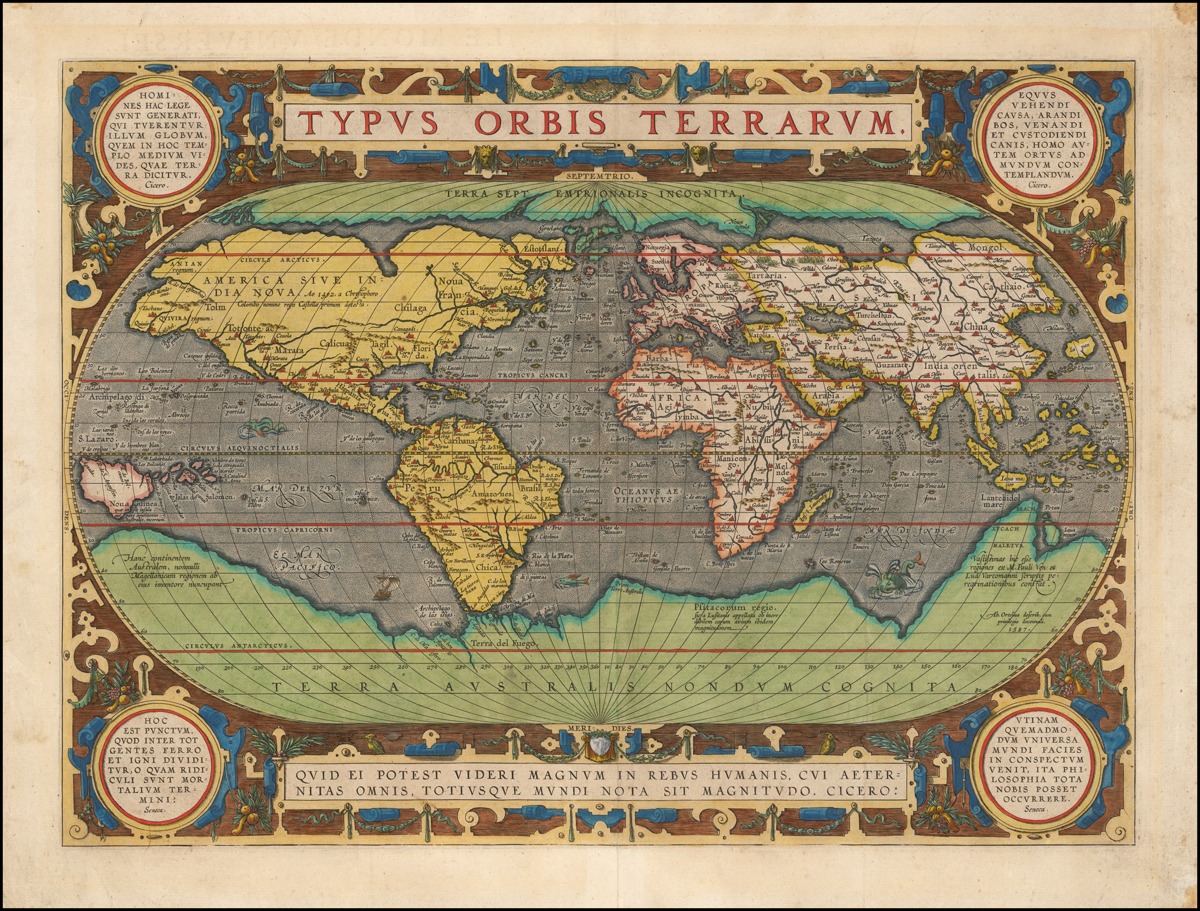
Related 1598 impression of Ortelius’s Typus Orbis Terrarum, showing a conjectural southern continent. This ornate third-plate map has corner medallions; the British Library image catalogued 1598 has a cloud border and is not the same printed plate. This image is historical cartography, not a surveyed outline of Antarctica.
Abraham Ortelius, Typus Orbis Terrarum, Antwerp 1598, third plate. Barry Lawrence Ruderman Antique Maps, stock 51516; via Wikimedia Commons. Public domain.
Image source record · Reuse terms
Image rights and evidence limits
Public-domain faithful reproduction of Ortelius (died 1598) map, published 1598, explicitly marked PD-old-100-expired and PD-Art on Commons. Source dealer Ruderman current Terms, Sale of High-Resolution Images, expressly does not claim copyright in images of works before the US copyright threshold; charges are facilitation fees, not copyright ownership. Commons delivered existing full-resolution scan. This is not a clearance of British Library digitization.
Image existence does not prove a linked claim. Consult image-specific captions and reuse conditions.
Sources and what they support
Links document the record, the claim’s circulation, an assessment, or reuse terms as labeled. A source link is not automatically corroboration.
- displayed image provenance; not proof of a linked interpretationhttps://www.raremaps.com/gallery/detail/51516/typus-orbis-terrarum-ortelius
- image-specific reuse conditionshttps://raremaps.com/site/terms
- documentary target record; may differ from displayed reproductionhttps://www.bl.uk/stories/blogs/posts/antarctica-a-brief-history-in-maps
- institutional or documentary recordhttps://www.bl.uk/stories/blogs/posts/antarctica-a-brief-history-in-maps
Explore the same topic
- Historical record
Abizaid’s flat, stationary-Earth map
John George Abizaid’s map with English and Arabic text.
- Historical record
Al-Idrisi’s world map — a sixteenth-century copy
Orientation is a cartographic convention, not inversion of the physical Earth.
- Historical record
Babylonian Map of the World
Disc and surrounding cosmic waters; ancient worldview, not an Antarctic survey.
- Historical record
Bertelli’s map of the known world
Southern land and fantastic fauna are speculative; do not label them surveyed ice-free Antarctica.