
World maps & models
Ortelius’s world map — 1570 edition
Historical recordThe 1570 edition of Ortelius’s world map, distinct from the existing 1598 edition. Historical conjectural geography is not evidence of a surveyed Antarctic civilization.
What this record establishes
Institutional record documented; does not authenticate interpretations.
Record details
- Original title
- Ortelius: Typus Orbis Terrarum
- Artifact date
- 1570
- Holding institution
- David Rumsey Map Collection, Stanford University Libraries
- Accession
- Rumsey10000.011
Edition note
Edition-specific1570 record; do not substitute a later edition image.
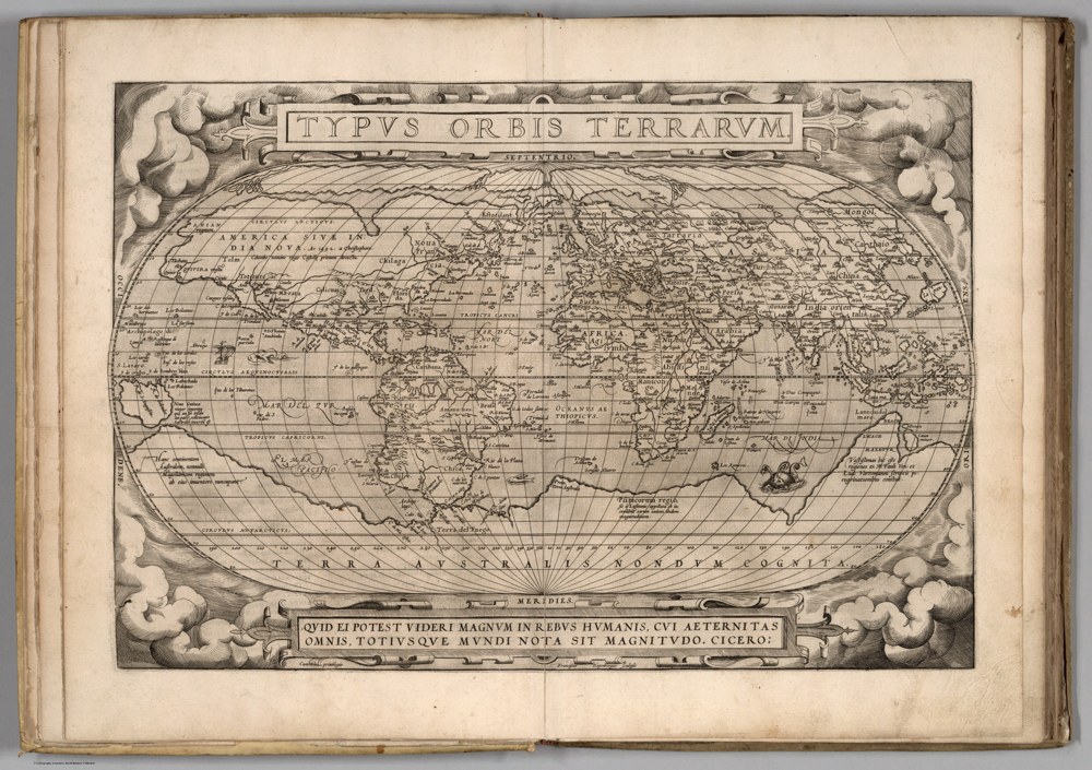
David Rumsey Map Collection, David Rumsey Map Center, Stanford University Libraries; courtesy of www.davidrumsey.com. Ortelius, Typus Orbis Terrarum, 1570 first-edition atlas map. Terra Australis is conjectural geography, not a measured Antarctic coastline. Proportionally resized; no reconstruction. Source & reuse ↗
Image source record
Image rights and evidence limits
Express site permission allows reproductions in digital publications by for-profit and nonprofit publishers without charge, with credit. Item includes Download 1 link; original is pre-1930. Linked general CC license is BY-NC-SA 3.0, NOT CC BY 4.0. No standalone facsimile sale authorized.
Image existence does not prove a linked claim. Consult image-specific captions and reuse conditions.
Sources and what they support
Links document the record, the claim’s circulation, an assessment, or reuse terms as labeled. A source link is not automatically corroboration.
- institutional or documentary recordhttps://www.davidrumsey.com/luna/servlet/detail/RUMSEY~8~1~275224~90048541:-1--Typus-Orbis-Terrarum-
Connected records
These are contextual links, not automatic corroboration.
- Ancient sea kings surveyed Antarctica
Ortelius’s 1570 map is a specific original for testing ancient-map interpretations, not an independently verified Antarctic survey.
Explore the same topic
- Historical record
Abizaid’s flat, stationary-Earth map
John George Abizaid’s map with English and Arabic text.
- Historical record
Al-Idrisi’s world map — a sixteenth-century copy
Orientation is a cartographic convention, not inversion of the physical Earth.
- Historical record
Babylonian Map of the World
Disc and surrounding cosmic waters; ancient worldview, not an Antarctic survey.
- Historical record
Bertelli’s map of the known world
Southern land and fantastic fauna are speculative; do not label them surveyed ice-free Antarctica.