
World maps & models
Ricci’s Chinese-language world map
Historical recordChinese-European collaboration; compare continental outlines and placement, not evidence of hidden polar territory.
What this record establishes
Institutional record documented; does not authenticate interpretations.
Record details
- Original title
- Kunyu wanguo quantu
- Artifact date
- 1602
- Creator
- Matteo Ricci with Li Zhizao and Chinese collaborators
- Holding institution
- University of Minnesota, James Ford Bell Library
- Classification
- World map
Antarctica connection
Contextual visual history; not direct evidence about Antarctica
Relevance and caution
Chinese-European collaboration; compare continental outlines and placement, not evidence of hidden polar territory.
Catalog context
Curatorial navigation label; original categories and source identity retained.
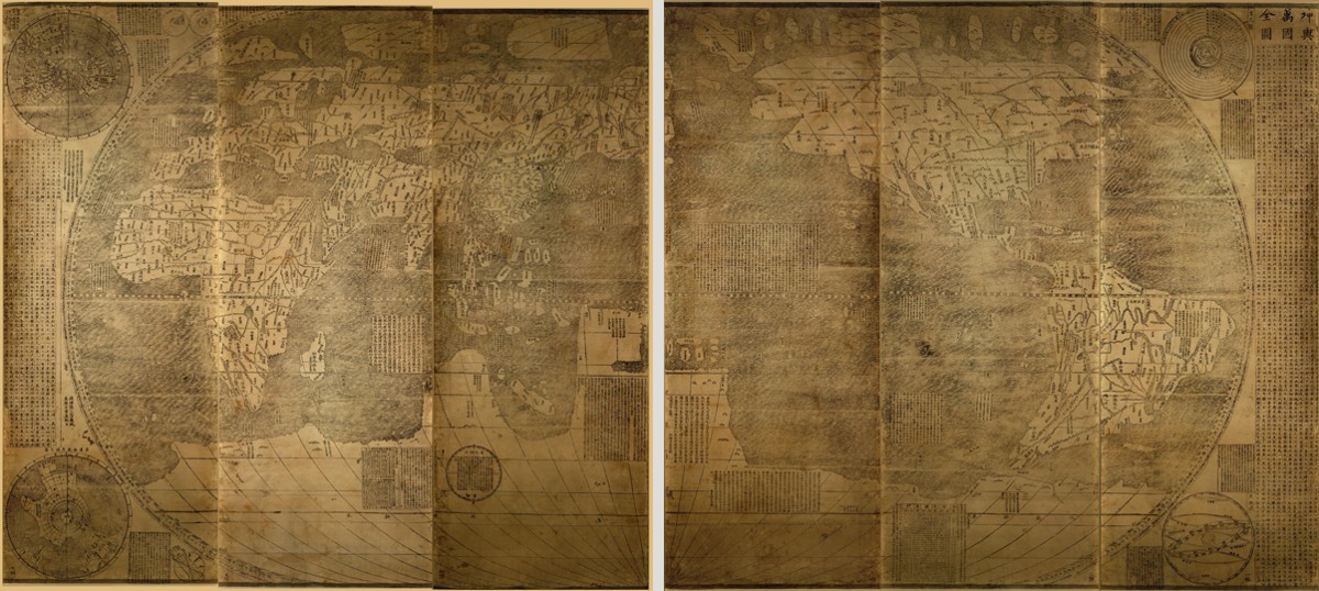
Ricci’s 1602 world map, James Ford Bell Foundation copy. The two three-panel LOC scans are shown side by side with a visible gap; this is a contact layout, not an invisibly stitched reconstruction. Conjectural southern geography is not a modern Antarctic survey.
Matteo Ricci with Li Zhizao and Chinese collaborators, 1602. James Ford Bell Foundation copy; digital reproduction: Library of Congress, Geography and Map Division, LCCN 2010585650.
Image source record · Reuse terms
Image rights and evidence limits
LOC Geography and Map Division: free to use and reuse unless contrary Rights Advisory; none present on exact record.
Image existence does not prove a linked claim. Consult image-specific captions and reuse conditions.
Sources and what they support
Links document the record, the claim’s circulation, an assessment, or reuse terms as labeled. A source link is not automatically corroboration.
- image reproduction provenance; not proof of a linked interpretationhttps://www.loc.gov/item/2010585650/
- image reuse conditionshttps://www.loc.gov/resource/g3200.ex000006Za/?sp=1
- institutional or documentary recordhttps://www.lib.umn.edu/collections/special/bell/ricci
Explore the same topic
- Historical record
Abizaid’s flat, stationary-Earth map
John George Abizaid’s map with English and Arabic text.
- Historical record
Al-Idrisi’s world map — a sixteenth-century copy
Orientation is a cartographic convention, not inversion of the physical Earth.
- Historical record
Babylonian Map of the World
Disc and surrounding cosmic waters; ancient worldview, not an Antarctic survey.
- Historical record
Bertelli’s map of the known world
Southern land and fantastic fauna are speculative; do not label them surveyed ice-free Antarctica.