
World maps & models
Medieval world map centered on Jerusalem
Historical recordJerusalem-centered sacred geography; circular composition alone does not establish flat-Earth doctrine.
What this record establishes
Institutional record documented; does not authenticate interpretations.
Record details
- Original title
- Psalter world map, Add MS 28681
- Artifact date
- c. 1260
- Creator
- Unknown English illuminator
- Holding institution
- British Library
- Classification
- Christian mappa mundi
Antarctica connection
Contextual visual history; not direct evidence about Antarctica
Relevance and caution
Jerusalem-centered sacred geography; circular composition alone does not establish flat-Earth doctrine.
Catalog context
Curatorial navigation label; original categories and source identity retained.
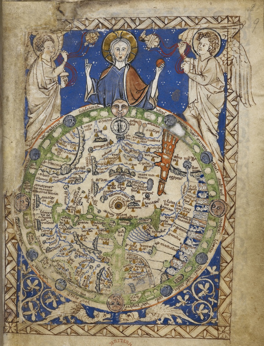
The medieval Psalter world map, British Library Add MS 28681, folio 9 r, circa 1260 s. East is at the top and Jerusalem at the center. A historical cosmographical manuscript, not a surveyed Antarctic map.
British Library, Add MS 28681, folio 9 r; image reference F 60039-95. Institution-released digital image via Wikimedia Commons, CC 0 1.0.
Image source record · Reuse terms
Image rights and evidence limits
Exact institution-provided file released under CC 0 1.0; British Library Images Online March 2014 release, with embedded metadata Public Domain from the British Library collections 2013. This is specific released file, not blanket permission for all BL images.
Image existence does not prove a linked claim. Consult image-specific captions and reuse conditions.
Sources and what they support
Links document the record, the claim’s circulation, an assessment, or reuse terms as labeled. A source link is not automatically corroboration.
- image reproduction provenance; not proof of a linked interpretationhttps://searcharchives.bl.uk/catalog/032-002020101
- image reuse conditionshttps://creativecommons.org/publicdomain/zero/1.0/
- institutional or documentary recordhttps://searcharchives.bl.uk/catalog/032-002020101
Explore the same topic
- Historical record
Abizaid’s flat, stationary-Earth map
John George Abizaid’s map with English and Arabic text.
- Historical record
Al-Idrisi’s world map — a sixteenth-century copy
Orientation is a cartographic convention, not inversion of the physical Earth.
- Historical record
Babylonian Map of the World
Disc and surrounding cosmic waters; ancient worldview, not an Antarctic survey.
- Historical record
Bertelli’s map of the known world
Southern land and fantastic fauna are speculative; do not label them surveyed ice-free Antarctica.