
Images, clips & hoaxes
Tanks guard an Antarctic crashed UFO
image interpretationEvidence status
unsupported interpretation
The page itself contains objections about buildings, scale, and coordinates. No verified vehicles or recovered craft are established.
Editorial assessment of this proposition; not a numeric confidence score.
Claim or proposition being examined
A fringe blog interpreted satellite objects near 77°49′47.46″S, 166°50′22.31″E as tanks guarding a craft.
Limitations
The page itself contains objections about buildings, scale, and coordinates. No verified vehicles or recovered craft are established.
Catalog review date reported: 2026-10-28. This is inherited catalog metadata, not a new verification of the linked source.
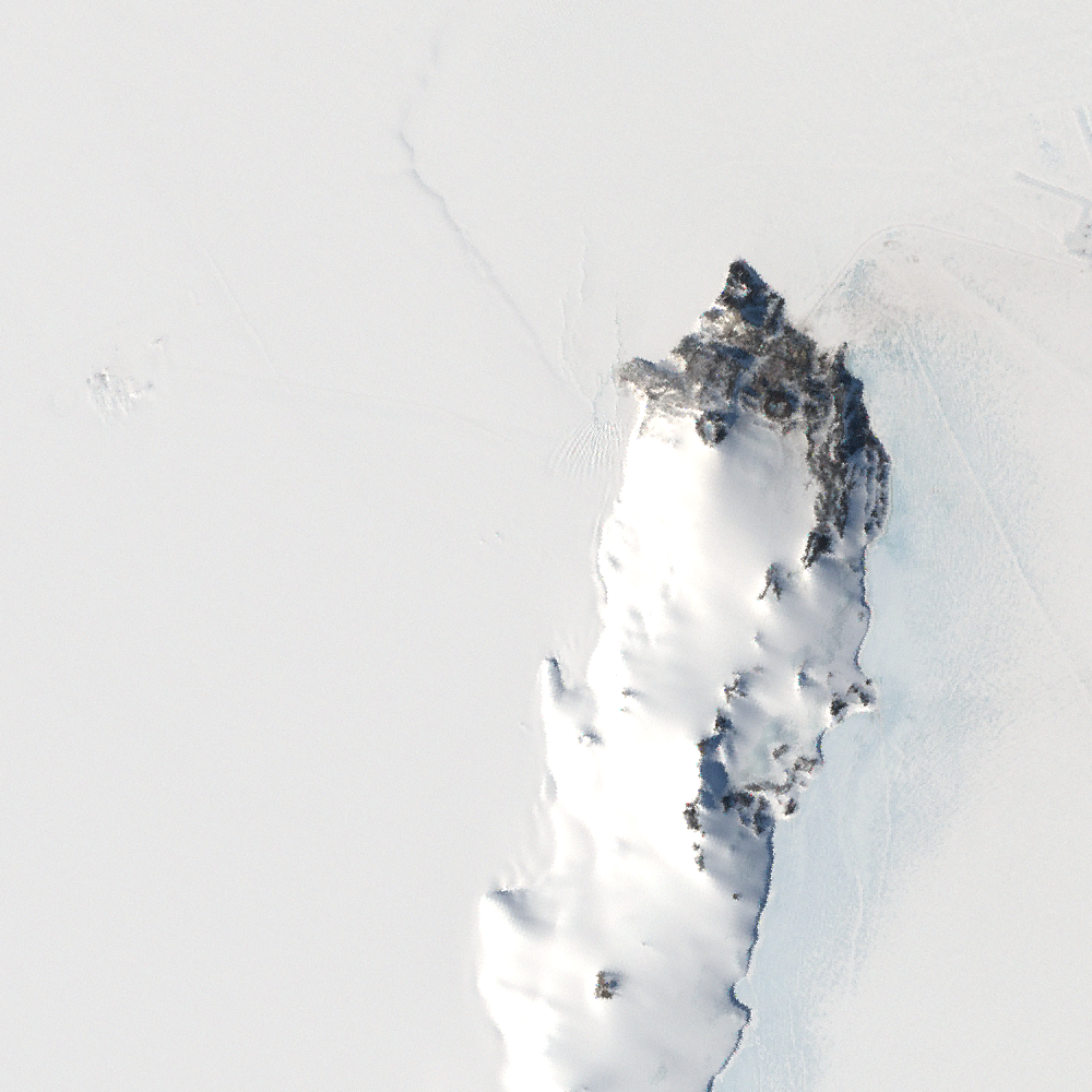
Authentic LIMA satellite context centered at the published claim coordinates 77°49′47.46″S, 166°50′22.31″E, in the Ross Island / McMurdo vicinity. This 15 × 15 km projected window is from a natural-color Landsat mosaic built mainly from 1999–2003 imagery. It is not the original Google Earth view and does not show or establish tanks or a crashed UFO.
Landsat Image Mosaic of Antarctica (LIMA) Project: USGS, NASA and British Antarctic Survey; Landsat 7 ETM+ imagery. Delivered by the official USGS EROS WMS.
The coordinate is transcribed from the source’s dotted degree/minute/second notation. Nearby land is visible, but the centered point lies near an ice-covered coastal margin; this does not establish the presence, identity or disappearance of any object. The source coordinate is a reported claim location, not independent authentication of the alleged event. The exact local acquisition date has not been verified; the imagery predates the claim and is not a current scene. Ice conditions can change. EPSG:3031 grid north is upward, not local geographic north; projected window dimensions are not exact ground-distance measurements. The mosaic’s resolution is insufficient to assess the alleged small objects, and no disappearance can be inferred.
Image source record · Reuse terms
Image rights and evidence limits
USGS identifies LIMA imagery as public domain and permits unrestricted use or redistribution of Landsat data obtained from USGS, with source acknowledgement requested.
Image existence does not prove a linked claim. Consult image-specific captions and reuse conditions.
Sources and what they support
Links document the record, the claim’s circulation, an assessment, or reuse terms as labeled. A source link is not automatically corroboration.
- claimant publicationhttps://www.ufosightingsfootage.uk/2018/06/antarctica-anomalies.html
- displayed image provenance; not proof of the associated claimhttps://nimbus.cr.usgs.gov/arcgis/services/Antarctica/USGS_EROS_Antarctica_LANDSAT/MapServer/WmsServer?SERVICE=WMS&VERSION=1.3.0&REQUEST=GetMap&LAYERS=LANDSAT_15M_RGB_1X_01&STYLES=&CRS=EPSG%3A3031&BBOX=294655.153194359%2C-1299754.79286702%2C309655.153194359%2C-1284754.79286702&WIDTH=1000&HEIGHT=1000&FORMAT=image%2Fpng&TRANSPARENT=FALSE
- image-specific reuse conditionshttps://lima.usgs.gov/access.php
- displayed image provenance; not proof of the associated claimhttps://nimbus.cr.usgs.gov/arcgis/services/Antarctica/USGS_EROS_Antarctica_LANDSAT/MapServer/WmsServer?SERVICE=WMS&VERSION=1.3.0&REQUEST=GetMap&LAYERS=LANDSAT_15M_RGB_1X_01&STYLES=&CRS=EPSG%3A3031&BBOX=272155.153194359%2C-1322254.79286702%2C332155.153194359%2C-1262254.79286702&WIDTH=1200&HEIGHT=1200&FORMAT=image%2Fpng&TRANSPARENT=FALSE
- documentary source for this record; not necessarily evidence supporting its claimhttps://www.ufosightingsfootage.uk/2018/06/antarctica-anomalies.html
- documentary source for this record; not necessarily evidence supporting its claimhttps://lima.usgs.gov/limadoc.php
Explore the same topic
- fabricated discovery
600-million-year-old tiny humanoid fossils
Snopes found no supporting scientific publication and documented manipulated skeletal imagery and inconsistent institutional details.
- satellite-image interpretation
A 400-foot ship is concealed in Antarctic ice
The reporting documents a shape-based interpretation, not an inspected vessel or authenticated wreck discovery. Resemblance in remote imagery alone cannot establish a ship.
- image hoax
Antarctic retrieval photos
Modern artwork, not photographs.
- misidentification
Artificial Antarctic pyramids
Pyramid-shaped mountain peaks are natural geological formations.
Browse Images, clips & hoaxes Open the original vault record