
Images, clips & hoaxes
King George Island disappearing cave cover-up
image interpretationEvidence status
unsupported interpretation
Snow cover and seasonal changes are ordinary alternatives; the cited discussion does not establish intervention.
Editorial assessment of this proposition; not a numeric confidence score.
Claim or proposition being examined
Changing imagery of a cave near 61.99°S, 58.02°W was attributed to concealment of an artificial entrance.
Limitations
Snow cover and seasonal changes are ordinary alternatives; the cited discussion does not establish intervention.
Catalog review date reported: 2026-10-28. This is inherited catalog metadata, not a new verification of the linked source.
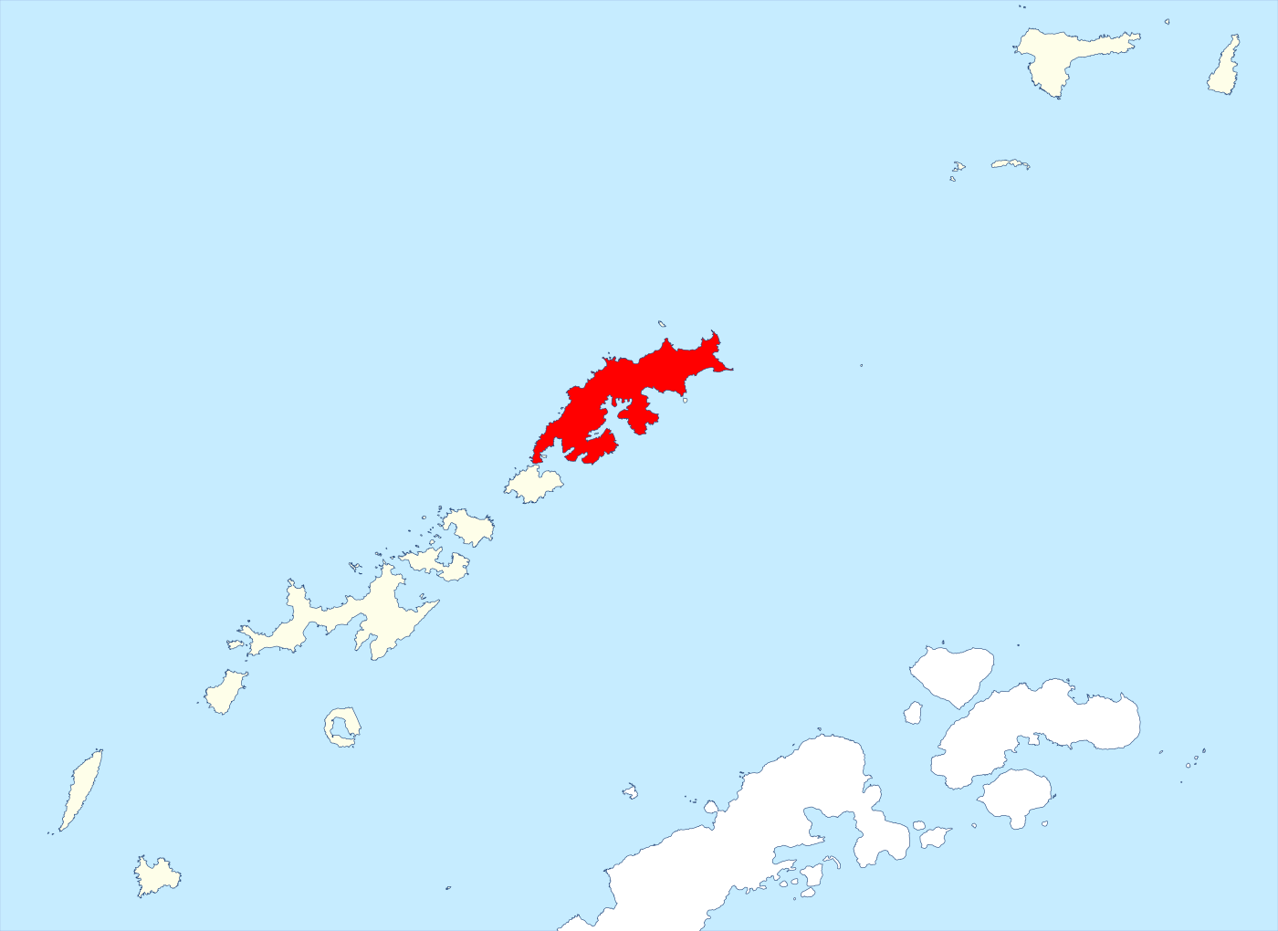
Geographic context map: King George Island is highlighted in red within the South Shetland Islands. This identifies the island named in the cave story; it neither locates nor depicts the alleged entrance near 61.99°S,58.02°W.
Hogweard / Wikimedia Commons,2022; data from SCAR Antarctic Digital Database, British Antarctic Survey. CC BY 4.0. Faithful SVG rasterization.
Locator map, not a satellite image or photograph of the alleged cave. No claim-site marker added. The viral Google Earth imagery remains uncleared. No general island photograph is presented as the cave.
Image source record · Reuse terms

Image rights and evidence limits
CC BY 4.0 on specific Commons derivative map. BAS original Antarctic Digital Database coastline item also explicitly CC BY 4.0, copyright SCAR. Preserve both map-maker and data credit; no endorsement.
Image existence does not prove a linked claim. Consult image-specific captions and reuse conditions.
Sources and what they support
Links document the record, the claim’s circulation, an assessment, or reuse terms as labeled. A source link is not automatically corroboration.
- claim documentation and alternative explanationhttps://nerdbot.com/2022/01/31/mysterious-antarctica-cave-resurfaced-google-earth/
- displayed image provenance; not proof of a linked interpretationhttps://commons.wikimedia.org/wiki/File:King_George_Island_-_South_Shetland_Islands.svg
- image-specific reuse conditionshttps://creativecommons.org/licenses/by/4.0/
- documentary target record; may differ from displayed reproductionhttps://nerdbot.com/2022/01/31/mysterious-antarctica-cave-resurfaced-google-earth/
Explore the same topic
- fabricated discovery
600-million-year-old tiny humanoid fossils
Snopes found no supporting scientific publication and documented manipulated skeletal imagery and inconsistent institutional details.
- satellite-image interpretation
A 400-foot ship is concealed in Antarctic ice
The reporting documents a shape-based interpretation, not an inspected vessel or authenticated wreck discovery. Resemblance in remote imagery alone cannot establish a ship.
- image hoax
Antarctic retrieval photos
Modern artwork, not photographs.
- misidentification
Artificial Antarctic pyramids
Pyramid-shaped mountain peaks are natural geological formations.
Browse Images, clips & hoaxes Open the original vault record