
Maps & hidden lands
Nimrod Islands
Historical sightingEvidence status
Phantom islands
Later searches found no islands at the reported location.
Editorial assessment of this proposition; not a numeric confidence score.
Claim or proposition being examined
A reported Southern Ocean island group entered charts after an 1828 sighting.
Limitations
One group-level claim, not an entry per imagined island.
Scope of catalog verification
Source existence and described claim checked via web search/excerpts; not independent validation of alleged event.
Catalog review date reported: 2026-10-28. This is inherited catalog metadata, not a new verification of the linked source.
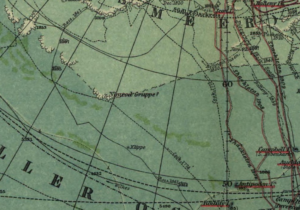
Nimrod Islands: cropped detail from the 1912 Süd-Polar-Karte. This documents the name on a historical chart, not a confirmed island. Original question marks, tracks and grid are retained; full sheet supplied for context.
August Petermann; corrected by Hermann Habenicht; engraved by Carl Böhmer. Süd-Polar-Karte, Stielers Hand-Atlas, J. Perthes, Gotha, 1912. Library of Congress, Geography and Map Division, LCCN 2002624041.
Image source record · Reuse terms
Image rights and evidence limits
Exact LOC resource: Geography and Map Division digitized collections free to use/reuse unless a contrary advisory; none present.
Image existence does not prove a linked claim. Consult image-specific captions and reuse conditions.
Sources and what they support
Links document the record, the claim’s circulation, an assessment, or reuse terms as labeled. A source link is not automatically corroboration.
- Historical reviewhttps://www.australiangeographic.com.au/history-culture/2025/10/phantom-islands-of-the-southern-ocean/
- Search-history overviewhttps://en.wikipedia.org/wiki/Nimrod_Islands
- image reproduction provenance; not proof of a linked interpretationhttps://www.loc.gov/item/2002624041/
- image reuse conditionshttps://www.loc.gov/resource/g9800.ct000774/?sp=1
Explore the same topic
- flat-earth allegation
Antarctic circumferential ice wall
Contradicted by surveys, navigation and satellite observations.
- Cartographic interpretation
Buache knew subglacial Antarctic divisions
Its speculative geography does not demonstrate knowledge of subglacial terrain.
- Historical sighting
Dougherty Island
The described island was not confirmed by later searches.
- flat-earth allegation
Drilling the firmament
Claimant explicitly cannot identify or authenticate the alleged witness.