
Maps & hidden lands
Leviathan’s Gate cargo route
flat-earth narrativeEvidence status
Unsupported community allegation
A social-media reading of vessel maps does not demonstrate a passage to outer lands. Heard and McDonald Islands are real sub-Antarctic islands.
Editorial assessment of this proposition; not a numeric confidence score.
Claim or proposition being examined
A 2025 conspiracy post alleged cargo vessels pass a hidden Antarctic ice-wall gate near the McDonald Islands.
Limitations
Related to existing outer-lands mythology but distinct alleged cargo-route proposition; sub-Antarctic location.
Catalog review date reported: 2026-10-28. This is inherited catalog metadata, not a new verification of the linked source.
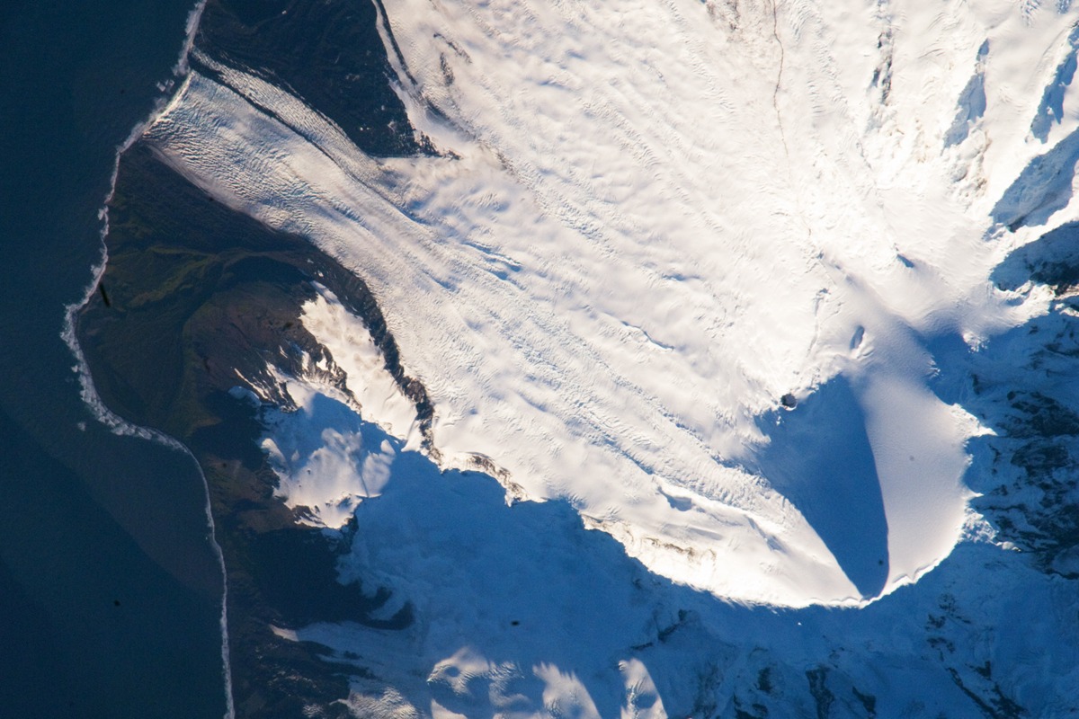
Authentic geographic context: an orbital photograph of Big Ben volcano, Mawson Peak and glaciers on Heard Island, taken on 28 February 2009. Heard Island is a subantarctic island about 1,550 km north of Antarctica, not the Antarctic mainland. The photograph documents the island landscape; it does not establish a secret shipping route, entrance or cargo operation.
NASA / Earth Science and Remote Sensing Unit, Johnson Space Center; Expedition 18 crew, ISS018-E-38182, 28 February 2009. NASA Earth Observatory.
Image source record · Reuse terms
Image rights and evidence limits
NASA Earth Observatory permits reuse including commercial use except identified third-party copyright. This specific image is credited to Expedition 18 / ISS Crew Earth Observations and NASA Johnson Space Center, without a third-party restriction. NASA/JSC astronaut-photography FAQ confirms no maintained copyright and requests credit/link. Informational editorial use only; no NASA endorsement implied.
Image existence does not prove a linked claim. Consult image-specific captions and reuse conditions.
Sources and what they support
Links document the record, the claim’s circulation, an assessment, or reuse terms as labeled. A source link is not automatically corroboration.
- claim provenance and/or documented assessmenthttps://www.reddit.com/r/conspiracy/comments/1jucvh1
- assessment/contexthttps://www.antarctica.gov.au/antarctic-operations/stations-and-field-locations/heard-island/
- displayed image provenance; not proof of a linked interpretationhttps://science.nasa.gov/earth/earth-observatory/mawson-peak-heard-island-37488/
- image-specific reuse conditionshttps://science.nasa.gov/earth/faq/
- documentary target record; may differ from displayed reproductionhttps://www.antarctica.gov.au/antarctic-operations/stations-and-field-locations/heard-island/
- documentary target record; may differ from displayed reproductionhttps://www.reddit.com/r/conspiracy/comments/1jucvh1
Explore the same topic
- flat-earth allegation
Antarctic circumferential ice wall
Contradicted by surveys, navigation and satellite observations.
- Cartographic interpretation
Buache knew subglacial Antarctic divisions
Its speculative geography does not demonstrate knowledge of subglacial terrain.
- Historical sighting
Dougherty Island
The described island was not confirmed by later searches.
- flat-earth allegation
Drilling the firmament
Claimant explicitly cannot identify or authenticate the alleged witness.