
Polar & expedition maps
South Pole map with uncharted southern land
Historical recordHondius-derived polar map; center remains uncertain.
What this record establishes
Institutional record documented; does not authenticate interpretations.
Record details
- Original title
- Polus Antarcticus
- Artifact date
- circa 1690
- Holding institution
- British Library
- Identifier
- Maps * 88710.(2.)
- Record type
- individual_artifact
Catalog review date reported: 2026-10-28. This is inherited catalog metadata, not a new verification of the linked source.
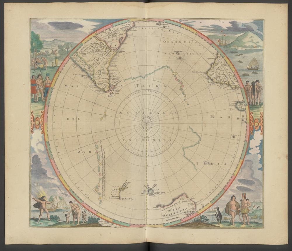
Related edition: Polus Antarcticus in Janssonius’s 1657 atlas, Zentralbibliothek Zürich. Not the British Library c.1690 copy.
Johannes Janssonius, Het vijfde Deel Des Grooten Atlas, Amsterdam 1657; Zentralbibliothek Zürich, T 13, via e-rara, DOI 10.3931/e-rara-89085.
Different edition and physical copy from target British Library c.1690. Use only as clearly labeled related-edition context, never identify as exact target artifact.
Image source record · Reuse terms
Image rights and evidence limits
Public Domain Mark 1.0 explicitly displayed by e-rara.
Image existence does not prove a linked claim. Consult image-specific captions and reuse conditions.
Sources and what they support
Links document the record, the claim’s circulation, an assessment, or reuse terms as labeled. A source link is not automatically corroboration.
- image reproduction provenance; not proof of a linked interpretationhttps://www.e-rara.ch/zuz/content/titleinfo/25535877
- institutional or documentary recordhttps://www.bl.uk/stories/blogs/posts/antarctica-a-brief-history-in-maps
Explore the same topic
- Historical record
Adélie Land sledge route — Australasian Antarctic Expedition
Separately numbered original manuscript in the Australasian Antarctic Expedition records; inventory item 17, 64cm x 91cm. Nunatak. Commonwealth Bay. Cape Pigeon Rookery.
- Historical record
Amundsen’s South Pole expedition routes
A separately catalogued expedition or regional map; scale 1 : 6 000 000. It records historical cartographic knowledge, not evidence of hidden continents.
- Historical record
Antarctic chart annotated by Captain J. K. Davis
Annotated nautical chart preserved in the Davis collection, NAA P2819.
- Historical record
Antarctic exploration map by Bayliss
South-centered azimuthal equidistant map compiles Antarctic exploration.
Browse Polar & expedition maps Open the original vault record