
Polar & expedition maps
Topographic map of Mawson & Mount Twintop, Mac. Robertson Land
Historical recordA separately catalogued mid-twentieth-century topographic map; scale 1 : 250 000. It records historical cartographic knowledge, not evidence of hidden continents.
What this record establishes
Institutional record documented; does not authenticate interpretations.
Record details
- Original title
- Sheets SQ 40-41/15 & Part SR 40-41/3 Mawson & Mount Twintop, Mac. Robertson Land, Australian Antarctic Territory [SQ 41-42/13 & SR 41-42/1]
- Artifact date
- September 1964
- Publisher
- Department of National Development, Division of National Mapping (Australia)
- Holding institution
- Australian Antarctic Data Centre
- Accession
- AADC map 89
- Projection
- Universal Transverse Mercator
- Scale
- 1 : 250 000
Scope of evidence
Evidence of an original historical map or manuscript, not evidence of hidden lands or a non-spherical Earth.
Catalog context
Mawson & Mount Twintop SQ 40-41/15 & Part SR 40-41/3 have been numbered according to a map numbering system adopted by Department of National Mapping in 1964 for the 1:250,000 series which is different from that adopted for the 1:1 million map series in 1971. The map should now be quoted as SQ 41-42/13 & SR 41-42/1.
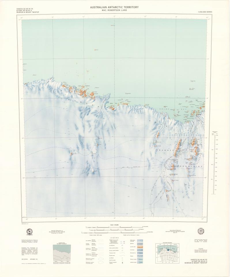
Commonwealth of Australia, Division of National Mapping; Australian Antarctic Data Centre, map 89. CC BY 4.0. Historical map reproduction, not evidence for modern hidden-land claims. Not for navigation; missing hazards does not imply safe terrain. Thumbnail renders the original 1964 first-edition PDF rather than the 1983 reprint shown in the institutional preview. Thumbnail resized without reconstruction. Source & reuse ↗
Image source record
Image rights and evidence limits
CC BY 4.0 — AADC current conditions explicitly cover maps unless otherwise marked; Commonwealth mapping agency publisher; no contrary notice in item record.
Image existence does not prove a linked claim. Consult image-specific captions and reuse conditions.
Sources and what they support
Links document the record, the claim’s circulation, an assessment, or reuse terms as labeled. A source link is not automatically corroboration.
- institutional or documentary recordhttps://data.aad.gov.au/aadc/mapcat/display_map.cfm?map_id=89
Explore the same topic
- Historical record
Adélie Land sledge route — Australasian Antarctic Expedition
Separately numbered original manuscript in the Australasian Antarctic Expedition records; inventory item 17, 64cm x 91cm. Nunatak. Commonwealth Bay. Cape Pigeon Rookery.
- Historical record
Amundsen’s South Pole expedition routes
A separately catalogued expedition or regional map; scale 1 : 6 000 000. It records historical cartographic knowledge, not evidence of hidden continents.
- Historical record
Antarctic chart annotated by Captain J. K. Davis
Annotated nautical chart preserved in the Davis collection, NAA P2819.
- Historical record
Antarctic exploration map by Bayliss
South-centered azimuthal equidistant map compiles Antarctic exploration.
Browse Polar & expedition maps Open the original vault record