
Polar & expedition maps
Maps of Charcot’s French Antarctic expedition, 1908–1910
Historical recordA separately catalogued expedition or regional map; scale 1 : 5 000 000. It records historical cartographic knowledge, not evidence of hidden continents.
What this record establishes
Institutional record documented; does not authenticate interpretations.
Record details
- Original title
- Maps to illustrate the paper by Dr. J.B. Charcot on the French Antarctic Expedition 1908-1910.
- Artifact date
- 1911
- Publisher
- Royal Geographical Society (United Kingdom)
- Holding institution
- Australian Antarctic Data Centre
- Accession
- AADC map 3691
- Projection
- Not Given
- Scale
- 1 : 5 000 000
Scope of evidence
Evidence of an original historical map or manuscript, not evidence of hidden lands or a non-spherical Earth.
Catalog context
5 maps showing the tracks of the "Belgica" 1898, "Francais" 1903-05, "Pourquoi Pas?" 1908-1909, and 1909-1910.
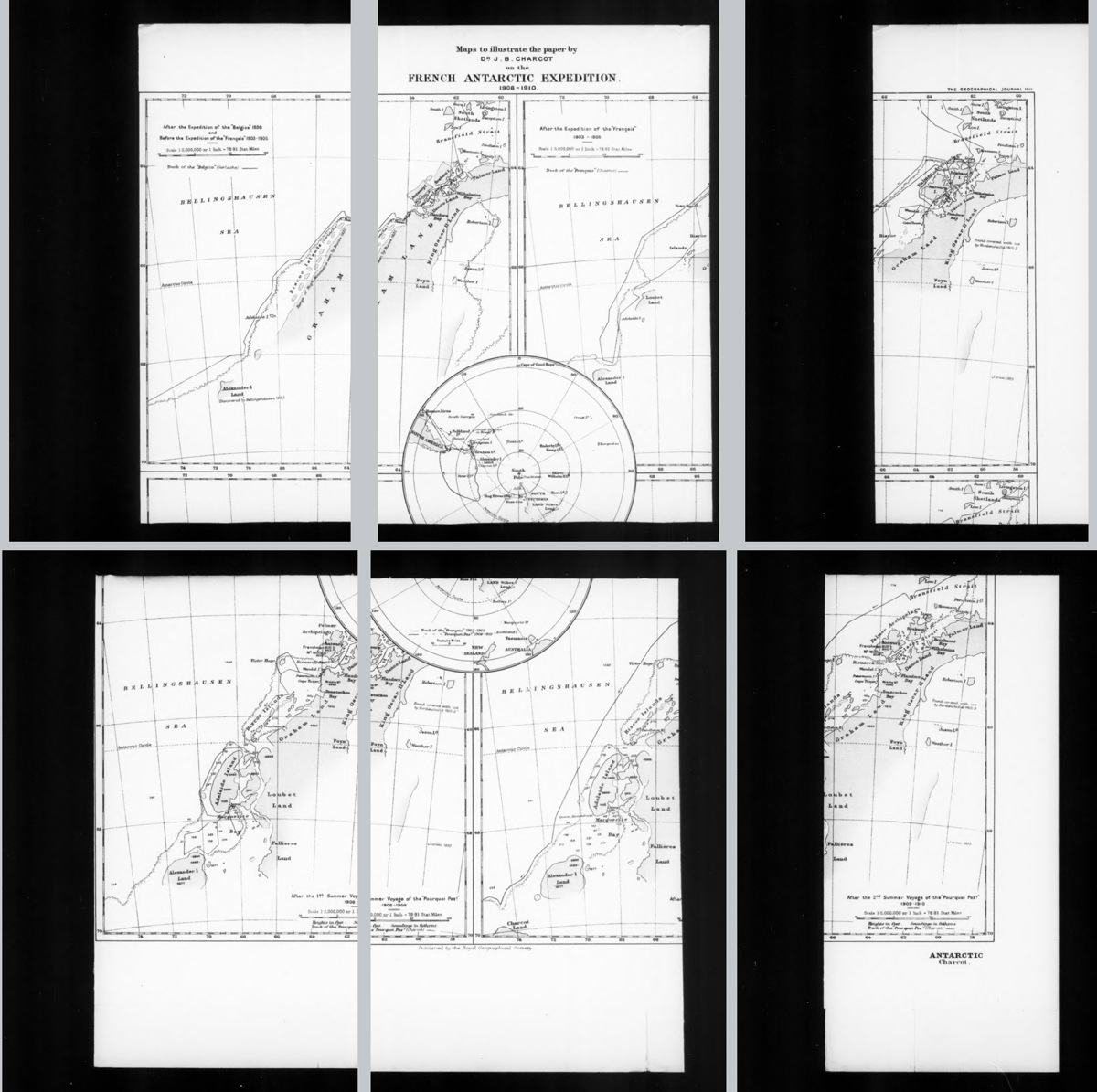
Six overlapping microfilm panels of the original 1911 sheet: four regional maps and a central polar overview comparing knowledge before and after the expeditions. Grey gaps separate the digitized panels; this is not a seamless map. Historical cartography, not a modern survey.
Jean-Baptiste Charcot (1867–1936); Royal Geographical Society, The Geographical Journal, 1911. Internet Archive independent microfilm digitization. Public-domain expiry assessment; no institutional licence asserted.
Exact named printed chart and publication year matching AADC record; independent digitization, NOT clearance of AADC preview pixels.
Image source record · Reuse terms
Image rights and evidence limits
Independent public-domain expiry assessment, not an Internet Archive licence: original English-language map published in 1911, before 1931 (US public domain by age); named creator Jean-Baptiste Charcot (1867–1936), more than 70 full years after death by 2026 under UK life-plus 70. Original layout over 25 years old. No additional named engraver appears in inspected map margins. Mechanical microfilm/PDF reproduction. IA item metadata has no explicit rights field and IA disclaims rights guarantees; this is not CC0, CC BY, or express institutional permission. Assessment applies to these map frames only, not entire issue or other illustrations.
Image existence does not prove a linked claim. Consult image-specific captions and reuse conditions.
Sources and what they support
Links document the record, the claim’s circulation, an assessment, or reuse terms as labeled. A source link is not automatically corroboration.
- image reproduction provenance; not proof of a linked interpretationhttps://archive.org/stream/laroussemensueli02auguoft#page/153/mode/1up
- image reuse conditionshttps://commons.wikimedia.org/wiki/File:Itin%C3%A9raire_du_Pourquoi-Pas.png
- displayed image provenance; not proof of a linked interpretationhttps://archive.org/details/sim_geographical-journal_1911-03_37_3
- image-specific reuse conditionshttps://www.gov.uk/government/publications/copyright-notice-duration-of-copyright-term/copyright-notice-duration-of-copyright-term
- documentary target record; may differ from displayed reproductionhttps://data.aad.gov.au/aadc/mapcat/display_map.cfm?map_id=3691
- documentary target record; may differ from displayed reproductionhttps://archive.org/stream/laroussemensueli02auguoft#page/153/mode/1up
- documentary target record; may differ from displayed reproductionhttps://commons.wikimedia.org/wiki/File:Itin%C3%A9raire_du_Pourquoi-Pas.png
- institutional or documentary recordhttps://data.aad.gov.au/aadc/mapcat/display_map.cfm?map_id=3691

Explore the same topic
- Historical record
Adélie Land sledge route — Australasian Antarctic Expedition
Separately numbered original manuscript in the Australasian Antarctic Expedition records; inventory item 17, 64cm x 91cm. Nunatak. Commonwealth Bay. Cape Pigeon Rookery.
- Historical record
Amundsen’s South Pole expedition routes
A separately catalogued expedition or regional map; scale 1 : 6 000 000. It records historical cartographic knowledge, not evidence of hidden continents.
- Historical record
Antarctic chart annotated by Captain J. K. Davis
Annotated nautical chart preserved in the Davis collection, NAA P2819.
- Historical record
Antarctic exploration map by Bayliss
South-centered azimuthal equidistant map compiles Antarctic exploration.
Browse Polar & expedition maps Open the original vault record