
Polar & expedition maps
Discovery expedition’s first-year exploration map
Historical recordDiscovery routes, winter quarters and observation-balloon site.
What this record establishes
Institutional record documented; does not authenticate interpretations.
Record details
- Original title
- Antarctica Exploration Sketch Map: first year
- Artifact date
- 1903
- Holding institution
- Library of Congress
- Record type
- individual_artifact
Catalog review date reported: 2026-10-28. This is inherited catalog metadata, not a new verification of the linked source.
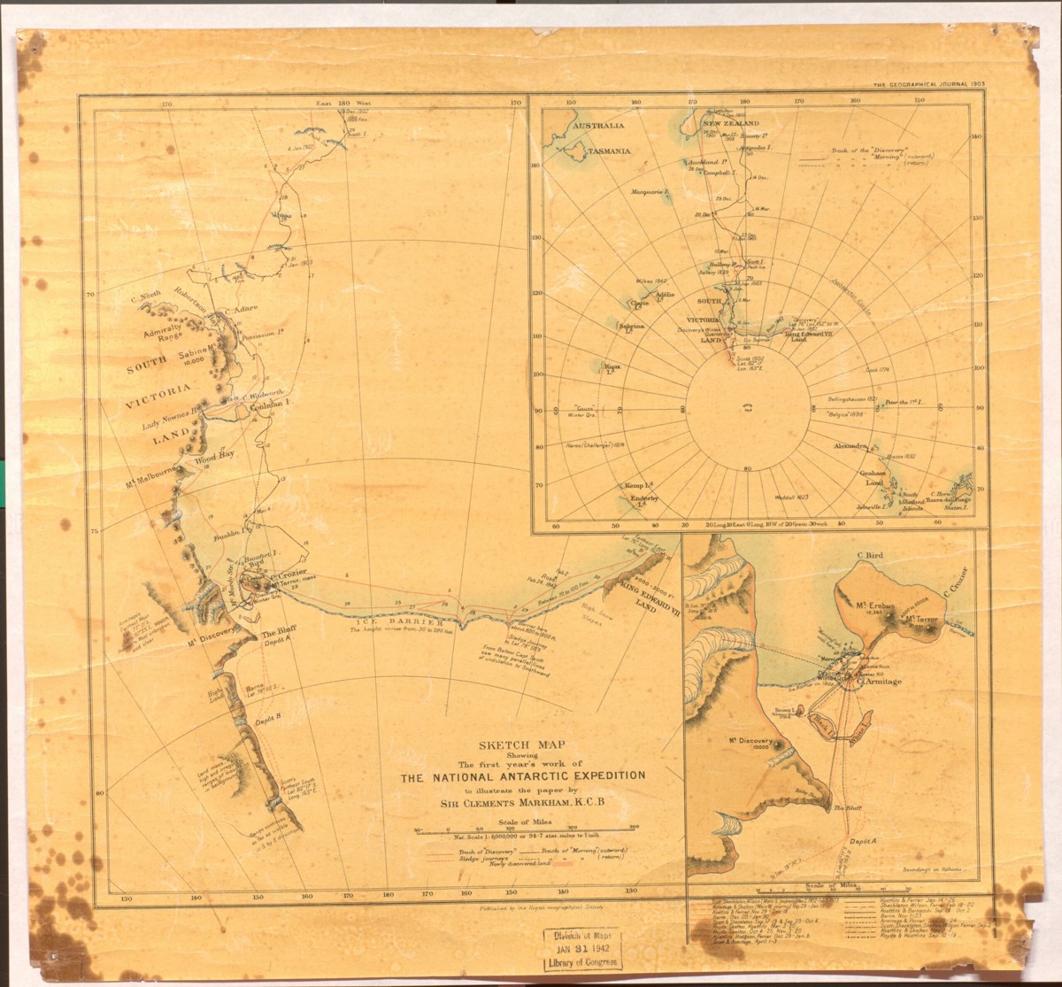
1903 sketch map of the Discovery expedition’s first year: tracks, winter quarters and observation-balloon location. Original sheet and institutional markings retained.
Royal Geographical Society, 1903. Library of Congress, Geography and Map Division.
Image source record · Reuse terms
Image rights and evidence limits
LOC Geography and Map Division digitized-collection policy allows free use/reuse unless a contrary Rights Advisory is present. Exact institutional blog identifies map and division; no contrary image advisory appears. Collection-level reuse basis; no independent item catalog was located.
Image existence does not prove a linked claim. Consult image-specific captions and reuse conditions.
Sources and what they support
Links document the record, the claim’s circulation, an assessment, or reuse terms as labeled. A source link is not automatically corroboration.
- image reproduction provenance; not proof of a linked interpretationhttps://blogs.loc.gov/maps/2021/09/reaching-the-south-pole-during-the-heroic-age-of-exploration/
- image reuse conditionshttps://www.loc.gov/collections/general-maps/about-this-collection/rights-and-access/
- institutional or documentary recordhttps://blogs.loc.gov/maps/2021/09/reaching-the-south-pole-during-the-heroic-age-of-exploration/
Explore the same topic
- Historical record
Adélie Land sledge route — Australasian Antarctic Expedition
Separately numbered original manuscript in the Australasian Antarctic Expedition records; inventory item 17, 64cm x 91cm. Nunatak. Commonwealth Bay. Cape Pigeon Rookery.
- Historical record
Amundsen’s South Pole expedition routes
A separately catalogued expedition or regional map; scale 1 : 6 000 000. It records historical cartographic knowledge, not evidence of hidden continents.
- Historical record
Antarctic chart annotated by Captain J. K. Davis
Annotated nautical chart preserved in the Davis collection, NAA P2819.
- Historical record
Antarctic exploration map by Bayliss
South-centered azimuthal equidistant map compiles Antarctic exploration.
Browse Polar & expedition maps Open the original vault record