
Polar & expedition maps
Navigation chart south of 20° south latitude
Historical recordJ. D. Potter great-circle sailing chart.
What this record establishes
Institutional record documented; does not authenticate interpretations.
Record details
- Original title
- Chart of South Latitudes beyond 20 Degrees
- Artifact date
- 1858
- Holding institution
- British Library
- Identifier
- Maps 88710.(6.)
- Record type
- individual_artifact
Catalog review date reported: 2026-10-28. This is inherited catalog metadata, not a new verification of the linked source.
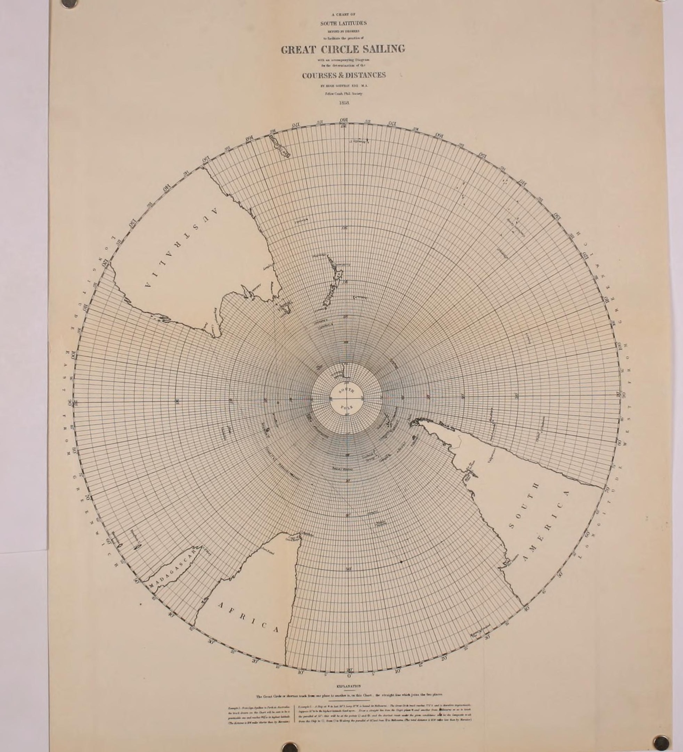
Hugh Godfray’s 1858 south-polar gnomonic navigation chart, reproduced as a foldout in the U.S. Hydrographic Office’s 1899 second edition of The Development of Great Circle Sailing. The surrounding text identifies Godfray’s 1858 charts and explains their use for great-circle navigation.
Hugh Godfray, A Chart of South Latitudes beyond 20 Degrees (1858), reproduced in G.W. Littlehales, The Development of Great Circle Sailing, U.S. Hydrographic Office No. 90, second edition (Washington: GPO, 1899), foldout following p. 22. University of California Libraries scan via Internet Archive, SRLF_UCI:LAGE-4476842. Public domain.
This is a historical reproduction of Godfray’s 1858 chart published in 1899, not the British Library’s exemplar or modern scan. Identical edition state is not asserted. The chart’s incomplete Antarctic geography reflects nineteenth-century knowledge, not evidence of hidden lands. The separate course-and-distance diagram is not included.
Image source record · Reuse terms
Image rights and evidence limits
Public domain. Godfray’s chart was published in 1858; the independent reproduction appears in the U.S. Hydrographic Office’s 1899 publication. Internet Archive records the University of California Libraries scan as NOT_IN_COPYRIGHT (US). St John’s College confirms Godfray died in 1877, placing the underlying chart beyond the ordinary life-plus-70 term. The displayed files are faithful reproductions of historical printed pages, not modern British Library photographs.
Image existence does not prove a linked claim. Consult image-specific captions and reuse conditions.
Sources and what they support
Links document the record, the claim’s circulation, an assessment, or reuse terms as labeled. A source link is not automatically corroboration.
- displayed image provenance; not proof of the associated claimhttps://archive.org/details/developmentofgr00unit/page/n37/mode/1up
- image-specific reuse conditionshttps://archive.org/metadata/developmentofgr00unit
- displayed image provenance; not proof of the associated claimhttps://archive.org/details/developmentofgr00unit/page/n35/mode/1up
- displayed image provenance; not proof of the associated claimhttps://archive.org/details/developmentofgr00unit/page/n6/mode/1up
- documentary source for this record; not necessarily evidence supporting its claimhttps://www.bl.uk/stories/blogs/posts/antarctica-a-brief-history-in-maps
- documentary source for this record; not necessarily evidence supporting its claimhttps://archive.org/details/developmentofgr00unit
- documentary source for this record; not necessarily evidence supporting its claimhttps://archive.org/metadata/developmentofgr00unit
- documentary source for this record; not necessarily evidence supporting its claimhttps://www.joh.cam.ac.uk/sites/default/files/Eagle/Eagle%20Volumes/1920s/1922/Eagle_1922_Easter.pdf#page=35
- documentary source for this record; not necessarily evidence supporting its claimhttps://venn.lib.cam.ac.uk/Documents/acad/lists/Esqui.html
- documentary source for this record; not necessarily evidence supporting its claimhttps://www.gov.uk/copyright/how-long-copyright-lasts
- institutional or documentary recordhttps://www.bl.uk/stories/blogs/posts/antarctica-a-brief-history-in-maps
Explore the same topic
- Historical record
Adélie Land sledge route — Australasian Antarctic Expedition
Separately numbered original manuscript in the Australasian Antarctic Expedition records; inventory item 17, 64cm x 91cm. Nunatak. Commonwealth Bay. Cape Pigeon Rookery.
- Historical record
Amundsen’s South Pole expedition routes
A separately catalogued expedition or regional map; scale 1 : 6 000 000. It records historical cartographic knowledge, not evidence of hidden continents.
- Historical record
Antarctic chart annotated by Captain J. K. Davis
Annotated nautical chart preserved in the Davis collection, NAA P2819.
- Historical record
Antarctic exploration map by Bayliss
South-centered azimuthal equidistant map compiles Antarctic exploration.
Browse Polar & expedition maps Open the original vault record