
Polar & expedition maps
Bartholomew’s South Polar map
Historical recordJ. G. Bartholomew polar geography.
What this record establishes
Institutional record documented; does not authenticate interpretations.
Record details
- Original title
- South Polar Chart
- Artifact date
- 1886
- Holding institution
- British Library
- Identifier
- Ac.6182
- Record type
- individual_artifact
Catalog review date reported: 2026-10-28. This is inherited catalog metadata, not a new verification of the linked source.
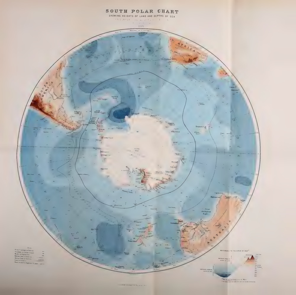
South Polar Chart showing heights of land and depths of sea, 1886. Exact published foldout after page 576, scanned from the University of Toronto copy.
J. G. Bartholomew, South Polar Chart, 1886. Scottish Geographical Magazine, volume 2; Robarts Library, University of Toronto, digitized by Internet Archive.
PDF page 606 (1-indexed), IA leaf 608. IA metadata date 1885 is the serial start, not this volume; printed volume title and map establish 1886.
Image source record · Reuse terms
Image rights and evidence limits
Public domain by independently assessed copyright expiry; not an explicit Internet Archive or University of Toronto licence.
Image existence does not prove a linked claim. Consult image-specific captions and reuse conditions.
Sources and what they support
Links document the record, the claim’s circulation, an assessment, or reuse terms as labeled. A source link is not automatically corroboration.
- displayed image provenance; not proof of a linked interpretationhttps://archive.org/details/scottishgeograph02scotuoft/page/n608/mode/1up
- image-specific reuse conditionshttps://www.gov.uk/government/publications/copyright-notice-digital-images-photographs-and-the-internet/copyright-notice-digital-images-photographs-and-the-internet
- documentary target record; may differ from displayed reproductionhttps://www.bl.uk/stories/blogs/posts/antarctica-a-brief-history-in-maps
- institutional or documentary recordhttps://www.bl.uk/stories/blogs/posts/antarctica-a-brief-history-in-maps
Explore the same topic
- Historical record
Adélie Land sledge route — Australasian Antarctic Expedition
Separately numbered original manuscript in the Australasian Antarctic Expedition records; inventory item 17, 64cm x 91cm. Nunatak. Commonwealth Bay. Cape Pigeon Rookery.
- Historical record
Amundsen’s South Pole expedition routes
A separately catalogued expedition or regional map; scale 1 : 6 000 000. It records historical cartographic knowledge, not evidence of hidden continents.
- Historical record
Antarctic chart annotated by Captain J. K. Davis
Annotated nautical chart preserved in the Davis collection, NAA P2819.
- Historical record
Antarctic exploration map by Bayliss
South-centered azimuthal equidistant map compiles Antarctic exploration.
Browse Polar & expedition maps Open the original vault record