
Polar & expedition maps
Map of lands and seas around the South Pole
Historical recordEarly charted Antarctic coastline.
What this record establishes
Institutional record documented; does not authenticate interpretations.
Record details
- Original title
- Circumjacent the South Pole
- Artifact date
- 1844
- Holding institution
- British Library
- Identifier
- Maps 38.e.8
- Record type
- individual_artifact
Catalog review date reported: 2026-10-28. This is inherited catalog metadata, not a new verification of the linked source.
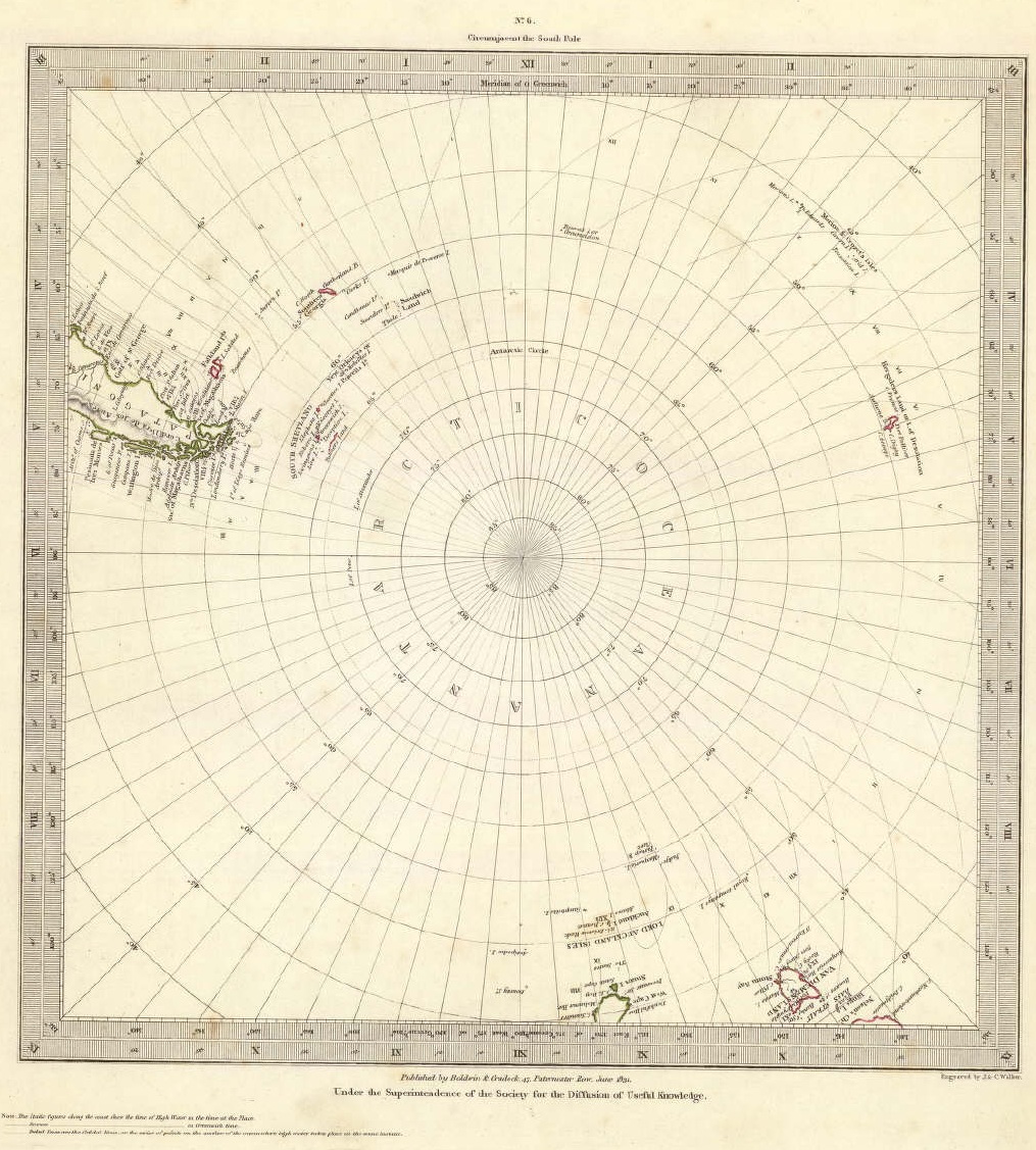
Related edition: Circumjacent the South Pole, SDUK sheet dated June 1831, from the David Rumsey collection. This sheet was laid into the collection’s 1844 atlas; it is not the British Library physical copy catalogued 1844. Its sparse coastal reports and unknown interior record historical knowledge, not concealed modern geography.
Society for the Diffusion of Useful Knowledge; J. & C. Walker, June 1831. David Rumsey Map Collection, David Rumsey Map Center, Stanford University Libraries,0890.009.
Explicit related-edition alternative only. Source map imprint 1831; parent atlas 1844; original BL target record date 1844 retained. Do not silently label this an exact 1844 impression.
Image source record · Reuse terms
Image rights and evidence limits
Rumsey current policy expressly allows print/digital publication by for-profit or nonprofit publishers without charge and with credit; not stand-alone for-sale facsimiles. Underlying 1831 work is historical public-domain map. IA mirror retains general CC BY-NC-SA 3.0 notice and downloadable original SID; using separate current Rumsey publication permission, not relabeling CC BY. Direct individual Luna viewer not readable in this check; official indexed collection metadata and IA mirror verified, no contrary item advisory observed.
Image existence does not prove a linked claim. Consult image-specific captions and reuse conditions.
Sources and what they support
Links document the record, the claim’s circulation, an assessment, or reuse terms as labeled. A source link is not automatically corroboration.
- image reproduction provenance; not proof of a linked interpretationhttps://www.davidrumsey.com/luna/servlet/detail/RUMSEY~8~1~20848~520041
- image reuse conditionshttps://www.davidrumsey.com/about/copyright-and-permissions
- institutional or documentary recordhttps://www.bl.uk/stories/blogs/posts/antarctica-a-brief-history-in-maps
Explore the same topic
- Historical record
Adélie Land sledge route — Australasian Antarctic Expedition
Separately numbered original manuscript in the Australasian Antarctic Expedition records; inventory item 17, 64cm x 91cm. Nunatak. Commonwealth Bay. Cape Pigeon Rookery.
- Historical record
Amundsen’s South Pole expedition routes
A separately catalogued expedition or regional map; scale 1 : 6 000 000. It records historical cartographic knowledge, not evidence of hidden continents.
- Historical record
Antarctic chart annotated by Captain J. K. Davis
Annotated nautical chart preserved in the Davis collection, NAA P2819.
- Historical record
Antarctic exploration map by Bayliss
South-centered azimuthal equidistant map compiles Antarctic exploration.
Browse Polar & expedition maps Open the original vault record