
Polar & expedition maps
Ortelius’s map of Tartary and the Great Khan’s realm
Historical recordHistoric Asian regional designation; not evidence of a global lost empire.
What this record establishes
Institutional record documented; does not authenticate interpretations.
Record details
- Original title
- Tartaria sive magni chami imperium
- Artifact date
- 1570
- Holding institution
- Library of Congress
- Record type
- individual_artifact
Catalog review date reported: 2026-10-28. This is inherited catalog metadata, not a new verification of the linked source.
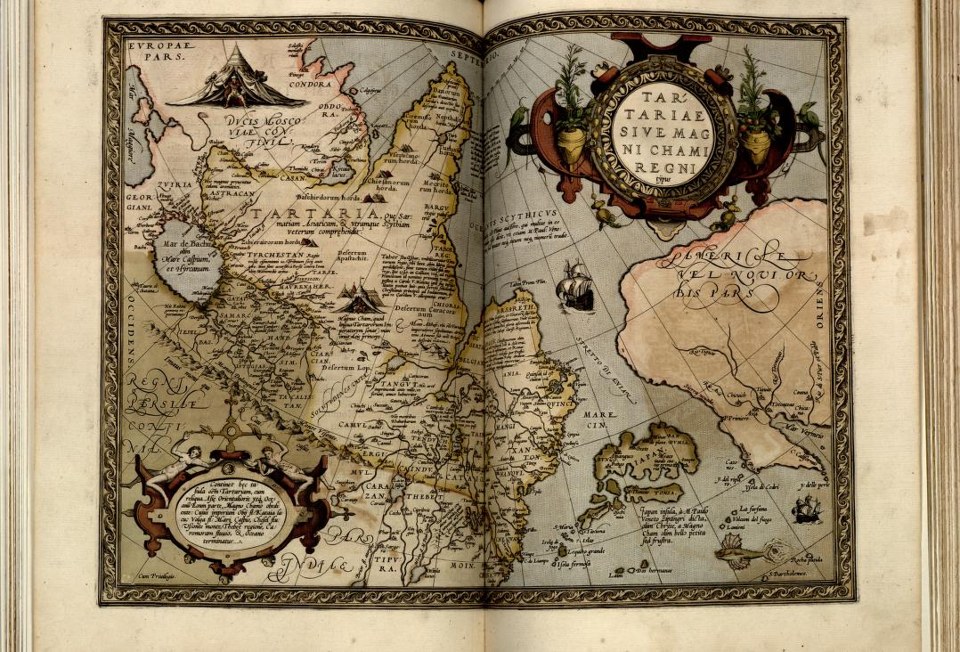
Abraham Ortelius (1570). Library of Congress, Geography and Map Division, G1006 .T5 1570, LCCN 2003683482. Actual institutional reproduction; labels and artifact existence do not verify later interpretations. Source & reuse ↗
Image source record
Image rights and evidence limits
Library of Congress Geography and Map Division: free use and reuse absent a contrary Rights Advisory; item has no contrary advisory.
Image existence does not prove a linked claim. Consult image-specific captions and reuse conditions.
Sources and what they support
Links document the record, the claim’s circulation, an assessment, or reuse terms as labeled. A source link is not automatically corroboration.
- institutional or documentary recordhttps://blogs.loc.gov/maps/2025/06/tracking-tartary-on-western-maps/
Connected records
These are contextual links, not automatic corroboration.
- Tartarian Antarctic reset in the 1800s
Compare another dated Asian regional map rather than treating every use of Tartaria as proof of the same global theory.
Explore the same topic
- Historical record
Adélie Land sledge route — Australasian Antarctic Expedition
Separately numbered original manuscript in the Australasian Antarctic Expedition records; inventory item 17, 64cm x 91cm. Nunatak. Commonwealth Bay. Cape Pigeon Rookery.
- Historical record
Amundsen’s South Pole expedition routes
A separately catalogued expedition or regional map; scale 1 : 6 000 000. It records historical cartographic knowledge, not evidence of hidden continents.
- Historical record
Antarctic chart annotated by Captain J. K. Davis
Annotated nautical chart preserved in the Davis collection, NAA P2819.
- Historical record
Antarctic exploration map by Bayliss
South-centered azimuthal equidistant map compiles Antarctic exploration.
Browse Polar & expedition maps Open the original vault record