
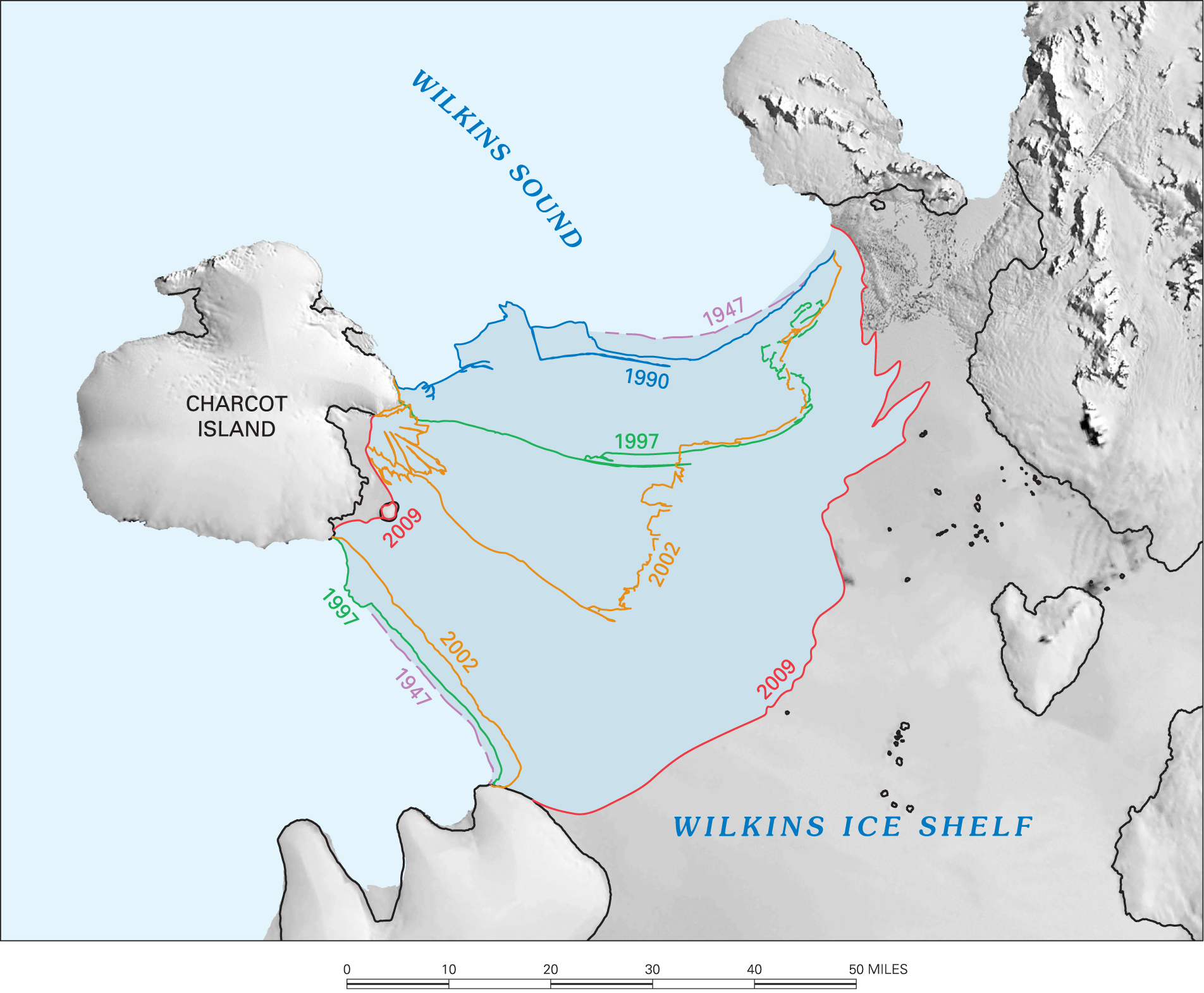
Wilkins Ice Shelf: mapped ice-front positions, 1947–2009
A USGS map compares dated ice-front positions around Wilkins Sound and Charcot Island. The colored outlines document retreat across several observation years, connecting historical survey evidence with modern coastal-change mapping.
U.S. Geological Survey
Public Domain, explicitly stated by USGS.
Scope and limitations
This is a regional comparison, not a continent-wide ice-loss measurement. The source identifies the related Palmer Land report as I-2600-C; the media page does not supply an explicit publication date.