
Polar & expedition maps
Authorized Map of the Second Byrd Antarctic Expedition [uncolored sheet]
A pictorial map associated with Byrd’s second Antarctic expedition, with a polar overview, expedition imagery and inset maps.
View original institutional record →
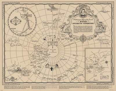
A pictorial map associated with Byrd’s second Antarctic expedition, with a polar overview, expedition imagery and inset maps.
George Annand; General Foods Corporation; digitized by University of Texas at Arlington Libraries
Image context and reuse
UTA permits non-commercial personal or educational use. This educational catalog retains attribution; other reuse may require contacting UTA Special Collections. No blanket rights clearance is asserted.
Original source and full reproductionObject and edition
- Artifact date
- 1934
- Creators
- George Annand; General Foods Corporation
- UTA identifier
- 20188999
What this establishes
The publisher’s word “Authorized” belongs to the historical title. This is an expedition-era publication, not an independent verification of every route or geographical interpretation.
Review scope
Institutional metadata and preview image checked on November 3, 2026. The source provides the full reproduction; individual annotations and all historical interpretations have not been independently authenticated.