
World maps & models
Southern Hemisphere, Corrected from the Latest Voyages
A south-polar hemisphere map combining coastlines, voyage tracks and place names in an early nineteenth-century geographic view.
View original institutional record →
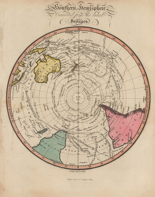
A south-polar hemisphere map combining coastlines, voyage tracks and place names in an early nineteenth-century geographic view.
Fisher & Co.; digitized by University of Texas at Arlington Libraries
Image context and reuse
UTA permits non-commercial personal or educational use. This educational catalog retains attribution; other reuse may require contacting UTA Special Collections. No blanket rights clearance is asserted.
Original source and full reproductionObject and edition
- Artifact date
- 1829
- Creators
- Fisher & Co.
- UTA identifier
- 20188997
What this establishes
“Latest Voyages” is the period title, not a claim of current accuracy. Gaps and generalized geography reflect the map’s historical information, not evidence of concealed modern land.
Review scope
Institutional metadata and preview image checked on November 3, 2026. The source provides the full reproduction; individual annotations and all historical interpretations have not been independently authenticated.